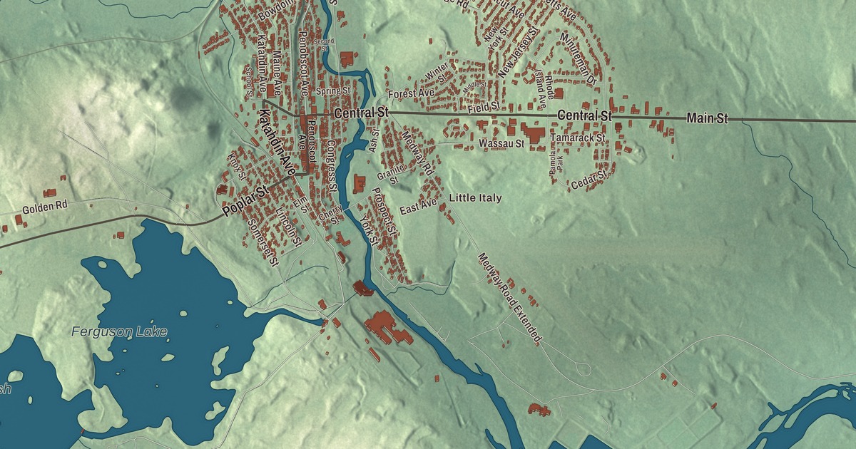
Katahdin Avenue, Penobscot Avenue and Central Street are the streets Millinocket grew up on, and this map lays them out with Dolby Pond nearby. Click here to purchase a print of this map for your wall.
Millinocket is a town in Penobscot County.
KNOWOL made this map in 2026 from public survey records, United States Geological Survey elevation data and Census Bureau files. Its atlas layout brings together Millinocket’s streets, buildings, ponds and waterways, and terrain, the town boundary and the pattern of buildings.
The land of many islands
Millinocket is an Abenaki word meaning land of many islands, after the islands in the Penobscot River. The Penobscot people lived in this area for more than 10,000 years. Betsy and Thomas Fowler cleared a farm near Shad Pond in 1829, and in 1846 Henry David Thoreau hired members of the Fowler family to guide him to Mount Katahdin, a trip he wrote about in The Maine Woods.
A town built for a mill
The Bangor and Aroostook Railroad ran through the area when it extended service to Houlton in 1894. Charles W. Mullen, an engineering graduate of the University of Maine, saw the falls as a water power source for a large pulp and paper mill and brought in Garret Schenck of the International Paper mill at Rumford Falls. Construction of the Great Northern Paper Company mill began on May 15, 1899, and because no town stood nearby, one had to be built. Millinocket was incorporated on March 16, 1901.
The mill produced its first roll of newsprint on November 9, 1900, and when it opened it was the world’s largest paper mill. Italian stonemasons did much of the work of building it, and immigrants from Poland, Finland, Lithuania and Hungary, along with French Canadians, came to work there too.
The mills closed in 2008, and Millinocket has since grown a service economy and become a four-season destination for visitors. It’s the closest town to Mount Katahdin, 20 miles to the northwest, and Gary Allen founded the Millinocket Marathon and Half here in 2015.
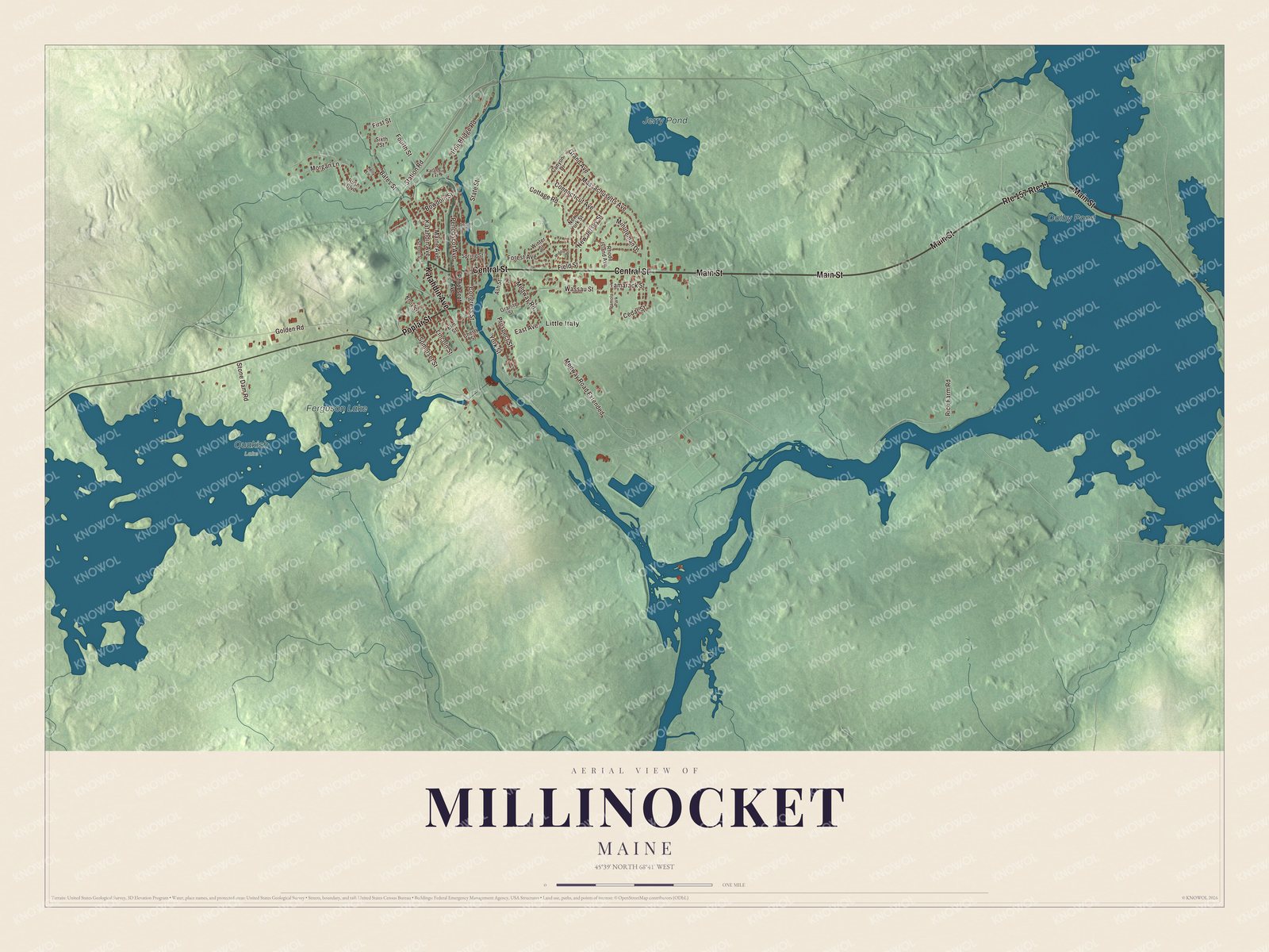
Click to explore a larger preview. The digital watermark does not appear on printed maps.
See it on a wall
The Millinocket map as a framed print. Swipe for more.


Explore the Millinocket map
Start with Little Italy, then follow Katahdin Avenue, Poplar Street, Main Street, Central Street, Penobscot Avenue and Iron Bridge Road across town. Those are printed street names.
Dolby Pond, Ferguson Lake and Jerry Pond are labeled too. Compare the grid of streets in the town center with the lakes and woods around it.
For people who call Millinocket home, this map shows the town as it looks today. Put it in your office, library, or den, or use it to teach children the geography and history of the area. Zoom in on the preview above to explore the details, then click here to get your copy of the Millinocket, Maine map.

Sources