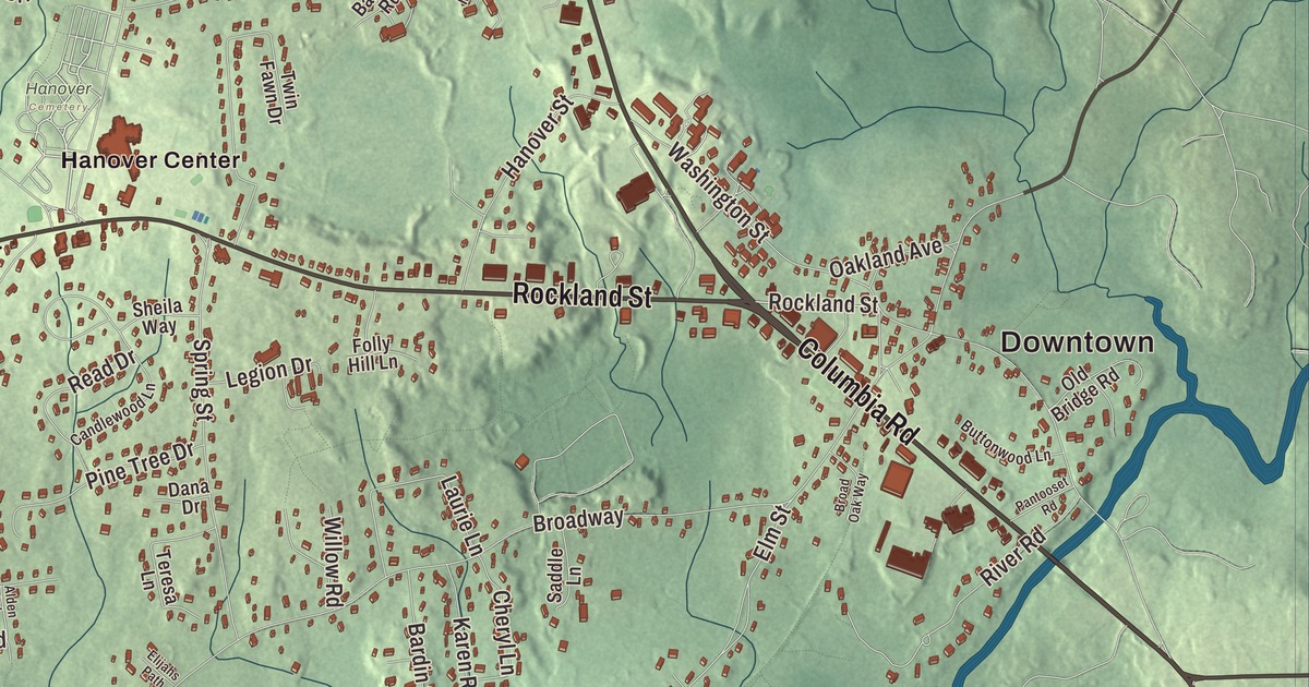
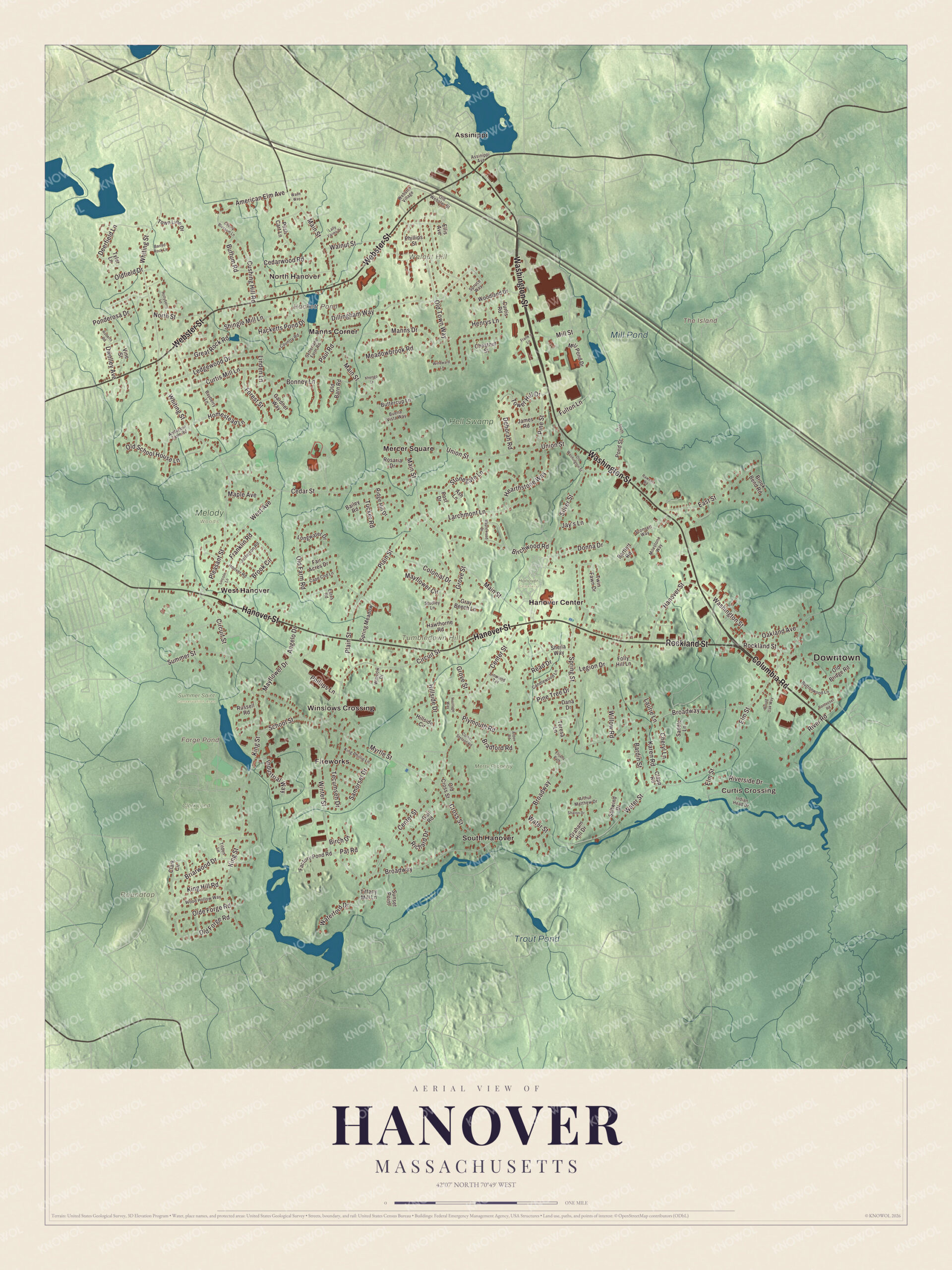
Hanover people measure the town by its villages: Hanover Center with its church and town hall, the shipyard history at Four Corners, Assinippi up by Walnut Hill. This map prints Washington Street, Hanover Street, Columbia Road, Rockland Street, Webster Street and Whiting Street, with Forge Pond, Hackett Pond, Tumbledown Hill and Walnut Hill. Click here to purchase a print of this map for your wall.
Hanover is in Plymouth County.
KNOWOL made this map in 2026 from public survey records, then gave it the look of a vintage atlas. The terrain comes from United States Geological Survey elevation data, and the Census Bureau supplied the streets and the town line. Hanover covers 15.7 square miles on the South Shore, about 20 miles southeast of Boston, and it had 14,833 people at the 2020 census. Much of its eastern and southern edge is water: the North River, the Indian Head River and the Third Herring Brook.
Barstow’s bridge and the new town
Wampanoag and Massachusett people lived here before any Europeans came, and local history records sites in Assinippi, in Pine Island Swamp and at Factory Pond. The Town of Hanover’s recorded history, in the Secretary of the Commonwealth’s list, dates European settlement to 1649. That’s the year the farmer William Barstow, from Scituate, built a bridge over the North River where Washington Street crosses it today. For decades the land was the western end of Scituate. The Hanover Center Historic District page says early meetings that led to a separate town were held at the Stetson House, built around 1700, probably by Cornet Robert Stetson’s son Benjamin.
Hanover was incorporated as a town in 1727, on June 14. The town page says the name was probably a tribute to King George I, the first Hanoverian king of Great Britain. The town remains part of Plymouth County today, and it grew up as six villages, North Hanover, Four Corners, West Hanover, Hanover Center, South Hanover and Assinippi, each with its own school district, store and post office. The Daniel Turner house, built in 1693, is the oldest building in town with the best documentation behind it.
Ships, anchors and tacks
Early Hanover lived by farming, small mills, anchor forging and shipyards along the North River. Thomas Barstow built the Grand Turk at his Two Oaks yard, and she was launched in May 1781 as a privateer for the Salem merchant Elias Hasket Derby. Derby’s page says that when she came home to Salem in 1787 she was the first New England ship to trade directly with China. The ship Oeno came off Barstow’s Lower Yard in 1821, and the town page passes on a saying that at the height of the 1812 shipbuilding boom, as many as 400 workers could be seen at the yards on a Saturday night. Today the old shipyard sites around Four Corners are a local point of interest.
In 1813 the Robert Salmond anchor forge at Luddam’s Ford made anchors for the USS Constitution. An iron forge in West Hanover turned from anchors to cannons and cannonballs during the Revolution, when Colonel John Bailey led Hanover men to help defend Boston Harbor and Castle Island. Wales Tavern, at Four Corners, hosted both Paul Revere and Daniel Webster. Later in the 1800s came tack and shoe factories on the smaller streams, and the town page credits Hanover with the invention of the first tack making machine. Forge Pond, in the southwest corner of town, had an anchor forge, and the land around it later became an industrial park that made fireworks and ammunition.
Hanover Center and the Cushing campus
The Hanover Center Historic District gathers seven properties where Hanover Street meets Main and Silver streets, near the middle of town. The Stetson House is now the historical society’s museum, and beside it stand the Curtis Free Library of 1907 and the Italianate town hall of 1863. The First Congregational Church, built in 1863 where the first meetinghouse stood in 1727, sits on an island between the three roads, with the town’s first cemetery to its north. The district was listed on the National Register in 1996.
On Washington Street in northern Hanover, the Cardinal Cushing Centers began in the late 1940s as St. Coletta’s by the Sea, a school for children with intellectual disabilities. Archbishop Richard Cushing pushed it into being with funding from the Kennedy family, and its page calls it one of the first of its kind in the nation. Cushing is buried on the campus, at the stone Portiuncula Chapel of 1953. The actor Chris Burke came to Hanover as a boy to attend the school and found his interest in acting there. George Washington Carver lived for several months in a small cabin on the North River in Hanover while he worked on his autobiography.
Click to explore a larger preview. The digital watermark does not appear on printed maps.
Names on this map
These names are printed on this map.
Places: Downtown, Curtis Crossing, North Hanover, Roundtop, The Island, Tumbledown Hill, Walnut Hill, Forge Pond, Hackett Pond, Mill Pond, Trout Pond, Clark Land, Hanover Cemetery, Hell Swamp, Melody Woods, Merry Property, Summer Saint Conservation Area, Assinippi, Fireworks, Hanover Center, Manns Corner, Mercer Square, South Hanover, West Hanover and Winslows Crossing.
Streets and roads: Rockland Street, Columbia Road, Washington Street, Hanover Street, Webster Street, Whiting Street, Pleasant Street, Bonney Lane, Olde Forge Road, Elm Street, Linden Lane, Broadway.
More street names, A to Z
Alden Road, American Elm Avenue, Anderson Farm Road, Angelo Drive, Arthur Matthew Drive, Ash Lane, Assinippi Avenue, Bailey Road, Bardin Street, Barred Rock Lane, Bartlett Road, Bayberry Lane, Birch Drive, Birchwood Road, Bradford Road, Briarwood Drive, Broad Oak Way, Brook Bend Road, Brook Circle, Buena Vista Way, Buffum Road, Buttercup Lane, Buttonwood Lane, Candlewood Lane, Cape Cod Lane, Cedar Street, Cedarwood Road, Center Street, Cherry Blossom Lane, Cheryl Lane, Chestnut Street, Circuit Street, Clapp Road, Clark Circle, Colonial Drive, Cornet Stetson Road, Country Road, Cross Street, Curtis Mill Lane, Curtis Road, Cushing Hill Road, Dana Drive, Deborah Road, Deerfield Lane, Dillingham Way, Donna Drive, Dwelley Avenue, East Street, Elijahs Path, Ellis Avenue, Estes Road, Factory Pond Road, Fair Acres Drive, Folly Hill Lane, Forest Street, Frank's Lane, Franklin Road, Fulton Lane, Gail Road, Gardner Way, Graham Hill Drive, Gray Beech Lane, Great Rock Road, Grove Street, Hacketts Pond Drive, Hawthorne Road, Hearthstone Way, Henrys Lane, Heritage Way, Hillside Circle, Hillside Drive, Hollyberry Lane, Homestead Lane, Hoover Road, Indian Head Drive, Industrial Way, James Road, Jay's Lane, Jefferson Road, Karen Road, King Hill Road, King Phillip Lane, King Street, Lally Farms Drive, Larchmont Lane, Laurie Lane, Ledgewood Drive, Legion Drive, Lincoln Lane, Linwood Terrace, Longwater Drive, Main Street, Manns Drive, Maple Avenue, Maplewood Drive, Mayflower Circle, Mayflower Drive, Meadowbrook Road, Milestone Way, Mill Pond Drive, Mill Street, Myrtle Street, North Street, Oakland Avenue, Old Barn Road, Old Bridge Road, Old Cross Street, Old Farm Road, Oldfield Drive, Old Forge Road, Old School House Lane, Old Town Way, Old Washington Street, Old Webster Street, Pantooset Road, Pat Road, Paul Road, Phillips Lane, Phillips Street, Pine Street, Pine Tree Drive, Plain Street, Plymouth Road, Ponderosa Drive, Pond Street, Post Drive, Push Cart Lane, Rawson Road, Read Drive, Richard Drive, Ridge Hill Drive, River Road, Riverside Drive, Roberts Road, Rosaria Drive, Russell Road, Saddle Lane, Saltwind Drive, Samorset Drive, School Street, Sconsett Way, Setterland Farm Road, Sharon Drive, Sheila Way, Shingle Mill Lane, Silver Street, South Street, Spring Meadow, Spring Street, Spruce Way, Stonegate Lane, Studley Lane, Summer Street, Sunset Point, Tecumseh Drive, Teresa Lane, Tiffany Mill Lane, Tilden Lane, Tower Hill Drive, Town Line Drive, Tucker Road, Twin Fawn Drive, Tyler Lane, Union Street, Vine Street, Wade Way, Walnut Street, Waterford Drive, Water Street, Webster Village, West Avenue, Willow Road, Windward Lane, Winslow Drive, Winter Street, Wood Hollow Way, Woodland Drive, Xhengo Lane.
Around the map
Start with Curtis Crossing. Follow Rockland Street, Columbia Road, Washington Street, Hanover Street, Webster Street and Whiting Street across town. Then look outward toward North Hanover, Assinippi, Fireworks, Hanover Center and Manns Corner. Forge Pond, Hackett Pond, Mill Pond, Trout Pond, Merry Property, Tumbledown Hill, Walnut Hill and The Island are all printed on the map, and each of those names sits right on the artwork. Walnut Hill, near Assinippi, is the highest point in Hanover. The town page says the second largest freshwater tidal marsh in Massachusetts lies along the North River in Hanover, toward the Third Herring Brook.
The Hanover map is a fine addition to an office, library or den, and it can help teach children the geography and history of a North River shipbuilding town. It’s made for people who call Hanover home, from Assinippi to Hanover Center, and it shows the town as it looks today. Zoom in on the preview above to explore the details, then click here to get your copy of the Hanover, Massachusetts map.

We made a map for every town and city in Massachusetts. Explore the complete Massachusetts map collection and find your town.
Sources