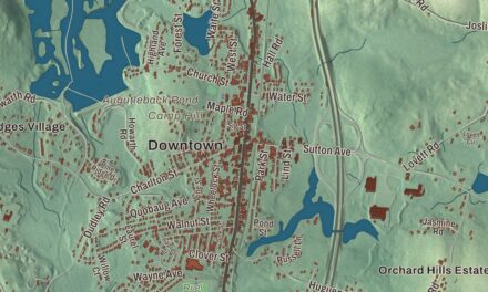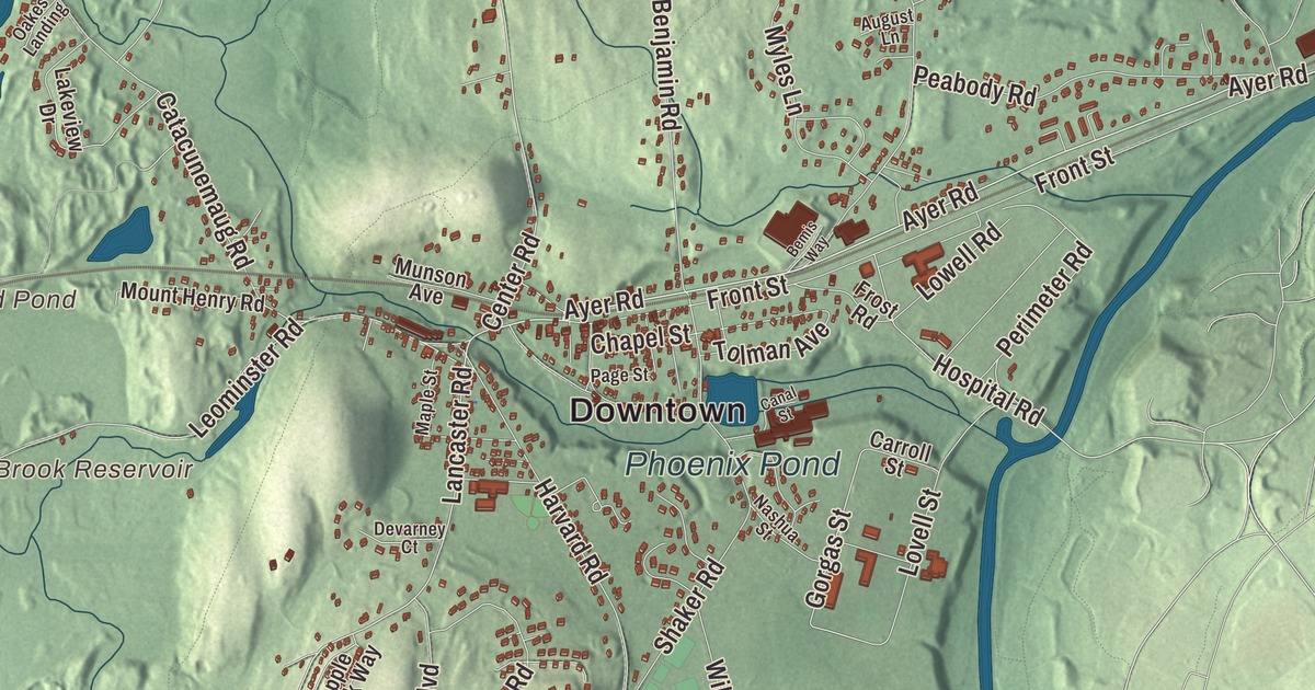
As a high school student, Benton MacKaye filled notebooks charting the woods, rivers and roads around Shirley Center, and years later he proposed the Appalachian Trail. This map of Shirley prints Great Road, Groton Road, Leominster Road, Ayer Road, Center Road and Lancaster Road, with Shaker Village, North Shirley and Shirley Center. Click here to purchase a print of this map for your wall.
Shirley is in Middlesex County.
KNOWOL made this map in 2026 from public survey data, set down in the manner of an old atlas. United States Geological Survey elevation data shapes the hills and river valleys, and the roads and the town line come from the Census Bureau. Shirley covers 15.9 square miles about thirty miles west-northwest of Boston, bounded by the Squannacook and Nashua rivers, and it takes in part of Devens. Mulpus Brook runs through it, and Spruce Swamp and Tophet Swamp are its large wetlands. Shirley had 7,431 people at the 2020 census.
Catacunemaug
The Nipmuc or Pennacook people who lived here when the English came called the area Catacunemaug. Once part of the Plantation of Groton, Shirley was first settled by English pioneers about 1720, the year the Town of Shirley’s recorded history, in the Secretary of the Commonwealth’s list, gives for European settlement. The town page says Shirley separated from Groton and was incorporated in 1753, named for William Shirley, governor of Massachusetts from 1741 to 1757, and the state list says Shirley was incorporated as a town in 1775. The common of 1753 is still the heart of Shirley Center, with the town hall and the First Parish Congregational Church and five roads running out from it, among them Center Road.
Oliver Holden, born in Shirley in 1765, became a carpenter, a hymn writer and a compiler of sacred music. When George Washington visited Boston in 1789, Holden wrote the ode and trained the choir that greeted him, and his tune “Coronation,” for “All Hail the Power of Jesus’ Name,” is said to be the earliest American hymn tune still in general use.
Mills and Shakers
A gristmill and sawmill stood on Catacoonamug Brook as early as 1740, and Shirley had a paper mill by about 1790 and the first of seven cotton mills in 1812. Shirley Village grew up in the south of town around a series of mills on the brook, and around the Boston and Fitchburg Railroad, which came through in 1845. Lancaster Road, which passes through the village, was the town’s only major stagecoach route. The big Phoenix Mills building still stands, and the village’s library is a brownstone-trimmed Romanesque building. In 1793 a Shaker community, Shirley Shaker Village, was founded on hundreds of acres in Shirley and Lancaster. The Shakers stood for pacifism, common property and celibacy, and they made and sold jellies, applesauce, herbs, mops and brooms. By 1853 there were 150 members. The village closed in 1908, when its remaining members moved to Hancock Shaker Village, and its meetinghouse was moved there in 1962. A state prison now stands on the land around the village’s remains, and the Shaker historic district has been on the National Register of Historic Places since 1976.
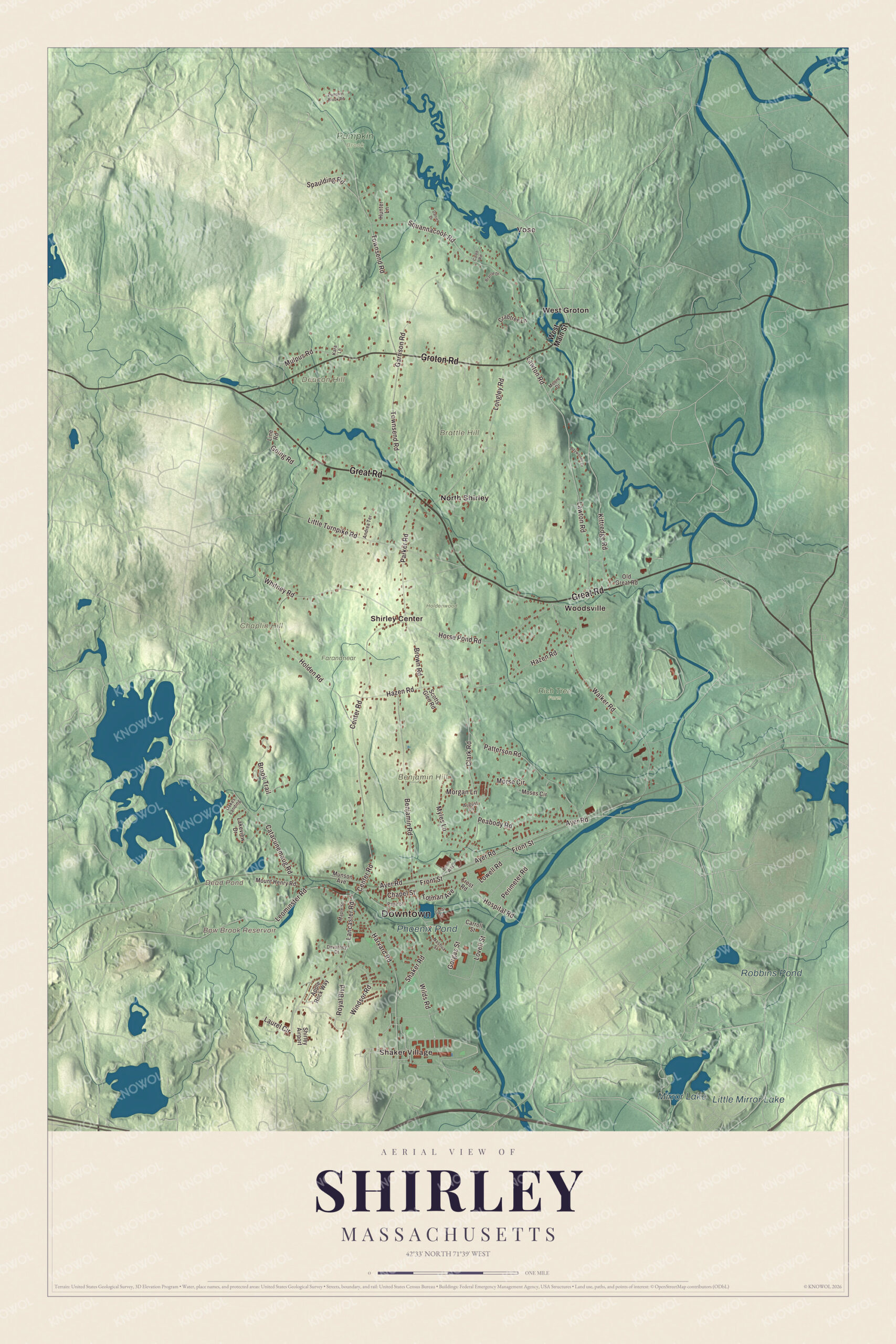
Click to explore a larger preview. The digital watermark does not appear on printed maps.
Names on this map
These names are printed on this map.
Places: Downtown, Shaker Village, Benjamin Hill, Brattle Hill, Chaplin Hill, Deacon Hill, Bow Brook Reservoir, Dead Pond, Mirror Lake, Robbins Pond, Little Mirror Lake, Phoenix Pond, Farandnear, Holdenwood, Pumpkin Brook, Rich Tree Farm, North Shirley, Shirley Center, Vose, West Groton, Woodsville and Shirley Airport.
Streets and roads: Great Road, Groton Road, Leominster Road, Ayer Road, Center Road, Lancaster Road, Mulpus Road, Gorgas Street, Hospital Road, Townsend Road, Hazen Road, Walker Road.
More street names, A to Z
Andrea Terrace, Apple Rock Way, August Lane, Baywoods Drive, Bemis Way, Benjamin Road, Brattle Drive, Brook Trail, Brown Road, Caleb Road, Canal Street, Carroll Street, Catacunemaug Road, Chapel Street, Clark Road, Crabtree Lane, Daniel Drive, Devarney Court, Front Street, Frost Road, Garrison Road, Going Road, Harvard Road, Holden Road, Horse Pond Road, Hunter Lane, Kara Lane, Kittredge Road, Lakeview Drive, Laurel Circle, Lawton Road, Line Road, Little Turnpike Road, Longley Road, Lovell Street, Lowell Road, Maple Street, Moore Drive, Morgan Lane, Morse Circle, Moses Circle, Mount Henry Road, Munson Avenue, Myles Lane, Nashua Street, Oakes Landing, Old Great Road, Page Street, Parker Road, Patterson Road, Peabody Road, Perimeter Road, Pumpkin Brook Road, Royal Boulevard, Scotts Glen Road, Shaker Road, Spaulding Road, Squannacook Road, Tolman Avenue, West Main Street, Whitney Road, Wilds Road, Windsor Road.
See it on a wall
The Shirley map as a framed print. Swipe for more.


Around the map
Start with Shaker Village. Follow Great Road, Groton Road, Leominster Road, Ayer Road, Center Road and Lancaster Road across town. Then look outward toward North Shirley, Shirley Center, Vose, West Groton and Woodsville. Bow Brook Reservoir, Dead Pond, Mirror Lake, Robbins Pond, Benjamin Hill, Brattle Hill and Chaplin Hill are all printed on the map. Leominster Road and Lancaster Road meet Harvard Road, Main Street and Center Road at the west end of Shirley Village, and the village stretches east along Ayer Road. The Benjamin Hill Recreation Area is one of the town’s parks. MacKaye’s family took to visiting Shirley Center to get away from city life, and his brother William bought an estate in town in 1888. Benton’s 1921 article, “An Appalachian Trail: A Project in Regional Planning,” proposed the trail.
The Shirley map makes a fine addition to an office, library or den, and it can help teach children the geography and history of a mill and Shaker town on the Nashua. It’s made for people who call Shirley home, from Shaker Village to North Shirley, and it shows the town as it looks today. Zoom in on the preview above to explore the details, then click here to get your copy of the Shirley, Massachusetts map.

Sources
- Shirley, Massachusetts, Wikipedia
- Shirley Center Historic District, Wikipedia
- Shirley Village Historic District, Wikipedia
- Shirley Shaker Village, Wikipedia
- Oliver Holden, Wikipedia
- Benton MacKaye, Wikipedia
- City and Town Incorporation and Settlement Dates, Secretary of the Commonwealth of Massachusetts (archived copy)