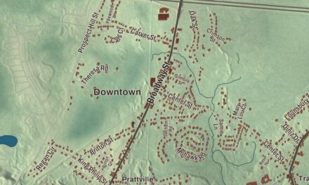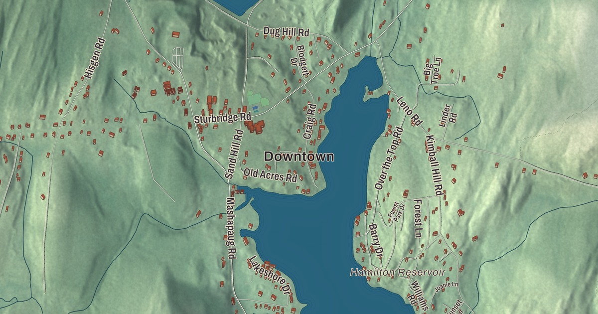
Holland is a lake town in the hills on the Connecticut line, with homes around Hamilton Reservoir, a swimming area at Lake Siog and Rattlesnake Mountain up in the northwest corner. This map prints Sturbridge Road, Mashapaug Road, Wales Road, Halfway Lane, Morse Road and Shore Drive, with Hamilton Reservoir, Holland Pond, Lost Lake and Rattlesnake Mountain. Click here to purchase a print of this map for your wall.
Holland is in Hampden County.
KNOWOL made this map in 2026 from public survey data and gave it the look of a vintage atlas. United States Geological Survey elevation data shapes the two ranges of hills, and the roads and the town line come from the Census Bureau. Holland covers 13.1 square miles in the southeastern corner of Hampden County, bounded by Sturbridge, Brimfield, Wales and Union, Connecticut, and it had 2,603 people at the 2020 census. The Quinebaug River drains the town, and the hills reach more than 1,100 feet on Rattlesnake Mountain.
Out from Wales
The town page says Joseph Blodgett settled the land in 1730, and his descendants still live in Holland. The Town of Holland’s recorded history, in the Secretary of the Commonwealth’s list, dates European settlement to 1725. The town page says Holland was incorporated on July 5, 1783, when it separated from Wales, which had itself split from Brimfield a few years earlier. It gives the reason too: the center of Wales lay up over a mountain and was hard to get to. By the state list, Holland was incorporated as a town in 1835. It took its name from Lord Holland, an English statesman whom the town page credits with lobbying for American independence. The town remains part of Hampden County today.
Over the years Holland has lived by farming, by making cloth and by making bricks. Today it’s known mostly for the outdoors. After the town hall burned in December 1995, a new one was dedicated on July 11, 1998.
The reservoir and the lake
Hamilton Reservoir lies in the southeastern part of town, and the town page counts it among the largest reservoirs in southern New England. The state stocks it with trout each year, and homes line its shores. Its outlet at the north end flows into the Quinebaug River. Lake Siog has a park and a swimming area, and the town center runs along Sturbridge Road, about 6 miles southwest of Sturbridge.
Team Hoyt
Holland was home to Team Hoyt, the father and son Dick and Rick Hoyt. Rick was born with cerebral palsy, and in 1977 he asked his father to run a race with him to benefit a lacrosse player at his school who had been paralyzed. Dick, then 36 and not a runner, pushed Rick’s wheelchair, and the two went on to race together in more than 30 Boston Marathons and in Ironman triathlons, with Dick pulling Rick in a boat for the swims and carrying him on a bicycle. They were inducted into the Ironman Hall of Fame and received ESPN’s Jimmy V Award. Holland’s notable people also include Carl Beane, the Fenway Park announcer from 2003 to 2012, and Ephraim Paddock, a justice of the Vermont Supreme Court.
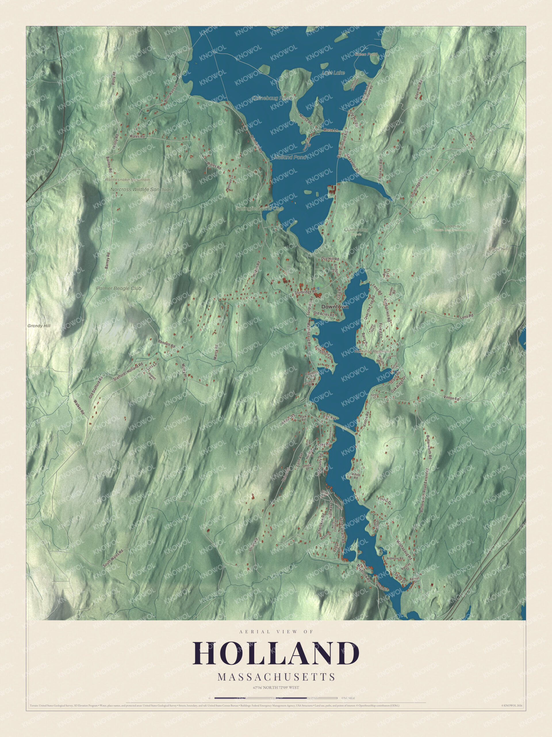
Click to explore a larger preview. The digital watermark does not appear on printed maps.
Names on this map
These names are printed on this map.
Places: Downtown, Blake Hill, Grandy Hill, Rattlesnake Mountain, Green Pond, Hamilton Reservoir, Holland Pond, Lost Lake, Quinebaug River, Norcross Wildlife Sanctuary, Palmer Beagle Club, Springfield Girls Club, Leadmine Wildlife Management Area and Quinebaug Woods.
Streets and roads: Mashapaug Road, Halfway Lane, Sturbridge Road, Wales Road, Morse Road, Butterworth Road Extended, Shore Drive, Polly Road, East Brimfield Road, Brimfield Road, South Wales Road, Morse Lane.
More street names, A to Z
Alexander Road, Allen Hill Road, Amber Road, Ardmore Road, Barclay Street, Barney Road, Barry Drive, Bennett Lane, Bennett Road, Big Tree Lane, Blodgett Drive, Butterworth Road, Candlewood Drive, Chandler Road, Cherokee Road, Craig Road, Davidson Road, Deyo Drive, Dug Hill Road, East Brimfield Holland Road, Evelyn Drive, Fenton Street, Forest Court, Forest Drive, Forest Lane, Forest Park Drive, Hamilton Drive, Heritage Drive, Hisgen Road, Howlett Road, Island Road, Joanie Lane, Kimball Hill Road, Lake Drive, Lake Ridge Drive, Lakeshore Drive, Lee Avenue, Leno Road, Linder Road, Lois Lane, Long Hill Road, Lynn Avenue, Maiden Lane, Marcy Place, Marcy Road, Maybrook Road, Mountain Road, North Cottage Road, North Wales Road, Oak Ridge Drive, Old Acres Road, Old County Road, Old East Brimfield Road, Old Stafford Road, Over the Top Road, Park Road, Pond-Bridge Road, Sand Hill Road, Sandy Beach Road, Sheila Drive, Sioux Lane, Sunset Lane, Union Road, Vinton Road, Walker Road, White Road, Williams Road, Wood Lane.
Around the map
Start in the town center along Sturbridge Road, then follow Mashapaug Road, Halfway Lane, Sturbridge Road, Wales Road, Morse Road and Shore Drive across town. Green Pond, Hamilton Reservoir, Holland Pond, Lost Lake, the Norcross Wildlife Sanctuary, Blake Hill, Grandy Hill and Rattlesnake Mountain are all printed on the map, and every one of those names is right there on the artwork. The Norcross Wildlife Sanctuary itself lies in Monson, an 8,000-acre refuge Arthur Norcross founded in 1939.
The Holland map makes a handsome addition to an office, library or den, and it can help teach children the geography and history of a small lake town on the state line. It’s made for people who call Holland home, from Hamilton Reservoir to Rattlesnake Mountain, and it shows the town as it looks today. Zoom in on the preview above to explore the details, then click here to get your copy of the Holland, Massachusetts map.

We made a map for every town and city in Massachusetts. Explore the complete Massachusetts map collection and find your town.
Sources