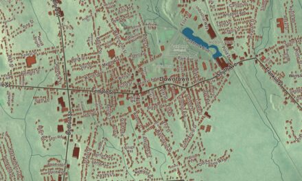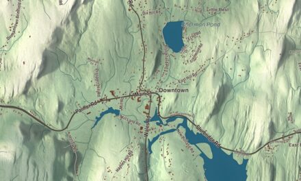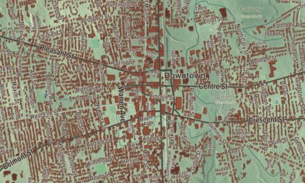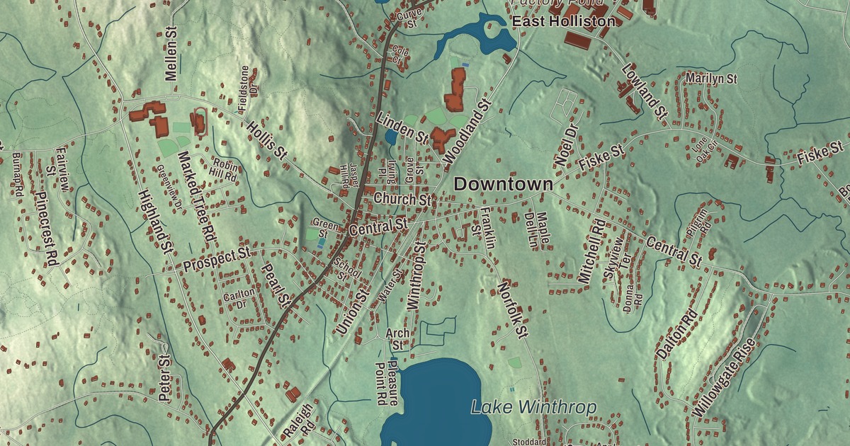
Ask anyone from Holliston for directions and you’ll hear about Washington Street, Concord Street and Highland Street, and sooner or later about Lake Winthrop. This map prints all of them, along with Summer Street, South Street and Prospect Street, Bloods Pond, Factory Pond, Bald Hill and Broad Hill. Click here to purchase a print of this map for your wall.
Holliston is in Middlesex County.
KNOWOL made this map in 2026 from public survey data and gave it the look of an old atlas. The relief comes from United States Geological Survey elevation data, and the streets and the town line come from the Census Bureau. Holliston covers 19.0 square miles about 21.6 miles west of Boston, between Sherborn, Millis, Medway, Milford, Hopkinton and Ashland. Routes 16 and 126 pass through town, and the Charles River runs near its southern edge. The town page notes that Holliston is the only town in Middlesex County that borders both Norfolk and Worcester counties. It had 14,996 people at the 2020 census.
Pout Lane and a gift of books
Before English farms reached this ground, it was Nipmuc country, part of the lands of the Awassamog family of Natick. A Nipmuc village called Mucksquit, “place of much grass,” stood on the shore of a lake the Nipmuc called Wennakeening, the “smile of the great spirit.” Today that lake is Lake Winthrop. Settler families such as the Morses, Sheffields, Marshalls and Bullards came out along Pout Lane, an old Native foot path that’s now partly Route 16 and Highland Street, and built farms along it. The town page says the lane played a major role in the settlement of Holliston and other places southwest of Boston.
The Town of Holliston’s recorded history, in the Secretary of the Commonwealth’s list, dates European settlement to 1659, when the land was still part of Sherborn. Holliston was incorporated as a town in 1724, on December 3, after the General Court approved a petition asking that “the western part of Sherborn be a Town.” The name honors Thomas Hollis of London, a merchant and benefactor of Harvard, who also gave his name to Hollis, New Hampshire. The First Congregational Church, built where the first meeting house stood, keeps the King James Bible that Hollis gave the town in 1724. The town remains part of Middlesex County today.
Shoes, granite and Mudville
The town page says Holliston was once the largest producer of shoes in the United States. The biggest company, the Goodwill Shoe Company, left empty factories on Water Street, and many of them now hold artists’ studios. In Braggville, at the town’s southern edge, Colonel Arial Bragg became Holliston’s first shoe and boot maker and the farm community’s first wholesale manufacturer. Braggville also had quarries of Milford pink granite that supplied buildings and railroad work in the late 1800s, and it had its own station on the Boston and Albany line until passenger service ended in 1919.
Holliston’s Mudville neighborhood says it’s the Mudville of Ernest Thayer’s 1888 poem “Casey at the Bat,” and it keeps up a rivalry with Stockton, California, which says the same thing. Thayer grew up in nearby Worcester, and his family’s wool mill stood less than a mile from Mudville’s ball field. Now and then Holliston players put on Mudville uniforms and play by the rules of that era. Thayer himself told a newspaper that the poem had no basis in fact.
Washington Street remembers a real visitor. On November 6, 1789, George Washington rode through on his way from Boston to New York and wrote in his diary about “an indifferent road” here, the road that would later carry his name. By legend his party stopped at Balancing Rock, a boulder of more than five tons perched on a granite ledge beside Route 16, and tried to tip it over, with the general himself lending a push. It didn’t budge for them, though it appears to have finally fallen on September 22, 2020.
There’s more history in plain sight. The Bullard family, among the first settlers, kept Bullard Farm from 1652 until 1916. Fiske’s General Store, founded in 1863, is the oldest retail business in town. Outside the police station grows one of the American sycamores raised from seeds that flew around the Moon on Apollo 14 in 1971. The Bogastow Brook Viaduct, an arch bridge off Woodland Street, is on a list of 1,000 places to visit in Massachusetts.
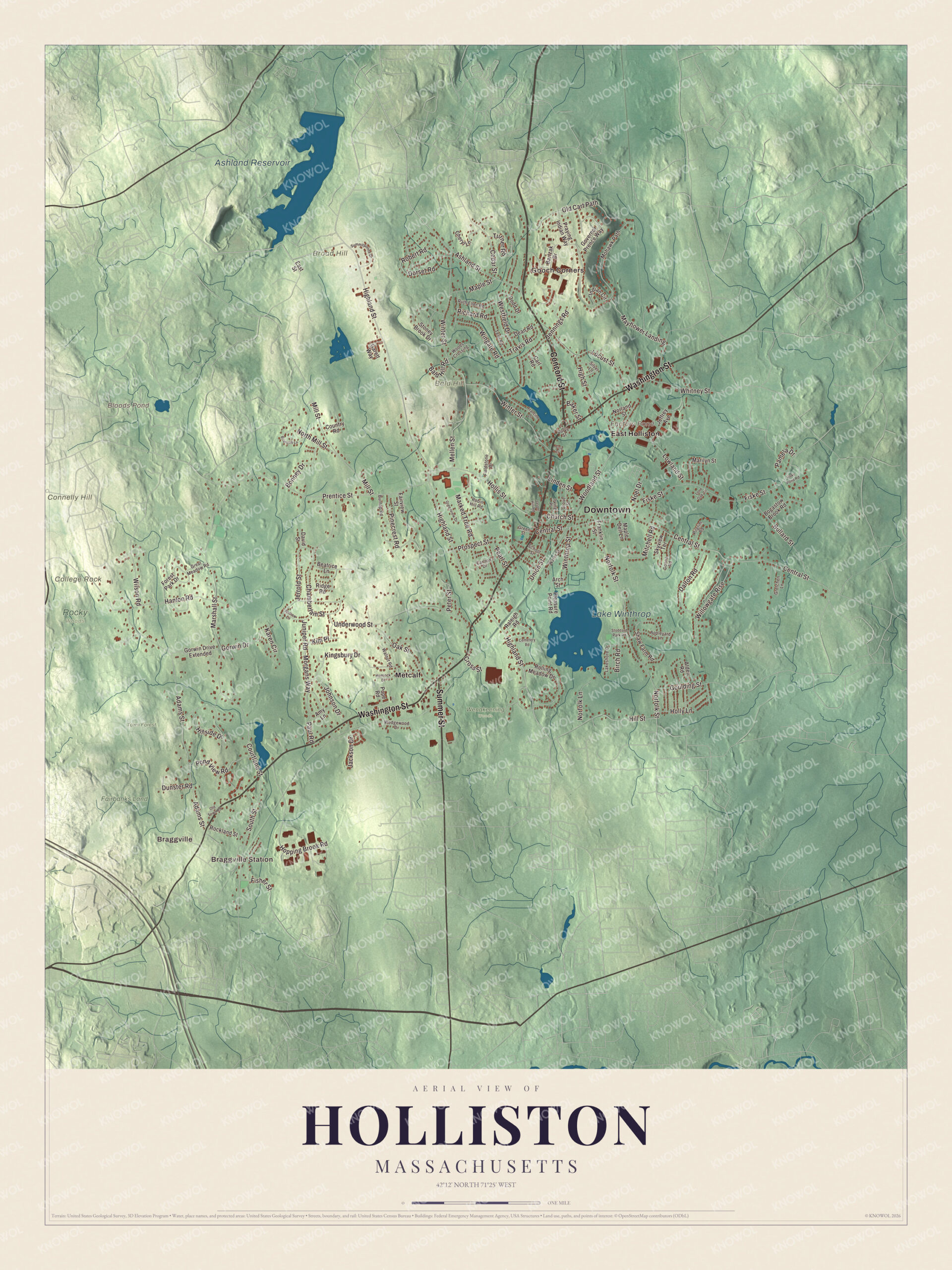
Click to explore a larger preview. The digital watermark does not appear on printed maps.
Names on this map
These names are printed on this map.
Places: Downtown, Braggville Station, Braggville, Gooch Corners, Bald Hill, Broad Hill, College Rock, Connelly Hill, Bloods Pond, Factory Pond, Ashland Reservoir, Lake Winthrop, Fairbanks Land, Rocky Woods, Town Forest, Wenakeening Woods, East Holliston and Metcalf.
Streets and roads: Washington Street, Concord Street, Summer Street, Highland Street, South Street, Prospect Street, Woodland Street, High Street, Kingsbury Drive, Morgans Way, Travis Road, Central Street.
More street names, A to Z
Adams Street, Alden Road, Amy Lane, Andrew Lane, Appleyard Lane, Arch Street, Ashland Street, Baker Street, Bald Hill Road, Bartzak Drive, Beatrice Lane, Birch Road, Bogastow Brook Road, Bonney Drive, Briarcliff Lane, Bullard Street, Burnap Road, Carl Road, Carlton Drive, Cedar Street, Cemetery Road, Chamberlain Street, Cheryl Lane, Church Street, Cole Court, Country Road, Courtland Street, Cross Street, Curve Street, Dalton Road, David Street, Dean Road, Dodd Drive, Donna Road, Dorset Road, Dunster Road, East Street, Fairview Street, Fieldstone Drive, Fisher Street, Fiske Pond Road, Fiske Street, Forest Park Drive, Francine Drive, Franklin Street, Garett Way, Gorwin Drive, Gorwin Drive Extended, Goulding Street, Governor Prence Way, Great Meadow Road, Green Street, Greenview Drive, Gretchen Lane, Grove Street, Hanlon Road, Hemlock Drive, Hillside Drive, Hill Street, Hollis Street, Holly Lane, Hopping Brook Road, Indian Circle, Irving Place, Jackson Drive, Jasper Hill Road, Jeffrey Avenue, Jennings Road, Jerrold Street, Johnson Drive, Juniper Road, Karen Circle, Kim Place, Lakeshore Drive, Linden Street, Locust Street, Lone Oak Circle, Lowland Street, Maple Dell Lane, Maple Street, Marilyn Street, Marked Tree Road, Marshall Street, Mayflower Landing, Mellen Street, Mill Street, Mitchell Road, Mohawk Path, Noel Drive, Norfolk Lane, Norfolk Street, Norland Street, North Mill Street, Oak Street, Old Cart Path, Old Town Road, Pamela Drive, Paul Road, Pearl Street, Peter Street, Pilgrim Road, Pinecrest Road, Pleasure Point Road, Pond View Road, Pope Road, Praying Indian Way, Prentice Street, Raleigh Road, Richard Road, Ridge Road, Robert Road, Robin Hill Road, Rockland Street, Rolling Meadow Drive, Ruth Ellen Road, School Street, Shaw Farm Road, Silver Lane, Skyview Terrace, Stoddard Park Road, Stoney Brook Drive, Summitpointe Drive, Temi Road, Turner Road, Underwood Street, Union Street, Walnut Road, Water Street, Wedgewood Drive, Westfield Drive, Whitney Street, Willowgate Rise, Wilson Road, Wingate Road, Winter Street, Winthrop Street, Woods Crossing.
Around the map
Start with Braggville Station, then follow Washington Street, Concord Street, Summer Street, Highland Street, South Street and Prospect Street across town. Look outward toward Braggville, Gooch Corners, East Holliston and Metcalf, which the town page lists among the areas Holliston officially recognizes as historic. Bloods Pond, Factory Pond, Ashland Reservoir, Lake Winthrop, the Town Forest, Bald Hill, Broad Hill and College Rock are all printed on the map, and every one of those names is right there on the artwork. Lake Winthrop is nearly a mile across and about 140 acres. Its old name was Dean Winthrop’s Pond, after John Winthrop’s son Dean, who used it to mark his land, and the town history places the Nipmuc village near today’s Lake Grove Cemetery on its southwestern shore. Stoddard Park and Pleasure Point sit on the lake with beaches and picnic areas.
The Holliston map makes a fine addition to an office, library or den, and it can help teach children the geography and history of a town that grew up along an old foot path. It’s made for people who call Holliston home, from East Holliston to Braggville, and it shows the town as it looks today. Zoom in on the preview above to explore the details, then click here to get your copy of the Holliston, Massachusetts map.

We made a map for every town and city in Massachusetts. Explore the complete Massachusetts map collection and find your town.
Sources