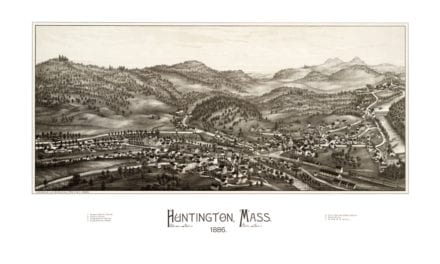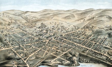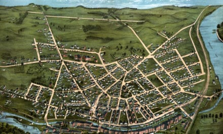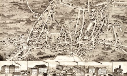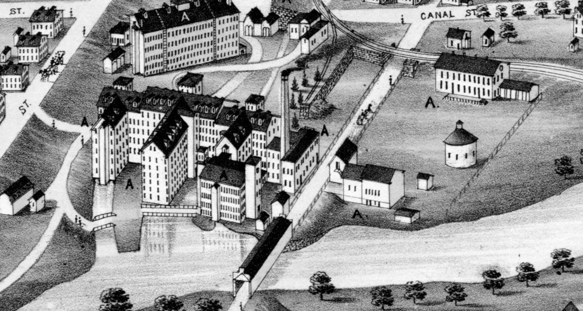
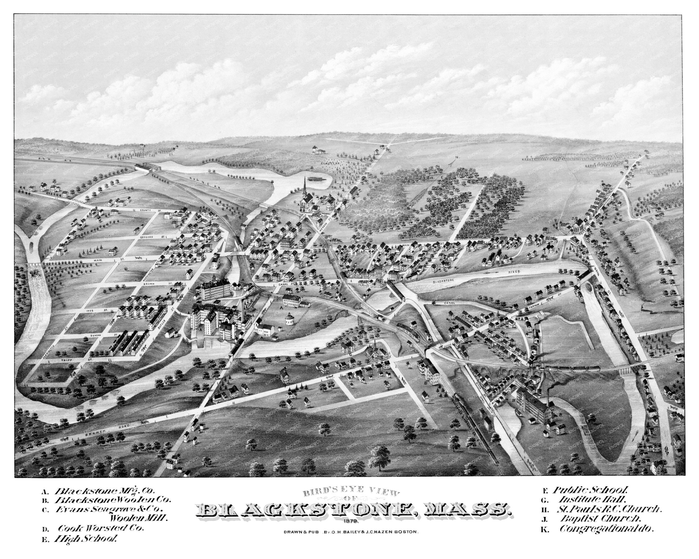
This old map of Blackstone, Massachusetts was created in 1879 by O.H. Bailey & J.C. Hazen, a prominent team of 19th century map makers. The map shows a detailed bird’s eye view of the area as it once was, including street names and old landmarks.
Landmarks on the map include Blackstone Manufacturing, Blackstone Woolen Company, Evans Seagrave Woolen Mill, Cook’s Worsted Company, Blackstone River, Institute Hall, St. Paul’s Roman Catholic Church, Baptist Church, and more.
This historic map of Blackstone was restored by KNOWOL. Reproductions of the restored map are available here.
Bird’s Eye View of Blackstone, Massachusetts in 1879
This map of Blackstone will make an attractive addition to your office, library, or den and can even be used to teach children the geography and history of the area. When you’re done exploring, click here to get your copy of the restored map.