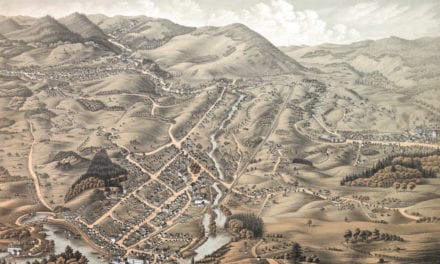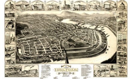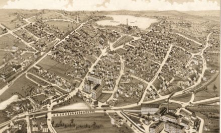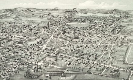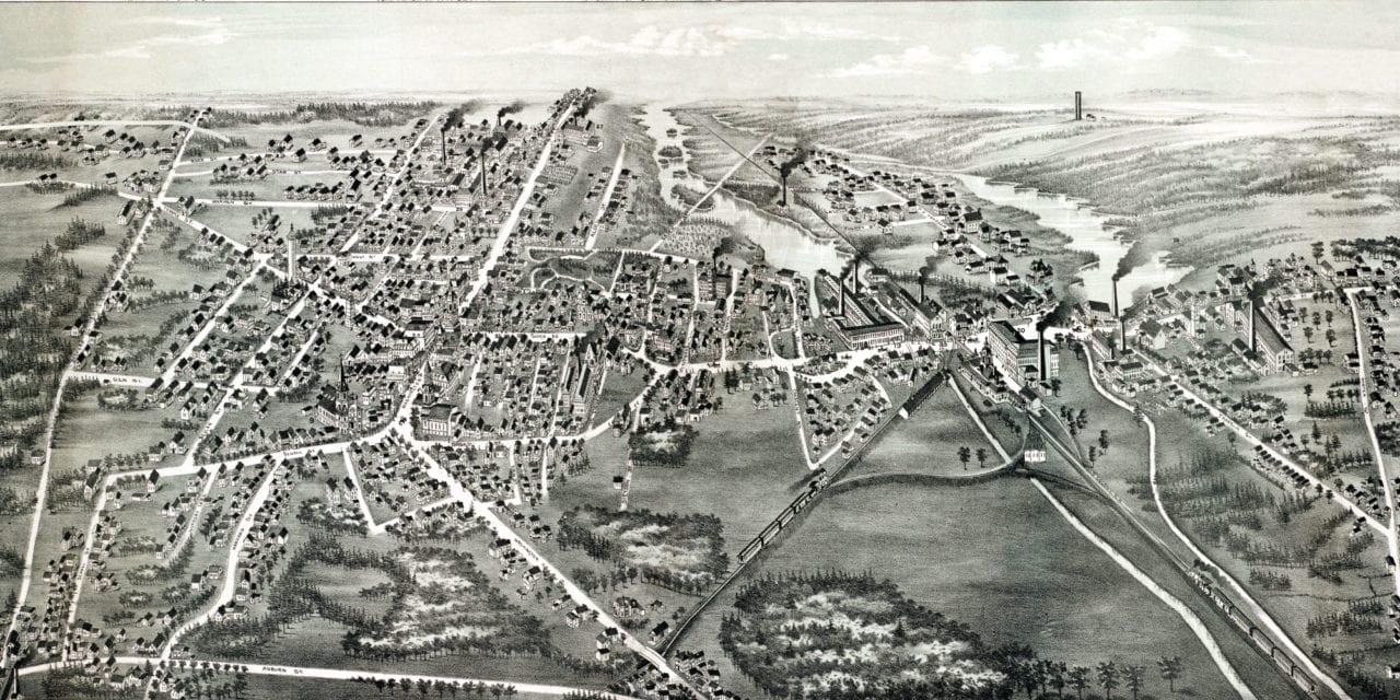
This historic old map of Whitman, Massachusetts was created in 1889 by O.H. Bailey, a prominent 19th century cartographer. The map shows a bird’s eye view of the town as it used to be, including street names and old landmarks.
Landmarks on the map include Whitman Grain Mill, Old Colony Railroad Station, Masonic Hall, Bates Block, Odd Fellows Hall, The Boston Store, Everson Jewelery, Union Hall, Jenkins Brothers Casket Manufacturers, Atwood Brothers Wooden Box Manufactury, Stetson Boot Manufactury, Village Block, Auburnville, and more.
This historic map of Whitman, MA has been restored by KNOWOL. Reproductions of the map are available here.
Bird’s Eye View of Whitman, MA from 1889
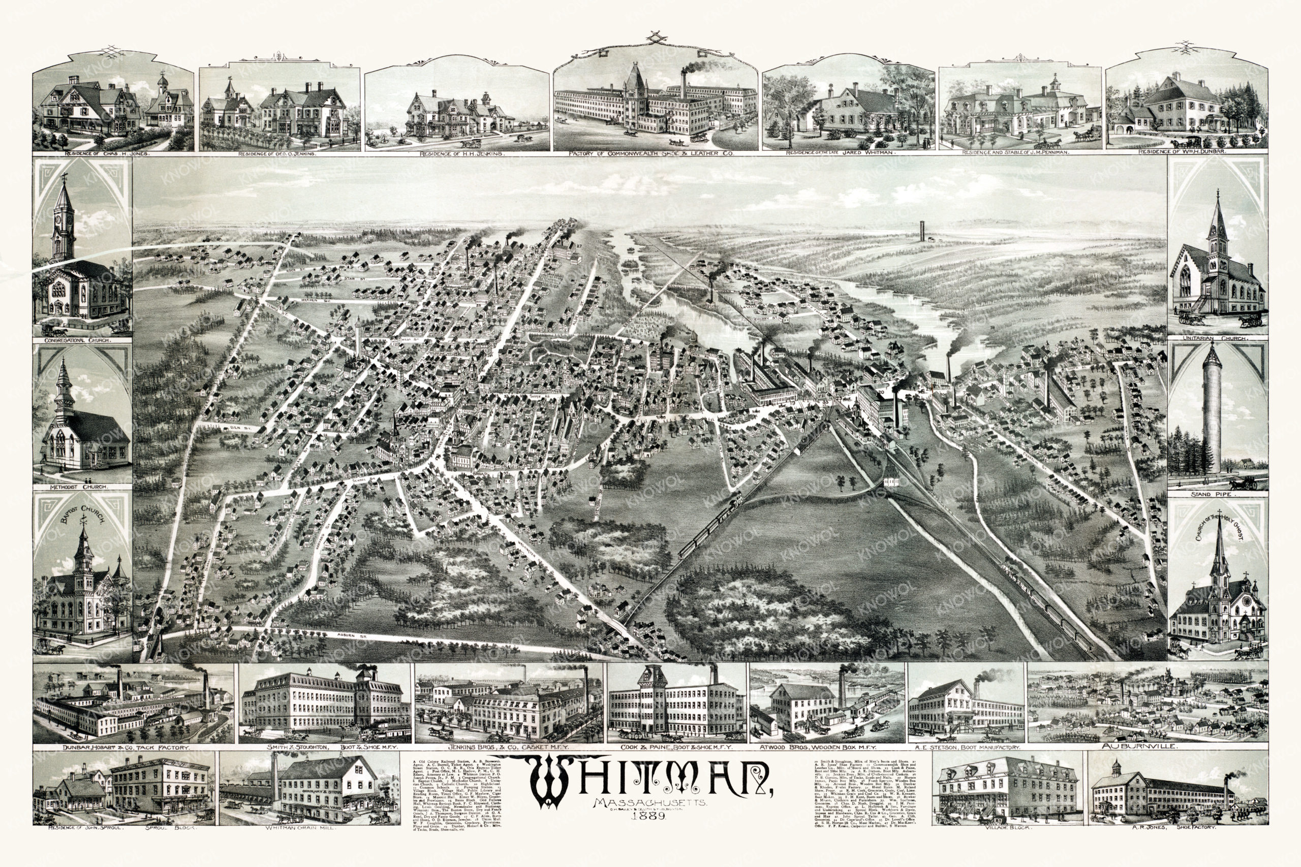
This historic map of Whitman will make an attractive addition to your office, library, or den and can even be used to teach children the geography and history of the area. When you’re done exploring, click here to get your copy.