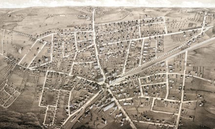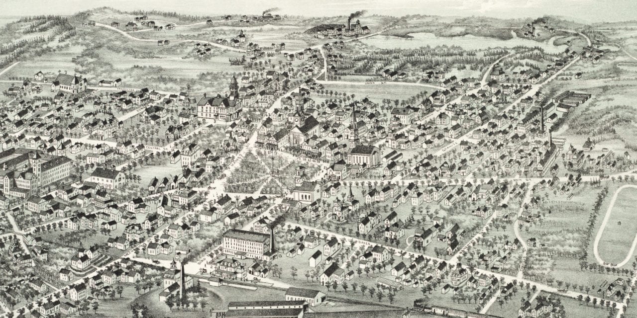
This old map of Foxborough, Massachusetts was created in 1888 by O.H. Bailey, a prominent 19th century map maker. The map shows a bird’s eye view of Foxborough as it was, including street names and old landmarks.
Old Foxborough landmarks on the map include Union Straw Works, Crocker’s Dry Goods Store, Union Building, Highlawn Farm, Memorial Hall & Public Library, Barbour Boarding House, Fairfield Confectionery & Ice Cream, Hadley Billiard Hall and more.
Union Straw Works was the world’s largest straw hat manufacturer. The factory was the oldest of its kind in the country, having been started in 1856. It burnt to the ground in 1900. The town post office now stands on the site.
This historic map of Foxboro, MA has been restored by KNOWOL. Reproductions of the map are available here.
Click to see Foxboro, Massachusetts in 1888
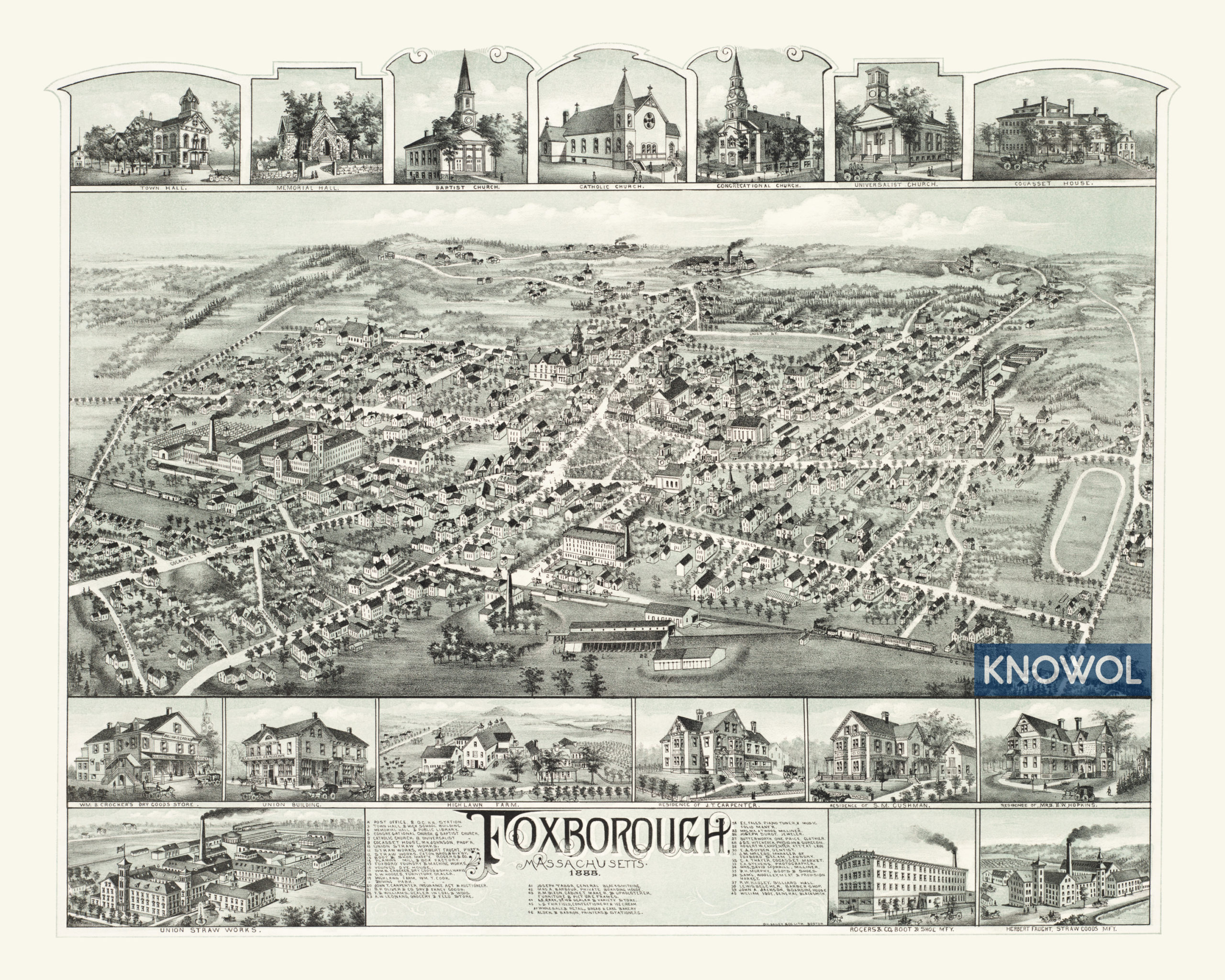
This map of Foxborough will make an attractive addition to your office, library, or den and can even be used to teach children the geography and history of the area. When you’re done exploring, click here to get your copy.