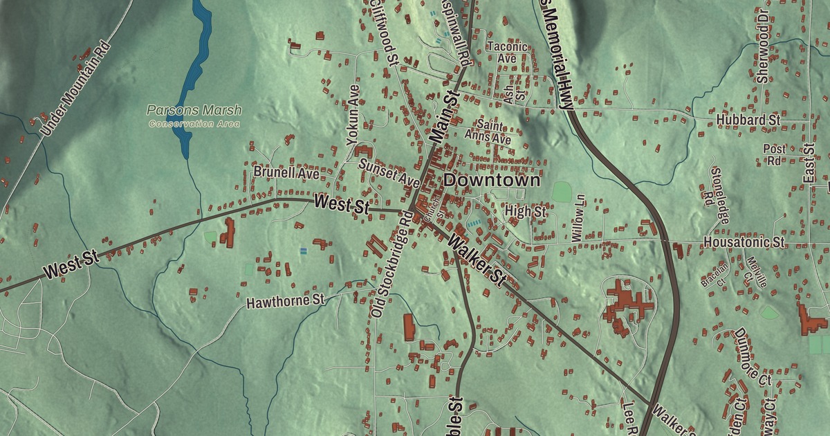
Summer in Lenox means Main Street through the village, Ventfort Hall on Walker Street, and the drives out to Tanglewood and The Mount. This map prints Main Street, Walker Street, West Street, Lee Road, Pittsfield Road and the Veterans Memorial Highway, with Laurel Lake, Woods Pond, Felton Lake and Lenox Mountain. Click here to purchase a print of this map for your wall.
Lenox is in Berkshire County.
KNOWOL made this map in 2026 from public survey data and gave it the look of a vintage atlas. The ridges come from United States Geological Survey elevation data, and the Census Bureau supplied the roads and the town line. Lenox covers 21.7 square miles about 8 miles south of downtown Pittsfield and had 5,095 people at the 2020 census. A branch of the Berkshires separates it from Richmond on the west, topped by Yokun Seat at 2,146 feet. On the east the Housatonic River runs along the foot of October Mountain, and a dam on the river forms Woods Pond. Routes 7 and 20 meet at the south end of town and head north toward Pittsfield on a bypass road.
Yokuntown becomes Lenox
Mahican people lived along the Housatonic before English settlers came. The French and Indian Wars held settlement back until 1750, when Jonathan and Sarah Hinsdale of Hartford, Connecticut, opened a small inn and general store here. The Town of Lenox’s recorded history, in the Secretary of the Commonwealth’s list, dates European settlement to 1750. The land was founded as part of Richmond in 1765, but the mountains split that town in two, and the village of Yokuntown, named for a Native chief, was set off on its own in 1767. It was meant to be Lennox, probably after Charles Lennox, 3rd Duke of Richmond and Lennox, but a clerk misspelled the name at incorporation. The Secretary of the Commonwealth’s list gives 1775 as the year Lenox was incorporated as a town. The town remains part of Berkshire County today.
Early Lenox lived on farming, sawmills, textile mills, potash, glassworks and quarrying. A vein of iron ore led to mines under the town, and in the 1780s Job Gilbert set up an iron works at Lenox Dale, also called Lenox Furnace. Lenox was the county seat from 1784 until 1868, when the title passed to Pittsfield, and the county courthouse built in 1816 is now the Lenox Library.
Writers and cottages
Lenox grew into an art colony. Catharine Sedgwick moved here in 1821, the actress Fanny Kemble followed, and Nathaniel Hawthorne and his family came from Salem in 1850 and stayed a year and a half. After the Housatonic Railroad arrived in 1838, more and more visitors found the town. In 1844 Samuel Gray Ward of Boston put together the first estate in Lenox, and the years from 1880 to 1920 became the Berkshire Cottage era, when the town turned into a Gilded Age resort much like Newport and Bar Harbor. During the Berkshire Season, from late summer into early fall, the annual Tub Parade lined Main Street with decorated carriages, and by 1903 an acre in Lenox cost $20,000 when land in nearby towns went for a few dollars.
Some of those houses survive with new lives. Edith Wharton designed The Mount, her house of 1902, and its grounds, called it her “first real home,” and lived there until 1911; it’s now a National Historic Landmark and museum. Ventfort Hall, built in 1893 at 104 Walker Street for George Morgan and his wife Sarah, a sister of J. P. Morgan, is a Gilded Age museum, and Shadowbrook became the Kripalu yoga center. Robert Gould Shaw, colonel of the 54th Massachusetts Volunteer Infantry, spent his brief honeymoon at Vent Fort, the smaller house that stood on the Ventfort Hall land before it was moved across the street.
Tanglewood
In 1937 the Boston Symphony Orchestra’s summer festival moved to Tanglewood, an estate given by Rosamond Sturgis Brooks and Mary Aspinwall Tappan, and it has been the orchestra’s summer home ever since. The estate lies partly in Stockbridge, and it takes its name from Tanglewood Tales, which Hawthorne wrote while living in a cottage on the grounds. The photographer James Van Der Zee, a leading figure of the Harlem Renaissance, was born in Lenox in 1886, bought his first camera at 14 and took hundreds of pictures of his family and his hometown before moving to Harlem in 1906.
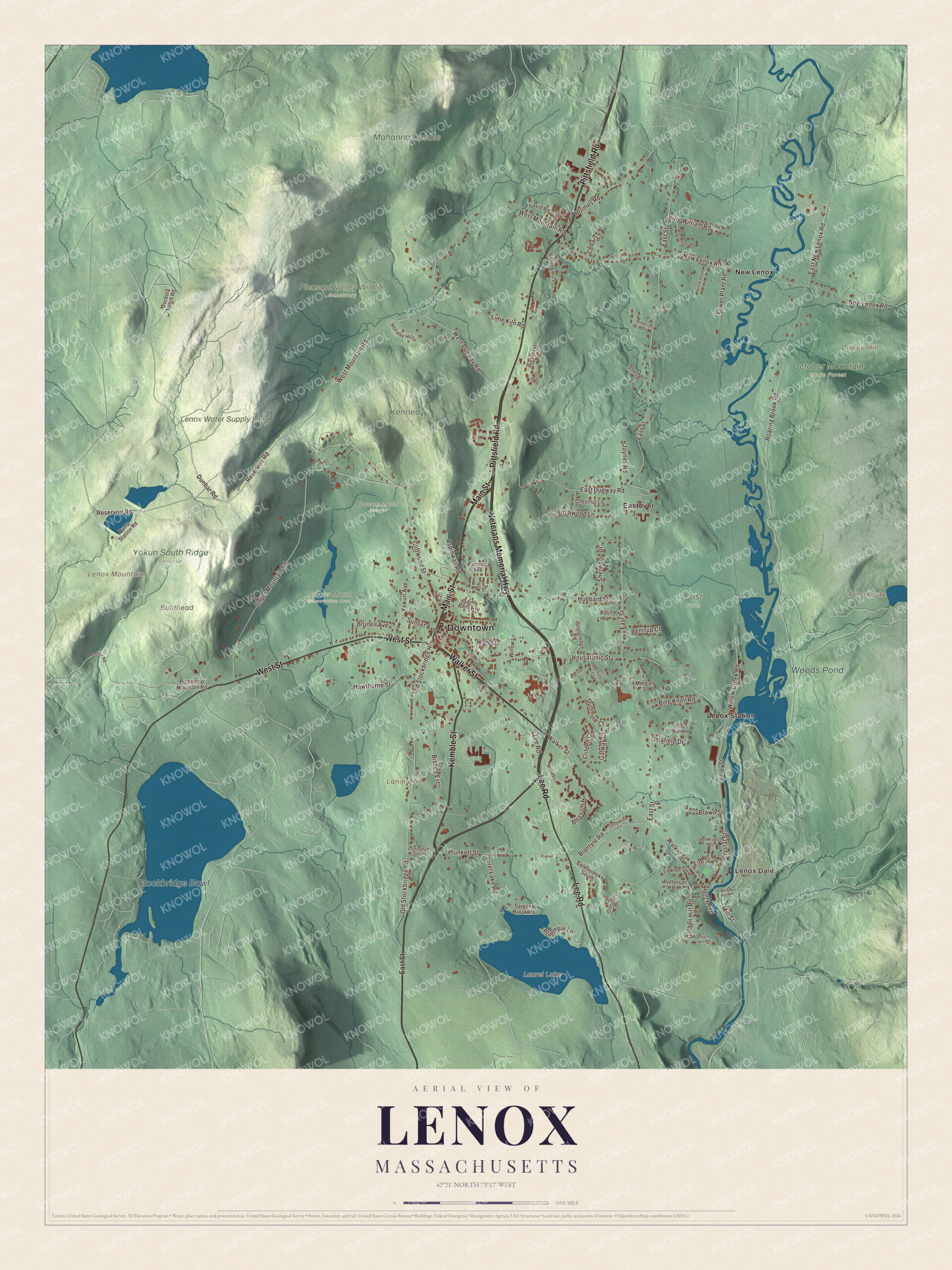
Click to explore a larger preview. The digital watermark does not appear on printed maps.
Names on this map
These names are printed on this map.
Places: Downtown, Lenox Dale, Baldhead, Dewey Hill, Lanier Hill, Lenox Mountain, Felton Lake, Laurel Lake, Stockbridge Bowl, Woods Pond, Kennedy Park, Lenox Water Supply Land, Mahanna Cobble, October Mountain State Forest, Parsons Marsh Reserve, Parsons Marsh Conservation Area, Pleasant Valley Wildlife Sanctuary, Post Farm, Yokun South Ridge Reserve, Eastover, Lenox Station and New Lenox.
Streets and roads: Main Street, Walker Street, Lee Road, Veterans Memorial Highway, West Street, Pittsfield Road, Kemble Street, Under Mountain Road, Cliffwood Street, Blossom Hl, Crystal Street, East Dugway Road.
More street names, A to Z
Ash Street, Aspinwall Road, Bentrup Court, Birchwood Lane, Bishop Est, Blantyre Road, Bracelan Court, Bramble Lane, Brown Street, Brunell Avenue, Cedar Lane, Chestnut Lane, Church Street, Clifden Court, Coldbroooke South, David Road, Delafield Drive, Dunbar Road, Dunmore Court, East New Lenox Road, East Street, Edgewood Drive, Elm Street, Frothingham Crossing, Galway Court, Gleneagles Drive, Golden Hill Road, Hawthorne Street, Henry Avenue, Highcrest Road, High Street, Holiday Hills, Holmes Road, Housatonic Street, Hubbard Street, Hutchinson Lane, Jaynes Road, King William Road, Laurel Lake Road, Lawton Street, Lenox Road, Lime Kiln Road, Melville Court, Mill Street, Morgan Street, New Lenox Road, October Road, Old Barn Road, Old Stockbridge Road, Old Town Way, Osceola Notch Road, Patterson Road, Pinecrest Drive, Pine Knoll Road, Plunkett Street, Post Road, Pump Station Road, Reservoir Road, Richmond Mountain Road, Roaring Brook Road, Rolling Hills, Saint Anns Avenue, Sargent Brook Road, Sedgwick Lane, Sewer Plant Road, Shaylor Hill Road, Sherwood Drive, Stoneledge Road, Sunset Avenue, Taconic Avenue, Valley Street, West Dugway Road, Westminster Road, West Mountain Road, Willow Creek Road, Willow Hill Road, Willow Lane, Woods Lane, Yokun Avenue.
Around the map
Start with Lenox Dale, where Job Gilbert’s iron works stood. Follow Main Street, Walker Street, Lee Road, the Veterans Memorial Highway, West Street and Pittsfield Road across town. Then look outward toward Eastover, Lenox Station and New Lenox. Penn Central trains last stopped at the Lenox railroad station in 1970, and the Berkshire Scenic Railway Museum is among the town’s sites today. Felton Lake, Laurel Lake, Woods Pond, Dewey Hill, Lanier Hill and Lenox Mountain are all printed on the map, each name right on the artwork.
The Lenox map makes a fine addition to an office, library or den, and it can help teach children the geography and history of a Berkshire cottage town. It’s made for people who call Lenox home, from New Lenox to Lenox Dale, and it shows the town as it looks today. Zoom in on the preview above to explore the details, then click here to get your copy of the Lenox, Massachusetts map.

We made a map for every town and city in Massachusetts. Explore the complete Massachusetts map collection and find your town.
Sources