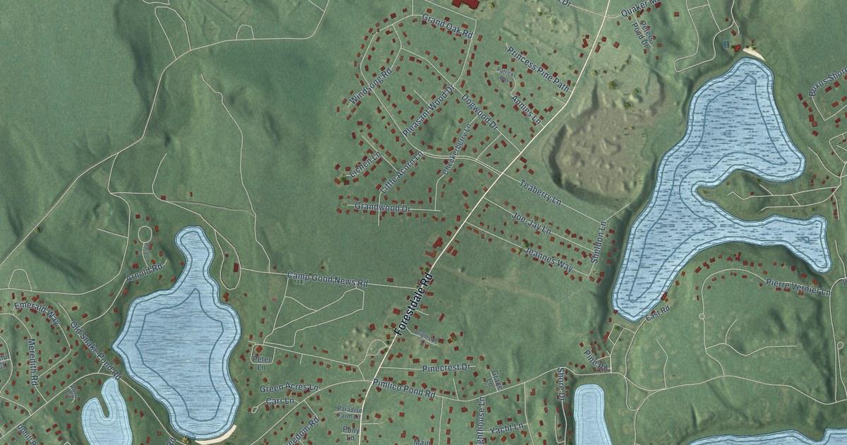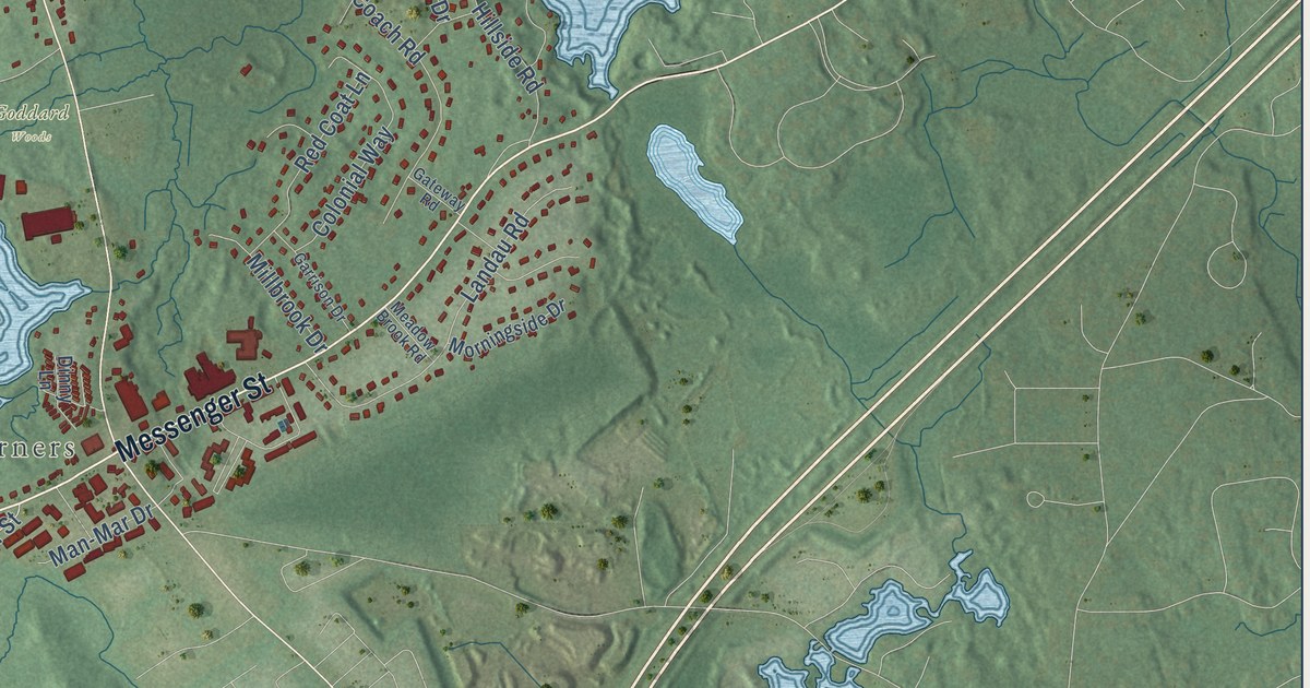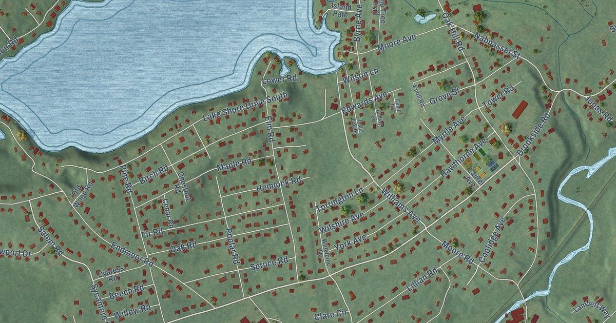
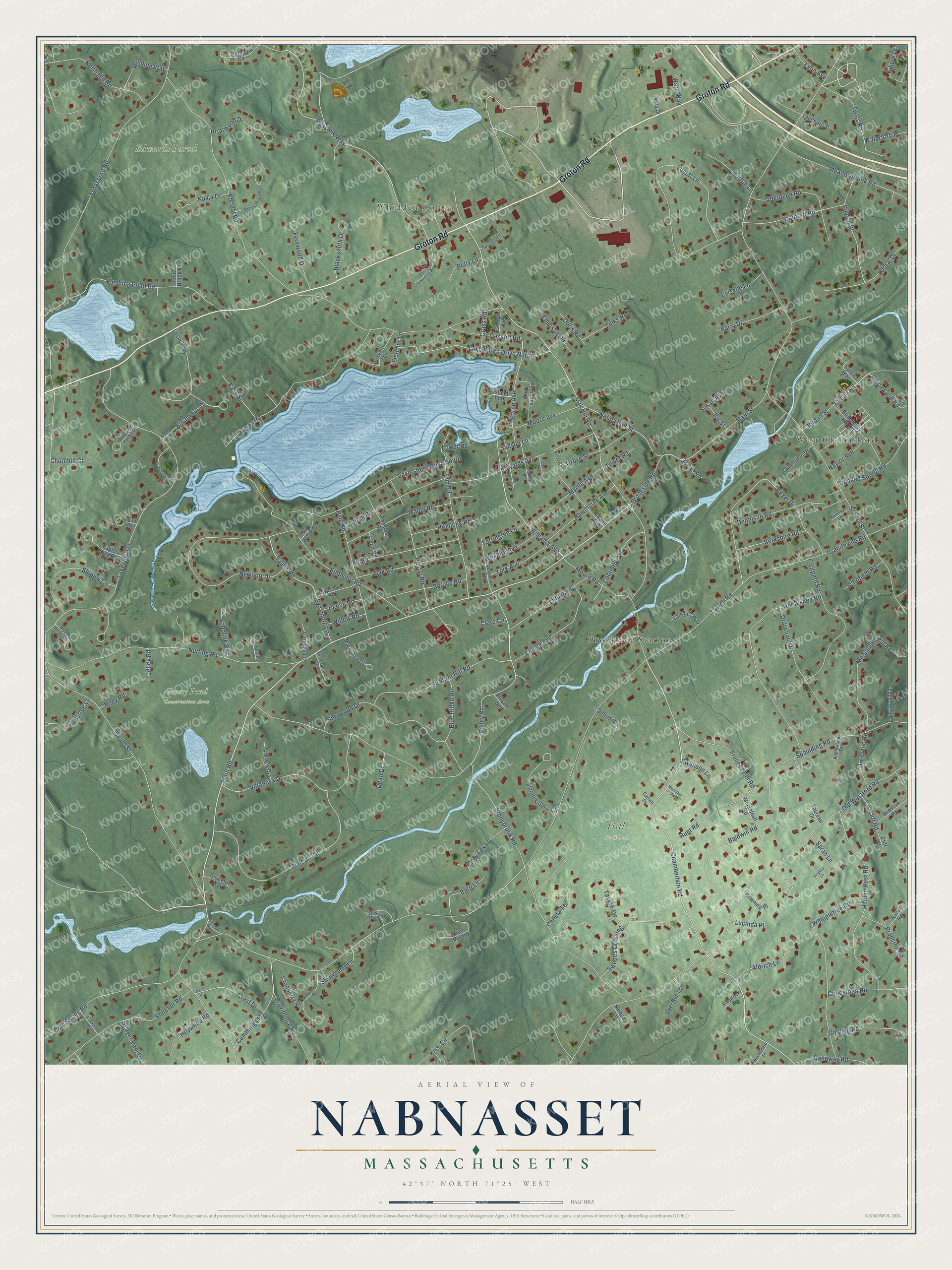
This beautifully detailed map of Nabnasset, Massachusetts was created in 2026 using aerial imagery combined with modern topographical, census, street and landmark data. It’s a one-of-a-kind view of Nabnasset that combines accurate data with a vintage aesthetic. The map shows every building in its true location, many of the roads carry their names, and the shaded topographic relief shows the shape of the land.
Explore an aerial view of Nabnasset, Massachusetts
On the map you’ll find Edwards Parcel, Grassy Pond Conservation Area, Hill Orchard, West Chelmsford, Brookside Station, and Whidden Corner, along with Groton Road, Jordan Road, Plain Road, Williams Avenue, Ridgewood Road, Depot Street, and more. If you look closely you can even find your house accurately drawn in its correct location. Zoom in on the preview to look for yours.
Did You Know?
From Internet Archive: "Winship of the Nabnasset School, who had taught so long and faithfully, retired from the service, much to the regret of all who were associated with her in the work."
Nabnasset is a community in Middlesex County.
Take a closer look at the Nabnasset map
Names on this map
These names are printed on this map.
Places: Edwards Parcel, Grassy Pond Conservation Area, Hill Orchard, West Chelmsford, Brookside Station and Whidden Corner.
Streets and roads: Groton Road, Jordan Road, Plain Road, Williams Avenue, Ridgewood Road, Depot Street, Salem Road, Chamberlain Road, Oak Hill Road, Russells Way, Nabnasset Street, Polley Road.
More street names, A to Z
Aberdeen Road, Aldrich Lane, Allison Drive, Almeria Circle, Applewood Drive, Baldwin Road, Barn Lane, Barry Drive, Beaver Dam Drive, Beech Road, Berkshire Road, Betty Lane, Birch Road, Birchwood Drive, Blacksmith Drive, Blackthorn Drive, Blue Brook Lane, Blue Heron Drive, Blue Ridge Road, Bobolink Road, Boxwood Road, Bradford Road, Briarwood Drive, Brookside Road, Buckboard Drive, Burbeck Way, Burton Lane, Byrne Avenue, Calista Terrace, Camp Road, Carl Thompson Road, Carolina Lane, Catamaran Drive, Cedar Road, Chesapeake Drive, Chestnut Road, Churchill Court, Cider Mill Road, Clare Circle, Cliff Road, Cliff Street, Cold Spring Road, Conestoga Road, Coolidge Avenue, Cranberry Drive, Crest Drive, Crest Street, Crooked Spring Road, Cross Road, Cummings Road, Cypress Road, Dayton Street, Dean Drive, Deer Run Drive, Dennison Road, Doral Drive, Doris Drive, Doris Road, Downing Place, Draycoach Drive, Drexel Drive, Eagle Nest Road, Eagles Nest Road, Easy Street, Edwards Avenue, Elm Road, Emerson Road, Endmoor Road, Fawn Road, Fernwood Drive, Fir Road, Fletcher Lane, Fletcher Road, Flushing Pond Road, Footpath Road, Forrest Road, Frances Hill Road, Galloway Road, Garrett Drive, Gassett Road, Gelding Road, George Avenue, Gifford Drive, Graceful Way, Granada Drive, Graniteville Road, Grassy Lane, Grey Fox Lane, Gristone Road, Grove Street, Hadley Road, Hawthorne Avenue, Hemlock Road, Heywood Road, Hitchin Post Road, Horseshoe Road, Hunt Road, Island Path, Jack Rabbit Lane, Jelley Road, Jonas Road, Jordan Street, Joy Street, Kayla Drive, Kiberd Drive, Kirsi Circle, Knoll Road, Lake Shore Drive North, Lake Shore Drive South, Lakeside Terrace, Lambert Way, Laurel Avenue, Lawson Road, Leedburg Street, Leighton Way, Lillian Road, Links Road, Loiselle Lane, Loon Way, Lovett Lane, Lowell Road, Lower Road, Lucille Avenue, Lucinda Place, Lynch Way, Lynn Avenue, Macintosh Road, Main Street, Maple Road, Marie Ann Drive, Meadowbrook Road, Monument Hill Road, Moore Avenue, Moore Road, Morning Glory Circle, Mountain Vw, Myrtle Avenue, Naylor Avenue, Newport Drive, North Hill Road, Nutting Lane, Nutting Road, Oak Road, Old Westford Road, Old Wood Road, Paddock Lane, Perham Circle, Pine Road, Pine Tree Trail, Pollyanna Lane, Pondview Circle, Poplar Road, Prancing Road, Providence Road, Quessy Lane, Rack Road, Riley Road, Rolling Meadow Lane, Sarah Lane, Schofield Road, School Street, Sherwood Drive, Shipley Circle, Sinbad Lane, Spaulding Road, Spruce Road, Stonybrook Road, Stratton Hill Road, Strawberry Hill Road, Strawberry Lane, Susan Avenue, Swanson Lane, Swedes Crossing, Sweetwood Circle, Sycamore Lane, Tavern Circle, Thoreau Drive, Timberlee Lane, Torrington Lane, Tower Road, Trails End Road, Twiss Road, Tyngsboro Road, Villanova Drive, Virginia Lane, Ward Way, Waterford Place, Whippletree Road, Willow Road, Wilshire Avenue, Wilson Lane, Winding Way, Winslow Road, Woodbine Terrace, York Avenue.
See it on a wall
The Nabnasset map as a framed print. Swipe for more.


This beautifully detailed map of Nabnasset makes an attractive addition to your office, library, or den, and it can even be used to teach children the geography and history of the area. It also makes a great gift for someone who left Nabnasset and still calls it home. When you’re done exploring, click here to get your copy of the Nabnasset map.