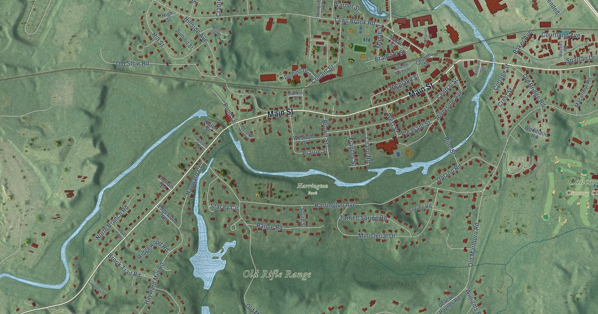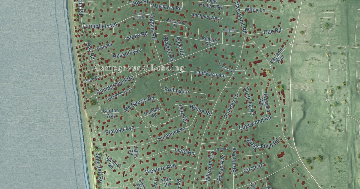
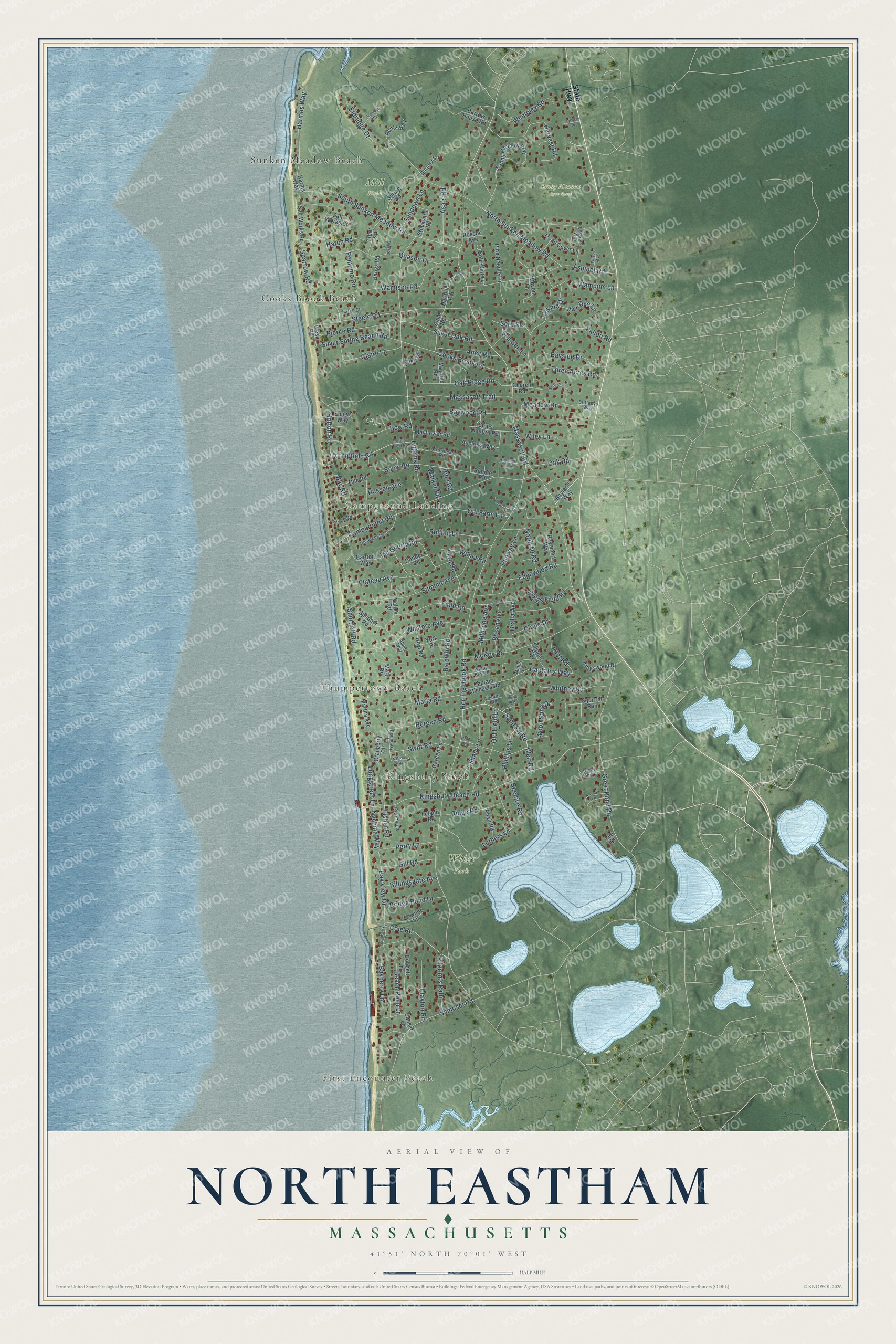
This beautifully detailed map of North Eastham, Massachusetts was created in 2026 using aerial imagery combined with modern topographical, census, street and landmark data. It's a modern aerial view of North Eastham in Barnstable County, Massachusetts, that combines modern data with a vintage aesthetic. The roads feature printed names, and if you look closely you can find your exact house accurately shown in its correct location.
Explore an aerial view of North Eastham, Massachusetts
On this map you'll find Sunken Meadow Beach, Cooks Brook Beach, First Encounter Beach, Campground Landing, Kingsbury Beach, Mill Field, Sandy Meadow Open Space, Wiley Park, Thumpertown Beach, Bay Road, Massasoit Road, Turnipfield Road, and more. Each red shape is a building, so zoom in on the preview and look for yours.
North Eastham is a community in Barnstable County. The Census Bureau counted 2,296 people here in 2020. The map prints the town name in its title panel, with the coordinates below it.
Take a closer look at the North Eastham map
Names on this map
These names are printed on this map.
Places: Sunken Meadow Beach, Cooks Brook Beach, First Encounter Beach, Campground Landing, Kingsbury Beach, Mill Field, Sandy Meadow Open Space, Wiley Park and Thumpertown Beach.
Streets and roads: Bay Road, Massasoit Road, Turnipfield Road, Captains Way, Herring Brook Road, Kingsbury Beach Road, North Sunken Meadow Road, Campground Road, Great Pond Road, Higgins Road, Samoset Road, South Sunken Meadow Road.
More street names, A to Z
Alice Road, Alpine Way, Anchors Way, Anne Road, Arrowhead Road, Asa's Road, Aspinet Road, Atwood Lane, Baldwin Road, Bangs Road, Barrow House Road, Bayberry Lane, Bayland Way, Bayside Drive, Bay View Drive, Baywood Road, Beach Plum Lane, Beehive Road, Belile Street, Ben's Way, Billingsgate Avenue, Bob-White Lane, Boreen Road, Bosan Avenue, Boundary Lane, Bowline Lane, Bow Road, Bradford Lane, Bralla Avenue, Bridge Pond Drive, Briggs Field Road, Brittanys Way, Captain Michaels Road, Carlton Way, Church Road, Circle Drive, Claire Lane, Clayton Road, Clipper Way, Cobbett Lane, Cole Road, Cooks Brook Road, Cranberry Circle, Cranberry Lane, Devon Lane, Dundee Road, Edgewood Road, Eldredge Drive, Ellen Road, Emilys Way, Fallon Road, Fern Road, Field Road, Fisher Road, Freeman Way, Garden Lane, Gile Road, Gill Road, Great Pond Place, Grove Road, Harding, Harding Road, Harmes Way, Harms Way, Harvest Road, Hatch Court, Hatch Road, Horton Road, Hoyt Road, Huckleberry Lane, Jackcin Drive, Jay-Dee Lane, Kathys Way, Kellies Path, Kingswood Drive, Lee Court, Leeward Way, Leland Road, Longstreet Lane, Luthers Lane, Maria Road, Martha Avenue, Mary Road, Massasoit Trail, Mates Lane, Maurice Road, Mayflower Road, Mc Guerty Road, McKoy Road, Meadow Drive, Milbrode Avenue, Millenium Lane, North 40 Road, Nycoma Way, Oak Ridge Road, Oak Road, Old Farm Lane, Old Field Lane, Penny Lane, Perry Lane, Phair Road, Phillips Lane, Pierce Road, Pilgrim's Path, Pilot Road, Pine Needle Lane, Pine Road, Plateau Avenue, Pompmo Road, Quail Cover Lane, Quason Court, Quason Drive, Raymond Way, Ridge Road, Rolling Lane, Ronnie Road, Roscoe Avenue, Runway Lane, Russell Avenue, Salt Works Court, Salt Works Road, Sander Lane, Sand Pit Road, Sandy Meadow Way, Schooner Lane, Sea Gull Lane, Serb Street, Shady Lane, Ships Lantern Road, Shore Road, Shurtleff Road, Silver Oak Road, Silver Spring Beach Road, Snow Road, Sparrow Road, Spooner Road, Spring Road, Squirrel Run, State Highway, Steele Road, Stockyard Road, Summit Avenue, Sundown Lane, Sunset Lane, Swift Road, Three Acres Road, Toedter Road, Toland Drive, Treat Street, Turnip Field Road, Valley Road, Walker Road, Wamisco Road, Wampum Lane, Weir Road, Western Avenue, West Road, Whelpley Road, Whitney Road, Wiley Lane, Wilma Road, Wilson Avenue, Windy Bay Road, Wood Song Drive, York Road.
See it on a wall
The North Eastham map as a framed print. Swipe for more.


Created by KNOWOL in 2026. The buildings are small red shapes, the roads carry their printed names, and shaded relief shows the shape of the land. The title panel reads "AERIAL VIEW OF NORTH EASTHAM, MASSACHUSETTS" with 41°51' NORTH 70°01' WEST.
It looks right in a kitchen, an office or a den, and it's a gift for anyone who grew up in North Eastham or moved away. Open the preview and find your street. See sizes and frames for the North Eastham map.