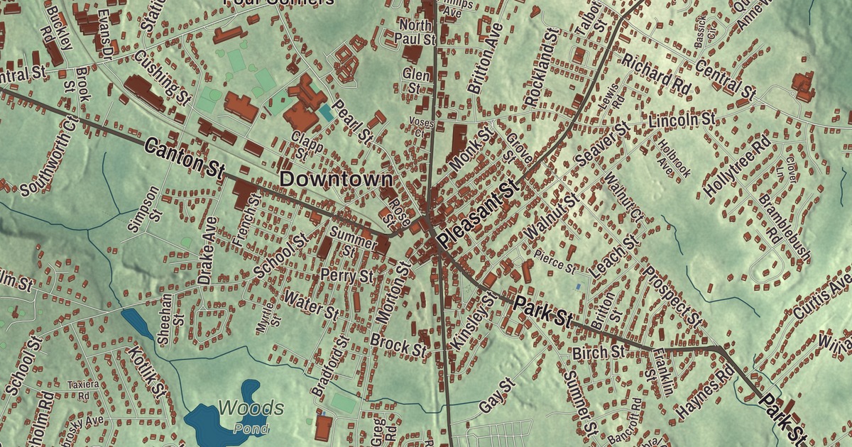
Washington Street, Park Street, Central Street, Canton Street and Sharon Street carry this map of Stoughton out to North Stoughton, West Stoughton, South Stoughton and Ames Long Pond. Click here to purchase a print of this map for your wall.
Stoughton is in Norfolk County.
KNOWOL made this map in 2026 from public survey data and set it down in the style of an old atlas. United States Geological Survey elevation data shapes the hills, and the roads and the town line come from the Census Bureau. Stoughton covers 16.3 square miles about 17 miles from Boston, bordered by Canton on the north, Randolph on the northeast, Avon on the east, Brockton on the southeast, Easton on the south and Sharon on the west. Its highest point, about 350 feet above sea level, is a hill in the southwest of town. Stoughton had 29,281 people at the 2020 census.
Out of Dorchester
The Town of Stoughton’s recorded history, in the Secretary of the Commonwealth’s list, dates European settlement to 1713, and Stoughton was incorporated as a town in 1726 from the southwestern part of the large town of Dorchester. At first it took in what are now Sharon, which separated in 1765, Canton, in 1797, and Avon, in 1888. It was named for William Stoughton, the first chief justice of the colony’s courts. Stoughton began as a farming town and became an important shoemaking center, and its public library was founded in 1874.
In 1774 the Boston composer William Billings taught a singing school in Stoughton, and it inspired 25 men of the town to form the Stoughton Musical Society on November 7, 1786. It’s the oldest choral society in the United States, and its constitution, written in 1787 just weeks after the United States Constitution, is the oldest of any musical society in the country. Around 1790 its singers met the chorus of the First Parish Church in Dorchester in what’s believed to be the first singing contest held in America. The Stoughton men sang Handel’s Hallelujah Chorus from memory and without instruments, and the Dorchester chorus conceded. The society sang several concerts at the World’s Columbian Exposition in Chicago in 1893, and since 1908 it has been called the Old Stoughton Musical Society.
The station with the clock tower
Stoughton’s railroad station opened in March 1888, Charles Brigham’s first work as an independent architect. It’s built of granite from the Myron Gilbert Quarry in Stoughton, in the Richardson Romanesque style, and its 62-foot tower holds four clock faces by E. Howard & Co. It was called Stoughton Central at first, and on November 1, 1896, it became simply Stoughton, while the town’s other station took the name South Stoughton. By 1967 it was the last terminal station in the area with a clock tower, and it was listed on the National Register of Historic Places in 1974. Town Meeting voted to buy the building in 2015, and the town took it over in 2019, the year it stood in for Concord’s station in the film Little Women.
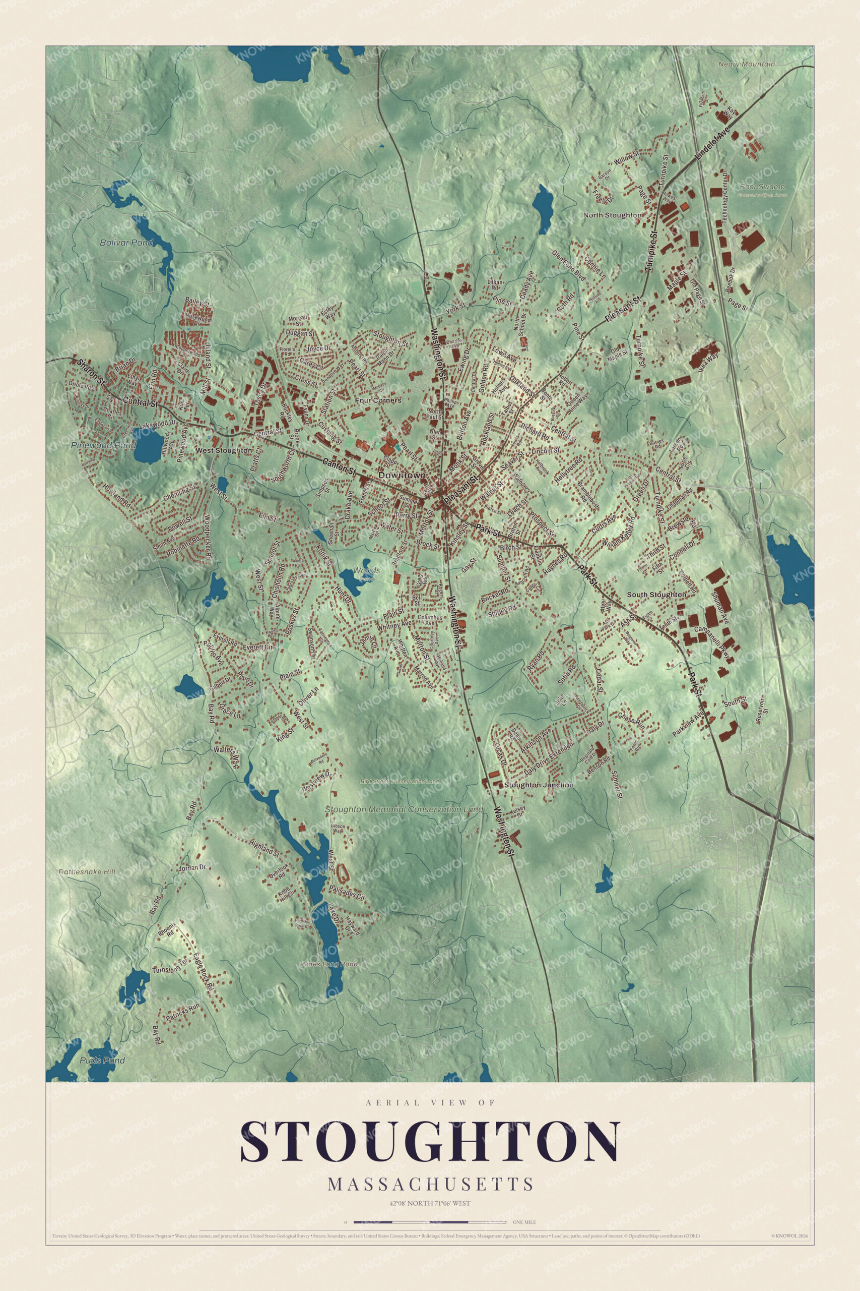
Click to explore a larger preview. The digital watermark does not appear on printed maps.
Names on this map
These names are printed on this map.
Places: Downtown, North Stoughton, Neary Mountain, Rattlesnake Hill, Ames Long Pond, Pinewood Pond, Puds Pond, Bolivar Pond, Stoughton Memorial Conservation Land, Bear Swamp Conservation Area, Bird Street Conservation Land, Woods Pond, Four Corners, South Stoughton, Stoughton Junction and West Stoughton.
Streets and roads: Canton Street, Park Street, Central Street, Turnpike Street, Sharon Street, Washington Street, Pleasant Street, Lindelof Avenue, Pearl Street, Cross Street, Bay Road, Pratts Court.
More street names, A to Z
Alger Way, Alpine Way, Amherst Road, Ash Park Drive, Ash Street, Atkinson Avenue, Bailey Street, Bancroft Road, Barnes Road, Bassick Circle, Bell Street, Belvedere Road, Benson Road, Bento Street, Bergeron Way, Birch Street, Bradford Street, Bramblebush Road, Brewster Road, Brian Drive, Brickel Road, Britton Avenue, Britton Street, Brock Street, Brook Street, Buckley Road, Cabral Circle, Campanelli Parkway, Carey Circle, Carson Drive, Caryl Road, Cedar Street, Central Drive, Chapman Road, Charles Avenue, Charles Circle, Chase Run, Chemung Street, Chisholm Road, Claire Drive, Clapp Street, Clover Lane, Columbus Avenue, Connell Drive, Connie Lane, Copperwood Drive, Corbett Road, Courtney Avenue, Curtis Avenue, Cushing Street, Daly Drive, Daly Drive Extended, Deady Avenue, Dean Road, Donahue Way, Drake Avenue, Duggan Street, Eagle Rock Road, East Vanston Road, Eastwood Road, Eighth Street, Elizabeth Street, Elm Street, Erin Road, Estey Way, Ethyl Way, Evans Drive, Everett Circle, Everett Road, Ewing Drive, Farrington Street, Fifth Street, Fiorello Road, Fitzpatrick Street, Fords Run, Fourth Street, Franklin Street, Freely Drive, French Street, Gay Street, Gibson Way, Gilbert Drive, Glen Echo Boulevard, Glen Street, Glover Drive, Golden Road, Grace Lane, Green Drive, Greenwood Avenue, Greg Road, Grove Street, Hawes Way, Haynes Road, Hayward Drive, Heelan Avenue, Highland Rock Drive, Highland Street, Hillside Avenue, Hillwood Avenue, Holbrook Avenue, Holland Avenue, Hollytree Road, Holmes Avenue, Howland Road, Hunt Drive, Ikea Way, Island Street, Jamie Lane, Jordan Drive, Joyce Drive, Julie Lane, Kay Way, Kelsey Drive, Kennedy Road, Kim Terrace, King Street, Kinsley Street, Knob Hill Circle, Kotlik Street, Kwedar Avenue, Lake Drive, Lakewood Drive, Larson Road, Leach Street, Lewis Road, Lillian Road, Lincoln Street, Lorraine Drive, Lowe Avenue, Lucas Drive, Lurie Circle, Maple Street, Marron Avenue, McEvoy Circle, Mill Street, Monk Street, Moreau Street, Morton Street, Myrtle Street, North Paul Street, North School Drive, Oakland Street, Old Maple Street, Old Page Street, Oliver Lane, Oriole Road, Overlook Road, Page Street, Palisades Circle, Parkview Avenue, Patricks Run, Perry Street, Phillips Avenue, Phoenix Road, Pierce Street, Pine Street, Pinewood Avenue, Plain Drive, Plain Street, Polillio Avenue, Poskus Street, Powell Street, Prospect Street, Queen Anne Way, Ralph Mann Drive, Reebok Drive, Reginald Cole Drive, Reservoir Street, Richard Road, Robert Road, Robinette Road, Rockland Street, Rogers Drive, Rose Street, Rosewood Drive, Ruth Road, Ryan Road, School Street, Seaver Street, Sheehan Street, Shirley Road, Shuman Avenue, Simpson Street, Smith Avenue, Sofia Road, South Street, Southworth Court, Station Street, Stoughton Street, Summer Street, Sumner Street, Swanson Terrace, Talbot Street, Taxiera Road, Technology Center Drive, Tenth Street, Third Street, Tosca Drive, Turnstone Terrace, Voses Court, Walnut Court, Walnut Street, Walters Way, Water Street, West Street, Westview Drive, Whitney Avenue, Whitten Avenue, William Kelley Road, Willow Street, Winfisky Drive, Woodpecker Road, York Street, Zabrosky Avenue.
See it on a wall
The Stoughton map as a framed print. Swipe for more.


Around the map
Start with North Stoughton. Follow Canton Street, Park Street, Central Street, Turnpike Street, Sharon Street and Washington Street across town. Then look outward toward Four Corners, South Stoughton, Stoughton Junction and West Stoughton. Ames Long Pond, Pinewood Pond, Puds Pond, Bolivar Pond, Stoughton Memorial Conservation Land, Bird Street Conservation Land, Neary Mountain and Rattlesnake Hill are all printed on the map. The town runs swimming programs at Ames Long Pond, and Halloran Park has picnic areas and a basketball court. Stoughton marks the Fourth of July with a parade and fireworks at the high school, honors veterans with a parade on Veterans Day, and holds a Holiday Parade of Lights in December. It was also the first municipality in Massachusetts to declare itself a “No Place for Hate” town. The songwriter Lori McKenna, who won Grammy Awards for “Girl Crush” and “Humble and Kind,” was born and raised in Stoughton and still lives here, and the gymnast Fred Richard, who won an Olympic team bronze medal in 2024, went to Stoughton High School; the town named October 6 Frederick Richard Day in his honor.
The Stoughton map makes a fine addition to an office, library or den, and it can help teach children the geography and history of a singing town south of Boston. It’s made for people who call Stoughton home, from North Stoughton to Four Corners, and it shows the town as it looks today. Zoom in on the preview above to explore the details, then click here to get your copy of the Stoughton, Massachusetts map.

Sources