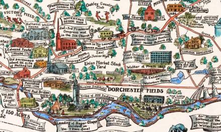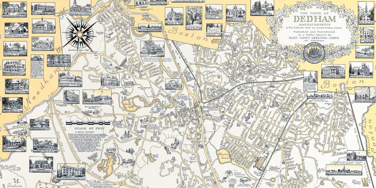
This map of Dedham, Massachusetts was created in 1954 by Ernest Chase Dudley, a highly renowned 20th century illustrator. The map shows a bird’s eye view of the town as it was, including street names and old landmarks.
The map contains more than 60 separate illustrations, all of which are done in the finest stipple work. This means that, working under a magnifying glass, he inked each picture, dot by dot, with tiny pens. The titles and text are beautifully done in a variety of script lettering which is remarkably easy to read in even the smallest sizes.
Historic Dedham landmarks on the map include Dedham County Club, Masonic Temple, Rust Craft Greeting Cards, Central Fire Station, Sprague Pond, Dedham High School, Mill Brook, the old Fairbanks House, and more.
This historic map of Dedham, MA has been restored by KNOWOL. Reproductions of the map are available here.
Historic Map of Dedham, Massachusetts, 1954
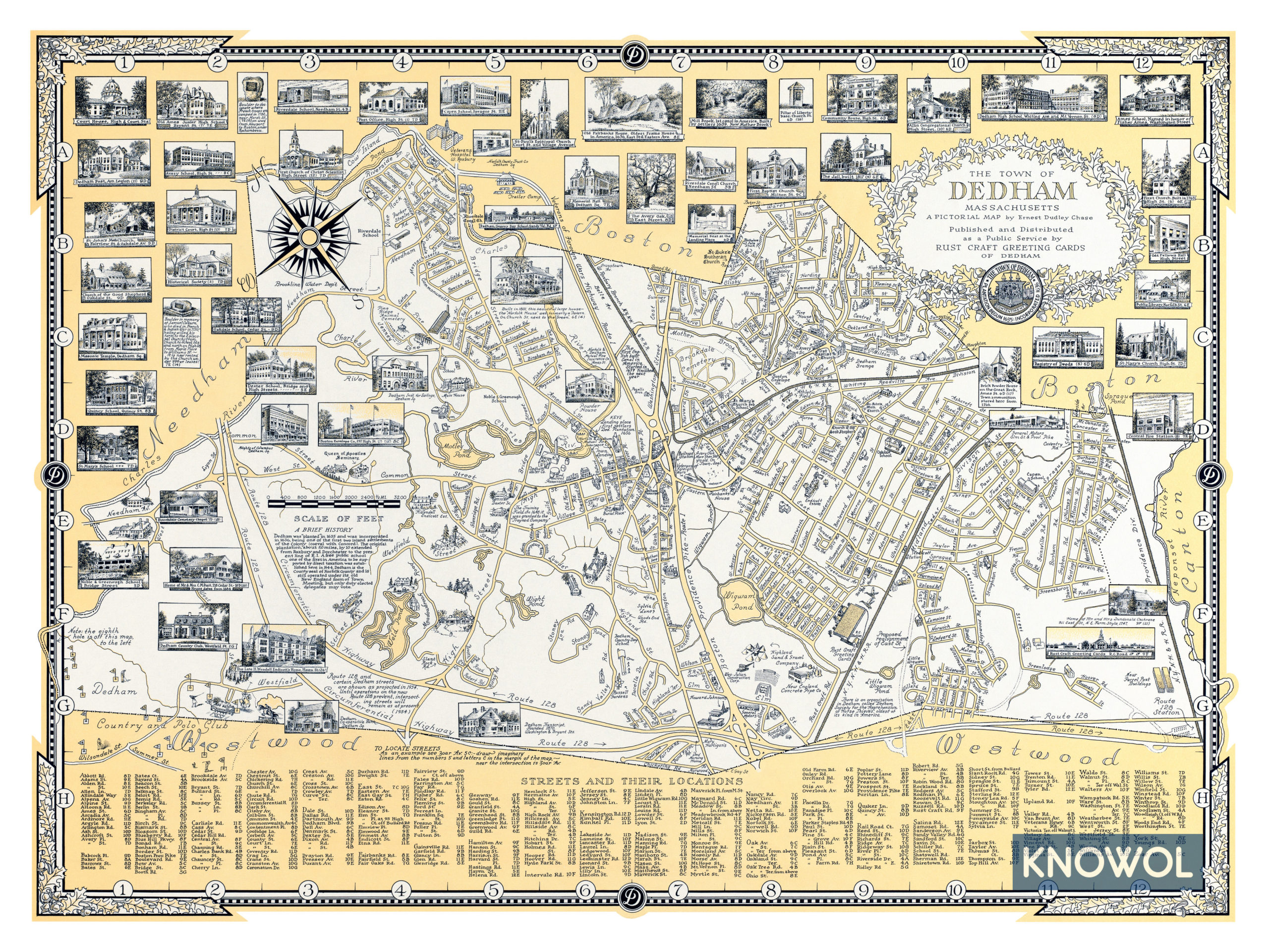
This historic map of Dedham will make an attractive addition to your office, library, or den and can even be used to teach children the geography and history of the area. When you’re done exploring, click here to get your copy.