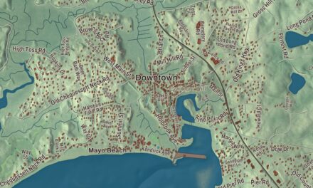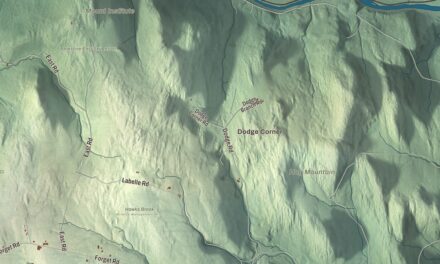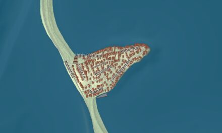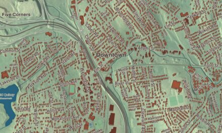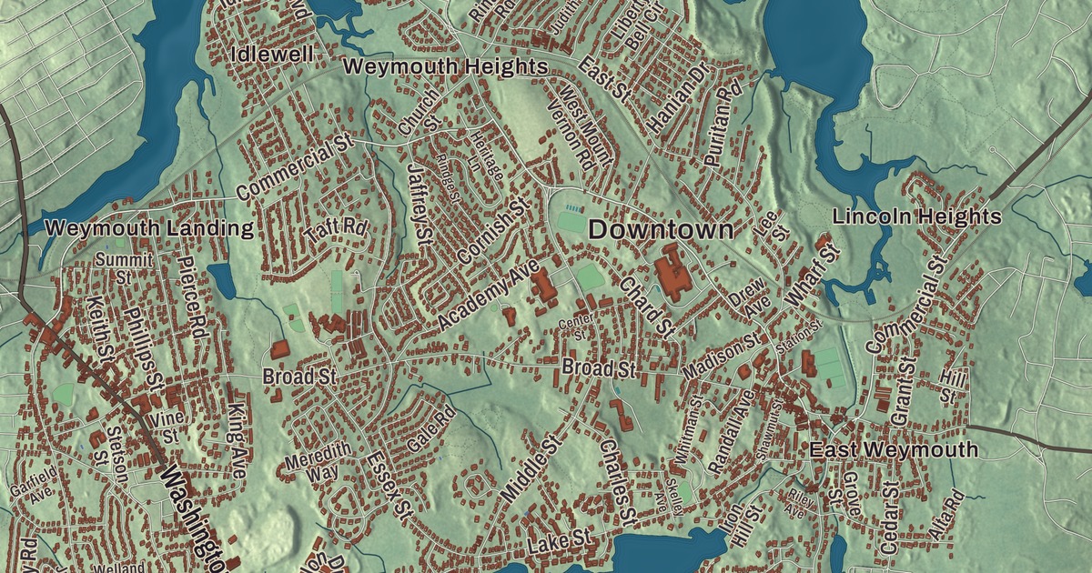
This aerial map of Weymouth, Massachusetts was created in 2026 using real geographic data to bring the town’s streets, buildings, neighborhoods, coastline, ponds and waterways, mountains and ridgelines, and terrain together in one highly detailed view. Look closer and you can pick out the familiar places that make Weymouth feel like home. Start with the street you know, then see how it connects to the rest of the Weymouth you call home. Click here to purchase a print of this map for your wall.
Explore an aerial view of Weymouth, Massachusetts
Start with Downtown and Pine Grove. Follow Bridge Street, Main Street, Washington Street, Pond Street, Commercial Street, and Oak Street across town. Then look outward toward East Weymouth, Hatherly, Idlewell, Lincoln Heights, and Lovell Corners.
Cat Island, Bouve Pond, Brewer Pond, Weymouth Great Pond, Baker Hill, and Bradley Hill are all labeled on the map. Every one of those names is printed directly on the artwork, giving you plenty to explore.
The Town of Weymouth’s recorded history dates European settlement to 1630. Weymouth was incorporated as a town in 1635. The town remains part of Norfolk County today. Click the image below to see the area as it looked in 2026.
Take a closer look at the Weymouth map
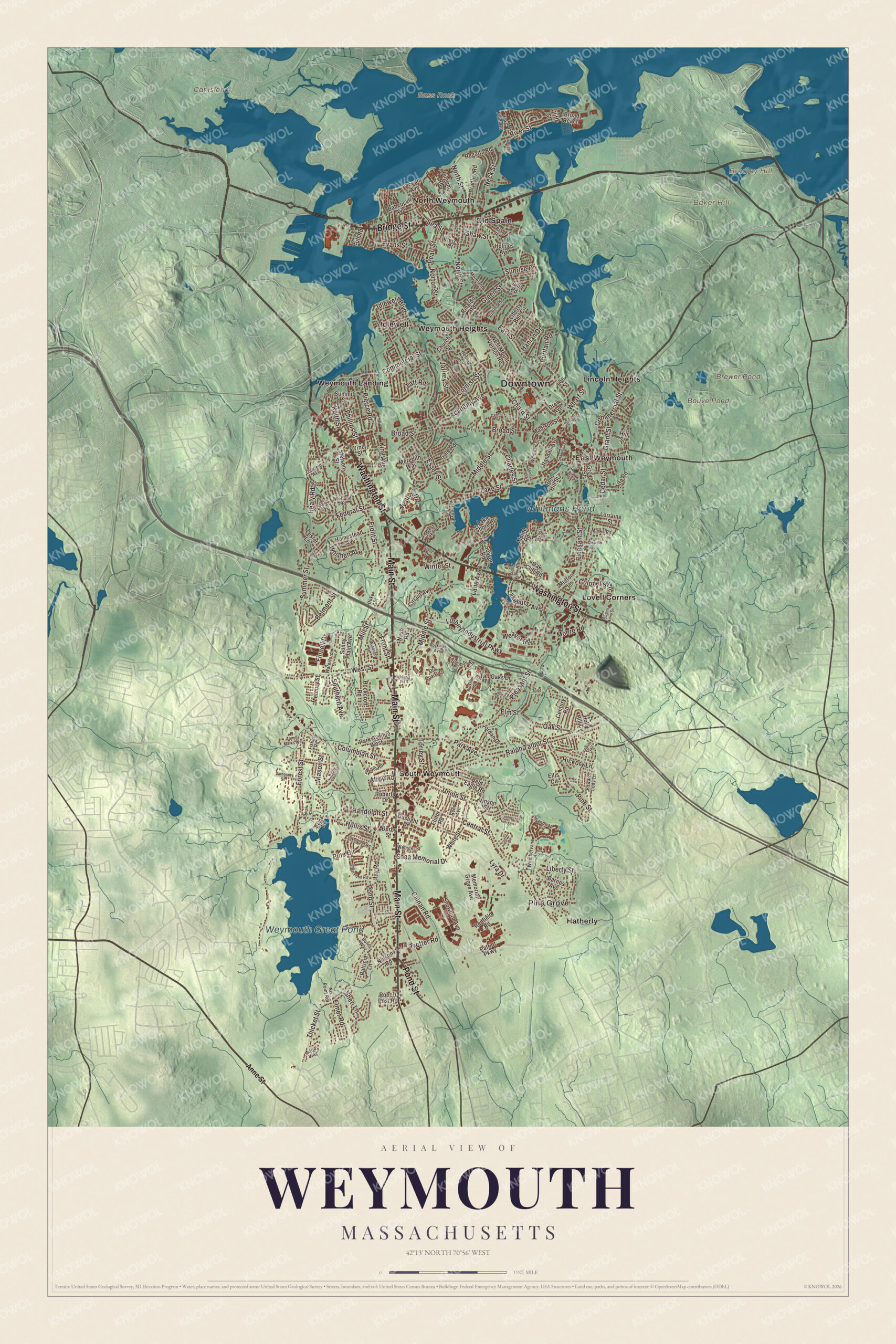
Click to explore a larger preview. The digital watermark does not appear on printed maps.
Names on this map
These names are printed on this map.
Places: Downtown, Pine Grove, Baker Hill, Bass Rock, Bradley Hill, Cat Island, Bouve Pond, Brewer Pond, Weymouth Great Pond, Whitmans Pond, East Weymouth, Hatherly, Idlewell, Lincoln Heights, Lovell Corners, North Weymouth, Old Spain, South Weymouth, Weymouth Heights and Weymouth Landing.
Streets and roads: Bridge Street, Main Street, Washington Street, Pond Street, Commercial Street, Oak Street, Ralph Talbot Street, Winter Street, Pleasant Street, Front Street, Middle Street, Broad Street.
More street names, A to Z
Academy Avenue, Adria Way, Alewife Lane, Alpine Road, Alroy Road, Alta Road, Anne Street, Athens Street, Audubon Road, Avalon Drive, Babcock Avenue, Bald Eagle Road, Barnes Avenue, Beach Road, Belmont Street, Bluff Road, Bradley Road, Brae Road, Broad Reach, Burkhall Street, Burns Way, Calnan Road, Cedar Street, Center Street, Central Street, Century Road, Chard Street, Charles Street, Church Street, Circuit Avenue, Circuit Road, Cliff Street, Colonel's Lane, Columbian Street, Cornish Street, Courier Street, Cross Street, Derby Street, Derek Drive, Drew Avenue, Duke Street, East Street, Edward Cody Lane, Elinor Road, Ellis Circle, Elmer Road, Elm Street, Essex Street, Evans Street, Federal Street, Finnell Drive, Fisher Road, Forest Street, Fort Point Road, Gale Road, Garfield Avenue, Gaslight Drive, Grant Street, Great Pond Road, Green Street, Greenvale Avenue, Grove Street, Hanian Drive, Healy Road, Heritage Lane, Hickory Lane, Highland Place, Hill Street, Hollis Street, Holly Hill Circle, Holmes Avenue, Homestead Avenue, Idlewell Boulevard, Iron Hill Street, Island View Road, Ivy Road, Jaffrey Street, Jordan Drive, Judith Road, Judson Road, Julia Road, Keith Street, King Avenue, King Philip Street, Lakehurst Avenue, Lake Shore Drive, Lake Street, Lakewood Road, Lane Avenue, Lee Street, Lester Lane, Libbey Industrial Parkway, Liberty Bell Circle, Liberty Street, Lintric Drive, Lorraine Street, Lyra Drive, Madison Street, Marks Road, Mason Street, Memorial Grove Avenue, Mercury Street, Meredith Way, Mill Street, Moore Road, Moreland Road, Mutton Lane, Nash Road, Neck Street, Nelson Road, Nevin Road, Nix Point Road, North Street, Norton Street, Oak Cliff Road, Ocean Avenue, Old Quarry Drive, Park Avenue, Park Avenue West, Patricia Lane, Patriot Parkway, Pearl Street, Phillips Street, Pierce Court, Pierce Road, Pilgrim Road, Pine Circle, Pine Street, Puritan Road, Queen Anne Drive, Randall Avenue, Randolph Street, Redfield Road, Reed Avenue, Regatta Road, Relda Road, Riley Avenue, Rinaldo Road, Rindge Street, River Street, Robert Post Road, Roberts Drive, Rockcroft Road, Rockway Avenue, Samoset Street, Sandtrap Circle, Sea Street, Seaver Road, Shawmut Street, Shaw Street, Shea Memorial Drive, Sheri Lane, Skelley Avenue, Snowbird Avenue, Southern Avenue, Station Street, Stella Drive, Stetson Street, Summer Street, Summit Street, Sunny Plain Avenue, Sunrise Drive, Taft Road, Tall Oaks Drive, Tamarack Trail, Thicket Street, Todd Lane, Tommy Marks Way, Torrey Street, Trotter Road, Union Street, Vine Street, Vinson Street, Waterford Drive, Weathervane Drive, Weaver Road, Webster Street, Welland Road, West Lake Drive, West Mount Vernon Road, West Street, Wharf Street, White Street, Whitman Street, Windsor Road, Worthen Avenue.
See it on a wall
The Weymouth map as a framed print. Swipe for more.


We designed the artwork at KNOWOL using Weymouth’s real streets, buildings, neighborhoods, coastline, ponds and waterways, mountains and ridgelines, and terrain, the town boundary, and the way buildings spread across the town. Then we chose the color, relief, lettering, and layout that make the map look great on the wall.
This beautifully detailed map of Weymouth makes an attractive addition to your office, library, or den and can even be used to teach children the geography and history of the area. When you’re done exploring, click here to get your copy of the Weymouth, Massachusetts map.