
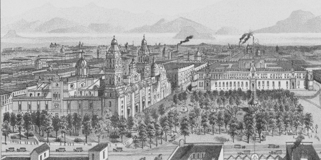
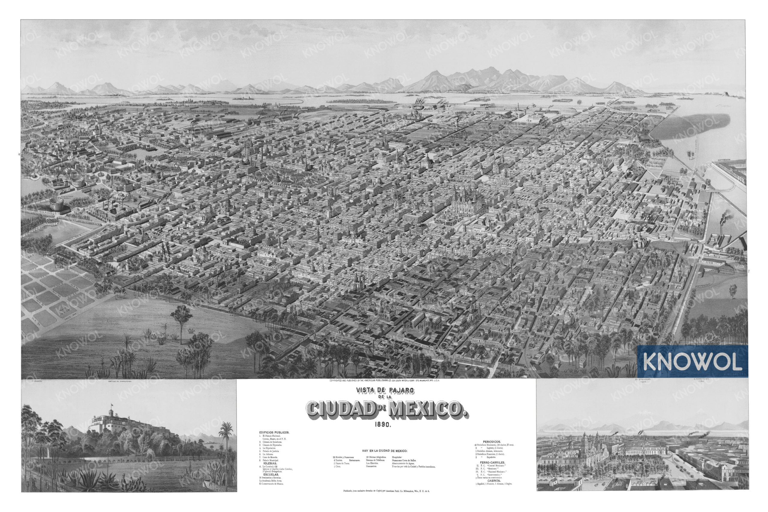
This historic map of Mexico City, Mexico was created in 1890 by The American Publishing Company. The map shows a bird’s eye view of Mexico City as it used to look, including street names and old landmarks.
Landmarks on the map include La Academia Bellas Artes, Teatros, Plazas de Toros, Circo, Seminarios y Escuelas, El Palacio Nacional, Camara de Senadores, Palacio de Justicia, La Aduana, Ferrocarriles, Periodicos, Casinos, and more.
This historic map of Mexico City has been restored by KNOWOL. Reproductions of the restored map are available here.
Historic Old Map of Mexico City, Mexico from 1890
This vintage map of Mexico City makes an attractive addition to your office, library, or den, and can even be used to teach children the geography and history of the area. When you’re done exploring, click here to get your copy of the restored map.


