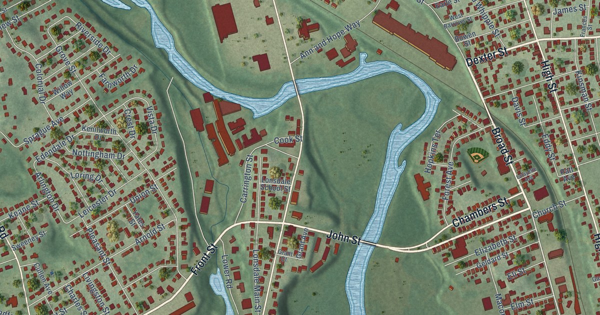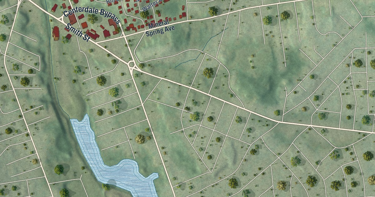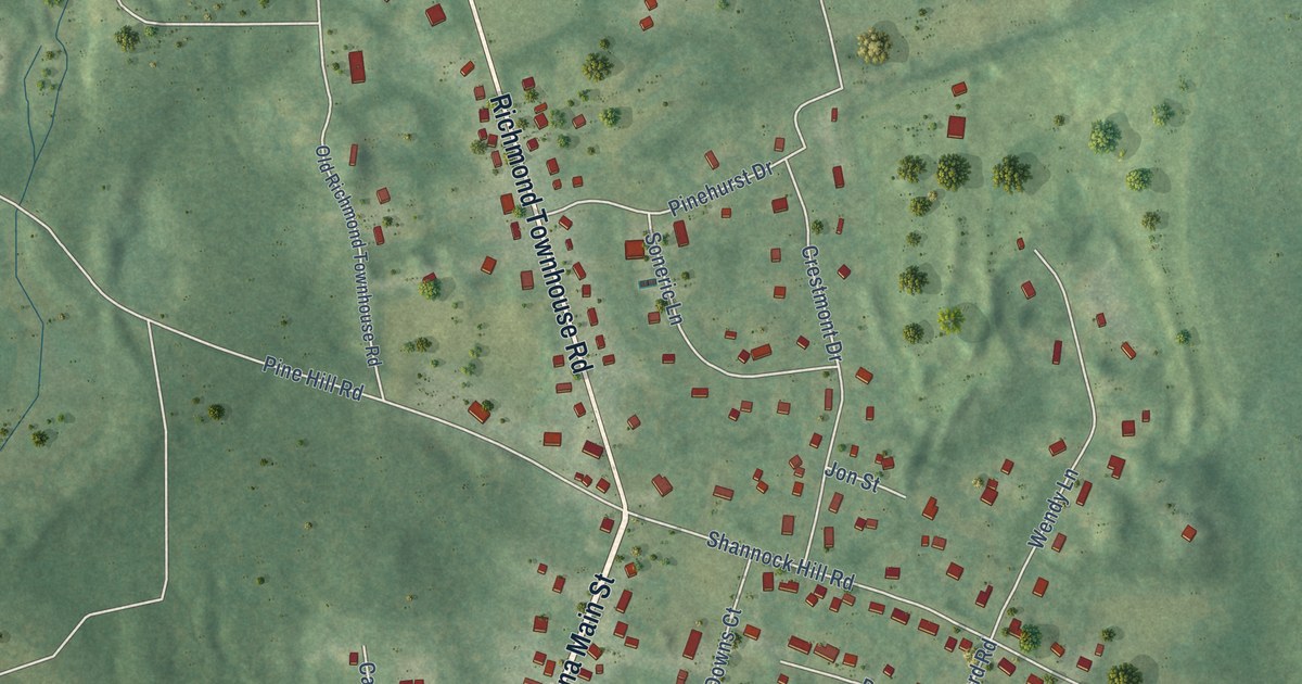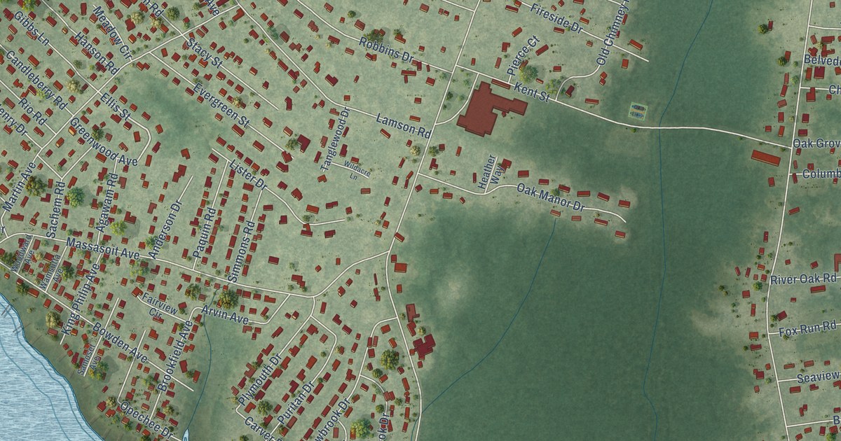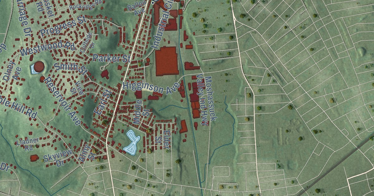
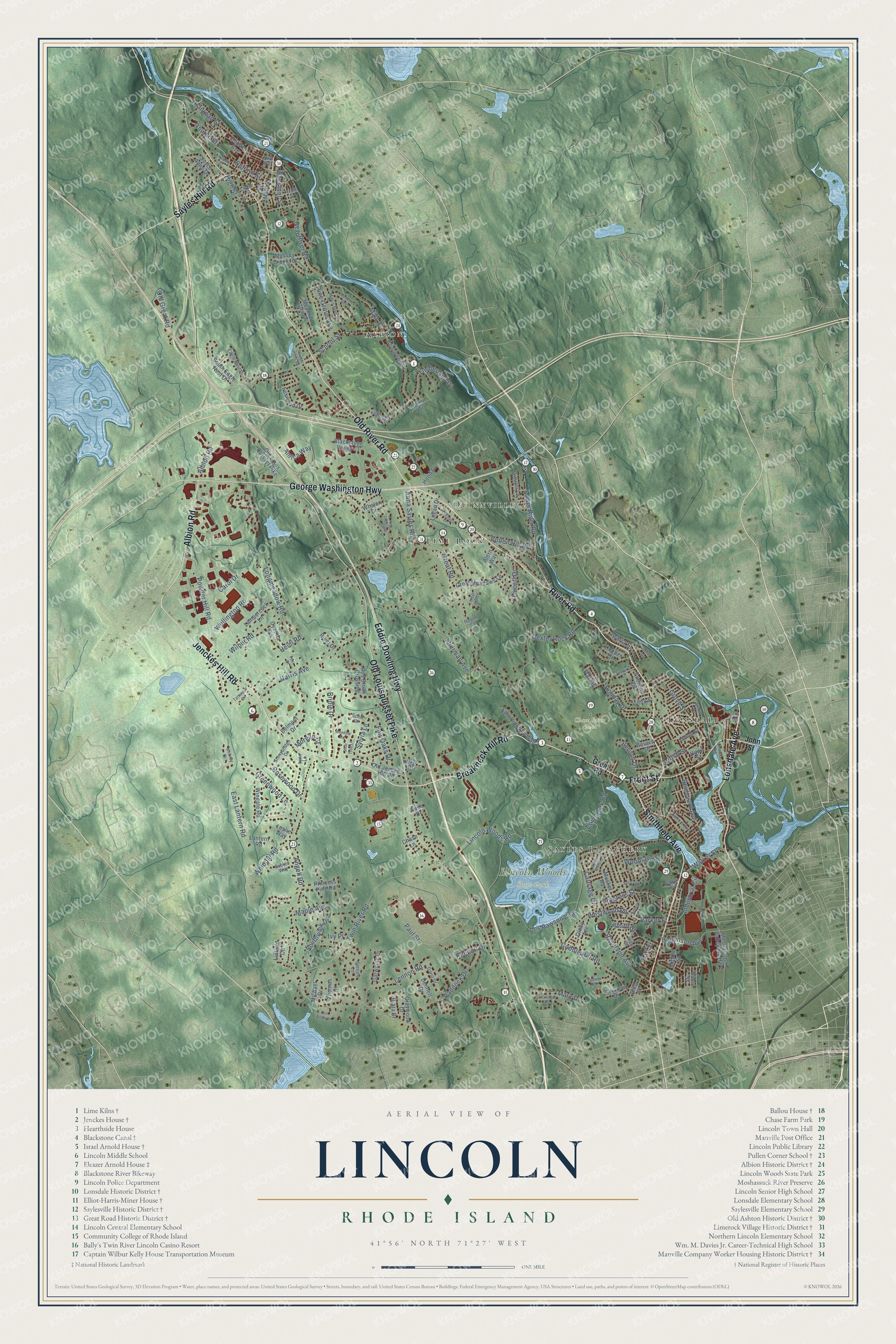
This beautifully detailed map of Lincoln, Rhode Island was created in 2026 using aerial imagery combined with modern topographical, census, street and landmark data. It’s a one-of-a-kind view of Lincoln that combines accurate data with a vintage aesthetic. The map shows every building in its true location, many of the roads carry their names, and the shaded topographic relief shows the shape of the land.
See the Lincoln, Rhode Island map on a wall
The Lincoln map as an 18 x 24 inch print in a black frame.

Explore an aerial view of Lincoln, Rhode Island
On the map you’ll find Chase Farm Park, Lincoln Woods State Park, Albion, Lonsdale, Sayles Bleachery, Quinnville, and Lime Rock, along with Old River Road, Jenckes Hill Road, River Road, Breakneck Hill Road, Front Street, and more. If you look closely you can even find your house accurately drawn in its correct location. Zoom in on the preview to look for yours.
Did you know this piece of Lincoln, Rhode Island history?
Lincoln was part of Smithfield until 1871, when it split off and was named for Abraham Lincoln. Limestone has been quarried at its village of Lime Rock since colonial times. In the late 1800s, textile factories along the Blackstone River made Lincoln an important mill town.
Take a closer look at the Lincoln map
Click to explore a larger preview. The digital watermark does not appear on printed maps.
Street and place names on the Lincoln, Rhode Island map
These names are printed on the map of Lincoln, Rhode Island.
Places: Chase Farm Park, Lincoln Woods State Park, Albion, Lonsdale, Sayles Bleachery, Quinnville and Lime Rock.
Streets and roads: Old River Road, Jenckes Hill Road, River Road, Breakneck Hill Road, Front Street, Smithfield Avenue, Albion Road, Eddie Dowling Highway, George Washington Highway, Old Louisquisset Pike, Lonsdale Avenue, Sayles Hill Road.
More street names, A to Z
Alern Way, Almy Street, Amica Way, Andrews Drive, Angell Road, Anna Sayles Road, Anne Drive, Arnold Street, Ashley Drive, Ballou Avenue, Belmont Drive, Bernon Drive, Beverly Drive, Blackstone Valley Place, Boulevard Avenue, Bouvier Avenue, Briarwood Drive, Bridle Drive, Carol Drive, Carriage Drive, Central Street, Chase Lane, Chestnut Street, Church Street, Cider Mill Lane, Cliffside Drive, Cobble Hill Road, Cook Street, Cooper Drive, Cross Street, Cullen Hill Road, Cynthia Road, Dario Drive, Dennell Drive, Dexter Rock Road, Ducarl Drive, Duxbury Court, Eagle Nest Drive, Earl Street, East Butterfly Way, East Lantern Road, Edelweiss Avenue, Elder Street, Elizabeth Drive, Fair Oaks Drive, Foxwood Drive, Foxx Drive, Garwaine Drive, Graywood Drive, Great Meadows Lane, Great Road, Greenwood Lane, Grove Street, Harris Avenue, Heidi Road, Henry Drive, Heritage Drive, Higginson Avenue, High Street, Holiday Drive, Hood Drive, Hope Street, Industrial Circle, Ivy Place, John Street, Joyce Anne Drive, Kendall Drive, Kilburn Avenue, Kirkbrae Drive, Lampercock Lane, Lantern Road, Laurel Lane, Ledge Road, Lennon Road, Leslie Way, Les Pawson Loop, Lincoln Woods Road, Linda Street, Linfield Circle, Lladner Road, Logan Drive, Longmeadow Road, Lori Ellen Drive, Lower River Road, Lower Road, Lynn Lane, Main Street, Maple Avenue, Maple Street, Maria Street, Mark Drive, Meader Pond Road, Meadow Glen Drive, Meadow Road, Michael Drive, Middle Street, Mitris Boulevard, Morgan Court, Moshassuck Valley Ind Highway, Musket Road, Mussey Brook Road, New River Road, Old Great Road, Old Jenckes Hill Road, Old Louis Quisset Pike, Old Main Street, Olney Avenue, Paddock Drive, Parker Street, Park Way, Pat Drive, Paul Street, Pine Grove Avenue, Pine Tree Lane, Powder Hill Road, Princess Pine Road, Progress Street, Prospect Street, Railroad Street, Realm Court, Red Brook Crossing, Reservoir Avenue, Riata Drive, Rivet Drive, Rockridge Road, Rosewood Drive, Sables Way, School Street, Scott Drive, Sherman Avenue, Skyview Drive, Smith Street, South Eagle Nest Drive, Southwick Drive, Steeple Lane, Stonybridge Drive, Sylvia Lane, Table Rock Road, Tattersall Drive, Thomas Drive, Timberland Drive, Twin River Road, Union Street, View Street, Vista Drive, Wagon Wheel Lane, Walker Street, Wellington Road, Westwood Road, Whalen Drive, Whipple Road, Whitman Way, Whitney Drive, Wilbur Road, Wingate Road, Woodland Street.
This beautifully detailed map of Lincoln makes an attractive addition to your office, library, or den, and it can even be used to teach children the geography and history of the area. It also makes a great gift for someone who left Lincoln and still calls it home. When you’re done exploring, click here to get your copy of the Lincoln map.