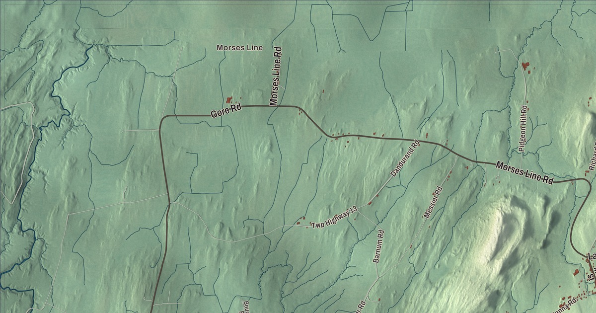
Franklin’s northern line is the Canadian border, and Lake Carmi fills its eastern side. This map prints the lake, Morses Line at the border, East Franklin, South Franklin, Beattys Four Corners and Browns Corners, with Lake Road, State Park Road, Morses Line Road, North Sheldon Road, Gore Road and Causway Road.
Franklin is a town in Franklin County, Vermont.
KNOWOL made this map in 2026 from public survey data, drawn to look like an old county atlas. The hills are shaded from United States Geological Survey elevation data, and the roads and the town line come from the Census Bureau. Franklin runs along the northern edge of Franklin County, which is also the northern edge of Vermont and the border between Canada and the United States. Click here to purchase a print of this map for your wall.
From Huntsburgh to Franklin
Vermont granted the land on October 24, 1787, and chartered it on March 19, 1789, as Huntsburgh. The town organized in 1793, and on October 25, 1817, it took the name Franklin, according to the Vermont Legislature. The main community is the hamlet of Franklin near the center of town. Vermont Route 120 runs through it, south to North Sheldon and east to East Franklin on the town’s eastern border. Vermont Route 235 runs northwest from the center to Morses Line, and Vermont Route 236 runs through the eastern part of town, north to East Franklin and south to South Franklin, which lies in the neighboring town of Sheldon.
Charles W. Gates was born in Franklin in 1856. He taught at the Franklin Academy and was its principal, ran a store while keeping his family farm, and founded the Franklin Telephone Company in 1895. As a state highway commissioner he won money for permanent road building, and he was governor of Vermont from 1915 to 1917, when the state enacted direct primaries for Congress, workers’ compensation and vocational education in the public schools. He died in Franklin in 1927. Seth Wakeman, born in Franklin in 1811, later served New York in Congress.
Lake Carmi
The lake covers 1,375 acres and is the fourth largest lake entirely within Vermont, though it’s shallow, averaging 20 feet deep. It was once much larger; over thousands of years the south end silted in, leaving wetland forest and the third largest peat bog in the state. The lake drains north into the Pike River in Quebec, which carries its water to Missisquoi Bay on Lake Champlain. People called it Silver Lake or Franklin Pond until 1910, when it was officially named for Carmi L. Marsh, a Franklin man who served as a second lieutenant in the 13th Vermont Infantry in the Civil War and later sat in both houses of the legislature.
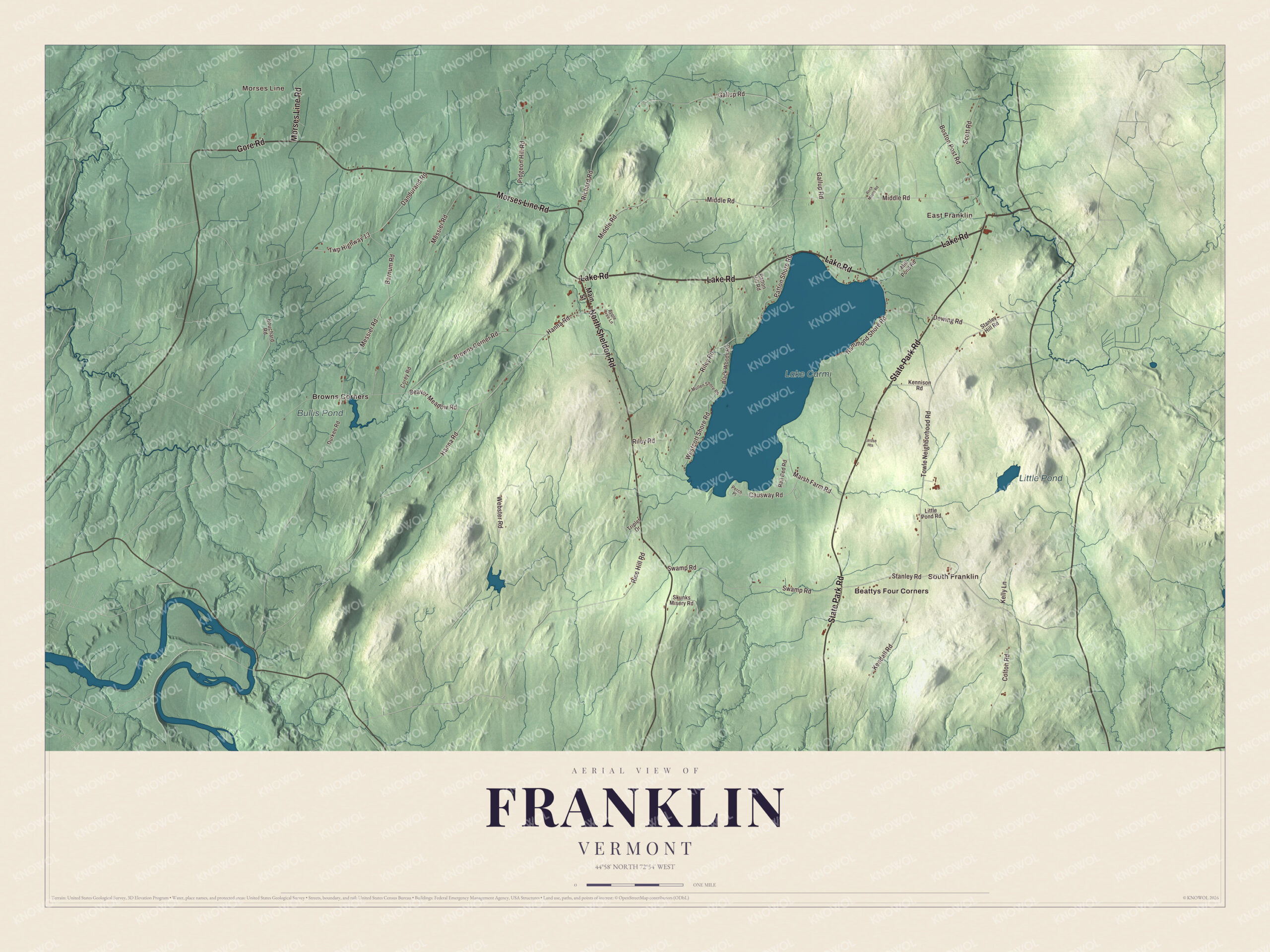
Click to explore a larger preview. The digital watermark does not appear on printed maps.
Names on this map
These names are printed on this map.
Places: Morses Line, East Franklin, South Franklin, Lake Carmi, Little Pond, Bullis Pond, Beattys Four Corners and Browns Corners.
Streets and roads: Lake Road, State Park Road, Morses Line Road, North Sheldon Road, Gore Road, Causway Road, Dandurand Road, Twp Highway 13, Towle Neighborhood Road, Messier Road, Barnum Road, Kendall Road.
More street names, A to Z
Apple Tree Lane, Beaver Meadow Road, Black Woods Road, Boston Post Road, Bouchard Road, Browns Corner Road, Colton Road, Corey Road, Dewing Road, Durkee Road, Gallup Road, Hammond Shore Road, Hanna Road, Kelly Lane, Kennison Road, Larose Heights, Little Pond Road, Main Street, Marsh Farm Road, Middle Road, Mill Pond Road, Mullen Shore Road, Patton Hill Road, Patton Shore Road, Perch Place, Pidgeon Hill Road, Rail Bed Road, Rice Hill Road, Richard Road, Riley Road, Rock Maple Road, Scott Road, Skunks Misery Road, Stanley Hill Road, Stanley Road, Swamp Road, Triplet Drive, Webster Road, Westcott Shore Road.
See it on a wall
The Franklin map as a framed print. Swipe for more.


Lake Carmi State Park, on Vermont Route 236, has more than two miles of shoreline on the south and east sides of the lake, with campsites, beaches and a nature center. The state has set aside 140 acres there as the Lake Carmi Bog Natural Area.
Morses Line grew up around a store that opened right on the boundary in 1871, and it’s named for that store. The United States built its border inspection station there in 1934, and that original building is still in use, the oldest of the country’s 163 land border stations still operating. It’s one of the quietest crossings in Vermont, with about 80 cars a day, and when the government moved to close it, local residents fought to keep it open.
On the map, start at Morses Line, then follow Morses Line Road, Lake Road and State Park Road. North Sheldon Road, Gore Road and Causway Road are printed too, along with East Franklin, South Franklin, Beattys Four Corners and Browns Corners. Little Pond and Bullis Pond are labeled as well. Franklin dates to 1789.
This map of Franklin is made for everyone who calls Franklin home, and it shows the town as it looks today, from the border to the shores of Lake Carmi. Hang it in an office, library or den, or use it to teach children the geography and history of their town. It’s printed on museum quality archival paper. Zoom in on the preview above to explore the details, then click here to get your copy of the Franklin, Vermont map.

Sources