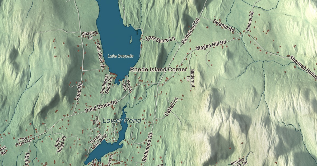
Hinesburg village lines Vermont Route 116 in the valley of the LaPlatte River, between South Burlington and Bristol. This map prints Mechanicsville Road, Richmond Road, Shelburne Falls Road, Magee Hill Road, Pond Road and Cvu Road, along with Mechanicsville, Rhode Island Corner, South Hinesburg, Lake Iroquois, Lower Pond and Lewis Creek.
Hinesburg is a town in Chittenden County, Vermont.
KNOWOL made this map in 2026 from public survey data and gave it the look of an old county atlas, shading the hills from United States Geological Survey elevation data and drawing the roads and town line from the Census Bureau. Hinesburg lies in southern Chittenden County, on the Addison County line, and 4,698 people lived here at the 2020 census, 872 of them in the village. Click here to purchase a print of this map for your wall.
Named for the town clerk
New Hampshire granted Hinesburg on June 24, 1762. The town is named for Abel Hine, its town clerk, and it organized on March 20, 1787; Lemuel Bostwick, its first listed representative, went to the legislature in 1789 and served several more terms in the 1790s. From the village, Route 116 runs north 11 miles to South Burlington and south 17 miles to Bristol. The town page lists the Hinesburg Community School, the Carpenter Carse Library and Champlain Valley Union High School, which serves Hinesburg and many of the towns around it.
In 1867 a dam on Pond Brook raised a spring-fed pond, then called Hinesburg pond, to give the mills in Hinesburg a better supply of water. Today that pond is Lake Iroquois, a 247-acre lake shared with Williston and Richmond. Its outlet runs into Sunset Lake in Hinesburg and on to the LaPlatte River and Lake Champlain, and the three towns share a beach at the north end. On Mechanicsville Road, just east of Route 116, the dairy farmer Cicero Goddard Peck built a Queen Anne house with a three-story tower in 1896. Peck, whose uncle Asahel Peck was governor of Vermont, helped organize a local cooperative and left the town the Peck Estate, an endowment that still supports its schools.
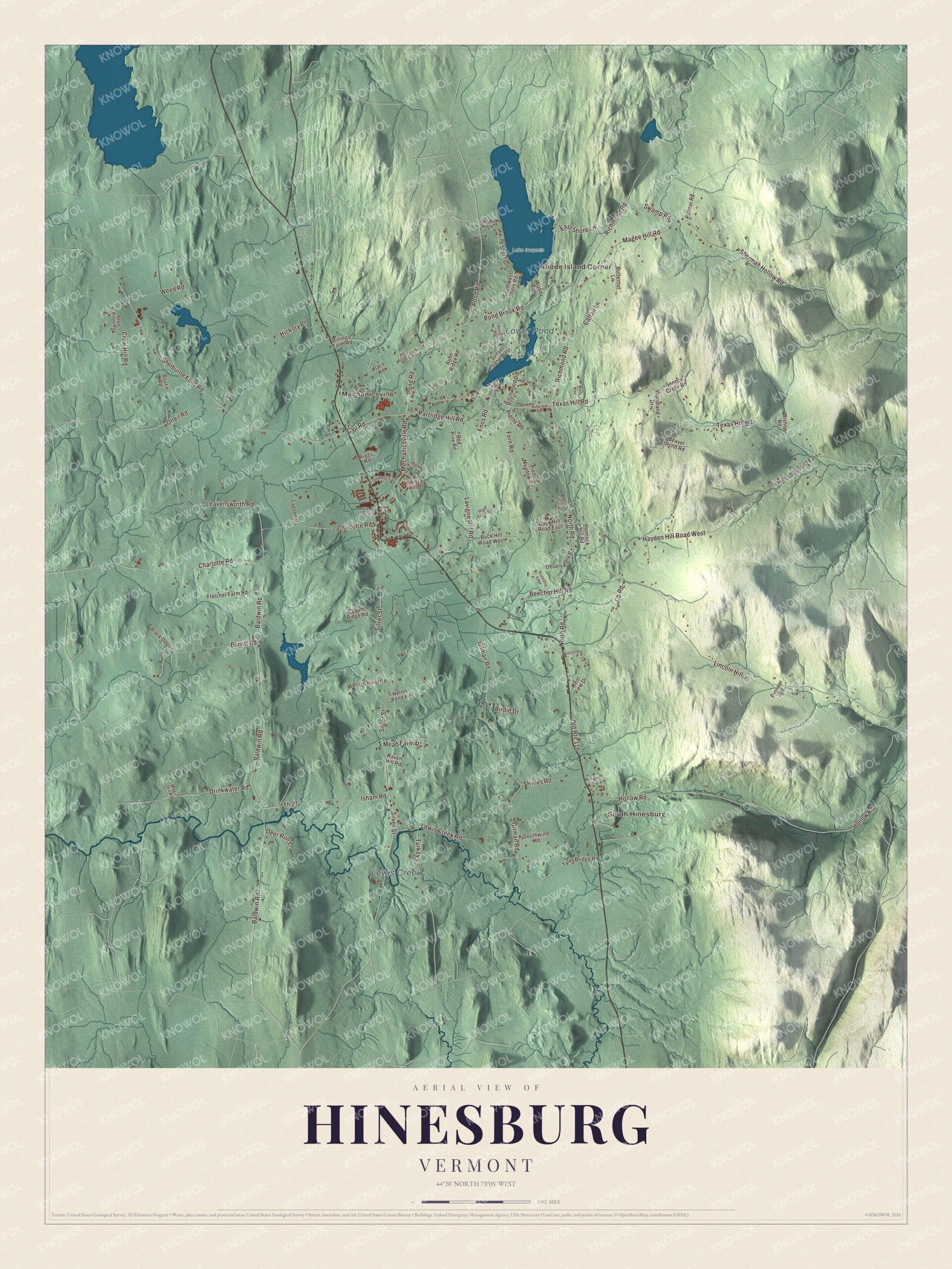
Click to explore a larger preview. The digital watermark does not appear on printed maps.
Names on this map
These names are printed on this map.
Places: Rhode Island Corner, South Hinesburg, Mechanicsville, Lower Pond, Lewis Creek and Lake Iroquois.
Streets and roads: Richmond Road, Shelburne Falls Road, Mechanicsville Road, Cvu Road, Magee Hill Road, Pond Road, Pond Brook Road, Leavensworth Road, Weed Road, Charlotte Road, Texas Hill Road, Hayden Hill Road West.
More street names, A to Z
Anthony Road, Apple Ridge Road, Aube Ridge Road, Baldwin Road, Beaver Pond Road, Beecher Hill Road, Billings Farm Road, Birchwood Drive, Birdie Drive, Bishop Road, Bissonette Lane, Black Dog Lane, Boutin Road, Buck Hill Road East, Buck Hill Road West, Burritt Road, Butternut Lane, Cattail Lane, Cb Road, Commerce Street, Coyote Ridge Road, Crow Hill Road, Deer Run Lane, Drinkwater Road, East Shore Lane, Enos Road, Fern Road, Fletcher Farm Road, Forests Edge, Gilman Road, Hawk Lane, Hayden Hill Road East, Hemlock Hill Road, Heron Pond Road, Hickory Place, High Rock Road, Hillview Terrace, Hines Road, Hollow Road, Isham Road, Jourdan Street, Lagoon Road, Lavigne Hill Road, Lewis Creek Road, Lincoln Hill, Magic Hill Road, Mallard Pond Road, Mead Farm Road, Molly Way, Mulligan Drive, North Road, Observatory Road, Old Route 116, Oneil Road, Palmer Road, Partridge Hill Road, Piette Meadow Road, Piette Road, Pine Shore Drive, Pioneer Road, Place Road, Place Road East, Raven Hill Road, Red Pine Road, Riggs Road, Seneca Creek Road, Shadow Lane, Sherman Hollow Road, Sickman Hill Road, Silver Street, Southwest Shore Road, Southwind Road, Stella Road, Sunset Lane West, Swamp Road, Th 27, Thistle Hill Drive, Turkey Lane, Tyler Bridge Road, West View Drive, Woodland Drive, Wood Run.
See it on a wall
The Hinesburg map as a framed print. Swipe for more.


The town forest and Hinesburg’s people
On the eastern edge of town, where Hayden Hill Road ends near the Huntington line, the Hinesburg Town Forest covers 836 acres. The town began replanting it in the 1930s, old sugar maples in its woods show where syrup was made in the 1800s, and in 2016 it went on the National Register as a good example of a forest run by a Vermont town. Trails cross a local dairy farm, so a hiker may meet cattle along the way.
Lucinda Hinsdale Stone, born in Hinesburg in 1814, went to Hinesburg Academy at thirteen and was teaching school by fifteen. She became an advocate for women’s education and voting rights, and her page says she was the first woman in the United States to take classes of young women abroad to study. The landscape painter William Lamb Picknell was born here in 1853; his work hangs in the Museum of Fine Arts, Boston, and the Metropolitan Museum of Art. William Alanson Howard, also born in Hinesburg, served Michigan in Congress and was governor of Dakota Territory.
On the map, start on Mechanicsville Road, then follow Richmond Road, Shelburne Falls Road, Magee Hill Road, Pond Road and Cvu Road. Mechanicsville, Rhode Island Corner and South Hinesburg are printed, and so are Lake Iroquois, Lower Pond and Lewis Creek. Hinesburg dates to 1762.
This map of Hinesburg is made for everyone who calls Hinesburg home, and it shows the town as it looks today, from Lake Iroquois to South Hinesburg. Hang it in an office, library or den, or use it to teach children the geography and history of their town. It’s printed on museum quality archival paper. Zoom in on the preview above to explore the details, then click here to get your copy of the Hinesburg, Vermont map.

Sources
- Hinesburg, Vermont, Wikipedia
- Town histories and representatives, H towns, Vermont Legislature
- Lake Iroquois (Vermont), Wikipedia
- Cicero Goddard Peck House, Wikipedia
- Hinesburg Town Forest, Wikipedia
- Lucinda Hinsdale Stone, Wikipedia
- William Lamb Picknell, Wikipedia
- William Alanson Howard, Wikipedia