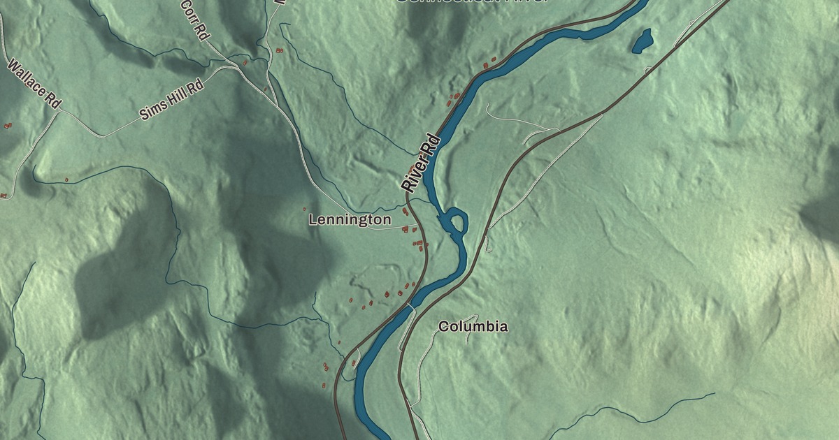
Lemington is a river town of 87 people in the northeast of Essex County, with a covered bridge to New Hampshire and a fire tower on its highest mountain. This map prints River Road, Sims Hill Road, Todd Hill Road, Mill Road, Frizzell Road and Corr Road, with Lennington, Simms Hill and Columbia, and the Connecticut River along the eastern edge.
Lemington is a town in Essex County, Vermont.
KNOWOL made this map in 2026 from public survey data and gave it the look of an old county atlas, shading the hills from United States Geological Survey elevation data and drawing the roads and town line from the Census Bureau. The town covers 35.5 square miles, bordered by Bloomfield, Lewis, Averill and Canaan in Vermont, with Colebrook and Columbia, New Hampshire, across the river. Click here to purchase a print of this map for your wall.
A small town on the river
New Hampshire granted Lemington on June 29, 1762. Settlement came in 1789, and the town organized on March 28, 1796. For its first decades one man, DeForest Mills, went to the legislature for Lemington again and again, from 1798 to 1826. Edward Dow was born here in 1820, the son of a carpenter, and learned his father’s trade young. At 16 he moved with his family to Newport, New Hampshire, and he went on to become an architect in Concord, designing the New Hampshire State Prison, Thompson Hall at the University of New Hampshire and Trinity Methodist Episcopal Church in Montpelier.
Vermont Route 102 runs south to north along the eastern edge of town beside the Connecticut. Route 26 leads east from it across the Connecticut into Colebrook village. On the Vermont side it runs only about 69 feet to the state line in the river before going on as New Hampshire Route 26, and Route 102’s page calls it the shortest signed route in Vermont.
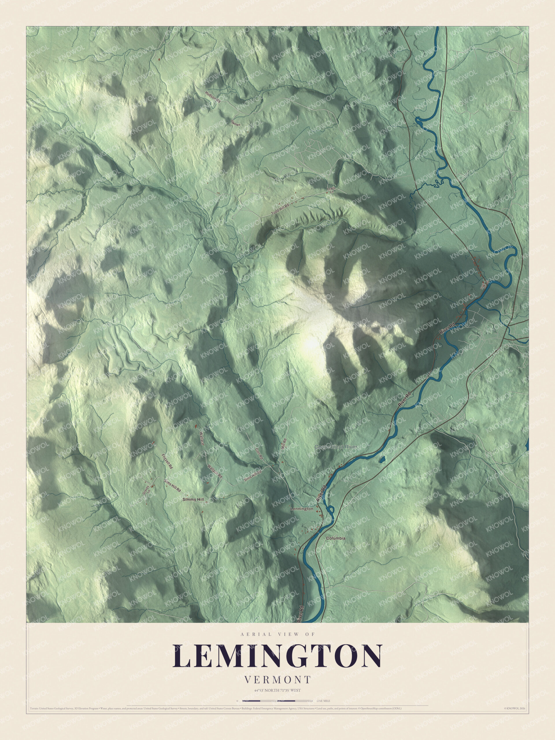
Click to explore a larger preview. The digital watermark does not appear on printed maps.
Names on this map
These names are printed on this map.
Places: Lennington, Connecticut River, Columbia and Simms Hill.
Streets and roads: River Road, Sims Hill Road, Todd Hill Road, Mill Road, Frizzell Road, Corr Road, Hudson Road, Wallace Road, Wallace, Graves Lane, Unkown, Lewis Lane.
More street names, A to Z
Covell Road.
See it on a wall
The Lemington map as a framed print. Swipe for more.


The Columbia Bridge
The covered Columbia Bridge joins Lemington to Columbia, New Hampshire, carrying Columbia Bridge Road from Vermont Route 102 to U.S. Route 3. Charles Babbitt built it in 1912, after fire destroyed the bridge before it the previous year, and it’s the third bridge on the site. It’s a single span of wood and iron Howe trusses, 146 feet long, and it’s one of only two New Hampshire bridges built with Howe trusses, the other being the Mount Orne Covered Bridge in Lunenburg. It’s one of the last covered bridges built in either state during the historic era of covered bridge construction, and it’s listed on the National Register of Historic Places.
Monadnock Mountain
The town’s highest point is Monadnock Mountain, 3,148 feet, an inselberg, a lone peak, in the eastern part of town overlooking the Connecticut and Colebrook. An old fire tower on the summit looks over Vermont and New Hampshire, and on a clear day the view reaches east into Maine and north into Quebec. The Monadnock Mountain Trail starts beside Route 102, 7.7 miles south of Canaan, and climbs 2.5 miles and 2,130 feet to the top. Near the base of the mountain is the Norton Mine, an abandoned gold mine whose entrance is now blocked by boulders.
On the map, follow River Road along the river, then take Sims Hill Road, Todd Hill Road, Mill Road, Frizzell Road and Corr Road. Lennington and Simms Hill are printed, and so is the Connecticut River. Columbia is printed as well. Columbia, New Hampshire, lies across the river to the southeast. Lemington dates to 1762.
This map of Lemington is made for everyone who calls Lemington home, and it shows the town as it looks today, from Monadnock Mountain to the Connecticut River. Hang it in an office, library or den, or use it to teach children the geography and history of their town. It’s printed on museum quality archival paper. Zoom in on the preview above to explore the details, then click here to get your copy of the Lemington, Vermont map.

Sources
- Lemington, Vermont, Wikipedia
- Lemington, Vermont (page source with the infobox dates), Wikipedia
- Town histories and representatives, L towns, Vermont Legislature
- Edward Dow (architect), Wikipedia
- Vermont Route 102, Wikipedia
- Columbia Bridge (Connecticut River), Wikipedia
- Mount Orne Covered Bridge, Wikipedia
- Monadnock Mountain (Vermont), Wikipedia