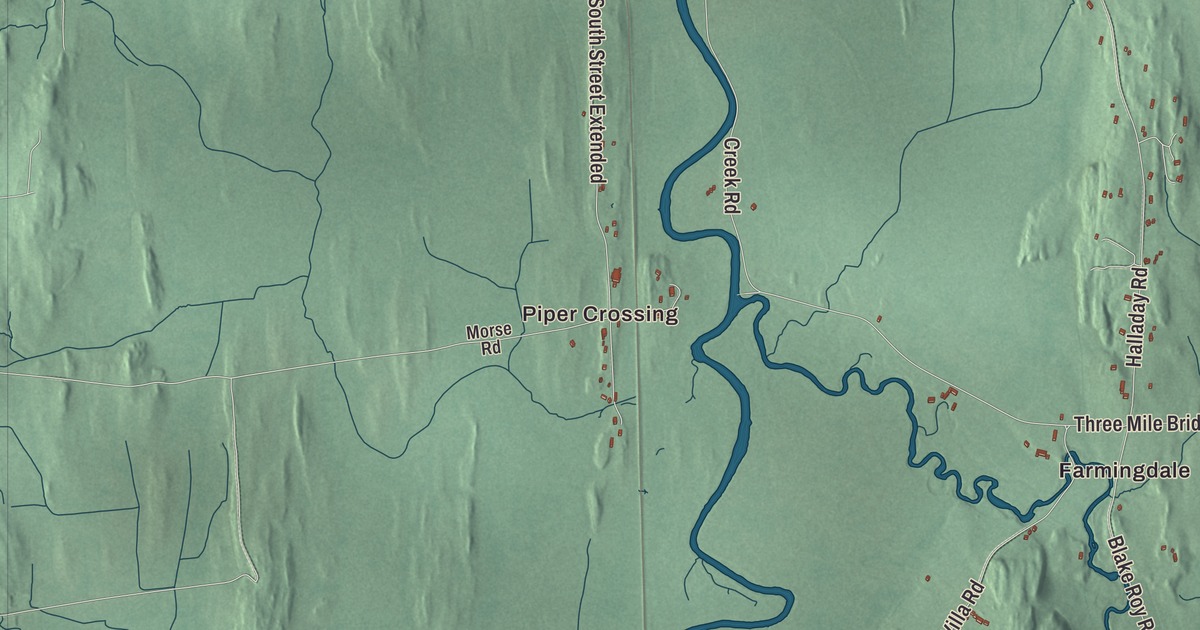
Middlebury grew up around the falls of Otter Creek, and the college on the hill west of the village opened in 1800. This map prints Main Street, South Main Street, College Street, Court Street, East Main Street and Case Street, with East Middlebury, Farmingdale and Piper Crossing, Otter Creek and Dow Pond.
Middlebury is a town in Addison County, Vermont.
KNOWOL made this map in 2026 from public survey data and gave it the look of an old county atlas, shading the hills from United States Geological Survey elevation data and drawing the roads and town line from the Census Bureau. Middlebury is the shire town of Addison County, with 9,152 people at the 2020 census, and Chipman Hill rises 450 feet above the village to the northeast. Click here to purchase a print of this map for your wall.
Between Salisbury and New Haven
Governor Benning Wentworth chartered Middlebury on November 2, 1761, to John Evarts and 62 others, and the name came from its place between the towns of Salisbury and New Haven. The first settlers arrived in 1766, and John Chipman was the first to clear his land, Lot Seven. Much of the young town was burned in Carleton’s Raid in November 1778, and after the war settlers came back to rebuild and farm. Gamaliel Painter, Chipman’s brother-in-law, lost his farm to Salisbury in a survey dispute and turned to building Middlebury Village instead, near the mill he shared with Abisha Washburn at the Otter Creek falls. He gave land for the courthouse and the Congregational church, and when the town organized on March 29, 1786, he became its first representative. Mills lined the river in the Frog Hollow area along Mill Street, and the town’s industries came to include a cotton factory, a sawmill, a gristmill, a pail factory, a paper mill, a woolen factory, an iron foundry and a marble quarry. The town’s page says that around 1830 Middlebury was the second-largest town in Vermont, and the railroad arrived on September 1, 1849.
The village sat on the stagecoach road between Burlington and Rutland, now U.S. Route 7, and its green holds the Congregational Church of 1806 to 1809, which its page calls the oldest in the county, and the Middlebury Inn of 1826. Most of the village is the Middlebury Village Historic District. At 3 Mill Street, the Stone Mill of 1840 stands on a mill site first used for a gristmill in 1789, and today it holds a restaurant, a public market, event space and a few hotel rooms. The Henry Sheldon Museum, founded in 1882, fills the 1829 Judd-Harris House with collections on Vermont’s history. In 1905 the town dedicated Middlebury to Her Soldiers, a granite monument given by Silas A. Ilsley, a Civil War veteran who had settled here, and a reported 7,000 people came to the celebration. On January 2, 1838, Patriote refugees from the Lower Canada Rebellion met in Middlebury, among them Louis-Joseph Papineau and Robert Nelson, to plan their next steps.
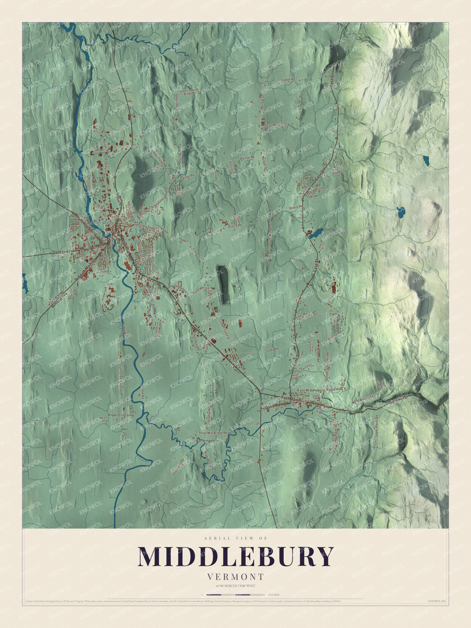
Click to explore a larger preview. The digital watermark does not appear on printed maps.
Names on this map
These names are printed on this map.
Places: Piper Crossing, Farmingdale, East Middlebury, Dow Pond, Otter Creek and Woodland Park.
Streets and roads: Main Street, South Main Street, Ripton 125, Case Street, East Main Street, Court Street, College Street, Weybridge Street, Ossie Road, South Street, South Street Extended, Washington Street Extended.
More street names, A to Z
Abbey Pond Road, Airport Road, Amory Lane, Bicentennial Way, Birch Drive, Blake Roy Road, Boardman Street, Burnham Drive, Buttolph Drive, Cady Road, Charles Avenue, Chateau Road, Cobble Road, Collins Drive, Creek Road, Deerfield Lane, Dorey Lane, Dow Farm Lane, Drew Lane, East Munger Street, Ellen Drive, Elm Street, Exchange Street, Farm Road, Fenn Farm Lane, Foote Street, Forest Ridge Drive, Franklin Street, Golf Course Road, Grist Mill Road, Halladay Road, Halpin Covered Bridge Road, Halpin Road, Happy Valley Road, Hepburn Road, High Street, Hmkl Way, Industrial Avenue, Kestrel Lane, Lindale Circle, Lodge Road, Lower Foote Street, Lower Plains Road, Mainelli Road, Mead Lane, Meadow Glen Drive, Middle Road North, Middle Road South, Mill Street, Monroe Street, Morse Road, Munger Street, Munson Road, NFS Road 236, North Branch Road, North Leno Lane, North Pleasant Street, Old Pasture Lane, Painter Hills Road, Painter Road, Piper Road, Pond Lane, Porter Field Road, Pratt Road, Quarry Road, Quesnel Lane, Rogers Road, Rolling Acres, School House Hill Road, Seminary Street Extended, Seth Warner Memorial Highway, Seymour Street, Seymour Street Extended, Shard Villa Road, Sheldon Lane, Skyline Lane, South Munger Street, Springside Road, Three Mile Bridge Road, Upper Plains Road, Valley Vw, Wilson Road.
See it on a wall
The Middlebury map as a framed print. Swipe for more.


The college and Emma Willard
Middlebury College received its charter on November 1, 1800, and began classes days later, which its page says made it the first operating college in Vermont. It was the town’s idea more than the church’s, and Painter helped win the charter and oversaw its first building, Painter Hall, built from 1812 to 1816. He left most of his estate to the college, and his walking cane is still carried by the president at convocation and graduation. Alexander Twilight, class of 1823, is recognized as the first African American to earn a bachelor’s degree from an American college, and in 1836 he became the first African American elected to a state legislature. In 1804 the college gave Lemuel Haynes an honorary master’s degree, which its page calls the first advanced degree given to an African American, and in 1899 Mary Annette Anderson became the first African American woman elected to Phi Beta Kappa. The college’s Bread Loaf Writers’ Conference, founded in 1926, is the oldest surviving conference of its kind in the nation, according to the town’s page.
Across from the campus, at 131 South Main Street, stands the Emma Willard House, built in 1809. Emma Willard came to Middlebury to run a girls’ academy, studied the college’s curriculum, and in 1814 opened the Middlebury Female Seminary in her own home. In 1821 she opened the Troy Female Seminary in New York, now the Emma Willard School. The house is a National Historic Landmark and now holds the college’s admissions office.
East Middlebury and the covered bridges
East Middlebury grew at the west end of the trail over the Green Mountains, where the Middlebury River Gorge gave power to mills. The East Middlebury Iron Works ran there from 1831 to 1890, the last iron works in Vermont to close, according to the village’s page. At 457 East Main Street, the Waybury Inn was built in 1810 as a stagecoach stop, one of the oldest operating inns in the state, and from 1982 to 1990 its outside stood in for the Stratford Inn on the television series Newhart. Up the road, Route 125 crosses the gorge on the Middlebury Gorge Concrete Arch Bridge of 1924, one of the state’s few such bridges to survive the 1927 floods. On Case Street, Fenn Farm, cleared for sheep about 1828, has stayed in the Fenn family since 1854. The Pulp Mill Covered Bridge carries Seymour Street over Otter Creek to Weybridge, one of only two double-barreled covered bridges in Vermont, though its age is disputed, and the Halpin Covered Bridge stands 41 feet above the Muddy Branch, which its page calls the highest covered bridge in the state.
On the map, follow Main Street, South Main Street and College Street through the village, then take Court Street south, East Main Street out to East Middlebury and Case Street. Piper Crossing and Farmingdale are printed, and so are Otter Creek and Dow Pond. Middlebury dates to 1761.
This map of Middlebury is made for everyone who calls Middlebury home, and it shows the town as it looks today, from the Otter Creek falls to East Middlebury. Hang it in an office, library or den, or use it to teach children the geography and history of their town. It’s printed on museum quality archival paper. Zoom in on the preview above to explore the details, then click here to get your copy of the Middlebury, Vermont map.

Sources
- Middlebury, Vermont, Wikipedia
- Town histories and representatives, M towns, Vermont Legislature
- Gamaliel Painter, Wikipedia
- Middlebury (CDP), Vermont, Wikipedia
- Stone Mill (Middlebury, Vermont), Wikipedia
- Henry Sheldon Museum of Vermont History, Wikipedia
- Middlebury to Her Soldiers, Wikipedia
- Middlebury College, Wikipedia
- Alexander Twilight, Wikipedia
- Emma Willard House, Wikipedia
- East Middlebury, Vermont, Wikipedia
- Waybury Inn, Wikipedia
- Middlebury Gorge Concrete Arch Bridge, Wikipedia
- Fenn Farm, Wikipedia
- Pulp Mill Covered Bridge, Wikipedia
- Halpin Covered Bridge, Wikipedia