
Connecticut
Explore the archive through editorial features, geography, and historical collections.
 Connecticut
Beautifully restored map of Rocky Hill, CT from 1869
Vintage landowners map of Rocky Hill, Connecticut as it used to be
 Connecticut
Beautiful hand drawn map of Stamford, Connecticut in 1883
Click here to see what Stamford looked like 100+ years ago.
 Connecticut
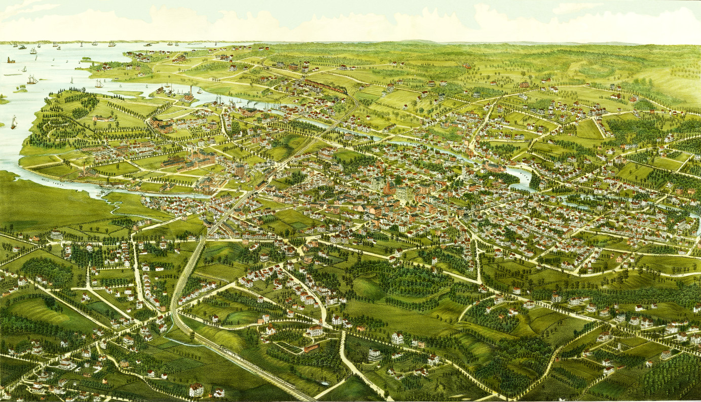
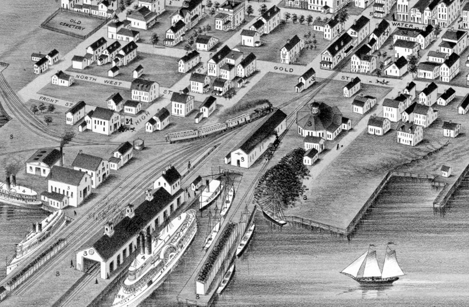
Beautifully restored map of Stonington, Connecticut from 1879
Historic bird's eye view of Stonington, Connecticut as it used to be
 Connecticut
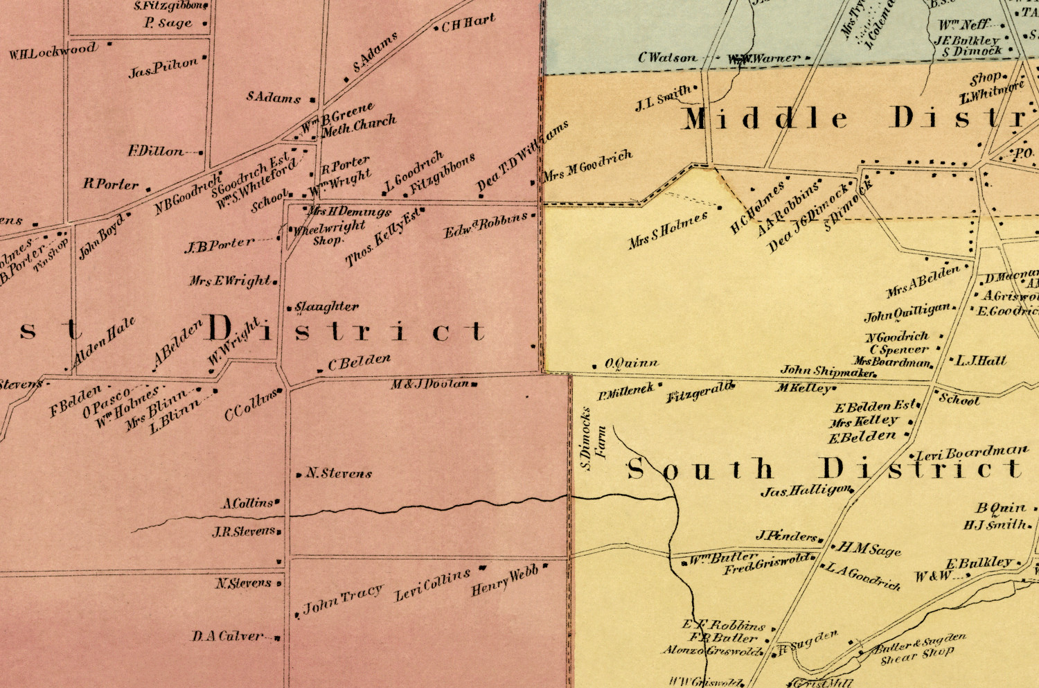
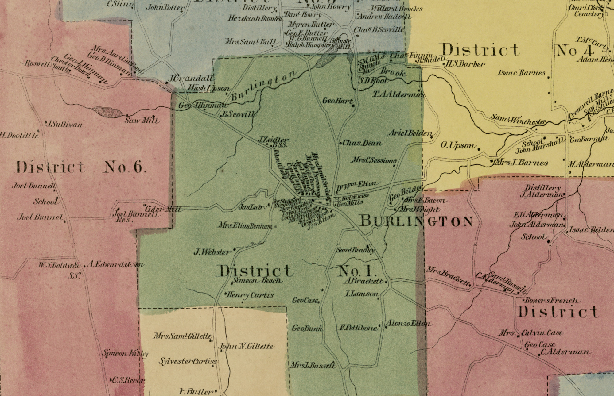
Historic landowners map of Burlington, CT from 1869
Vintage landowners map of Burlington, Connecticut as it used to be
 Connecticut
Beautifully restored map of Naugatuck, Connecticut from 1877
Historic bird's eye view of Naugatuck, Connecticut from 1877
 Connecticut
Beautifully restored map of Cheshire, Connecticut from 1882
Detailed bird's eye view of Cheshire, Connecticut as it used to be
 Connecticut
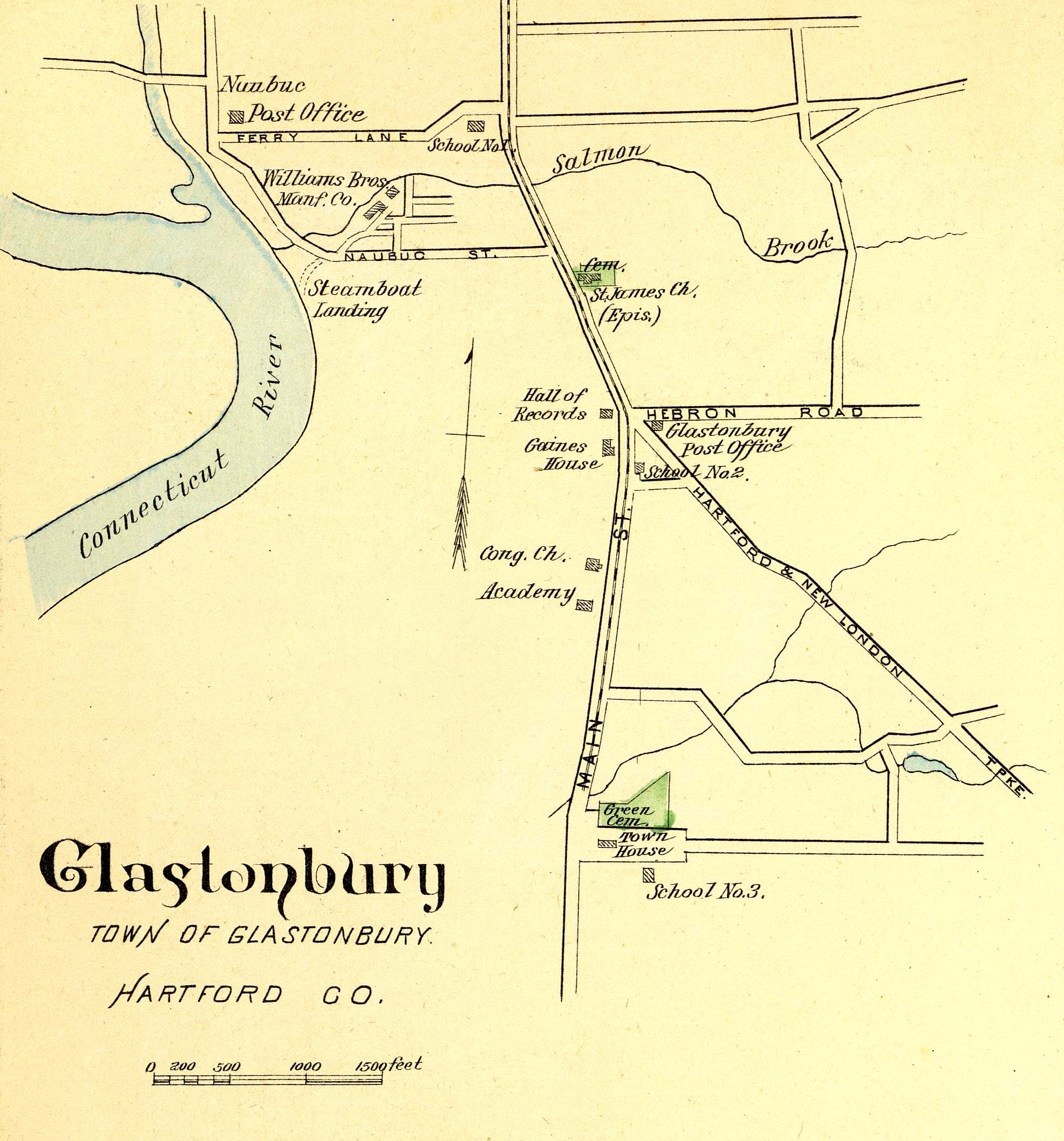
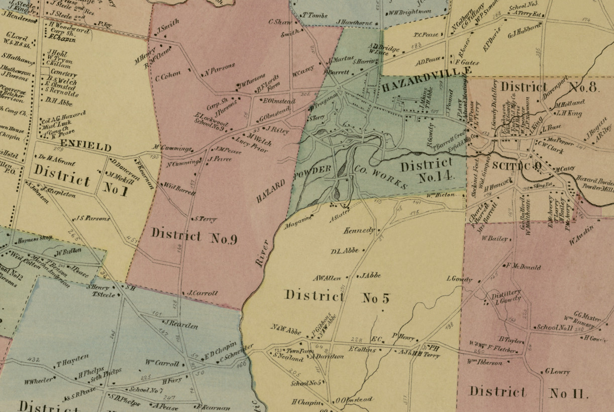
Glastonbury, Rocky Hill, Enfield & Collinsville, CT in 1893
This map shows Glastonbury, Rocky Hill, Enfield & Collinsville, Connecticut as they looked in 1893. The hand colored map was originally printed as a…
 Connecticut
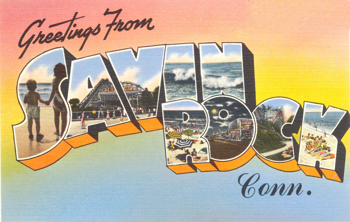
4 vintage images of Savin Rock Amusement Park in West Haven
Savin Rock was an amusement park in West Haven, Connecticut that operated from the 1870's - 1966.
 Connecticut
40 enchanting pictures from Connecticut’s past
This collection of pictures reveals a side of Connecticut that many have never seen.
 Connecticut
15 fascinating pictures of America’s oldest amusement park in the 1940’s
Lake Compounce in Bristol, CT is America’s oldest continuously operated theme park.
 Connecticut
Historic landowners map of Enfield, Connecticut from 1869
Vintage landowners map shows Enfield, Connecticut as it used to be
 Connecticut
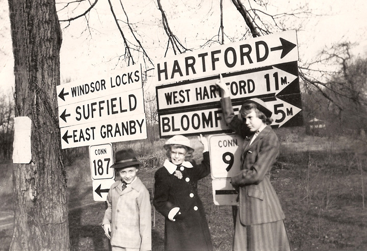
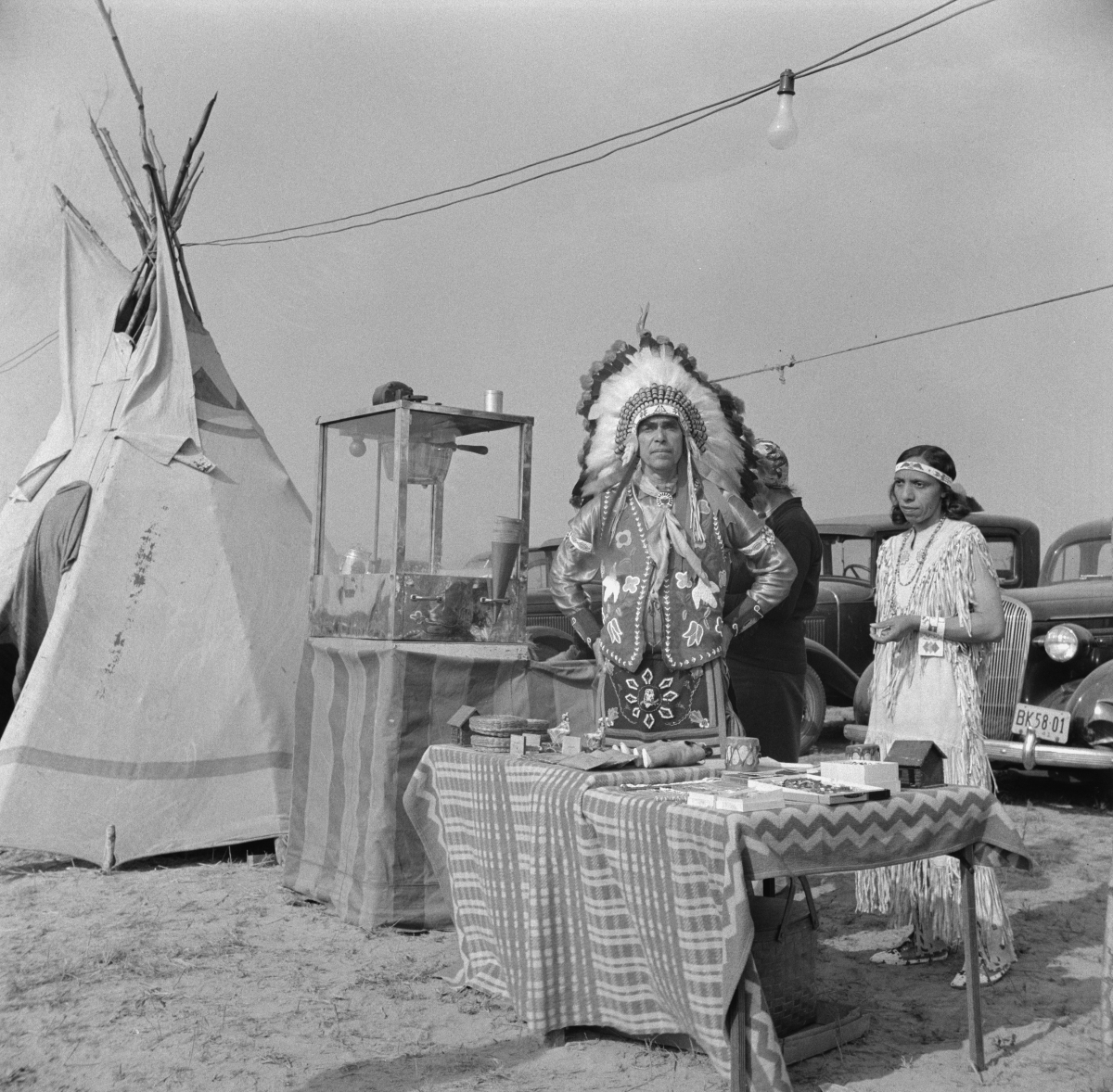
12 Vintage Pictures of Windsor Locks, Connecticut’s Indian Harvest Festival in 1941
The Windsor Locks Indian Harvest Festival took place from September - October, 1941
 Connecticut
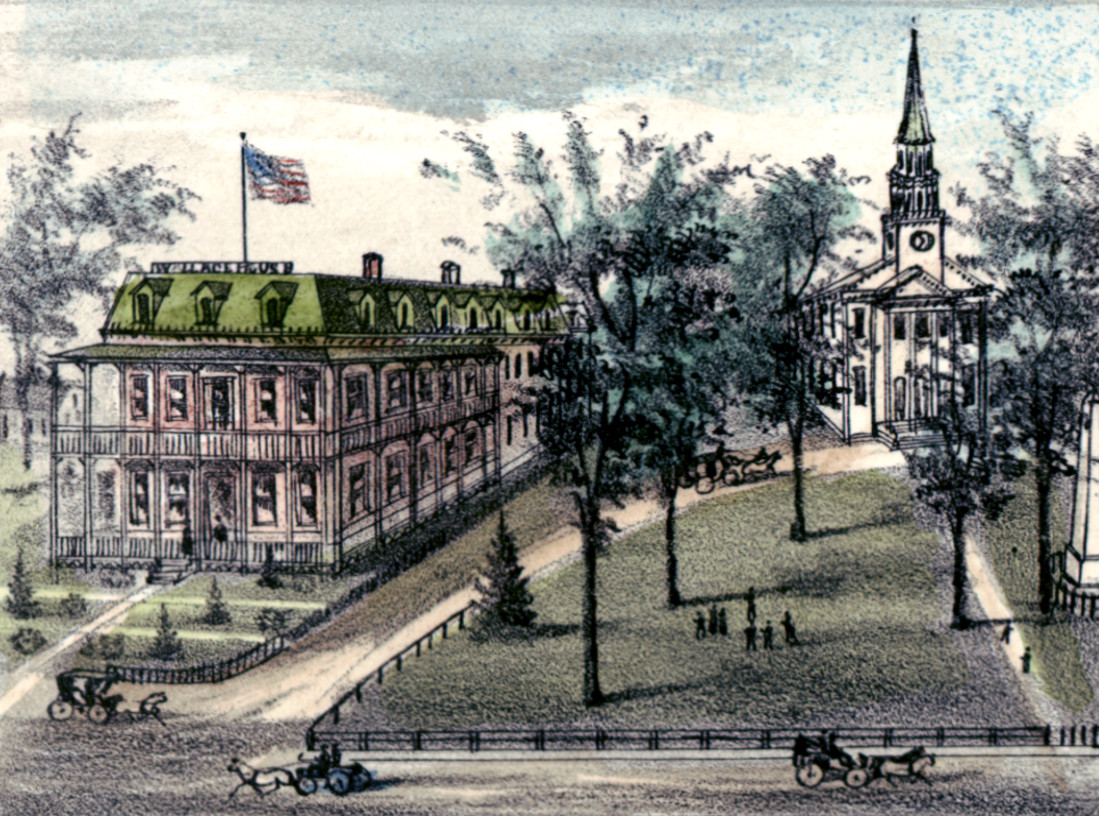
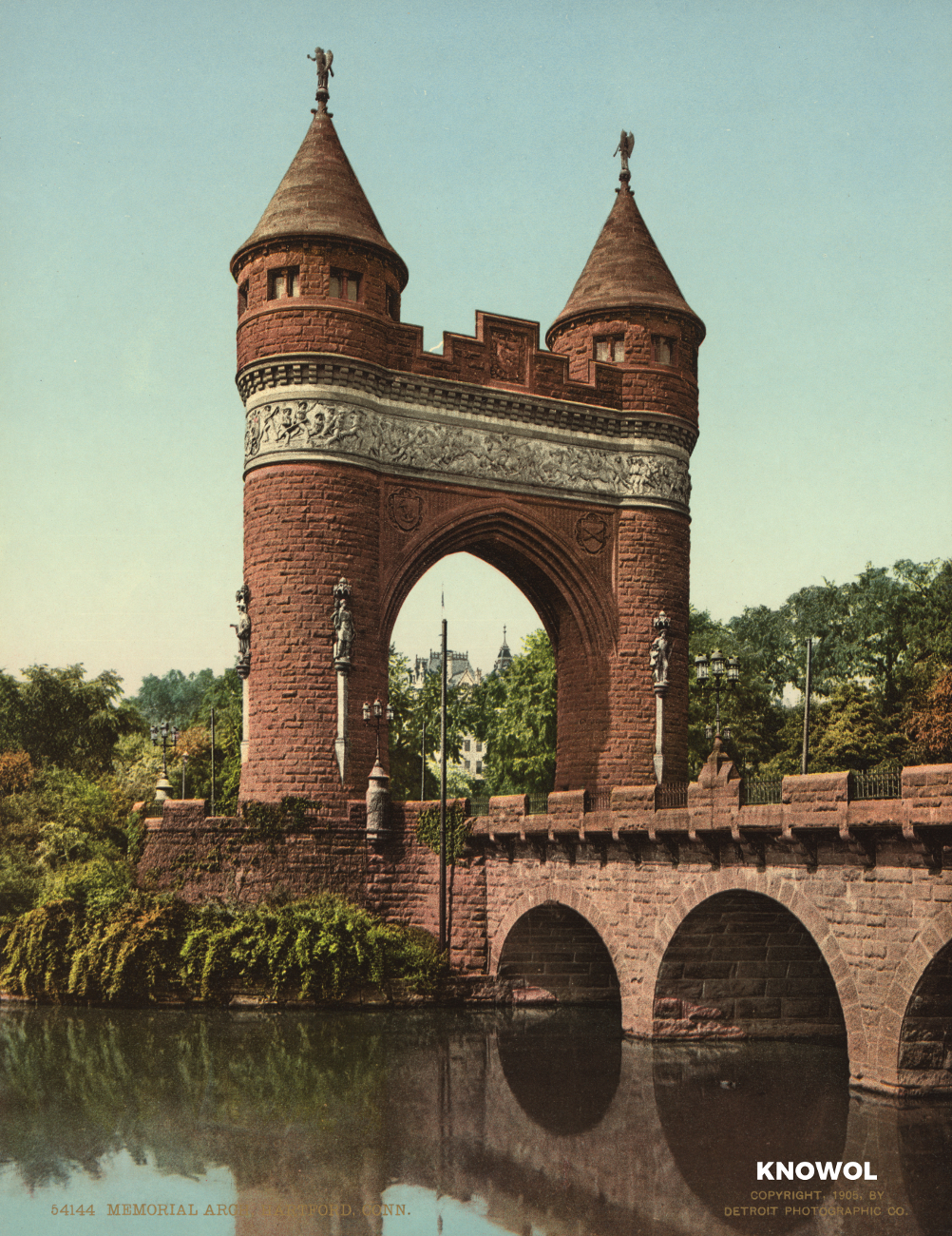
Hartford’s State Capital, Memorial Arch, and Bushnell Park
These pictures of Hartford, Connecticut were taken over the span of 20 years, from 1900 -1920.
 Connecticut
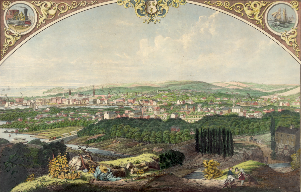
Cityscape view of Bridgeport, Connecticut from a nearby hill in 1857
This beautiful vintage print shows Bridgeport, Connecticut as it looked in 1857. The artist, Walter Staengel, sat atop what was then known as "Old…
 Connecticut
Historic landowners map of South Windsor, CT from 1869
Vintage landowners map shows South Windsor, Connecticut as it used to be
 Connecticut
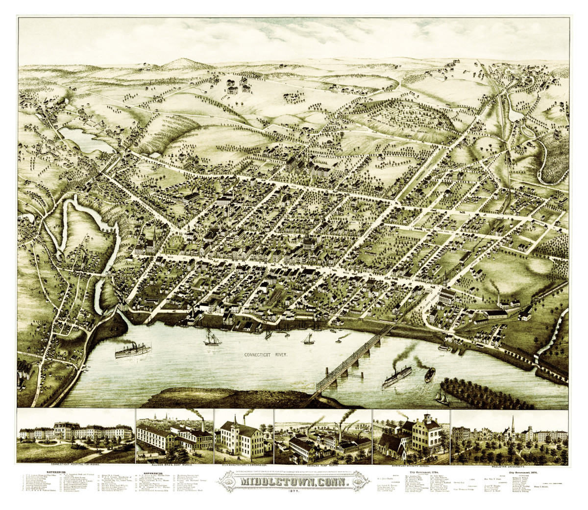
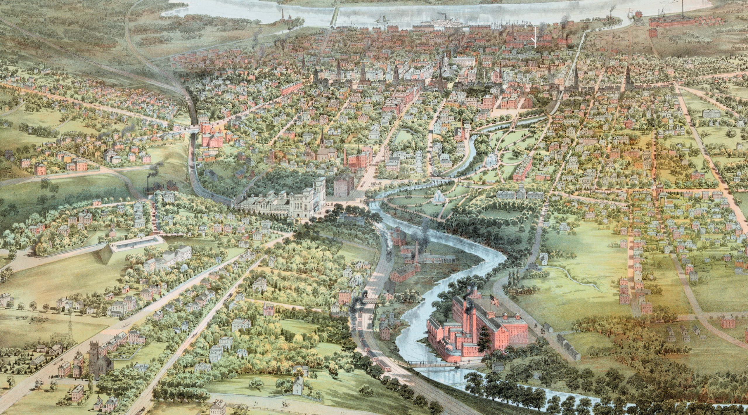
Bird’s eye view of Middletown, Connecticut in 1877
This beautiful vintage map shows Middletown, Connecticut as it looked in 1877. At the time approximately 7,000 people lived in Middletown and manufacturing was the…
 Connecticut
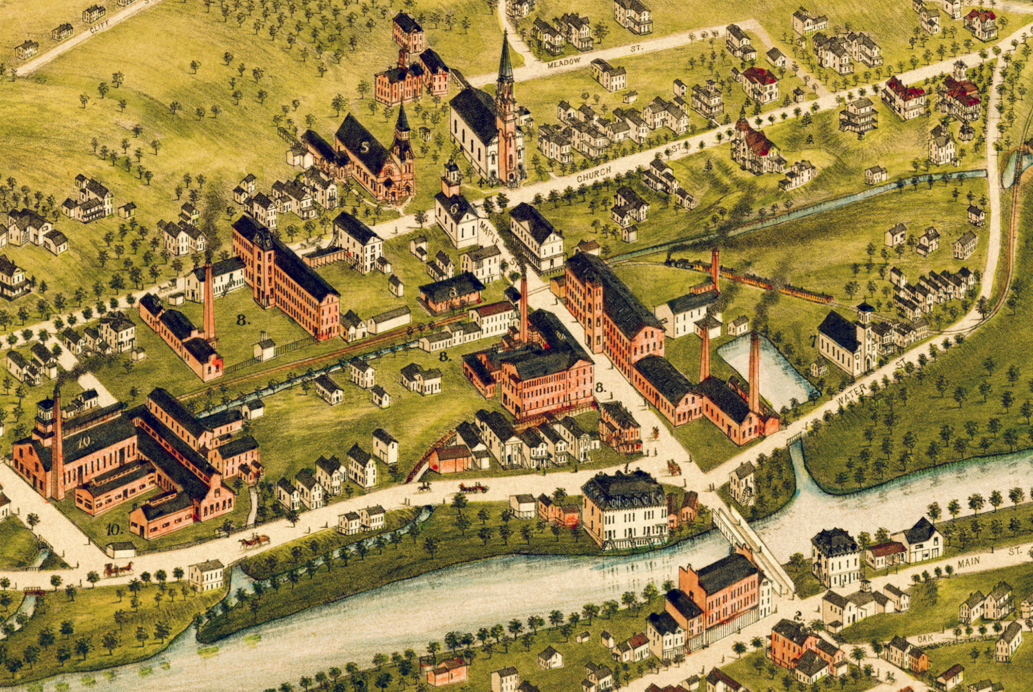
Beautifully restored map of Wallingford, Connecticut in 1881
Historic bird's eye view of Wallingford, Connecticut
 Connecticut
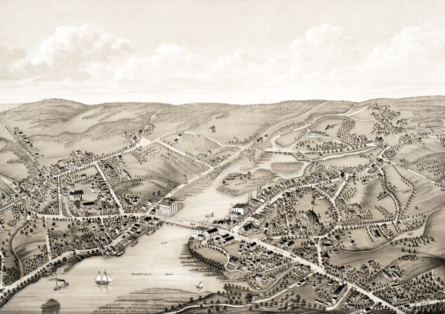
Beautifully detailed map of Westport, CT from 1878
Detailed bird's eye view of Westport, Connecticut in 1878
 Connecticut
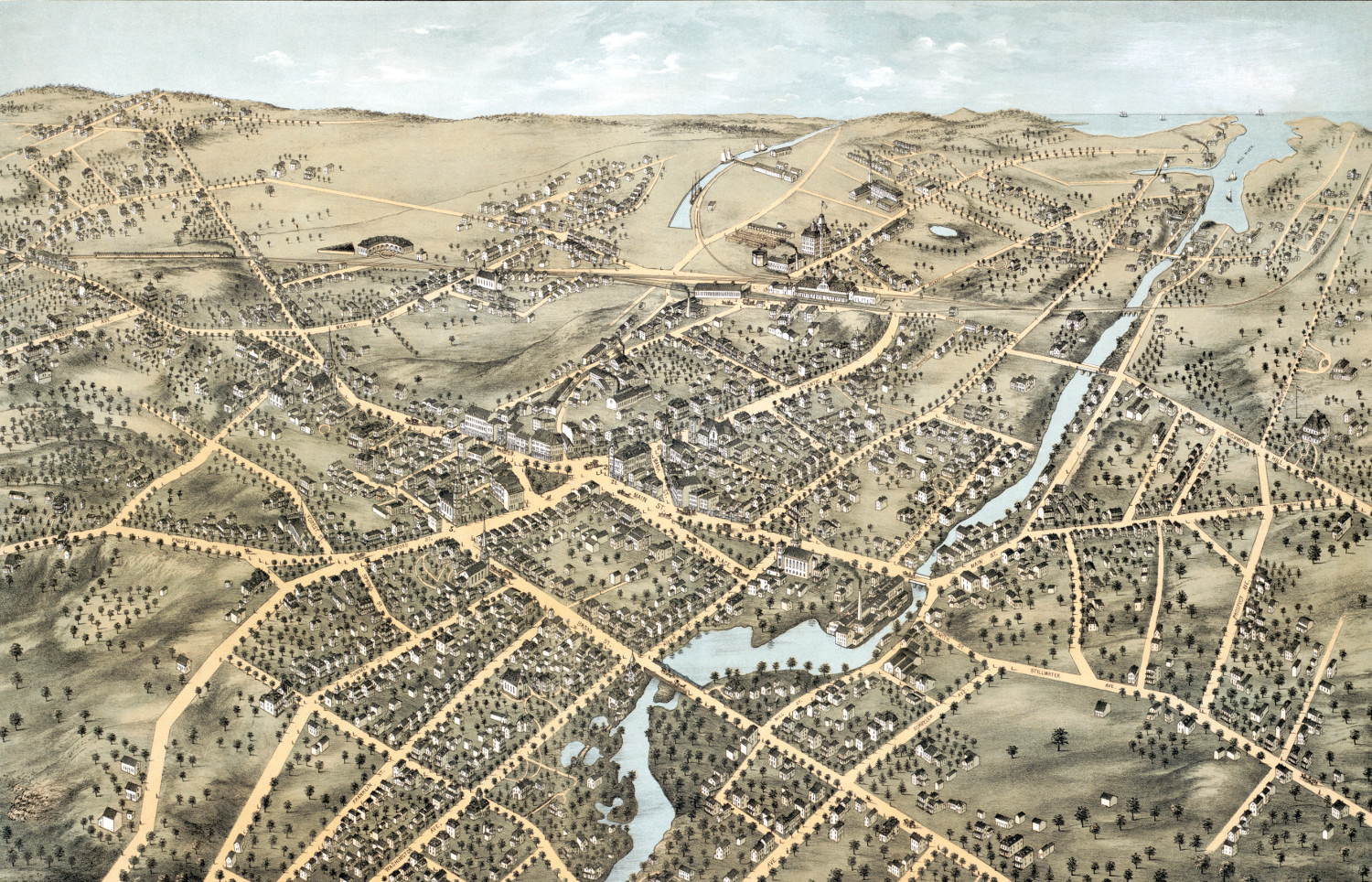
Beautifully detailed map of Stamford, CT from 1875
Historic bird's eye view of Stamford, Connecticut in 1875
 Connecticut
Beautifully detailed map of Hartford, Connecticut from 1864
Historic bird's eye view of Hartford, Connecticut from 1836
 Connecticut
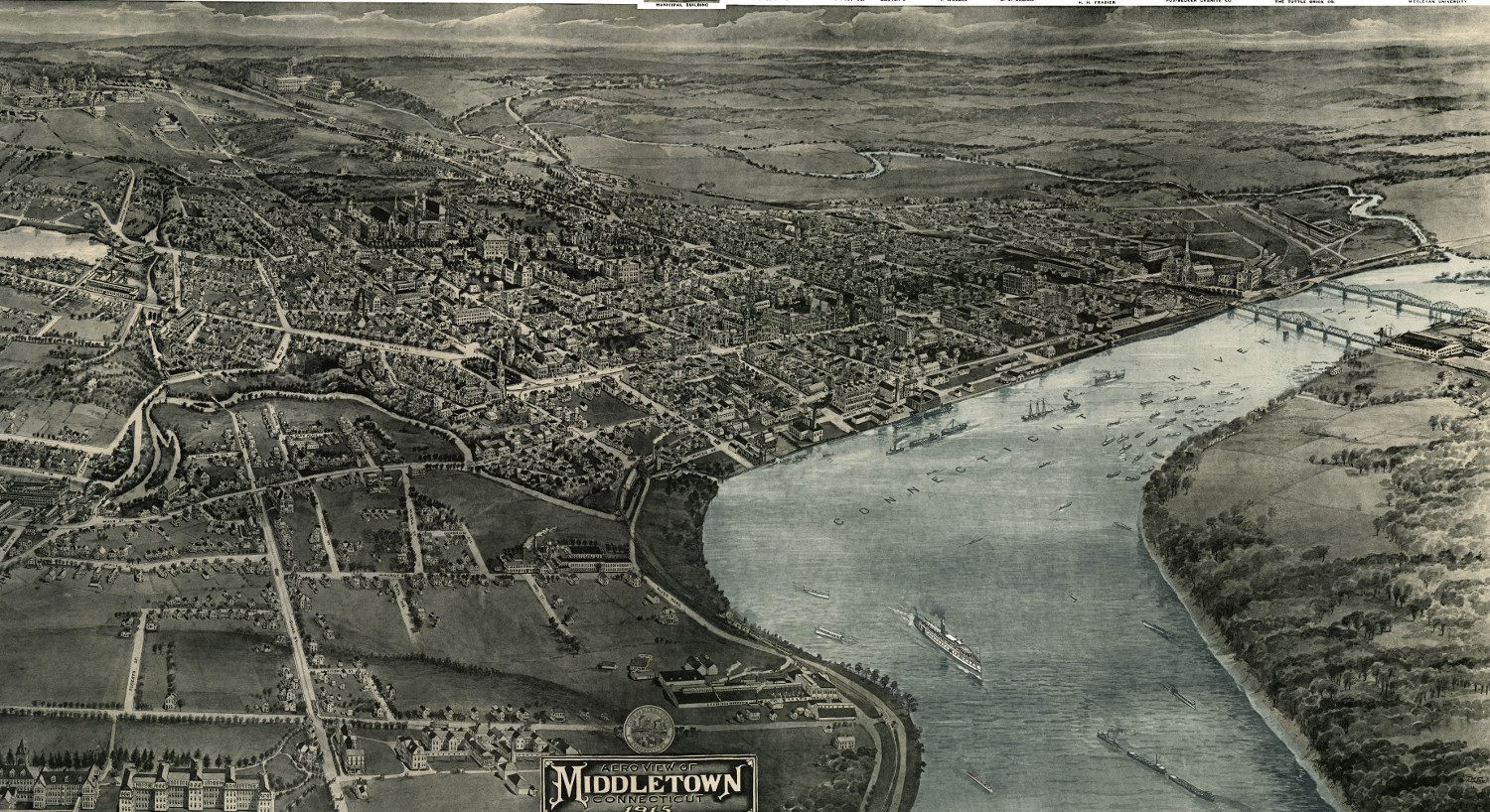
Vintage map shows Middletown, Connecticut in 1915
This old map shows Middletown, Connectiicut in the early 20th century.