
Connecticut
Explore the archive through editorial features, geography, and historical collections.
 Connecticut
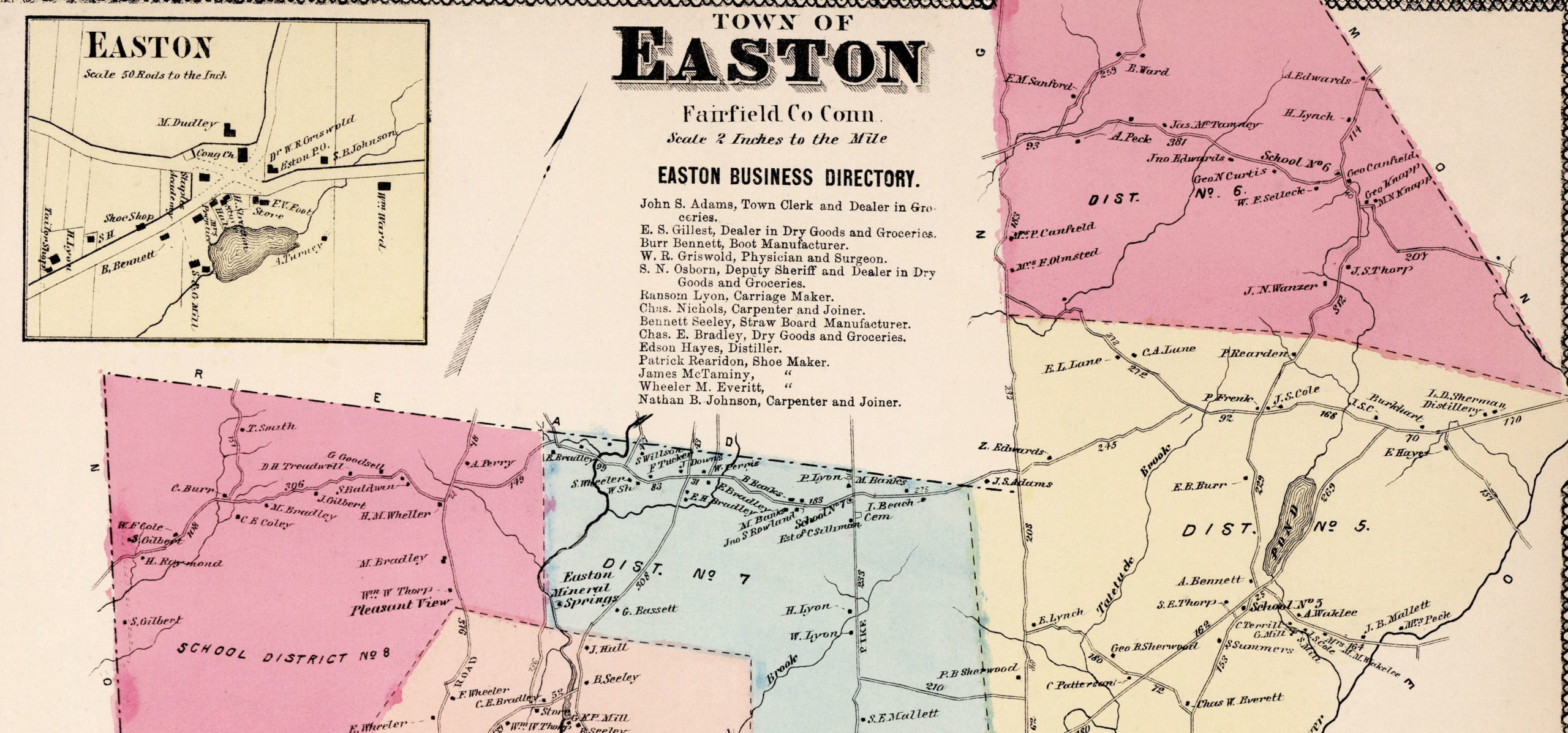
Vintage Property Map of Easton, Connecticut from 1867
This vintage landowners map of Easton, Connecticut was created in 1867 by Frederick W. Beers. a prominent 19th century map maker. Beers was a prominent American map maker and publisher during the 19th century. He began his career as a civil engineer and surveyor, and later established the firm of F.W. Beers, A.D. Ellis & Co. in 1866.
 Connecticut
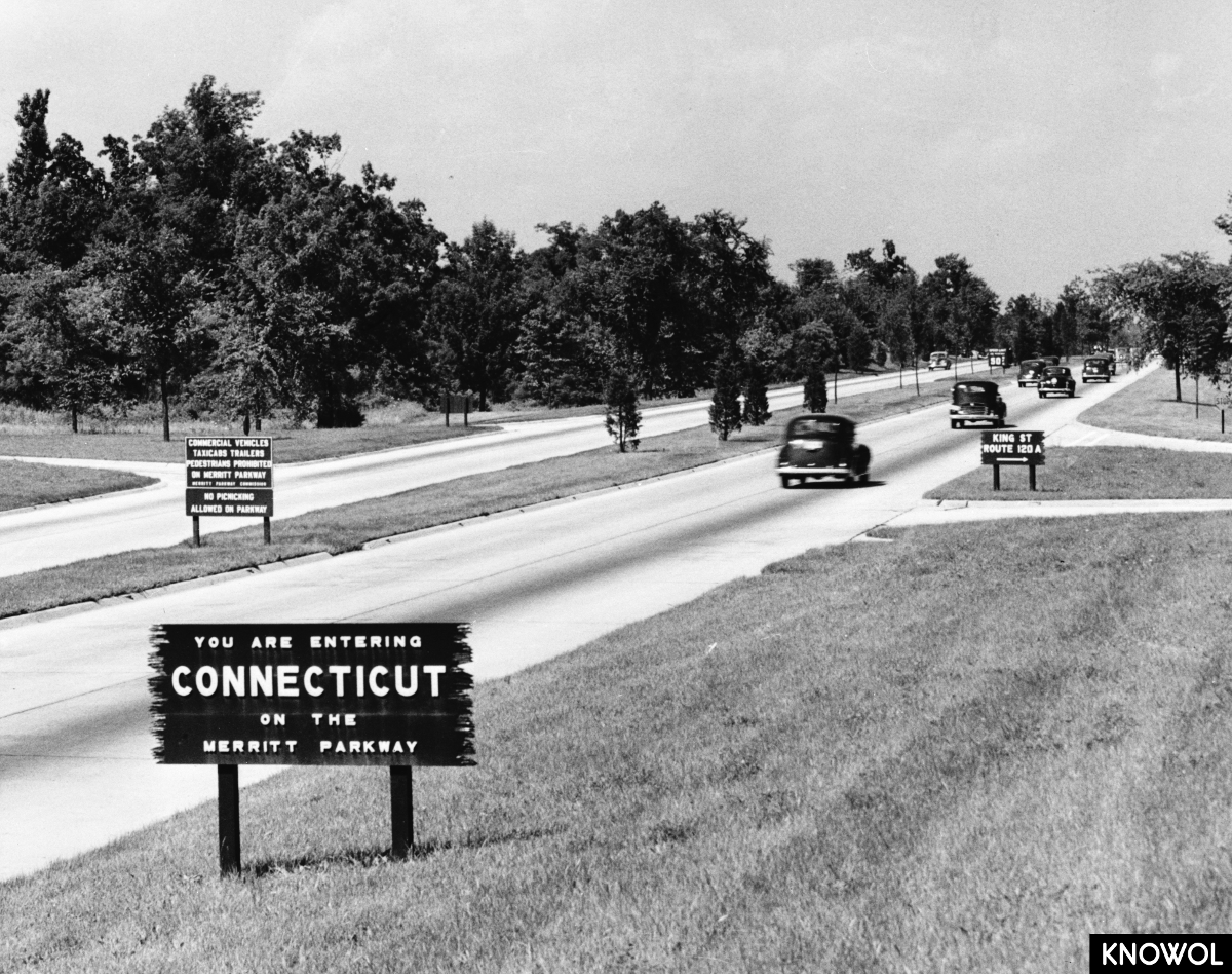
Historic Beauty of Connecticut’s Merritt Parkway Bridges
The Merritt Parkway was the first divided-lane, limited-access highway in Connecticut.
 Connecticut
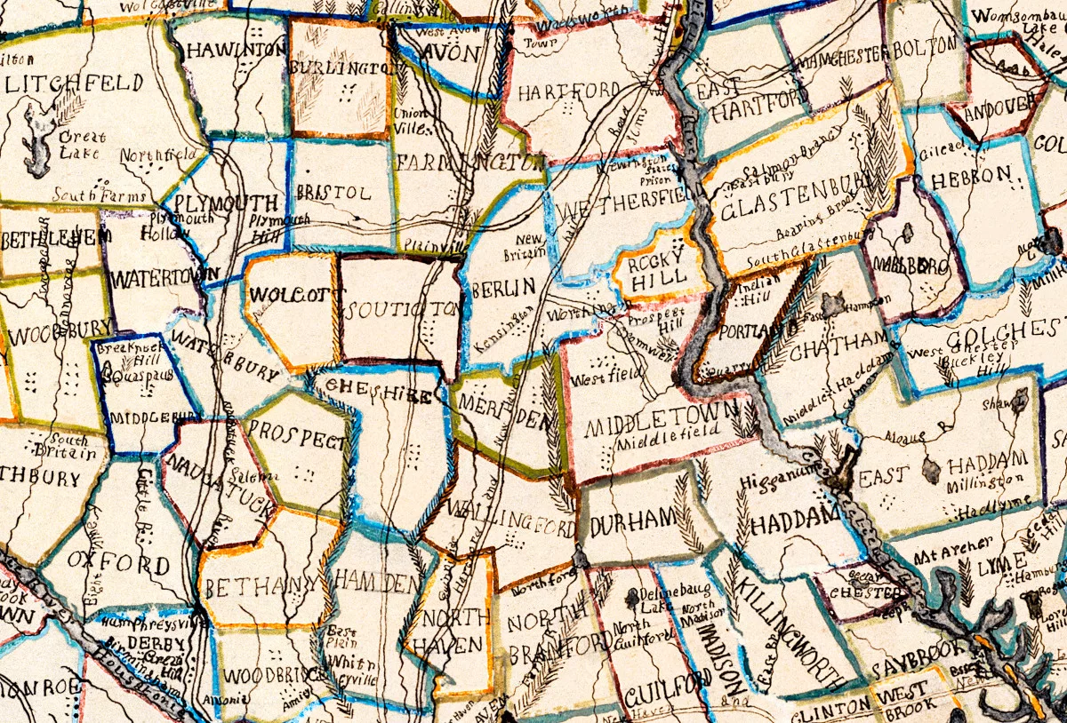
Vintage hand-colored map of Connecticut from 1857
This beautiful hand drawn map of Connecticut was created in 1857 by Laura Roys, a student who attended Hartford Female Seminary, an all-female academy in Hartford, Connecticut. The map is beautifully colored, with shades of blue, orange, red, pink, yellow, and violet adorning the border of each city and town.
 Connecticut
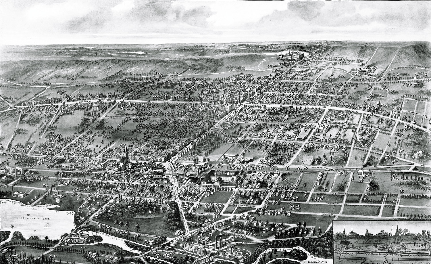
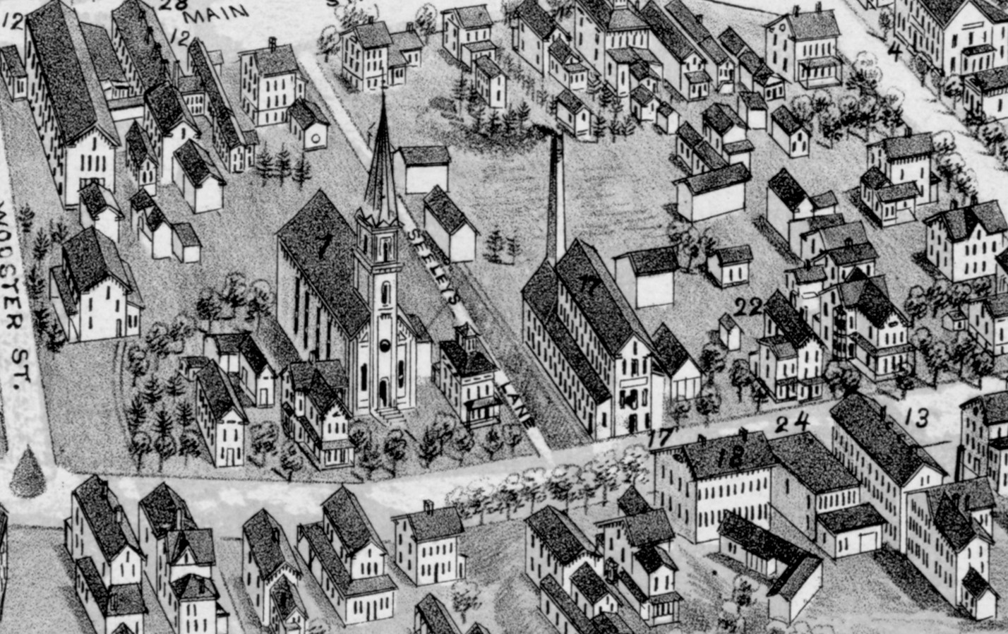
Beautifully detailed map of Wallingford, CT from 1905
Wallingford, Connecticut in the 19th century.
 Connecticut
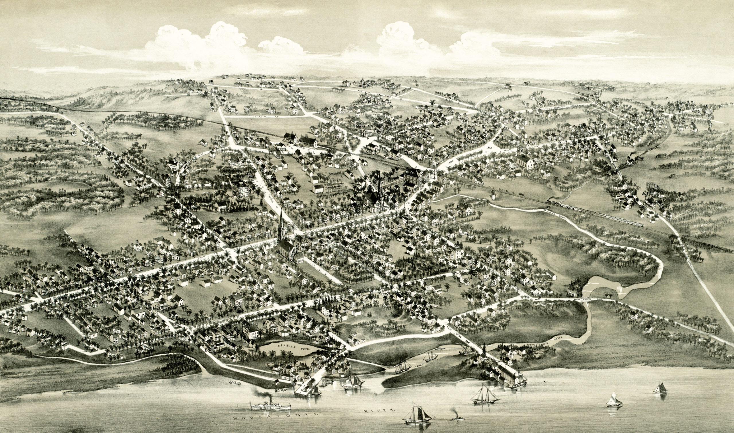
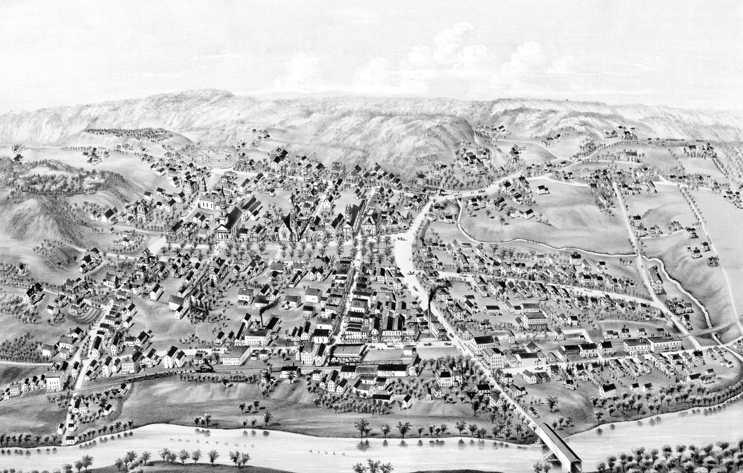
Historic map of Stratford, Connecticut from 1882
Historic bird's eye view of Stratford, Connecticut from 1882
 Connecticut
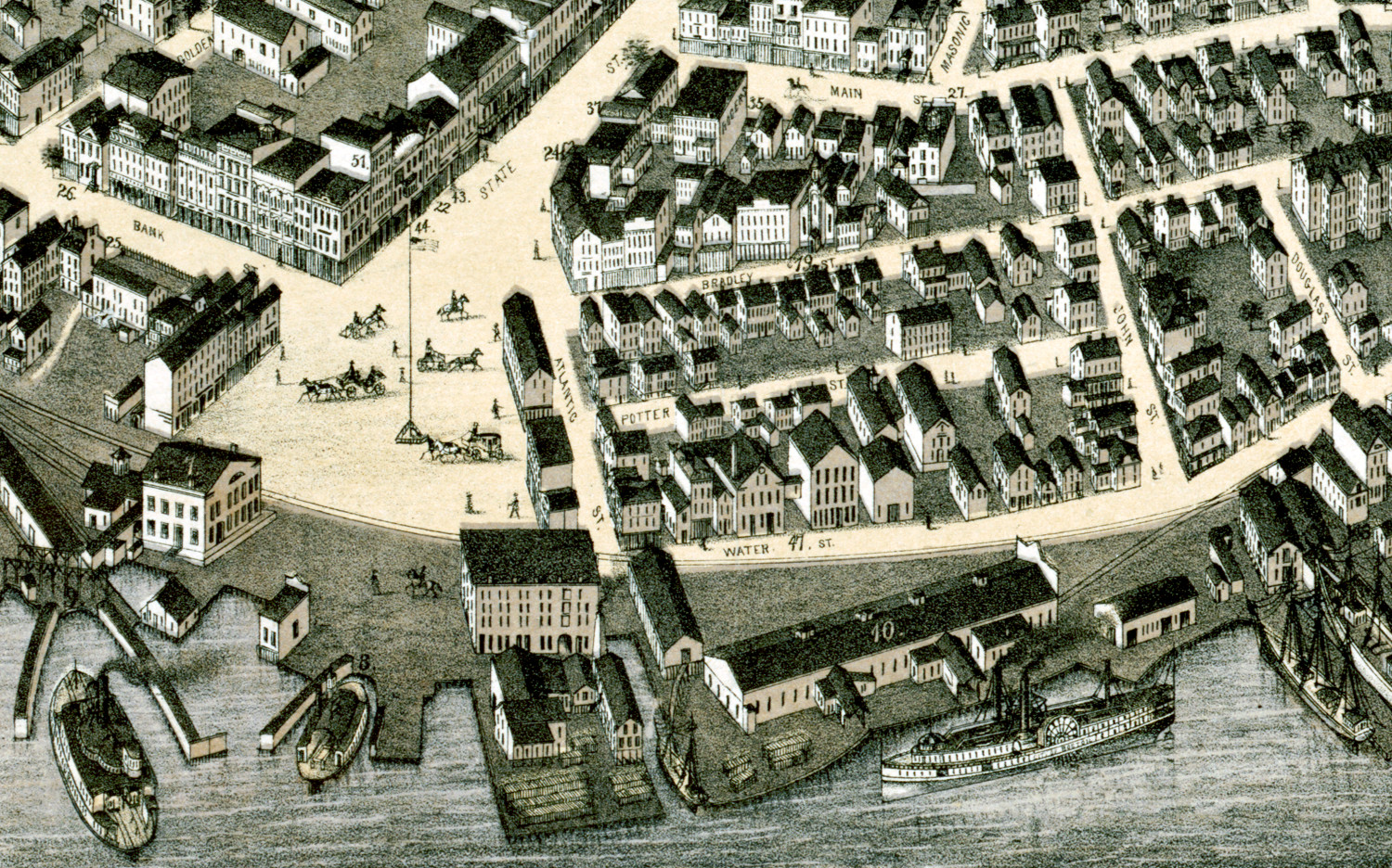
Beautifully restored map of New London, Connecticut from 1876
Bird's eye view of New London, Connecticut in 1876
 Connecticut
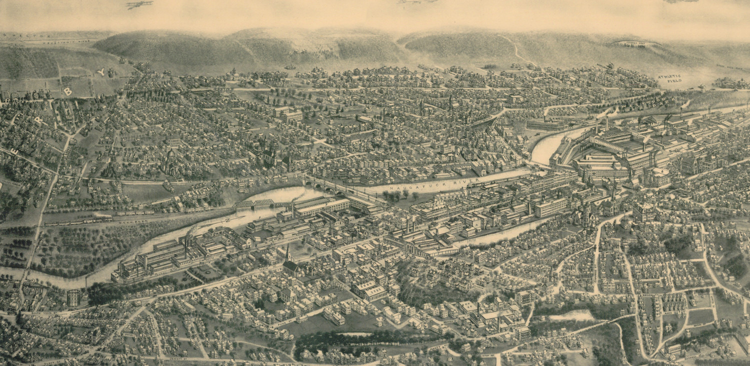
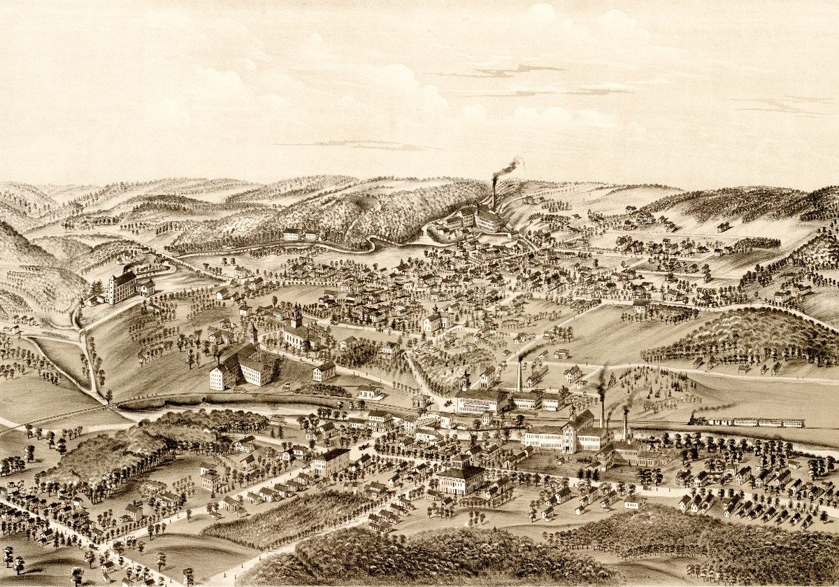
Beautifully restored map of Ansonia, Connecticut from 1921
Old map showing an aerial view of Ansonia, Connecticut from 1921
 Connecticut
10 amazing old pictures reveal forgotten history of Hartford, CT
Hartford is the capital of Connecticut and one of the oldest cities in the United States. It is home to the nation's oldest public art…
 Connecticut
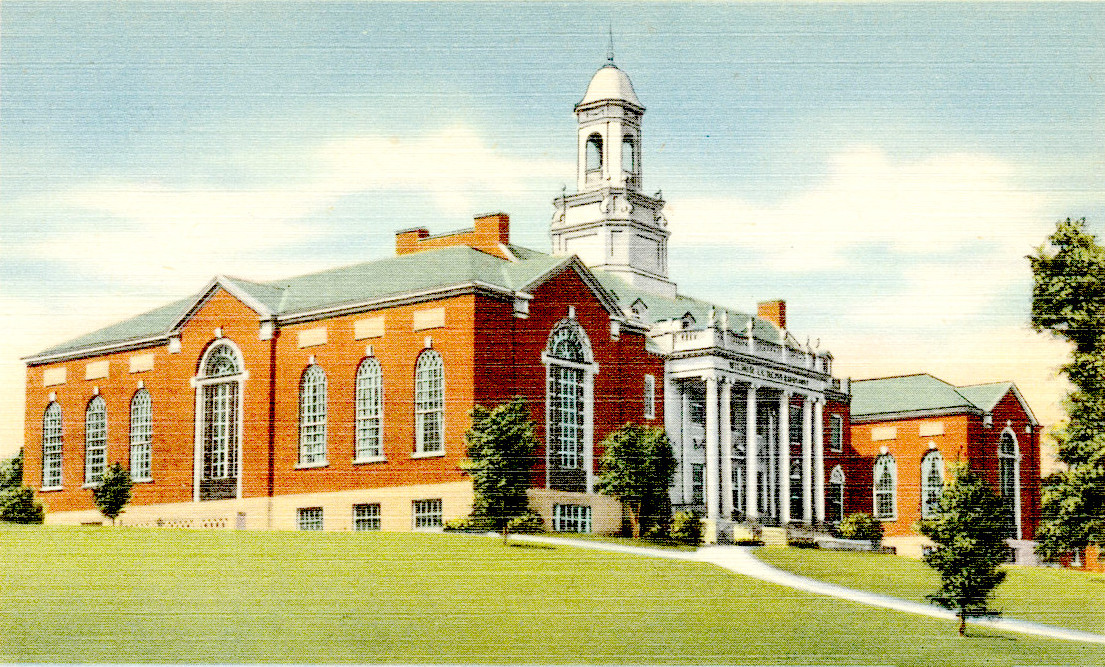
12 fascinating pictures of the University of Connecticut in the 1950’s
The University of Connecticut began its history in 1880, when two brothers...
 Connecticut
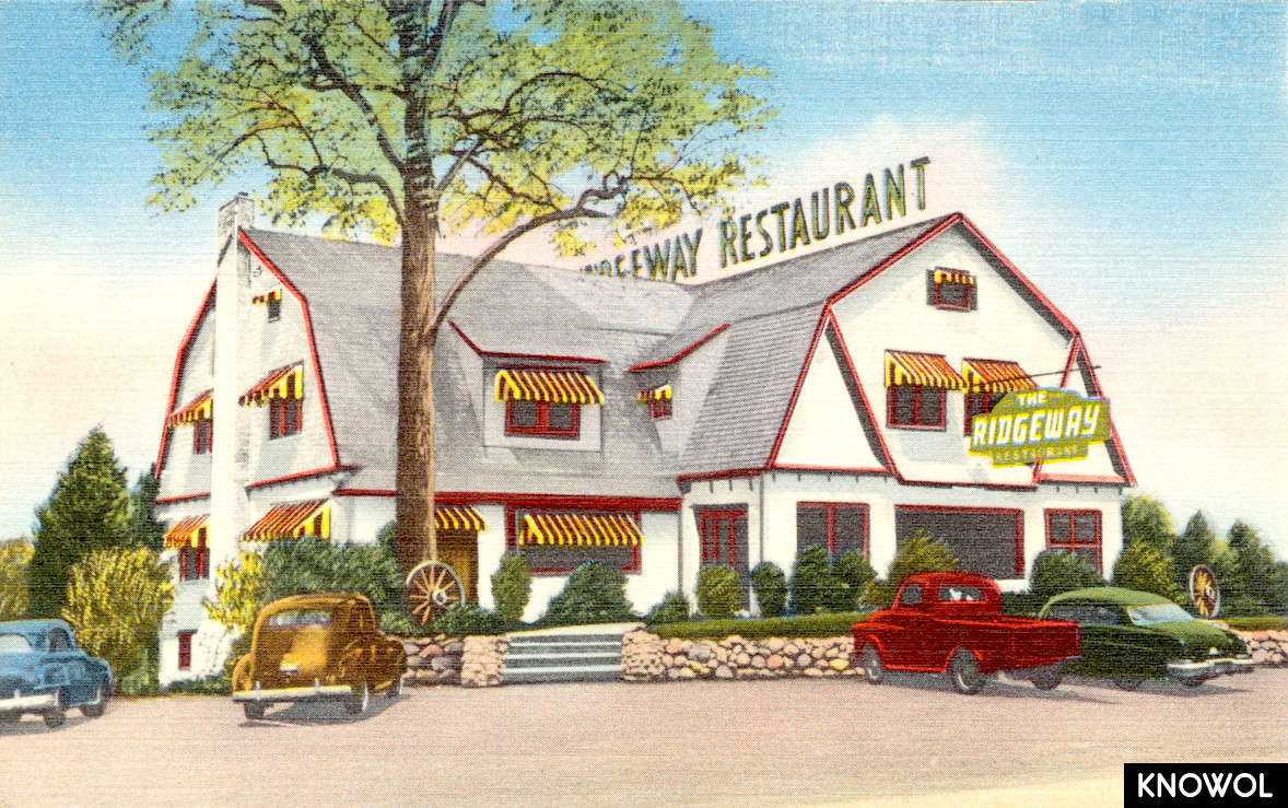
9 beautiful old pictures of Berlin Turnpike landmarks
The Berlin Turnpike is a roadway in Connecticut that served as the primary route connecting Hartford and New Haven during the 1940's - 1960's. The…
 Connecticut
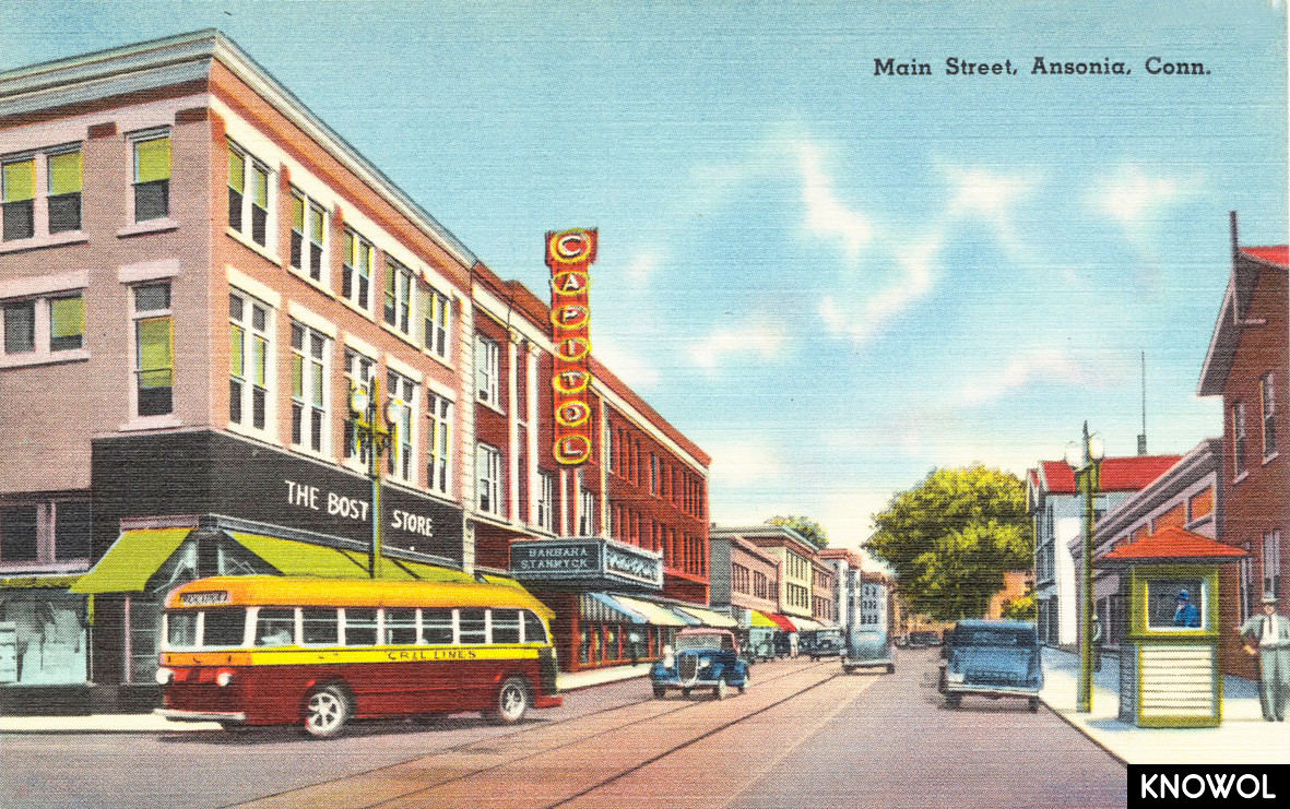
9 historic images reveal the colorful history of Ansonia, CT
Ansonia is a city in New Haven County, Connecticut that was first settled by...
 Connecticut
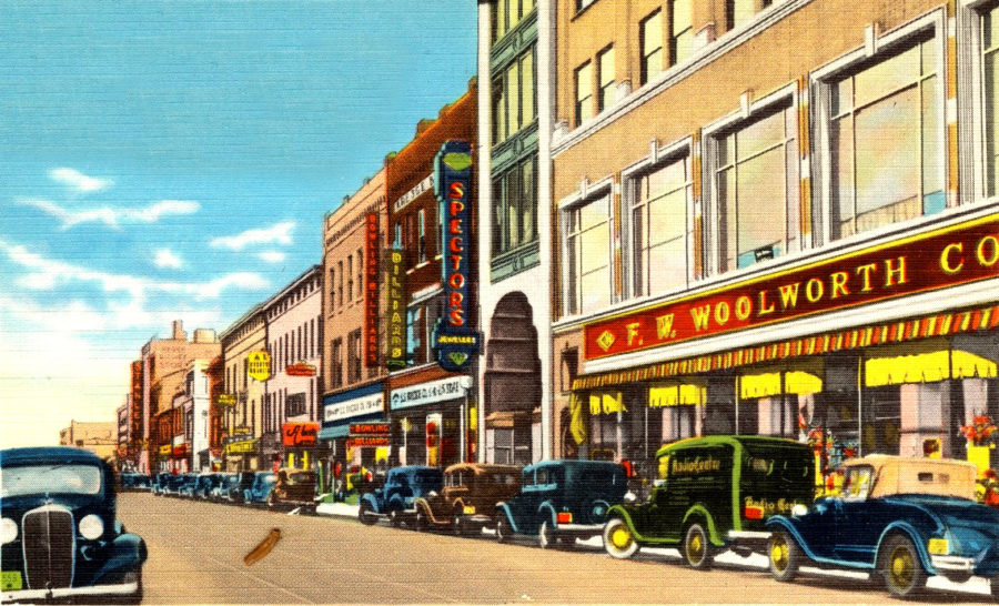
24 amazing old images reveal forgotten historical treasures of New Haven, CT
New Haven is the second largest city in Connecticut. The city was founded in...
 Connecticut
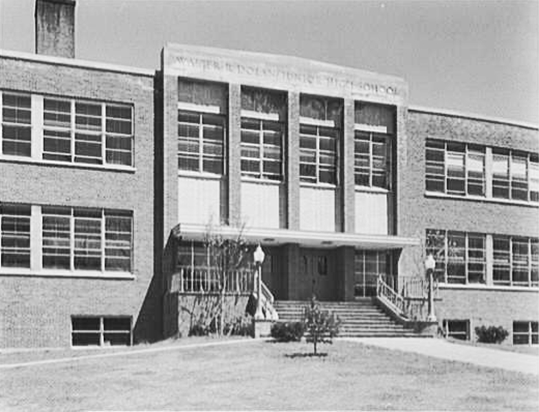
19 historic pictures of Stamford’s Dolan Middle School
Generations of Stamford, Connecticut residents have attended Dolan Middle...
 Connecticut
Stunning vintage map of New Milford, CT from 1882
This vintage map shows New Milford, Connecticut as it looked in 1882.
 Connecticut
Beautiful vintage map of Forestville, CT from 1880
This old map shows the Forestville section of what is now known as Bristol, Connecticut.
 Connecticut
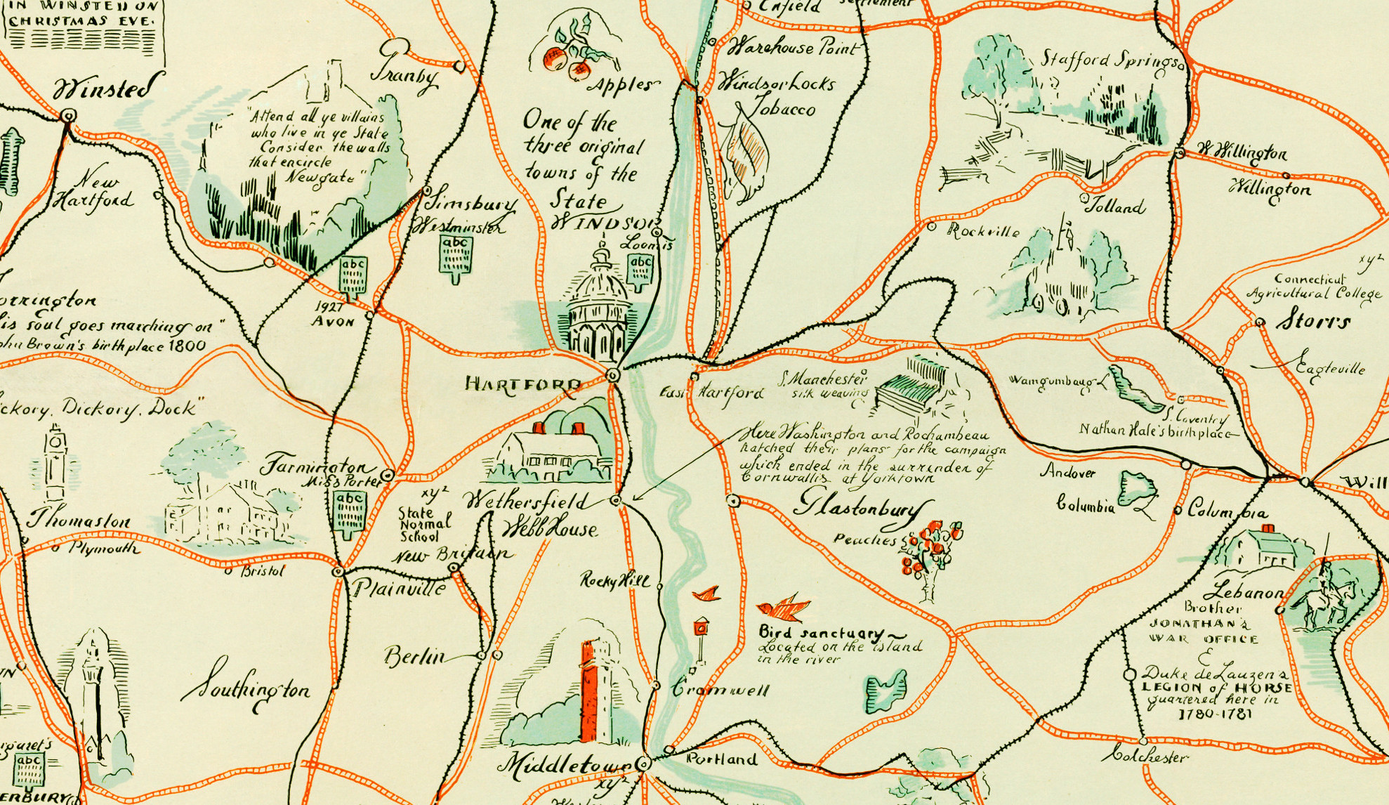
Beautifully illustrated map of Connecticut from 1926
Beautiful old map of the Nutmeg State illustrated with unique vintage drawings.
 Connecticut
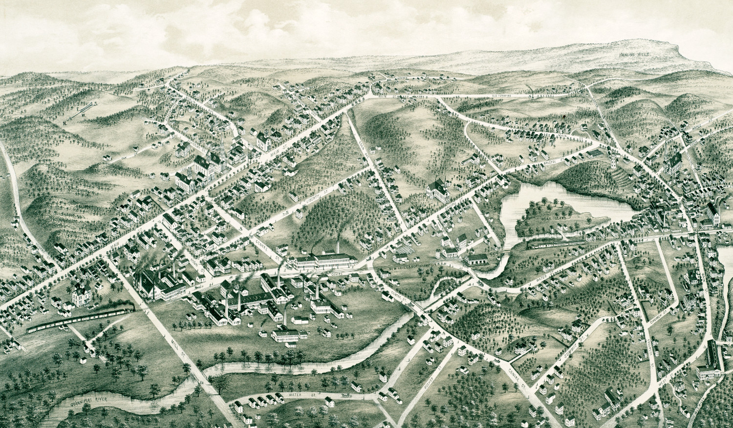
Beautifully restored map of Southington, CT from 1878
This map shows Southington, Connecticut as it looked in 1878.
 Connecticut
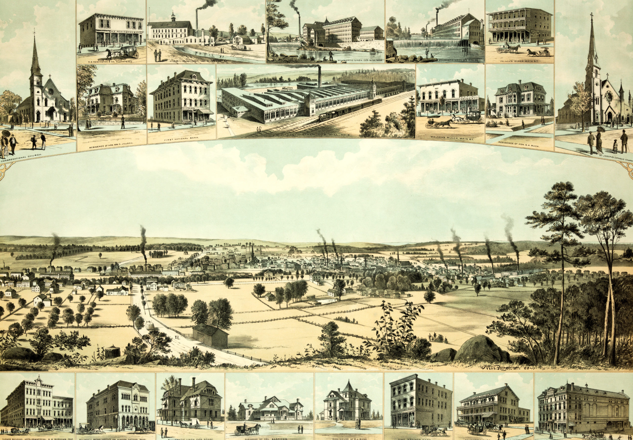
Bird’s eye view of Willimantic, CT from 1882
This old map shows Willimantic, Connecticut in the late 19th century.
 Connecticut
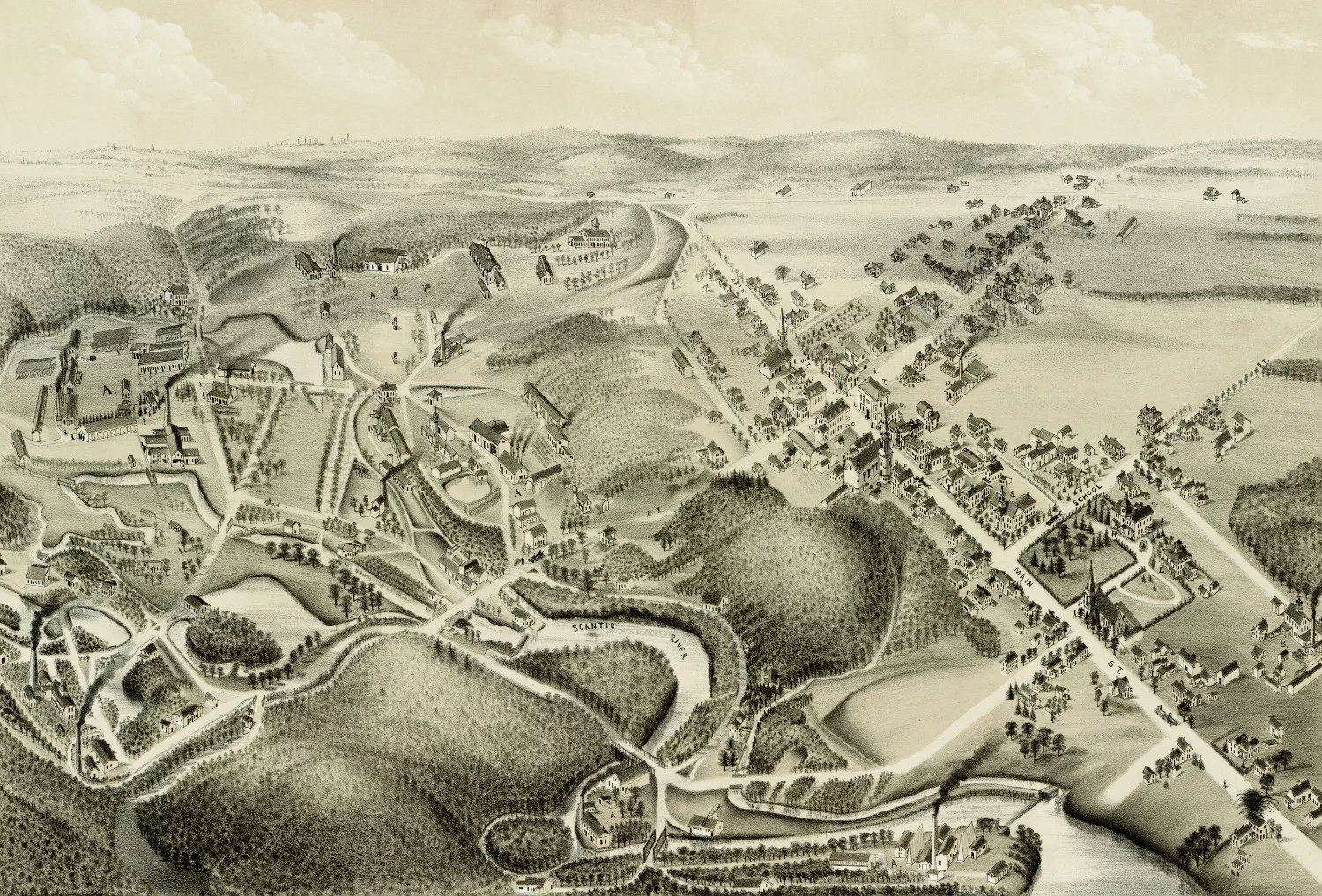
Old map showing a bird’s eye view of Hazardville, CT in 1880
This old map shows Hazardville, Connecticut in the late 19th century.
 Connecticut
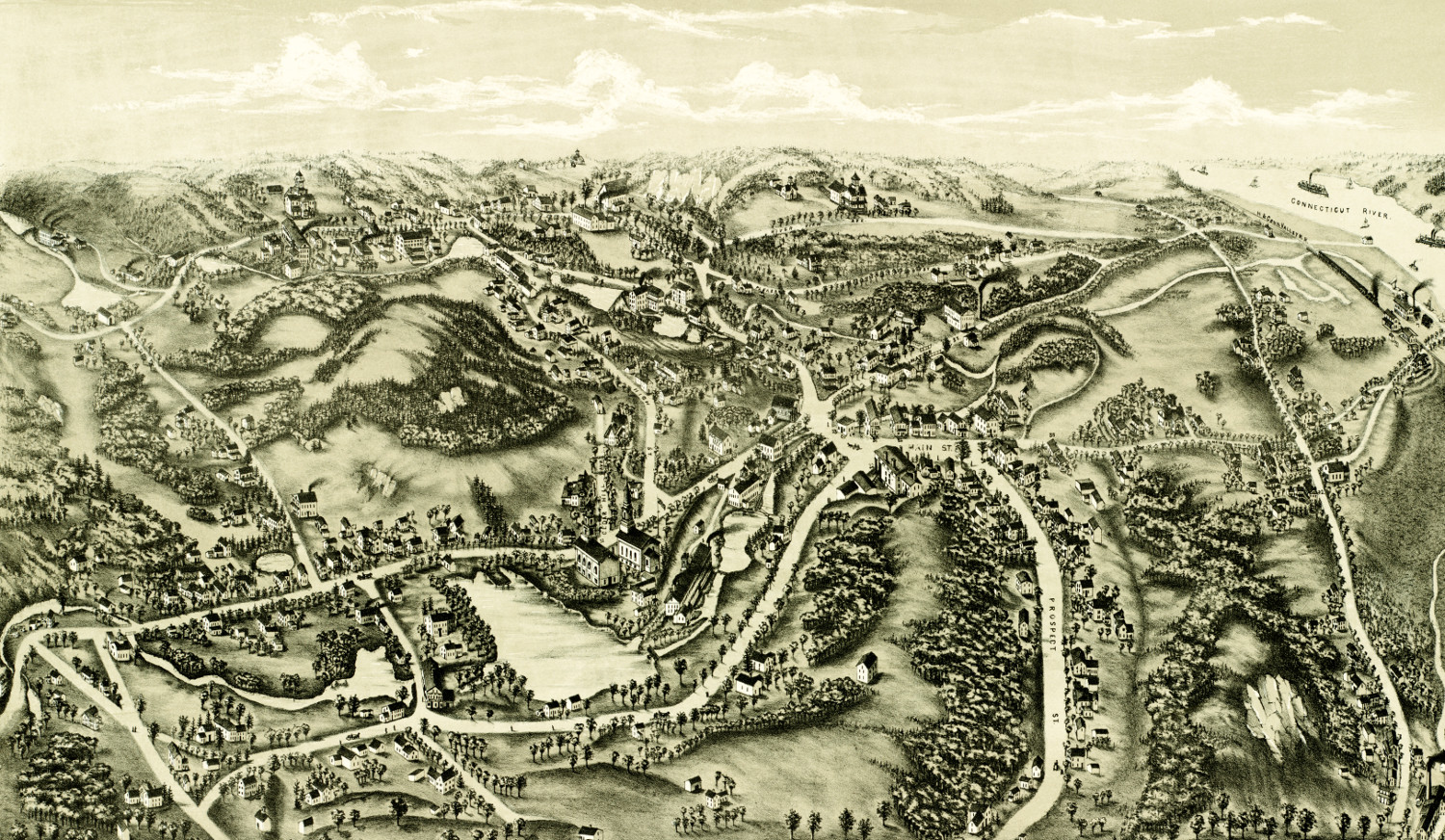
Bird’s eye view of Chester, Connecticut from 1881
This old map shows Chester, Connecticut in the late 19th century.
 Connecticut
Historic old map shows bird’s eye view of Bethel, Connecticut in 1879
Historic bird's eye view of Bethel, Connecticut in 1879