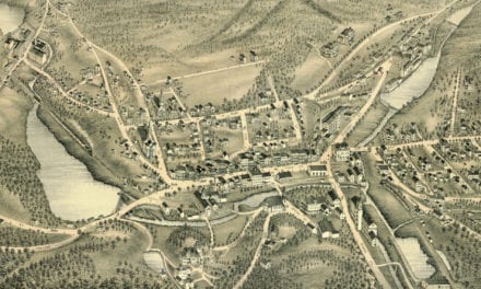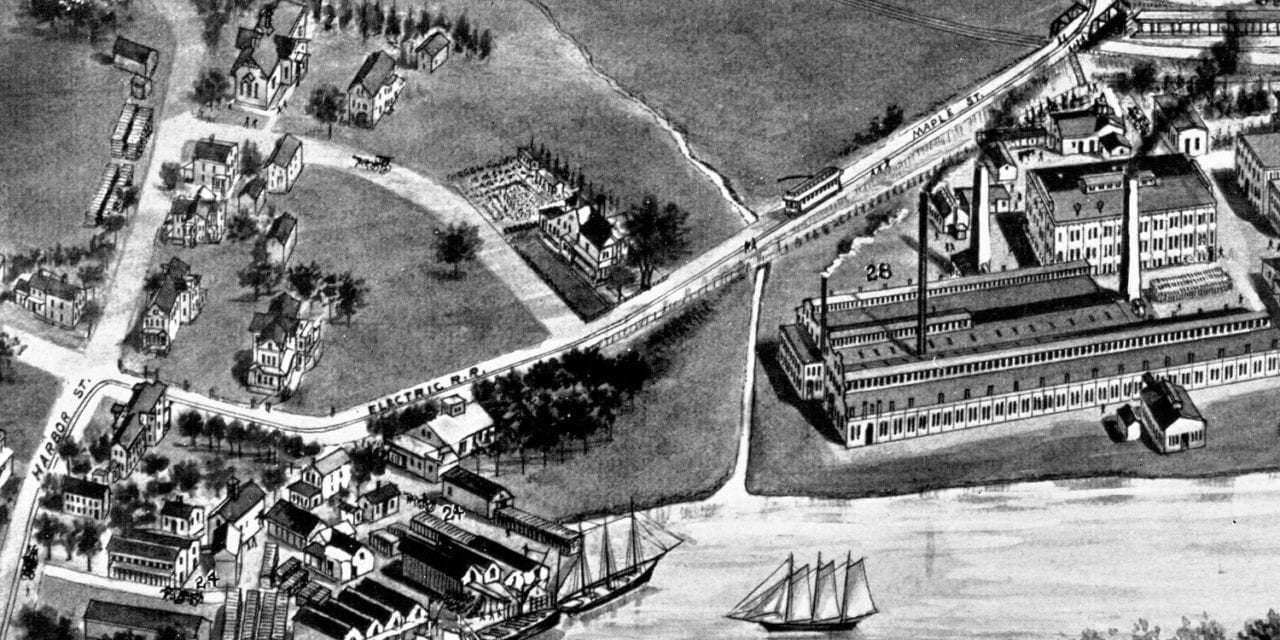
This beautiful hand drawn map of Branford, Connecticut was created in 1905 by Hughes & Bailey. The map shows a detailed bird’s eye view of Branford as it was, including street names and old landmarks.
The map includes historic images of Branford landmarks such as Branford High School, Blackstone Memorial Library, McCarthy’s Hillside Ave Cafe (serving ales and lagers), and multiple churches, residences and manufacturing companies.
This historic map of Branford has been restored by KNOWOL. Reproductions of the restored map are available here.
Historic Bird’s Eye View of Branford, CT in 1905
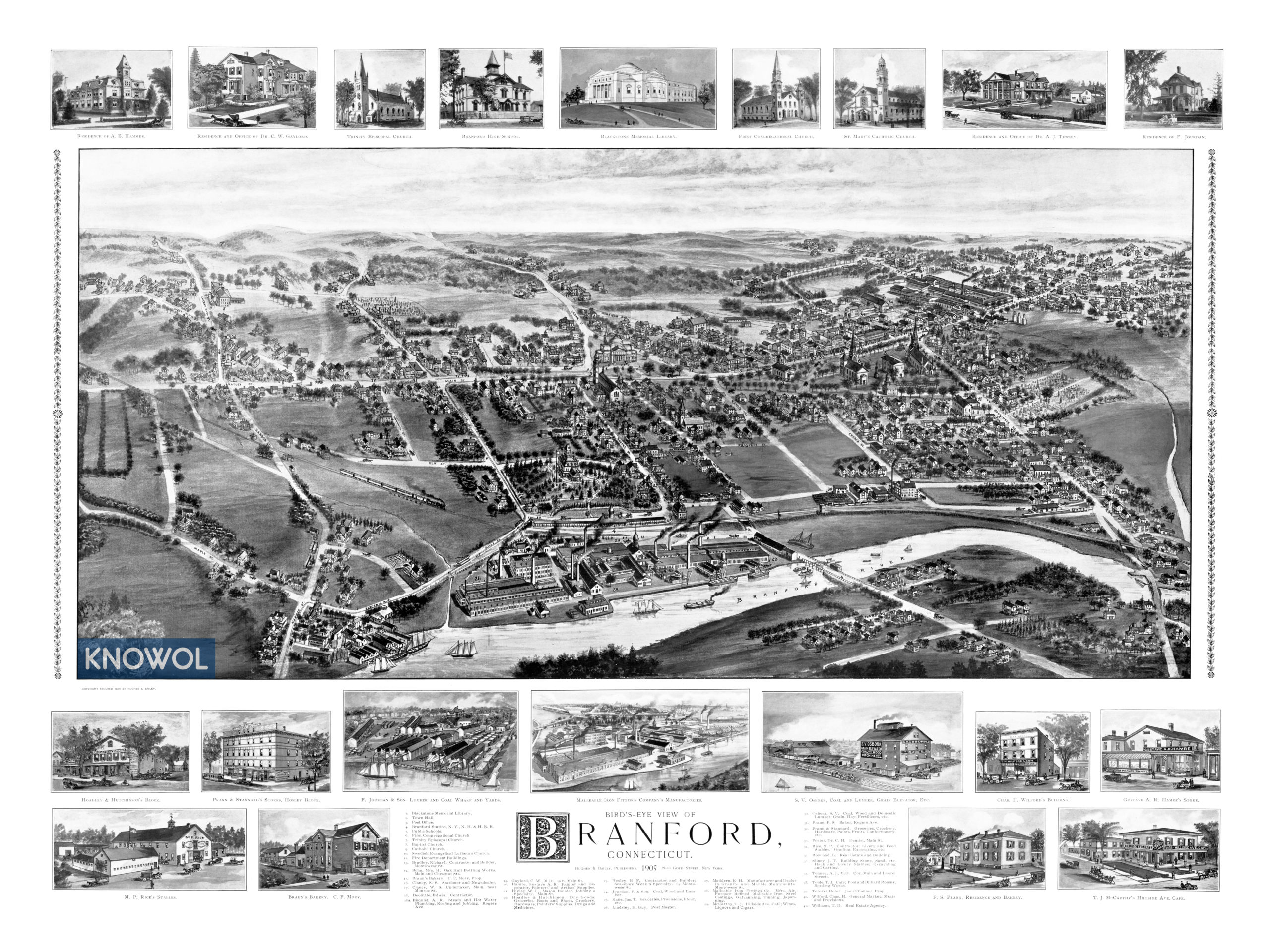
This historic map of Branford will make an attractive addition to your office, library, or den and can even be used to teach children the geography and history of the area. When you’re done exploring, click here to get your copy of the restored map.