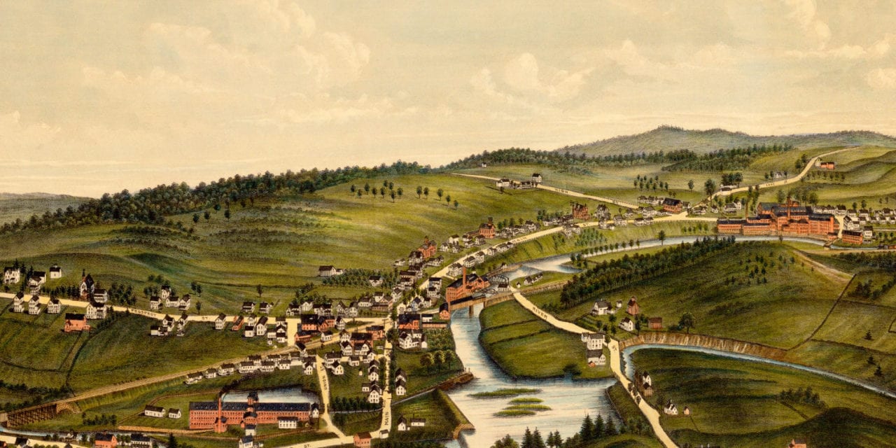
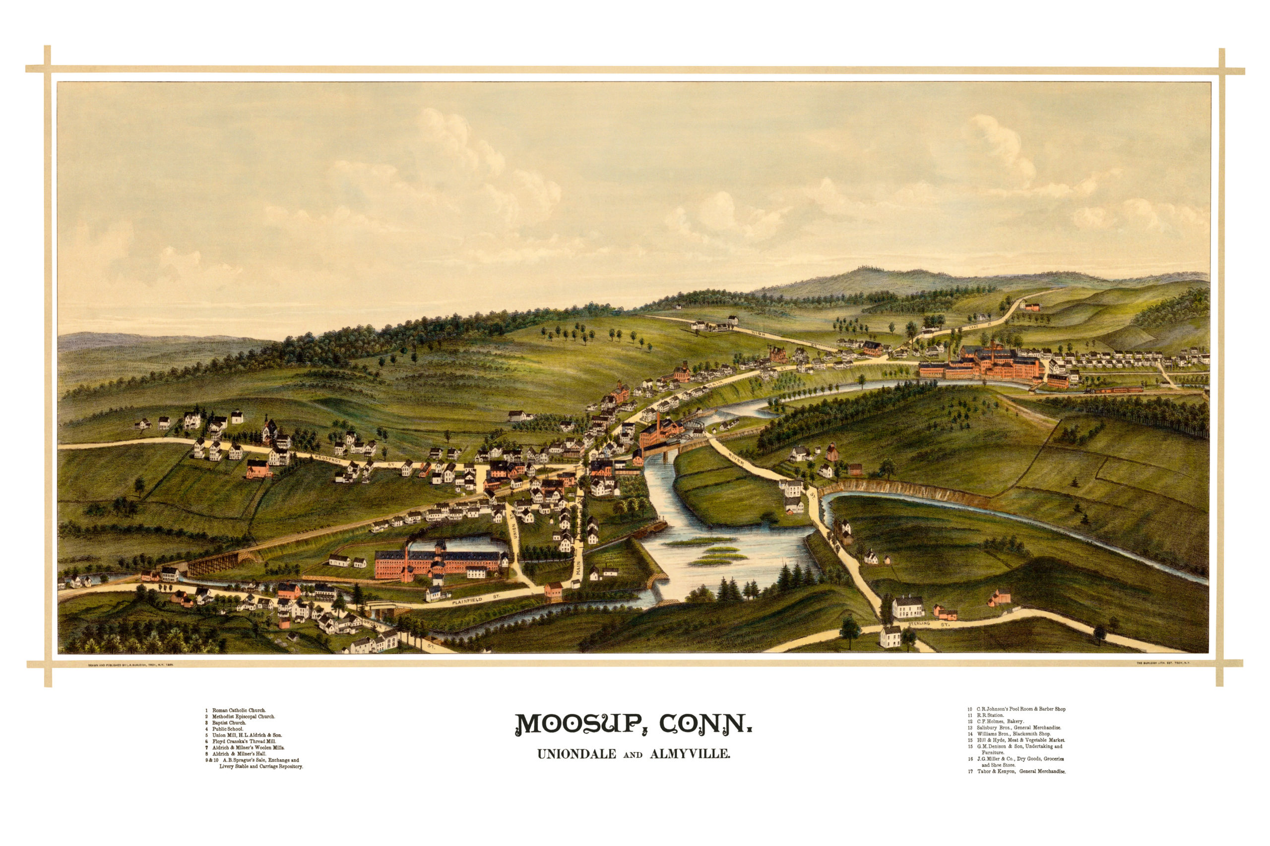
This old map of Moosup, Connecticut was created in 1889 by Lucien R. Burleigh, a prominent 19th century artist and cartographer who spent much of his life traveling the U.S. creating detailed bird’s eye view maps of American towns.
The map shows a bird’s eye view of Moosup as it looked at the end of the 19th century. Old Moosup landmarks on the map include Floyd Cranska’s Thread Mill, Moosup Catholic, Baptist and Episcopal Churches, Aldrich & Milner’s Hall, C.R. Johnson’s Pool Room & Barber Shop, C.F. Holmes Bakery, and more!
Click here to see Moosup, Connecticut in 1889.
Reproductions of the restored map are available here.
This old map of Moosup has been lovingly restored by the team at KNOWOL. Reproductions of the restored map are available on museum quality, archival paper to ensure that this piece of Connecticut history can be passed on to the next generation. Click here to get a copy of the map.