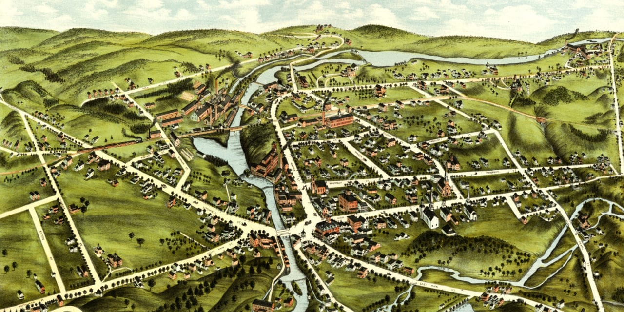
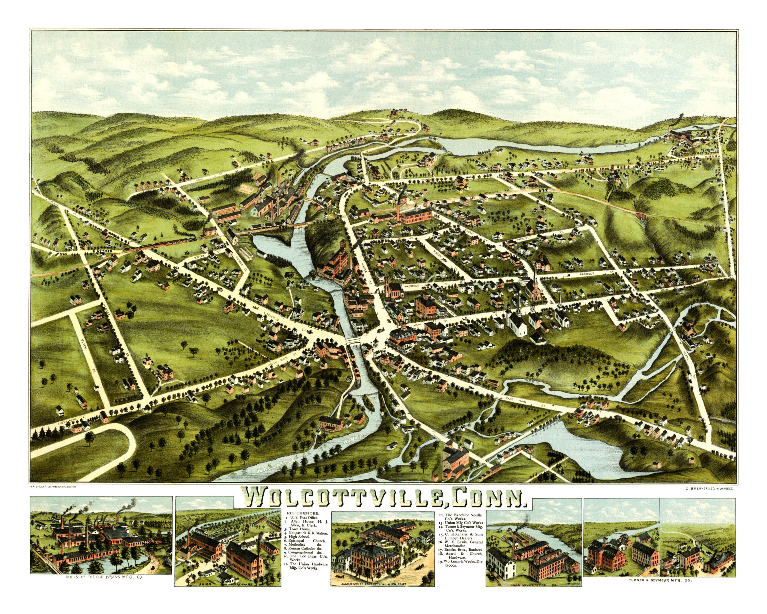
This old map of Wolcotville, Connecticut was first published in 1877 by O.H. Bailey. The area once known as Wolcotville is now the central business district of Torrington, Connecticut.
Oakley Hoopes Bailey was one of the most prominent map publishers of the 19th century, and spent a majority of his life publishing hand drawn maps of American towns. This map of Wolcotville was hand drawn and colored by Bailey.
The map shows a bird’s eye view of Torrington, Connecticut as it looked at the end of the 19th century. Landmarks on the map include Naugatuck Railroad Station, The Coe Brass Company, Union Hardware Manufacturing, The Excelsior Needle Company, Brooks Brothers Bankers and more.
Click here to see Wolcotville/Torrington, CT in 1877.
This map of Wolcotville & Torrington has been lovingly restored by the team at KNOWOL. Reproductions of the restored map are available on museum quality, archival paper to ensure that this piece of Connecticut history can be passed on to the next generation. Click here to get a copy of the map.