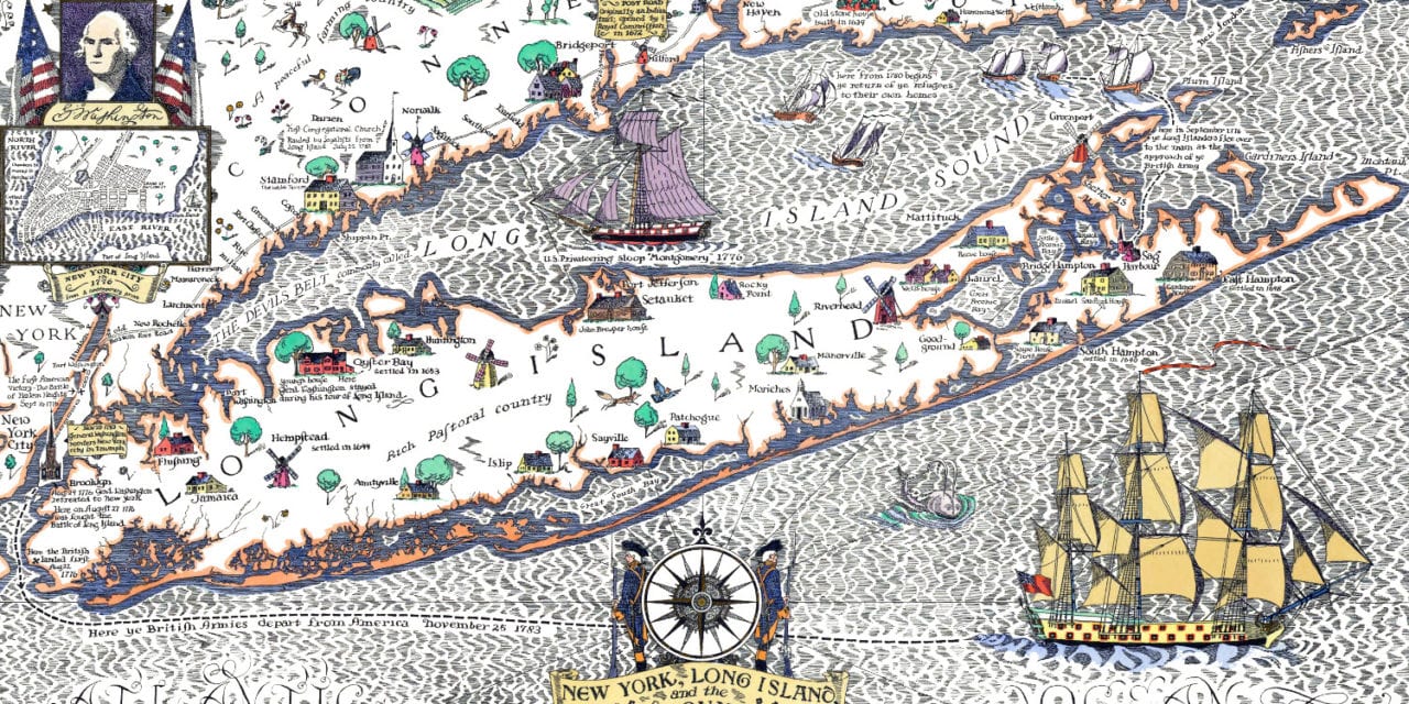
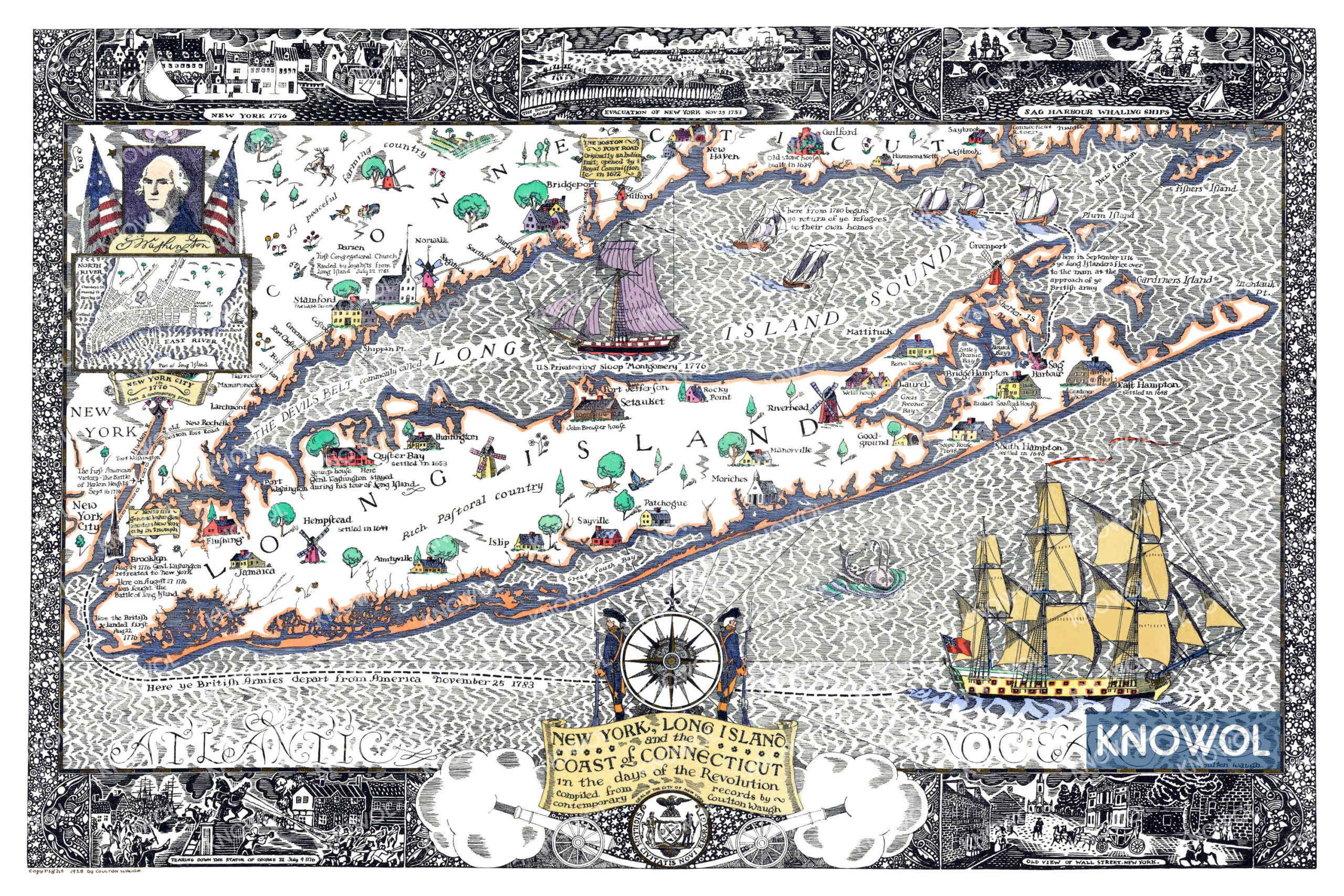
This map is titled “New York, Long Island, and the Coast of Connecticut in the days of the Revolution”, and features stunning hand drawn scenes. The map was created by Colton Waugh in 1928. The map shows a view of Long Island, New York, and the Coast of Connecticut in the days of the Revolutionary War.
Long Island towns on the map include Port Washington, Hempstead, Amityville, Oyster Bay, Islip, Huntington, Port Jefferson, Setauket, Sayville, Patchogue, Moriches, Manorville, Rocky Point, Riverhead, Sag Harbor, East & South Hampton, Greenport, and more. Colorful scenes strewn throughout the map show the location of historic events such as the flight of Long Islanders to Connecticut in 1776, the evacuation of New York in 1783, Sag Harbor Whaling Ships, and New York in 1776.
This historic map of Long Island has been restored by KNOWOL. Reproductions of the restored map are available here.
Historic Old Map of Long Island During the Revolution
This vintage map of Long Island makes an attractive addition to your office, library, or den, and can even be used to teach children the geography and history of the area. When you’re done exploring, click here to get your copy of the restored map.