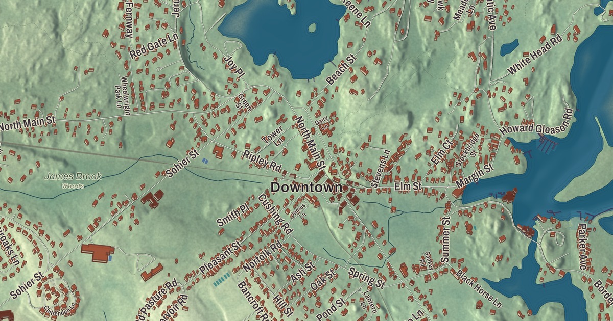
Cohasset sits on the rocky corner of the South Shore, where Boston Harbor ends and Massachusetts Bay begins, with Minot’s Ledge Light standing a mile offshore. This map prints North Main Street, King Street, East Street, Hull Street, Canterbury Street and the Chief Justice Cushing Highway, with Straits Pond, Lily Pond, the Aaron River Reservoir and Atlantic Hill. Click here to purchase a print of this map for your wall.
Cohasset is in Norfolk County, though it doesn’t touch the rest of it: the town is an exclave of the county.
KNOWOL made this map in 2026 from public survey data and gave it the look of an old atlas. The relief comes from United States Geological Survey elevation data, and the streets and the town line come from the Census Bureau. Cohasset covers 31.4 square miles, but only 9.8 of them are land; the rest is water. Hingham lies to the west, Hull to the northwest and Scituate to the east and south, with Massachusetts Bay along the north. The town had 8,381 people at the 2020 census.
Conahasset
The name comes from the Massachusett word “Conahasset,” which may mean “long rocky place” or “fishing promontory,” and in 1634 “Conihosset” was listed as a noted place to live in New England. The Town of Cohasset’s recorded history, in the Secretary of the Commonwealth’s list, dates European settlement to 1647; the town’s own page puts the first English settlement in 1670. That January a special town meeting divided the shares among the “Conahasset Partners,” many of them large Hingham landowners, and the land was granted without consulting the people who lived on it. The lots were laid out in long, narrow strips, so that more of them fronted a road.
Until it became a town, Cohasset was the eastern part of Hingham. In 1713 people here won permission to build a second meetinghouse, and the town’s page says Cohasset became a town of its own in 1770, a hundred years after English settlement began. The state list gives a later year: Cohasset was incorporated as a town in 1775. It belonged first to Suffolk County and then, from 1793, to the new Norfolk County, along with Hingham and Hull. When those two towns moved to Plymouth County in 1803, Cohasset was left on its own, and the town remains part of Norfolk County today.
The Common and the old burying ground
Cohasset Common was set aside as common land in the first division of lands in 1670. Main Street, along one side, was formally laid out as a road in 1685, when it was little more than a cattle track. Houses, churches and the town hall now line the Common, most of them built between the mid-1700s and the mid-1800s, and since 1996 the 24-acre district has been on the National Register. On North Main Street and Joy Place, Cohasset Central Cemetery holds the graves of Ibrook Tower, the town’s first settler, and his wife Margaret, whose burial in 1705 was its first. Levi B. Gaylord, the town’s only Medal of Honor recipient, and Civil War general Zealous Bates Tower are buried there too, and a Celtic Cross from 1914 marks the graves of Irish immigrants lost in an 1849 shipwreck off the coast.
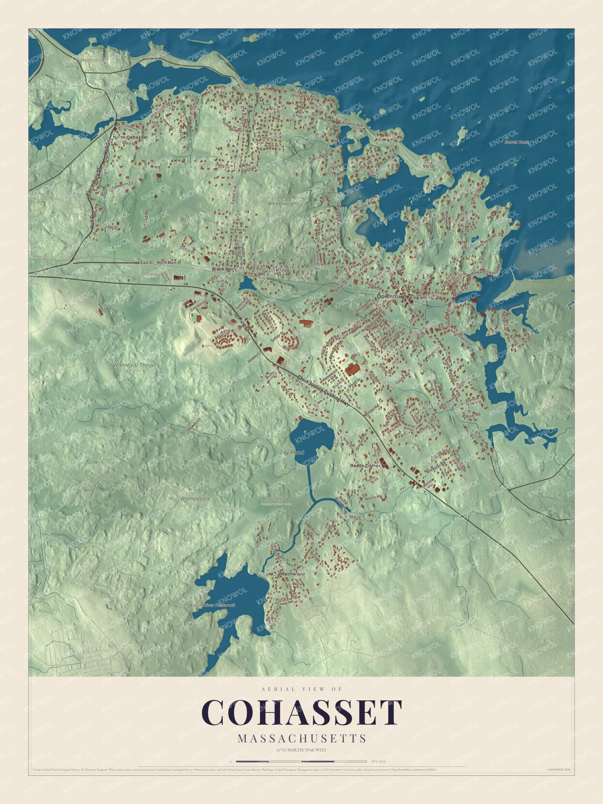
Click to explore a larger preview. The digital watermark does not appear on printed maps.
Names on this map
These names are printed on this map.
Places: Downtown, Atlantic Hill, Barrel Rock, Aaron River Reservoir, Straits Pond, Lily Pond, Brass Kettle Conservation Area, James Brook Woods, Wheelwright Park, Whitney & Thayer Woods, Wompatuck State Park, Woodside Cemetery, Beechwood, Black Rock, North Cohasset and Reeds Corner.
Streets and roads: Hull Street, Canterbury Street, King Street, Chief Justice Cushing Highway, North Main Street, East Street, Ripley Road, Cedar Street, Doane Street, South Main Street, Forest Avenue, Reservoir Road.
More street names, A to Z
Aaron River Road, Arrowwood Street, Ash Street, Atlantic Avenue, Avalon Drive, Bancroft Road, Bates Lane, Bayberry Lane, Beach Street, Beechwood Street, Black Horse Lane, Black Rock Road, Border Street, Bound Brook Lane, Bow Street, Brewster Road, Castle Road, Cedar Acres Lane, Cedar Lane, Cemetery Road, Chittenden Lane, Church Street, Cohasset Station Drive, Crocker Lane, Cushing Road, Dairy Lane, Deep Run, Elm Court, Elm Street, Fairoaks Lane, Fernway, Flintlock Ridge Road, Gammons Road, Golf Club Road, Grace Drive, Green Street, Hammond Avenue, Haystack Lane, Heather Drive, Heritage Lane, Hickory Circle, Hillside Drive, Hill Street, Hobart Lane, Holly Lane, Howard Gleason Road, Howe Road, Howes Lane, Hyde Lane, Ingram Lane, James Lane, Jerusalem Road, Joy Place, Keene Lane, Kendall Village, Lamberts Lane, Lantern Lane, Laugelle Lane, Ledge Way, Ledgewood Drive, Ledgewood Farm Drive, Lily Pond Lane, Linden Drive, Little Harbor Road, Locust Road, Lothrop Lane, Margin Street, Marion Way, Meadow Lane, Mendel Road, Mill Lane, Mohawk Way, Nichols Road, Norfolk Road, Norman Todd Road, Oak Street, Old Coach Road, Old Pasture Road, Orchard Drive, Otis Avenue, Ox Pasture Lane, Parker Avenue, Pleasant Street, Pond Street, Powers Lane, Red Fox Lane, Red Gate Lane, Ridge Road, River Road, Riverview Drive, Rocky Lane, Rustic Drive, Rust Way, Sanctuary Pond Road, Sandy Beach Lane, Sankey Road, Schofield Road, Sesito Lane, Sheldon Road, Smith Place, Sohier Street, Spring Street, Stanton Road, Stevens Lane, Stockbridge Street, Summer Street, Summit Avenue, Surry Drive, Tad Lane, Tower Lane, Virginia Lane, Walnut Hill Lane, Wheelwright Park Lane, White Head Road, White Way, Whitney Woods Lane, Windy Hill Road, Woodland Drive.
See it on a wall
The Cohasset map as a framed print. Swipe for more.


I love you, from the ledge
Minots Ledge, a mile offshore of Cohasset and Scituate, was the scene of many wrecks, with 40 on it and nearby reefs between 1832 and 1841. A first iron-pile lighthouse there lasted only from January 1850 until a storm in April 1851. The granite tower that replaced it was designed under Joseph G. Totten, chief engineer of the Army Corps of Engineers, built from blocks cut in Quincy and pinned to the rock, and first lit on November 15, 1860; at $300,000 it was the most expensive lighthouse built in the United States up to then. Since 1894 its light has flashed in a 1-4-3 pattern, which locals call “I love you,” for the number of letters in each word. An image of the light has been on the label of Cohasset Punch, a rum drink first mixed in the 1890s at the Cohasset home of the actor William H. Crane, since 1899.
Around the map
Start with Beechwood, then follow Hull Street, Canterbury Street, King Street, the Chief Justice Cushing Highway, North Main Street and East Street across town, and look outward toward Black Rock, North Cohasset and Reeds Corner. Straits Pond divides Cohasset from Hull, and Cohasset Cove and The Gulf form a long stretch of the line with Scituate. Little Harbor, a large inlet near the middle of the coast, is cut off from the ocean by Beach Island. In the southwest, part of Wompatuck State Park reaches into town on the grounds of a former naval ammunition depot annex, and the 136-acre Aaron River Reservoir, mostly in Cohasset, lies in the park’s eastern side, with the village of Beechwood to its east. The Whitney & Thayer Woods Reservation shares that corner. Aaron River Reservoir, Straits Pond, Lily Pond and Atlantic Hill are all printed on the map.
A map of Cohasset makes a fine addition to an office, library or den, and it can help teach children the geography and history of the harbor town they come from. It’s made for people who call Cohasset home, from Beechwood to North Cohasset, and it shows the town as it looks today. Zoom in on the preview above to explore the details, then click here to get your copy of the Cohasset, Massachusetts map.

Sources
- Cohasset, Massachusetts, Wikipedia
- Cohasset Common Historic District, Wikipedia
- Cohasset Central Cemetery, Wikipedia
- Minot’s Ledge Light, Wikipedia
- Wompatuck State Park, Wikipedia
- Aaron River Reservoir, Wikipedia
- City and Town Incorporation and Settlement Dates, Secretary of the Commonwealth of Massachusetts (archived copy)