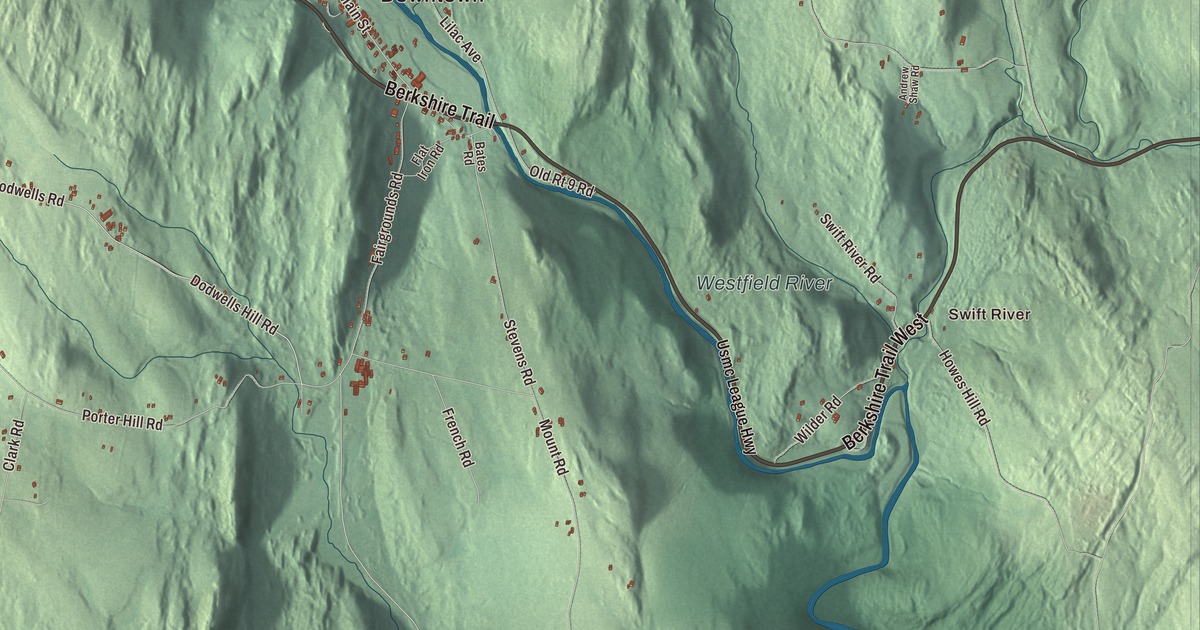
Cummington is a small hill town on the Westfield River, with Route 9 following the river through town for most of its way. This map prints the Berkshire Trail, West Cummington Road, Bryant Road, Bush Hill Road, Terrell Road and Dodwells Road, with the Westfield River, Bryant Mountain State Forest, Bashan Hill, Bear Mountain, Bryant Mountain and Bassett Meadow. Click here to purchase a print of this map for your wall.
Cummington is in northwestern Hampshire County, on the line with Berkshire County.
KNOWOL made this map in 2026 from public survey data and gave it the look of an old atlas. The relief comes from United States Geological Survey elevation data, and the roads and the town line come from the Census Bureau. Cummington covers 23.1 square miles, with Peru and Windsor to the west, Plainfield to the north, Ashfield to the northeast, Goshen to the east, Chesterfield to the southeast and Worthington to the south. The town had 829 people at the 2020 census.
Colonel Cumings’s land
The Town of Cummington’s recorded history, in the Secretary of the Commonwealth’s list, dates European settlement to 1762. The town is named for Colonel John Cumings, who held the land first. Cummington was incorporated as a town in 1779, and the town remains part of Hampshire County today. Its first Congregational minister was the Rev. James Briggs of Norton, a Yale graduate of about 1775, and Revolutionary War patriots Nathaniel Holbrook and Seth Wilder Sr. and Jr. are buried here.
Cummington gave its name to a mineral. Cummingtonite, a metamorphic amphibole, was discovered in the town in 1824 and named for it, and it has since turned up as far away as Sweden, South Africa, Scotland and New Zealand.
The poet’s homestead
William Cullen Bryant, one of America’s foremost poets and the longtime editor of the New-York Evening Post, was born near Cummington in 1794. His grandfather Ebenezer Snell built the family house in 1783, his father Peter Bryant bought it in 1799, and William lived there from age four until he was 22. After a short stay at Williams College he came home, studied law and practiced in Plainfield, walking the seven miles from Cummington every day, and on one of those walks, in December 1815, the sight of a single bird on the horizon moved him to write “To a Waterfowl.” Several of his poems grew out of the landscape around the town, among them “The Rivulet” and “Inscription for the Entrance to a Wood.”
The house left the family in 1835, and Bryant bought it back in 1865, raised it to build a new first floor beneath it, planted fruit trees and spent his summers there until his death. His granddaughter gave it to The Trustees of Reservations in 1929. The William Cullen Bryant Homestead, at 205 Bryant Road, is a National Historic Landmark of 155 acres above the Westfield River valley, with a stand of old-growth forest, a grove of 150-foot pines, sugar maples nearly 200 years old and two and a half miles of trails and roads. The town library, the Bryant Free Library, carries his name too.
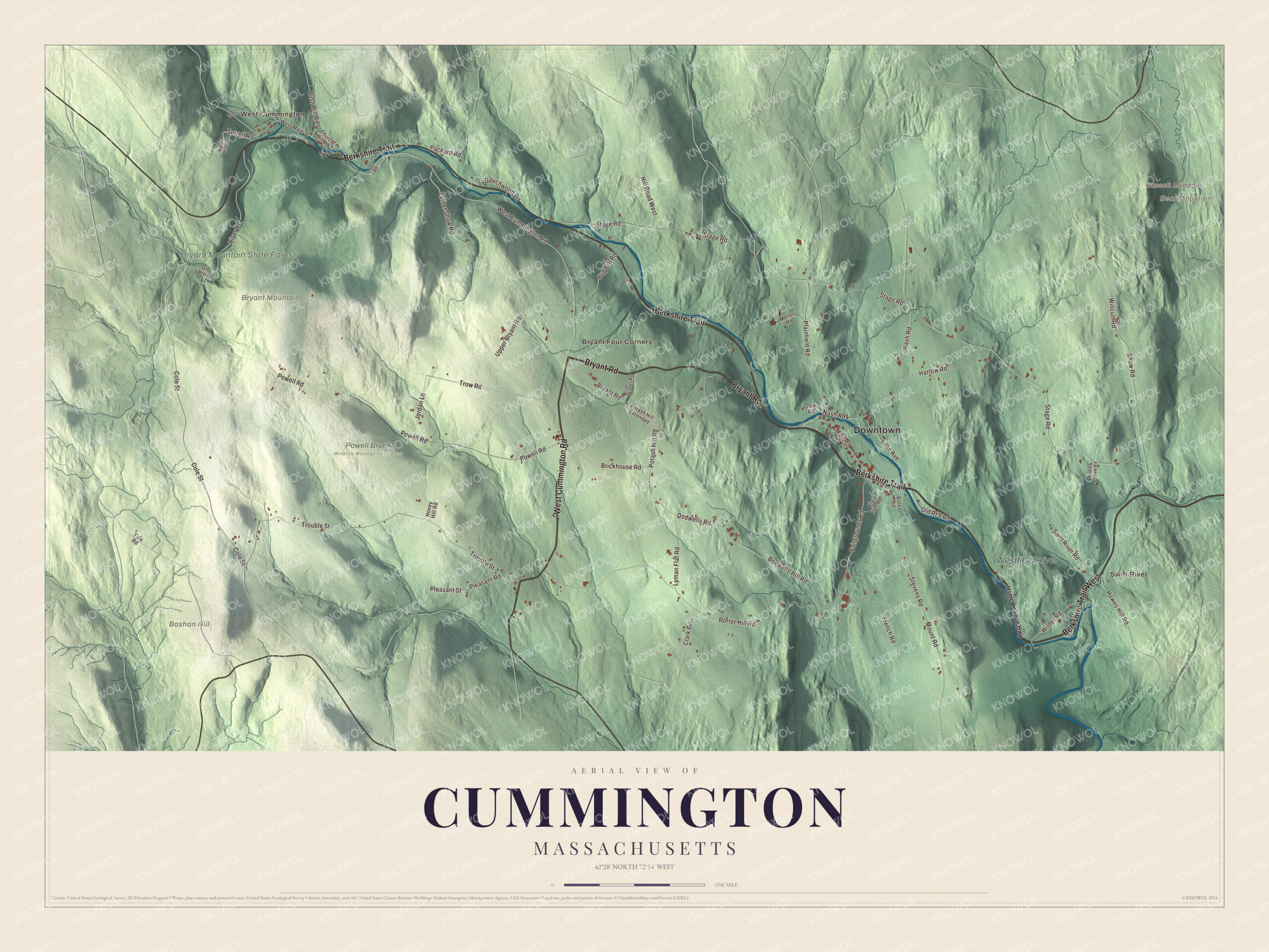
Click to explore a larger preview. The digital watermark does not appear on printed maps.
Names on this map
These names are printed on this map.
Places: Downtown, Swift River, West Cummington, Bryant Four Corners, Bashan Hill, Bassett Meadow, Bear Mountain, Bryant Mountain, Westfield River, Bryant Mountain State Forest and Powell Brook Wildlife Management Area.
Streets and roads: West Cummington Road, Bryant Road, Berkshire Trail West, Berkshire Trail, Terrell Road, Bush Hill Road, Dodwells Road, Main Street, Cole Street, Fairgrounds Road, Nash Road, Willcutt Road.
More street names, A to Z
Andrew Shaw Road, Bates Road, Beechwood Road, Brickhouse Road, Bug Hill Road, Church Hill Road, Clark Road, Dodwells Hill Road, Flat Iron Road, French Road, Grout Road, Harlow Road, Hill Road West, Honey Hill Road, Howes Hill Road, Jordan Lane, Lilac Avenue, Luther Shaw Road, Lyman Flat Road, Mellor Road, Mount Road, Old Route 9, Old Rt 9 Road, Packard Road, Plainfield Road, Pleasant Road, Pleasant Street, Porter Hill Road, Potash Hill Extended, Potash Hill Road, Powell Road, River Road, Savoy Road, Shaw Road, Snow Road, Stage Road, Stevens Road, Swift River Road, Tirrell Hill Road, Town Road, Trouble Street, Trow Road, Upper Bryant Road, Usmc League Highway, West Main Street, Wilder Road, Yale Road.
See it on a wall
The Cummington map as a framed print. Swipe for more.


A town that welcomed strangers
In 1945 Cummington was the subject of a documentary film, The Cummington Story, about the welcome the town gave a group of European refugees. Every August it hosts the Cummington Fair, with 4-H and adult exhibition halls, a craft barn, a vaudeville stage, an antique car parade, an oxen pull, rides and food. The Kingman Tavern Historical Museum and the Greenwood Music Camp are among its points of interest, and its notable people include the poets Richard Wilbur and William Jay Smith, the author Alan Weisman and the broadcaster Rachel Maddow.
Around the map
Start with the Swift River, then follow West Cummington Road, Bryant Road, the Berkshire Trail, Terrell Road, Bush Hill Road and Dodwells Road across town, and look outward toward West Cummington and Bryant Four Corners. The Westfield River, sometimes called the East Branch here, flows through Cummington, and Route 9 follows it for most of the way, running 20 miles southeast to Northampton and 22 miles west to Pittsfield, while Route 112 leads west and then south to Huntington. The Westfield River, Bryant Mountain State Forest, Bashan Hill, Bear Mountain, Bryant Mountain and Bassett Meadow are all printed on the map.
A Cummington map makes a fine addition to an office, library or den, and it can help teach children the geography and history of the town where Bryant grew up. It’s made for people who call Cummington home, from West Cummington to Bryant Four Corners, and it shows the town as it looks today. Zoom in on the preview above to explore the details, then click here to get your copy of the Cummington, Massachusetts map.

Sources