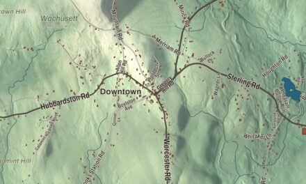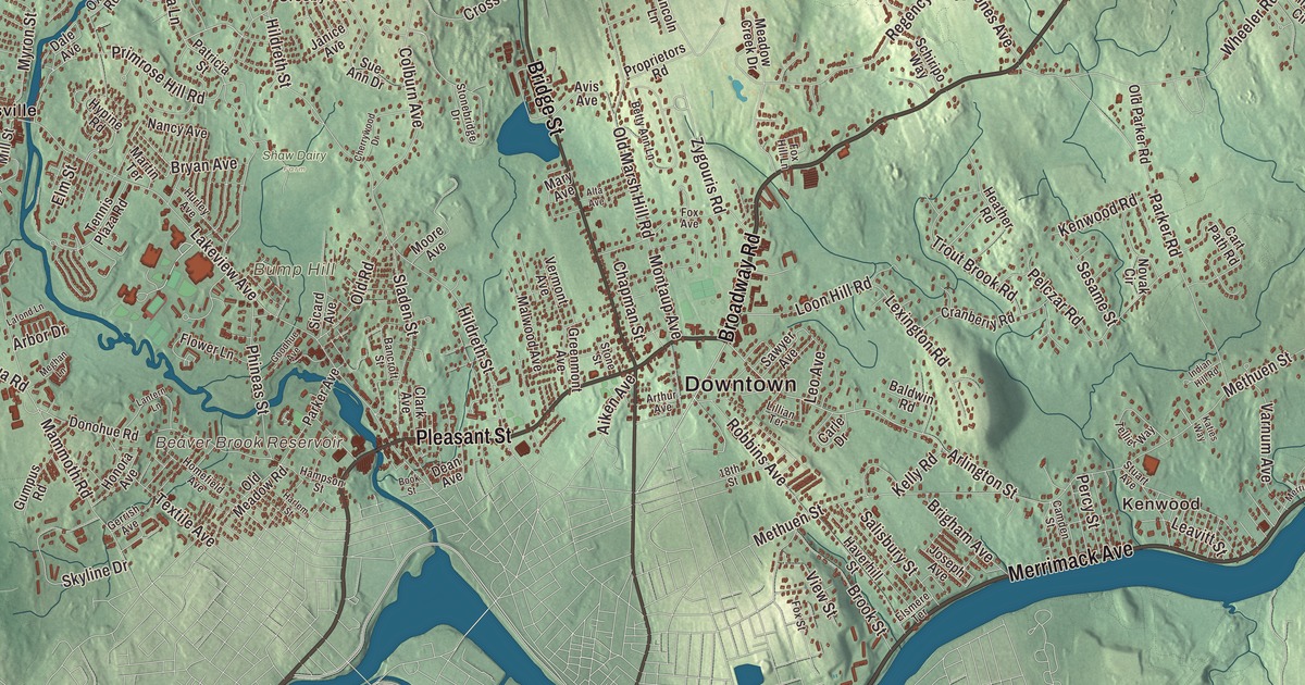
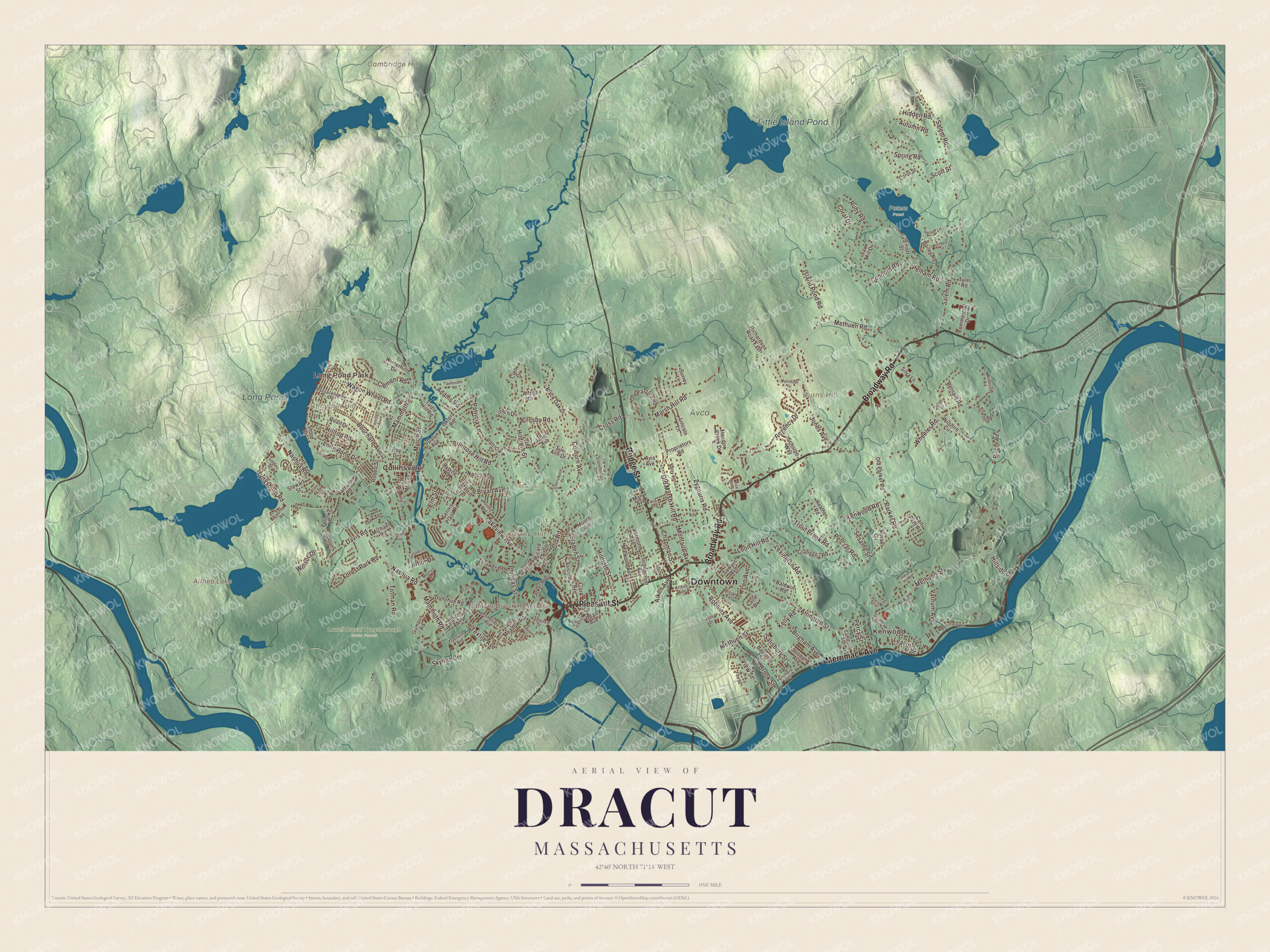
Dracut lies on the north bank of the Merrimack River, across from Lowell, with Beaver Brook running down the middle of town toward the river. This map prints Broadway Road, Merrimack Avenue, Bridge Street, Pleasant Street, Arlington Street and Zygouris Road, with Long Pond, Little Island Pond, Althea Lake, the Beaver Brook Reservoir and Long Pond Park. Click here to purchase a print of this map for your wall.
Dracut is in Middlesex County, on the New Hampshire line north of Lowell.
KNOWOL made this map in 2026 from public survey data and gave it the look of an old atlas. The relief comes from United States Geological Survey elevation data, and the roads and the town line come from the Census Bureau. Dracut covers 21.4 square miles, with Tyngsborough to the west, Lowell to the south and west, Methuen to the east and Pelham, New Hampshire, to the north. The town had 32,617 people at the 2020 census, which its page says makes it the second most populous town in Massachusetts still governed by open town meeting.
Augumtoocooke
Before Europeans came, this land was called Augumtoocooke. Pennacook settlements fished at Pawtucket Falls on the Merrimack and hunted in the marshes, and the powerful sachem Passaconaway and his family spent much of their lives here. In 1665 his daughter Bess sold the land to Captain John Evered, also known as Webb of Draucutt, whose family is closely tied to Dreycot Foliat in Wiltshire, England, and the settlers came to know the area as Dracut. The Town of Dracut’s recorded history, in the Secretary of the Commonwealth’s list, dates European settlement to 1664, the year on Samuel Varnum’s deed for “Drawcutt upon Mirrimack.” Edward Colburn and his family were probably the first settlers to own land here meaning to stay. For years the settlers paid taxes to Chelmsford across the river and went there for church, until the settlers, by then about twenty families, petitioned for a town of their own. Dracut was incorporated as a town on February 26, 1701, and the town remains part of Middlesex County today.
Mills on Beaver Brook
Beaver Brook rises in Chester, New Hampshire, and flows 30.7 miles south to the Merrimack, crossing into Dracut on the way and cutting the town in two. The early town lived by fishing, lumbering and milling, and those led to paper making and cotton textiles in the 19th century, including the Beaver Brook Mill. The mills drew Irish and French-Canadian immigrants. Twice in the 19th century Lowell annexed large pieces of Dracut, and today suburban growth presses in from the city, though some rural land and handsome old houses remain. The town’s page says Dracut was, as of 2020, the only town in the world with exactly its name and spelling. Every September since 2001 the town has held an Old Home Day.
Varnums and the Lew family
The Varnum family put down deep roots here. Joseph Bradley Varnum, born in Dracut, commanded the town’s militia company in the Revolution, served as Speaker of the U.S. House from 1807 to 1811 and later as president pro tempore of the Senate, and is buried in Varnum Cemetery in Dracut. James Mitchell Varnum, also born in Dracut, graduated in the first class of the college that became Brown University and served as a general in the Continental Army. Harry “Bucky” Lew was born in the Pawtucketville section of Dracut, which Lowell annexed in 1874, and is known as the first Black professional basketball player; he joined Lowell’s Pawtucketville Athletic Club in 1902. His great-great-grandfather Barzillai Lew played the fife at Bunker Hill, and his great-great-aunt Lucy Lew was a civil rights activist.
Click to explore a larger preview. The digital watermark does not appear on printed maps.
Names on this map
These names are printed on this map.
Places: Downtown, Kenwood, Long Pond Park, Bump Hill, Burns Hill, Cambridge Hill, Chandler Hill, Althea Lake, Beaver Brook Reservoir, Long Pond, Little Island Pond, Avco, Lowell Dracut Tyngsborough State Forest, Peters Pond, Shaw Dairy Farm and Collinsville.
Streets and roads: Broadway Road, Merrimack Avenue, Bridge Street, Pleasant Street, Arlington Street, Zygouris Road, Methuen Street, Mammoth Road, Lakeview Avenue, Hildreth Street, Nashua Road, Wheeler Road.
More street names, A to Z
18th Street, Adams Road, Aiken Avenue, Alfred Drive, Alta Avenue, Arbor Drive, Arthur Avenue, Autumn Road, Avis Avenue, Bailey Road, Baldwin Road, Bancroft Street, Bernard Road, Betty Ann Lane, Black Oak Drive, Book Street, Bouchard Avenue, Brigham Avenue, Brook Street, Bryan Avenue, Camden Street, Carle Drive, Carol Street, Cart Path Road, Chapman Street, Cherrywood Drive, Clark Avenue, Clement Road, Cleo Drive, Colburn Avenue, Commercial Drive, Concord Road, Coral Drive, County Road, Cranberry Road, Crosby Road, Cross Road, Dale Avenue, Dallas Drive, Davis Road, Dean Avenue, Donohue Road, Elliott Street, Elm Street, Elsmere Terrace, Fanning Avenue, Fellows Lane, Flower Lane, Forest Park Road, Fox Avenue, Fox Hill Lane, Fox Street, Gerrish Avenue, Gilbert Street, Glen Avenue, Goodhue Avenue, Greenlawn Avenue, Greenmont Avenue, Gumpus Road, Hampson Street, Harlem Street, Haverhill Street, Heather Road, Hidden Road, Hillside Drive, Hilltop Road, Homefield Avenue, Honora Avenue, Horseshoe Road, Hurley Avenue, Hypine Road, Indian Hill Road, Island Pond Road, Janice Avenue, Jefferson Road, Jones Avenue, Joseph Avenue, Katies Way, Kelly Road, Kenwood Road, Lafond Lane, Lantern Lane, Leavitt Street, Leo Avenue, Lexington Road, Lillian Terrace, Lincoln Lane, Linden Street, Long Drive, Long Pond Drive, Loon Hill Road, Macintosh Drive, Malwood Avenue, Marsh Hill Road, Martin Terrace, Mary Avenue, Meadow Creek Drive, Meghan Lane, Methuen Road, Michael Road, Mill Street, Montaup Avenue, Moore Avenue, Myron Street, Nancy Avenue, Novak Circle, Oak Terrace, Old Marsh Hill Road, Old Meadow Road, Old Parker Road, Old Pasture Road, Old Road, Oxford Road, Paddock Lane, Parker Avenue, Parker Road, Passaconaway Drive, Patricia Lane, Patricia Street, Pelczar Road, Pelham Road, Percy Street, Phineas Street, Pinetree Lane, Primrose Hill Road, Proprietors Road, Quail Drive, Regency Drive, Richardson Road East, Rinzee Road, Robbins Avenue, Robert Street, Roy Drive, Ruby Road, Salem Road, Salisbury Street, Saw Mill Drive, Sawyer Avenue, Schiripo Way, Scott Street, Sesame Street, Settlers Way, Shore Drive, Sicard Avenue, Silva Lane, Skyline Drive, Sladen Street, Spring Road, Stewart Street, Stonebridge Drive, Stone Street, Stuart Avenue, Sue Ann Drive, Surrey Lane, Tellier Way, Tennis Plaza Road, Textile Avenue, Totman Road, Trout Brook Road, Turtle Hill Road, Tyler Road, Tyngsboro Road, Varnum Avenue, Varnum Road, Vermont Avenue, View Street, Village Drive, Wagon Wheel Road, Wildrose Road, Wilshire Circle, Winsor Drive, Winterhill Drive.
Around the map
Start with Kenwood, then follow Broadway Road, Merrimack Avenue, Bridge Street, Pleasant Street, Arlington Street and Zygouris Road across town, and look outward toward Long Pond Park and Collinsville. Kenwood and Collinsville are two of the nine business districts the town has named, most of them for its historic neighborhoods, along with Dracut Center, East Dracut, Hovey Square, Lakeview and the Navy Yard. The Lowell-Dracut-Tyngsboro State Forest spreads over 1,109 acres in Lowell, Dracut and Tyngsborough, with six miles of trails and entrances on Trotting Park Road and Althea Avenue; Thomas Varnum sold several hundred acres of Hawk Valley Farm to the state in 1941 to start it. Althea Lake, the Beaver Brook Reservoir, Long Pond, Little Island Pond, Bump Hill, Burns Hill, Cambridge Hill and Long Pond Park are all printed on the map.
The Dracut map makes a fine addition to an office, library or den, and it can help teach children the geography and history of the town across the river from Lowell. It’s made for people who call Dracut home, from Kenwood to Collinsville, and it shows the town as it looks today. Zoom in on the preview above to explore the details, then click here to get your copy of the Dracut, Massachusetts map.

We made a map for every town and city in Massachusetts. Explore the complete Massachusetts map collection and find your town.
Sources
- Dracut, Massachusetts, Wikipedia
- Beaver Brook (Merrimack River tributary), Wikipedia
- Joseph Bradley Varnum, Wikipedia
- James Mitchell Varnum, Wikipedia
- Harry Lew, Wikipedia
- Lowell-Dracut-Tyngsboro State Forest, Wikipedia
- City and Town Incorporation and Settlement Dates, Secretary of the Commonwealth of Massachusetts (archived copy)