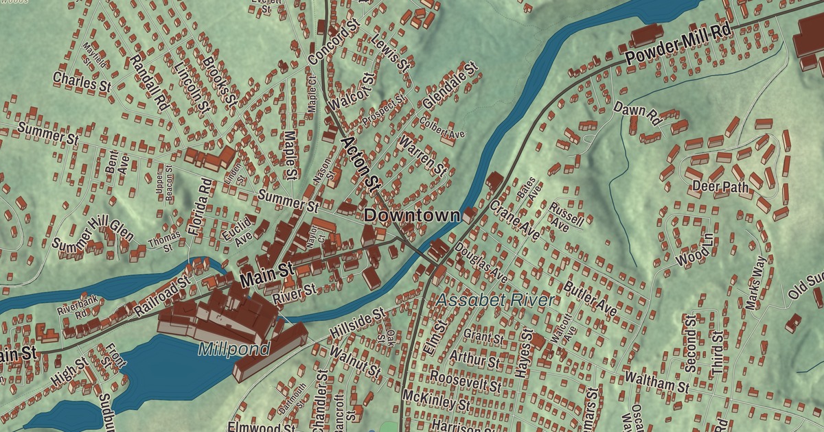
Maynard grew up around a woolen mill on the Assabet River, and the old mill, with its clock tower, still stands by Main Street. This map prints Main Street, Acton Street, Powder Mill Road, Parker Street, Brown Street and Great Road, with the Assabet River, Puffer Pond, Vose Pond, the Millpond, Summer Hill and Tuttle Hill. Click here to purchase a print of this map for your wall.
Maynard is in Middlesex County.
KNOWOL made this map in 2026 from public survey data and gave it the look of an old atlas. The relief comes from United States Geological Survey elevation data, and the streets and the town line come from the Census Bureau. Maynard is a small town, just 5.4 square miles, bordered by Acton, Stow and Sudbury, 22 miles west of Boston. The Assabet River crosses it from west to east under seven road bridges and one footbridge, and Summer Hill is the highest point in town. Maynard had 10,746 people at the 2020 census.
Assabet Village
The Native people called this area Pompositicut or Assabet, and Puritan colonists first farmed it in the 1600s. The Town of Maynard’s recorded history, in the Secretary of the Commonwealth’s list, dates European settlement to 1638. Luke Brooks of Summer Street marched with the Stow militia to Concord on April 19, 1775, and in 1851 Henry David Thoreau wrote in his journal about walking through the area; he also published a poem about Old Marlboro Road, part of which runs through Maynard. The village was called Assabet Village and was split between Stow and Sudbury. Maynard was incorporated as a town in 1871, with state approval on April 19, and the new town paid Sudbury about $23,600 and Stow about $8,000. Its 1,820 people already outnumbered either parent town. The town remains part of Middlesex County today.
The mill and the minicomputer
The town is named for Amory Maynard, who with William Knight bought water rights on the Assabet, built a dam and opened a carpet mill in 1846 and 1847. The Assabet Woolen Mill grew with the town and made wool cloth for Union uniforms in the Civil War. It went bankrupt in 1898, and the American Woolen Company bought it the next year and expanded it through 1919, building 206 houses for its workers in 1902 and 1903 on new streets named for eight presidents. Lorenzo Maynard gave the town the mill’s clock tower in 1892, and the town page calls its E. Howard clock the oldest still-working hand-wound clock in the country; it’s wound by hand once a week. In the early 1900s Maynard was more modern and urban than many of the towns around it, and Babe Ruth, who spent off-seasons in Sudbury, came to buy cigars and play pool on Main Street.
The woolen mill closed in 1950. In 1957 Digital Equipment Corporation rented 8,680 square feet of the old mill for $300 a month. It grew until it bought the whole complex in 1974, and Maynard took the nickname “Mini Computer Capital of the World.” DEC stayed until 1998. Today the renovated mill is Mill & Main Place, home to businesses including Powell Flutes, and the Maynard Community Farmers’ Market sets up in the mill lot beside Main Street on Saturdays in season.
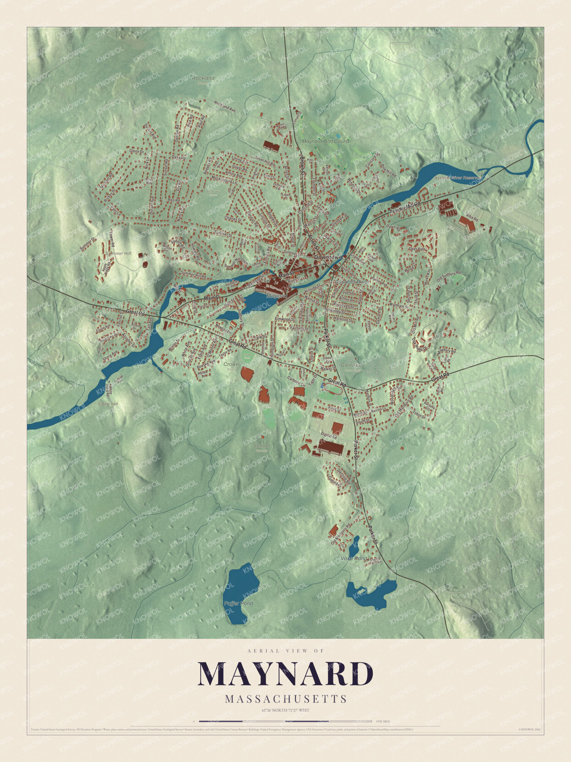
Click to explore a larger preview. The digital watermark does not appear on printed maps.
Names on this map
These names are printed on this map.
Places: Downtown, Summer Hill, Tuttle Hill, Assabet River Reservoir, Puffer Pond, Millpond, Vose Pond, Assabet River, Crowe Park, Glenwood Cemetery, Rockland Woods, School Woods, Blue Jay Woods, Crowe Field, Maynard Golf Course and Riverside Park.
Streets and roads: Acton Street, Powder Mill Road, Parker Street, Brown Street, Great Road, Main Street, Waltham Street, Summer Street, Dawn Road, Third Street, Boeske Avenue, North Street.
More street names, A to Z
Abbott Road, Alba Road, Allan Drive, Amory Avenue, Apple Ridge Road, Arthur Street, Assabet Street, Balcom Lane, Bancroft Street, Barilone Circle, Bates Avenue, Bent Avenue, Blue Jay Way, Brian Way, Brigham Street, Brooks Street, Butler Avenue, Carbone Circle, Chance Farm Lane, Chandler Street, Charles Street, Cindy Lane, Colbert Avenue, Conant Street, Concord Street, Country Lane, Crane Avenue, Cutting Drive, Dana Road, Dartmouth Street, Deer Path, Demars Street, Dettling Road, Digital Road, Dineen Circle, Dix Road, Douglas Avenue, Driscoll Avenue, Durant Avenue, Elaine Avenue, Elm Court, Elmhurst Road, Elm Street, Elmwood Street, Espie Avenue, Ethelyn Circle, Euclid Avenue, Everett Street, Fairfield Street, Field Street, Fletcher Street, Florida Road, Forest Street, Front Street, Garden Way, George Road, Glendale Street, Glenn Drive, Grant Street, Guyer Road, Harrison Street, Hayes Street, Heights Terrace, High Street, Hillside Street, Hird Street, Howard Road, Karlee Drive, King Street, Kristen Lane, Lewis Street, Lincoln Street, Linden Street, Little Road, Loring Avenue, Louise Street, Maple Court, Maple Street, Marble Farm Road, Marks Way, Marlboro Street, Maybury Road, Mayfield Street, McKinley Street, Meadow Lane, Michael Road, Mill Street, Mockingbird Lane, Nancy Circle, Nason Street, Naylor Court, Newton Drive, Nick Lane, O'Moore Avenue, Oak Ridge Drive, Oak Street, Old Marlboro Road, Old Mill Road, Old Sudbury Road, Orchard Terrace, Oscars Way, Park Street, Patti Lane, Paul Road, Pine Hill Road, Pine Street, Prospect Street, Railroad Street, Randall Road, Reeves Road, Reo Road, Rice Road, Rickey Drive, Riverbank Road, River Street, Riverview Avenue, Rockland Avenue, Roosevelt Street, Russell Avenue, Sarah Lane, Second Street, Sherman Street, Shore Avenue, Silver Hill Road, South Street, Spring Lane, Sudbury Street, Summer Hill Glen, Summer Hill Road, Sunset Road, Taft Avenue, Taylor Road, Thomas Street, Thompson Street, Tiger Drive, Tobin Drive, Tower Road, Tremont Street, Turner Road, Upper Beacon Street, Vernon Street, Walcott Avenue, Walcott Street, Walker Street, Walnut Street, Warren Street, White Avenue, White Pond Road, Wilder Street, Wilson Circle, Windmill Drive, Winter Street, Wood Lane, Woodridge Road.
Around the map
Start downtown, then follow Acton Street, Powder Mill Road, Parker Street, Brown Street, Great Road and Main Street across town. Glenwood Cemetery, one of the town’s first creations in 1871, sits at the northeast corner of Parker Street and Great Road; Amory Maynard is buried there, and the Maynard family crypt, an earth-covered mound with a granite front, can be seen from Parker Street. Puffer Pond, the Millpond, Vose Pond, the Assabet River, Summer Hill, Tuttle Hill and the Assabet River Reservoir are all printed on the map, and every one of those names is right there on the artwork. Summer Hill, which the Native people called Pompasitticut, “land of many hills,” is mostly conservation land today, with 24 acres of hiking trails. In 1942 the Army took about a fifth of the town for a munitions depot, and that land became part of the Assabet River National Wildlife Refuge, which opened to the public in 2005. The Assabet River Rail Trail now runs through downtown from the Acton line to the Stow line.
The Maynard map makes a fine addition to an office, library or den, and it can help teach children the geography and history of an Assabet River mill town. It’s made for people who call Maynard home, from Summer Hill to the Millpond, and it shows the town as it looks today. Zoom in on the preview above to explore the details, then click here to get your copy of the Maynard, Massachusetts map.

We made a map for every town and city in Massachusetts. Explore the complete Massachusetts map collection and find your town.
Sources
- Maynard, Massachusetts, Wikipedia
- Assabet Woolen Mill, Wikipedia
- Glenwood Cemetery (Maynard, Massachusetts), Wikipedia
- Summer Hill (Maynard, Massachusetts), Wikipedia
- Assabet River National Wildlife Refuge, Wikipedia
- Assabet River Rail Trail, Wikipedia
- City and Town Incorporation and Settlement Dates, Secretary of the Commonwealth of Massachusetts (archived copy)