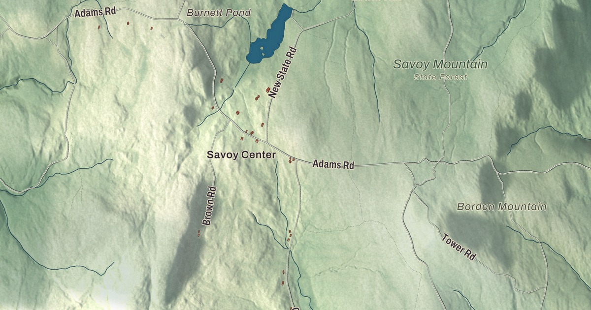
Savoy is a hill town of state forest in the Berkshires, and this map traces its roads, Main Road, Windsor Road, Adams Road, New State Road, Bush Road and a stretch of the Mohawk Trail, from Savoy Center out to Borden Mountain, Lewis Hill and Burnett Pond. Click here to purchase a print of this map for your wall.
Savoy is in Berkshire County.
KNOWOL made this map in 2026 from public survey data and gave it the old atlas treatment. United States Geological Survey elevation data shapes the mountains, and the roads and the town line come from the Census Bureau. Savoy covers 36.0 square miles on the eastern edge of the county, with Florida to the north, Charlemont, Hawley and Plainfield to the east, Windsor to the south, Cheshire to the southwest and Adams to the west. It’s about 120 miles from Boston, closer to both Hartford and Albany than to its own state capital. Routes 116 and 8A meet near the center of town. Savoy had 645 people at the 2020 census.
New Seconk
Savoy began as part of Northern Berkshire Township Number 6, a tract that also took in today’s Adams, North Adams, Cheshire and Lanesborough. The land was auctioned off several times before Colonel William Bullock of Rehoboth finally bought it. The Town of Savoy’s recorded history, in the Secretary of the Commonwealth’s list, dates European settlement to 1777, when a group led by Colonel Lemuel Hathaway arrived, and Savoy was incorporated as a town in 1797. Its first settlers called it New Seconk, and it was supposedly renamed for the land’s likeness to the Duchy of Savoy. The town grazed livestock at first, and later several lumber mills took hold. By the middle of the nineteenth century it had people of several faiths, and today it’s a quiet rural town known for its scenery.
Savoy Mountain State Forest
Much of the town lies in Savoy Mountain State Forest, and parts of the Mohawk Trail, Windsor and Kenneth Dubuque Memorial state forests reach in too. The state began the forest in 1918 by buying 100 acres of abandoned farmland. In the 1930s the Civilian Conservation Corps replanted much of it with Norway and blue spruce and built concrete dams at Bog, Burnett and Tannery ponds. Near the Cold River and Tannery Falls, which drops 100 feet, 120 acres of old growth forest have been found, with hemlock, red spruce, yellow birch and sugar maple from 150 to 400 years old. Lewis Hill rises to 2,177 feet in the forest, and Borden Mountain, the highest point in Savoy, carries a fire lookout tower on its summit.
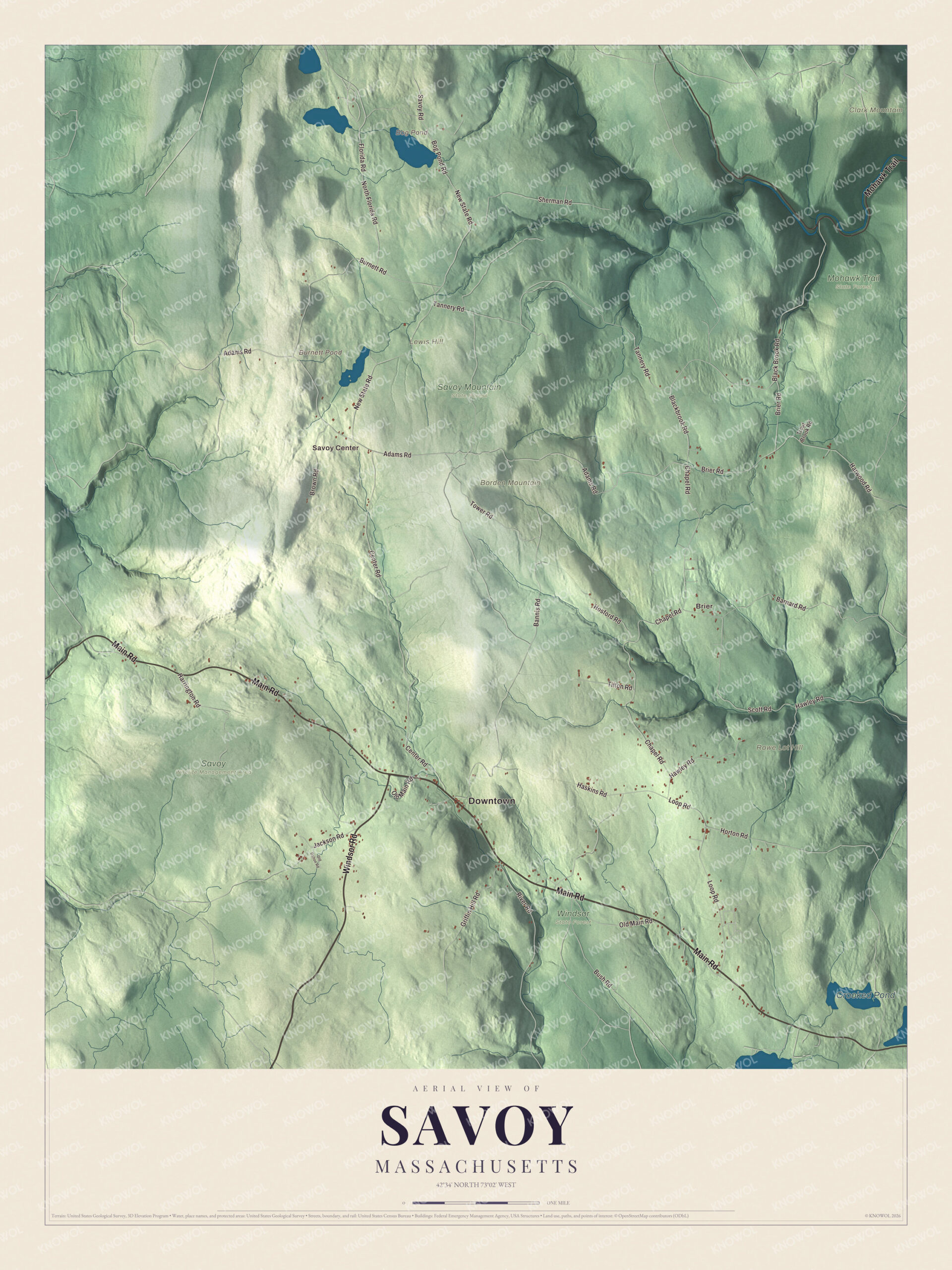
Click to explore a larger preview. The digital watermark does not appear on printed maps.
Names on this map
These names are printed on this map.
Places: Downtown, Savoy Center, Brier, Borden Mountain, Clark Mountain, Lewis Hill, Rowe Lot Hill, Bog Pond, Burnett Pond, Crooked Pond, Mohawk Trail State Forest, Savoy Wildlife Management Area, Savoy Mountain State Forest and Windsor State Forest.
Streets and roads: Main Road, Windsor Road, Mohawk Trail, Adams Road, New State Road, Bush Road, Hawley Road, Chapel Road, Black Brook Road, Loop Road, Blackbrook Road, Center Road.
More street names, A to Z
Bannis Road, Barnard Road, Bog Pond Road, Brier Road, Brown Road, Burnett Road, Florida Road, Griffin Hill Road, Harrington Road, Harwood Road, Haskins Road, Horton Road, Hosford Road, Jackson Road, North Florida Road, Old Dalton Road, Old Main Road, River Road, Savoy Road, Scott Road, Sherman Road, Tannery Road, Tilton Road, Tower Road, Trout Brook Road.
See it on a wall
The Savoy map as a framed print. Swipe for more.


Around the map
Start with Savoy Center. Follow Main Road, Windsor Road, Mohawk Trail, Adams Road, New State Road and Bush Road across town. Then look outward toward Brier. Bog Pond, Burnett Pond, Crooked Pond, Borden Mountain, Clark Mountain and Lewis Hill are all printed on the map. The Mohawk Trail began as a Native American trade route over the Hoosac Range, and today Route 2 follows it along Savoy’s northeast edge before it crosses the Cold River into Florida. A stretch of the old footpath route up the Cold River valley, through Florida, Savoy and Charlemont, was added to the National Register of Historic Places on April 3, 1973. The Cold River forms part of the town’s northern border, and the North Branch of the Westfield River rises in Savoy and flows southeast toward Windsor. Savoy keeps its own elementary school, the Emma L. Miller Memorial Elementary School.
The Savoy map makes a fine addition to an office, library or den, and it can help teach children the geography and history of a mountain town in the Berkshires. It’s made for people who call Savoy home, from Savoy Center to Brier, and it shows the town as it looks today. Zoom in on the preview above to explore the details, then click here to get your copy of the Savoy, Massachusetts map.

Sources