
Connecticut
Browse historical articles, vintage map research, and collectible print discoveries connected to Connecticut.
 Connecticut
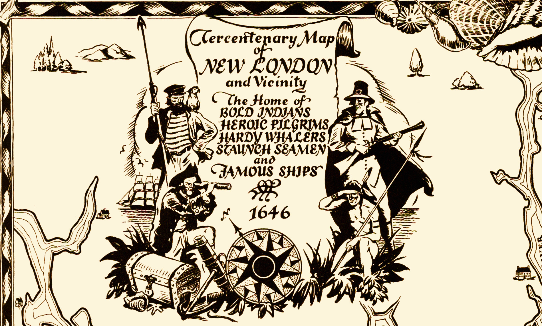
Wonderfully illustrated historical map of New London, CT from 1946
This historical map was created to celebrate New London's 300th anniversary in 1946.
 Connecticut
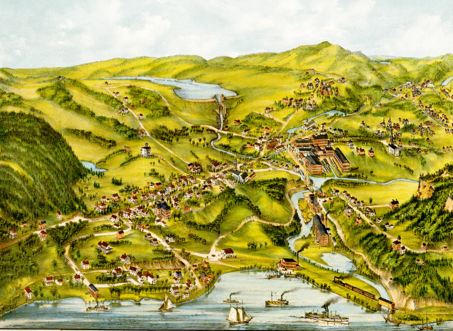
Beautifully restored map of Higganum, CT from 1881
This old map shows Higganum, Connecticut in the late 19th century.
 Connecticut
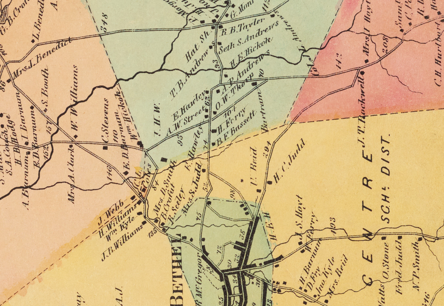
Beautifully restored map of Bethel, Connecticut from 1867
Vintage landowners map of Bethel, Connecticut as it used to be
 Connecticut
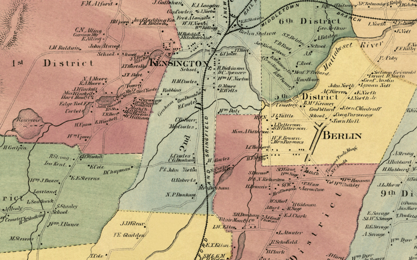
Historic landowners map of Berlin, CT from 1869
Vintage landowners map shows Berlin, Connecticut as it used to be
 Connecticut
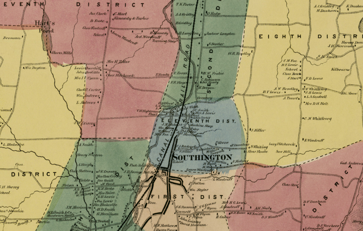
Historic landowners map of Southington, CT from 1869
Vintage landowners map of Southington, Connecticut as it used to be
 Connecticut
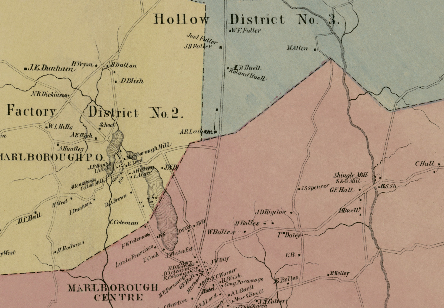
Historic landowners map of Marlborough, CT from 1869
Vintage landowners map of Marlborough, Connecticut from 1869
 Connecticut
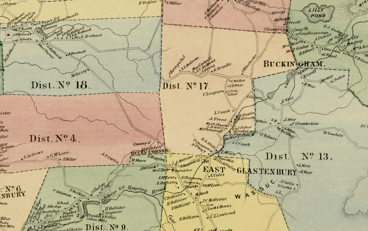
Historic landowners map of Glastonbury, CT from 1869
Vintage landowners map of Glastonbury, Connecticut as it used to be
 Connecticut
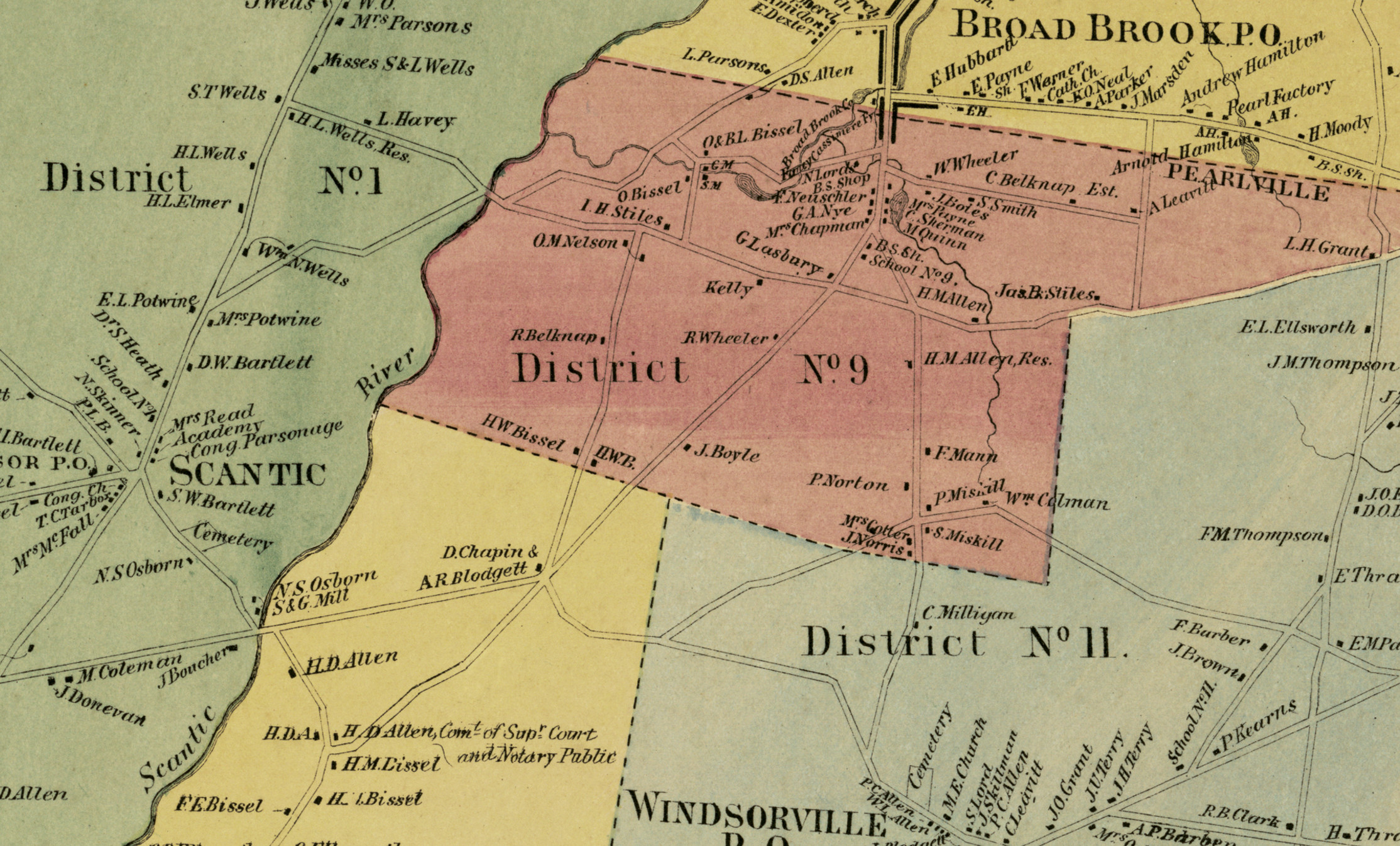
Historic landowners map of East Windsor, Connecticut from 1869
Historic landowners map of East Windsor, Connecticut from 1869
 Connecticut
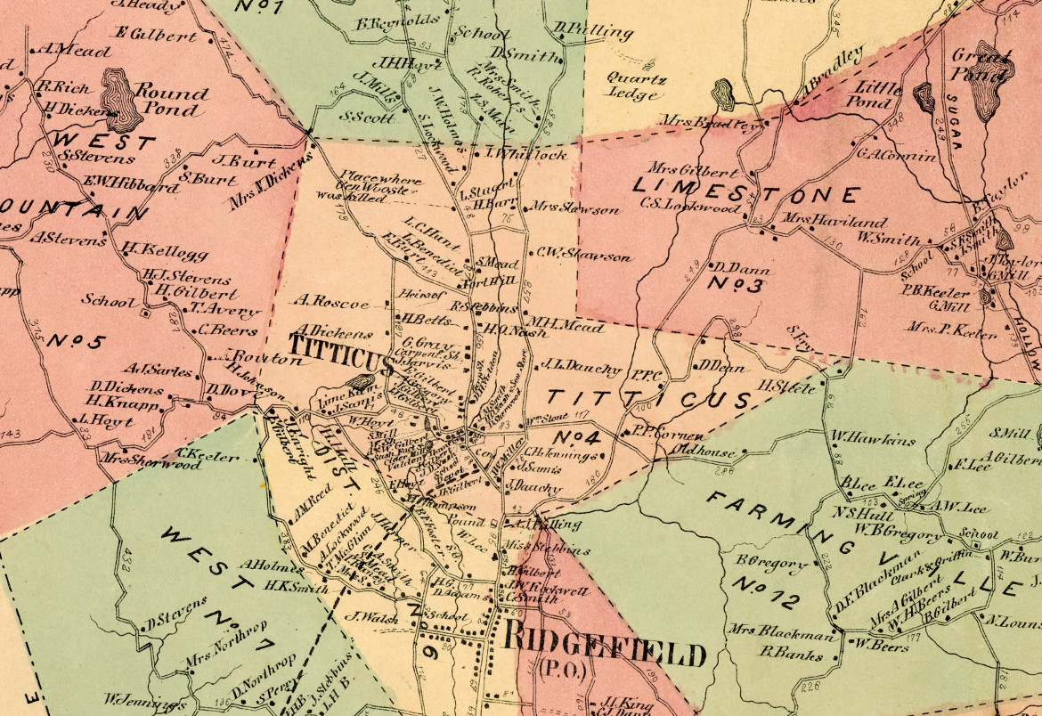
Historic landowners map of Ridgefield, CT from 1867
Vintage landowners map of Ridgefield, Connecticut as it used to be
 Connecticut
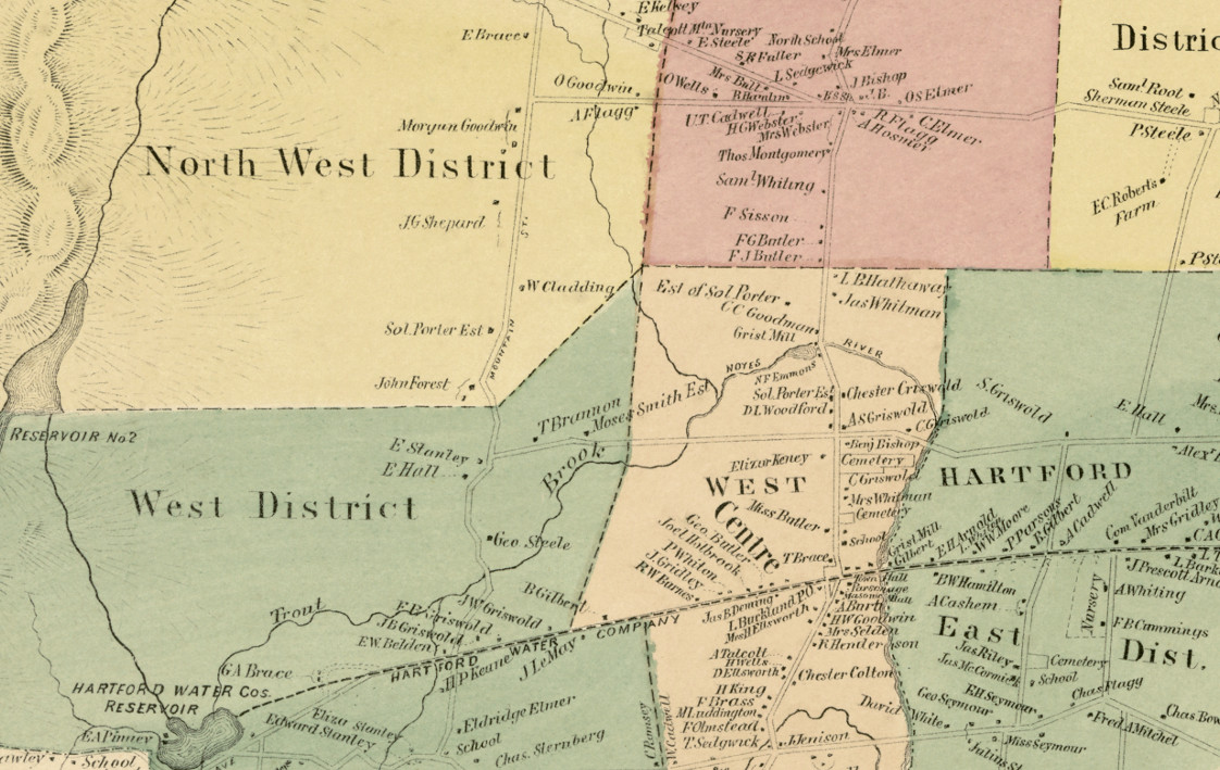
Historic landowners map of West Hartford, Connecticut from 1869
Bird's Eye View of West Hartford, Connecticut from 1869
 Connecticut
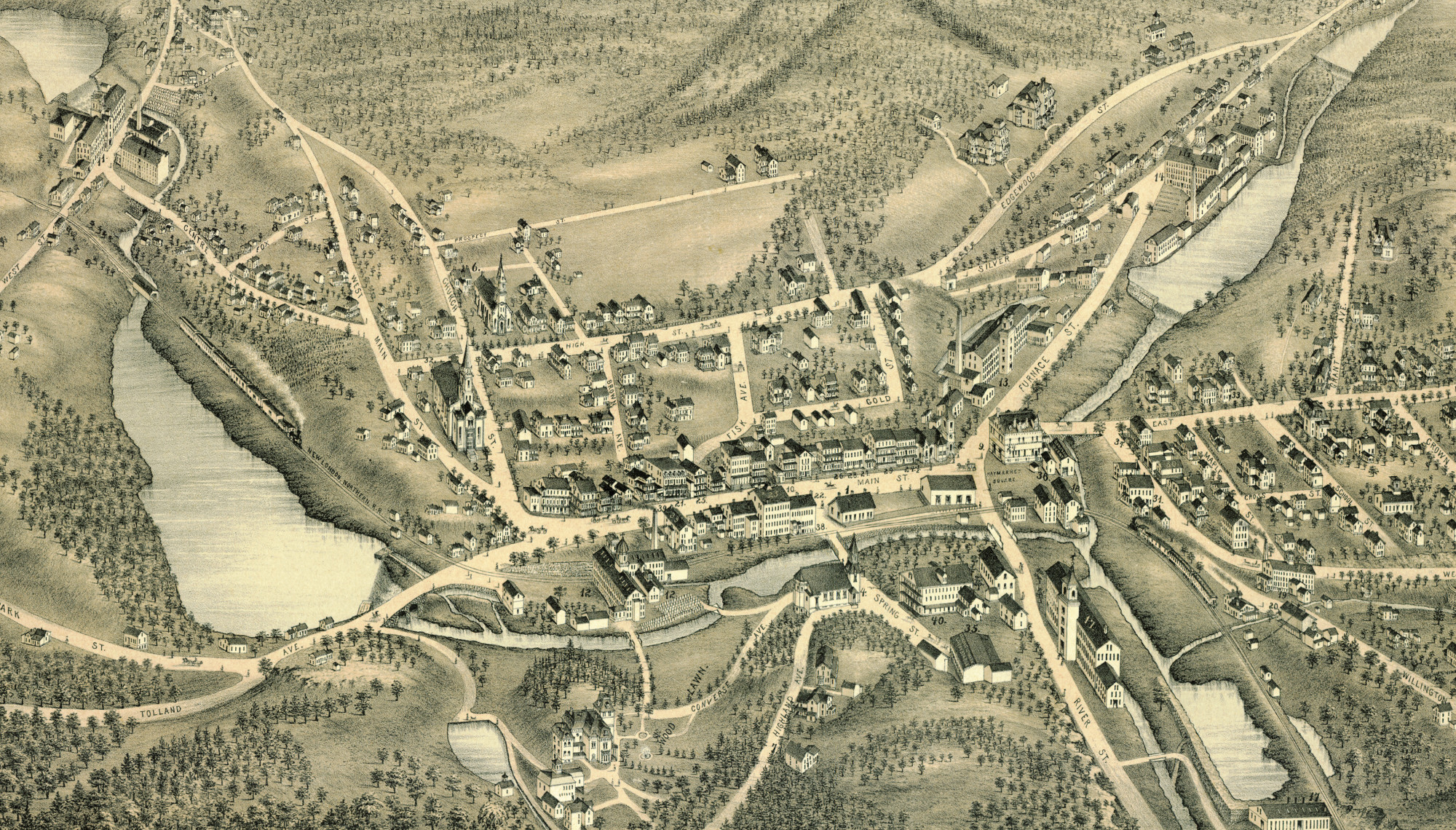
Beautifully restored map of Stafford Springs, CT from 1878
Bird's eye view of Stafford Springs, Connecticut as it used to be
 Connecticut
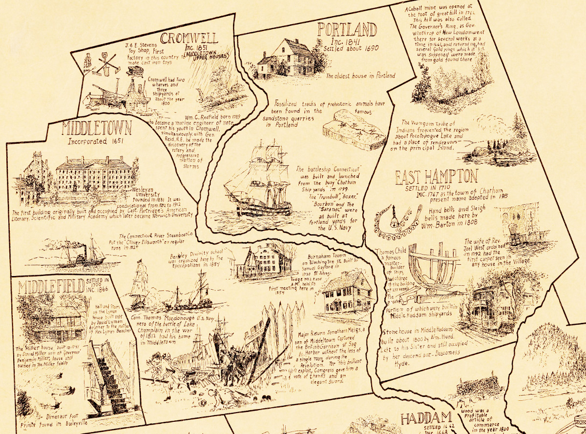
Historical map of Middlesex County, Connecticut
The cities are outlined and within each are drawings and historical facts and stories about the area.