
Connecticut
Browse historical articles, vintage map research, and collectible print discoveries connected to Connecticut.
 Connecticut
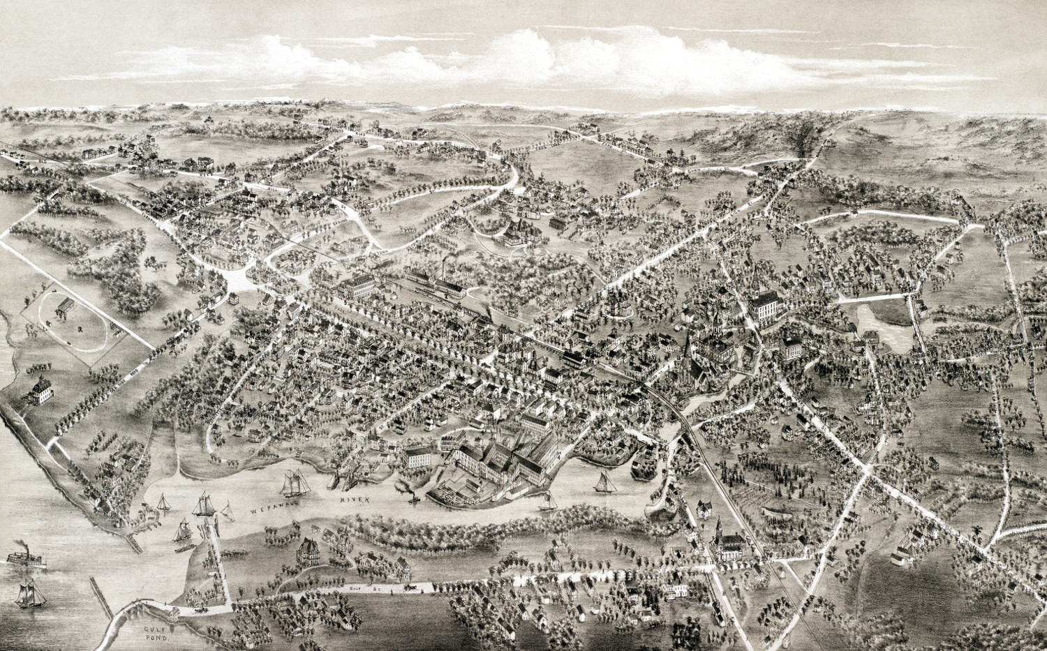
Beautiful vintage map of Milford, Connecticut from 1882
Historic bird's eye view of Milford, Connecticut in the late 19th century.
 Connecticut
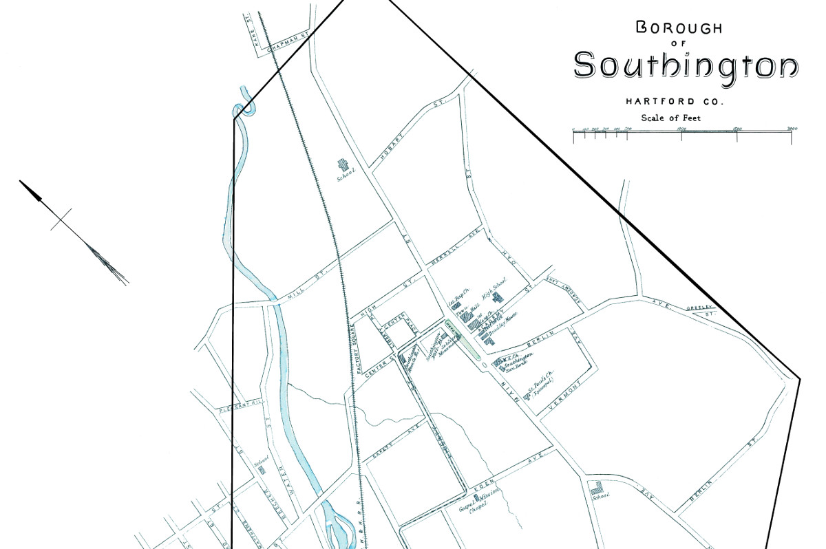
Historic map of the borough of Southington, CT from 1893
This beautiful map of Southington, Connecticut was created using government surveys in 1893.
 Connecticut
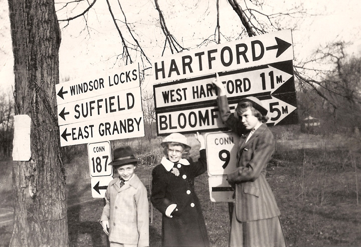
40 enchanting pictures from Connecticut’s past
This collection of pictures reveals a side of Connecticut that many have never seen.
 Connecticut
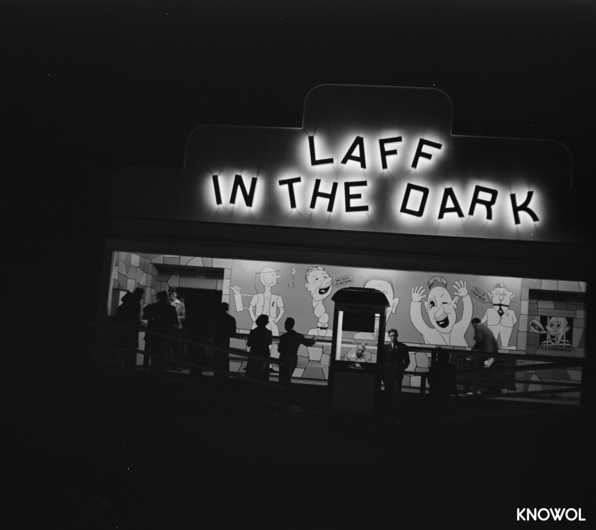
15 fascinating pictures of America’s oldest amusement park in the 1940’s
Lake Compounce in Bristol, CT is America’s oldest continuously operated theme park.
 Connecticut
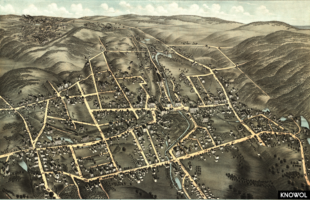
Beautiful old map of Bristol, Connecticut from 1878
This old map shows Bristol, Connecticut as it looked in 1878.
 Connecticut
Beautifully detailed map of Danbury, Connecticut from 1884
Historic bird's eye view of Danbury, Connecticut from 1884
 Connecticut
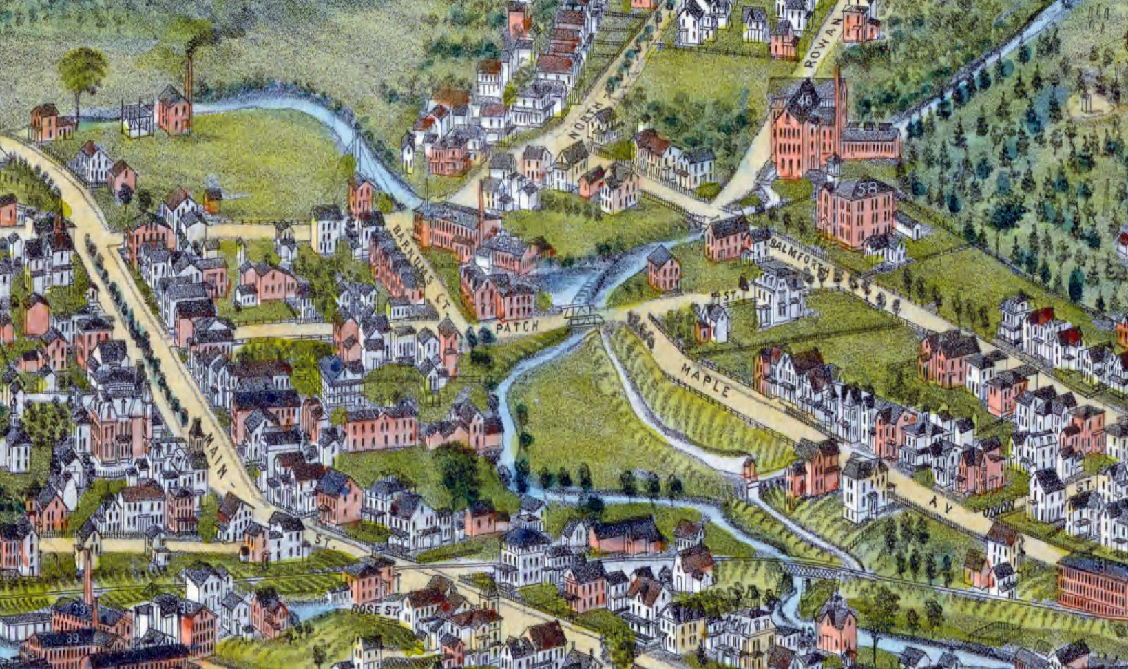
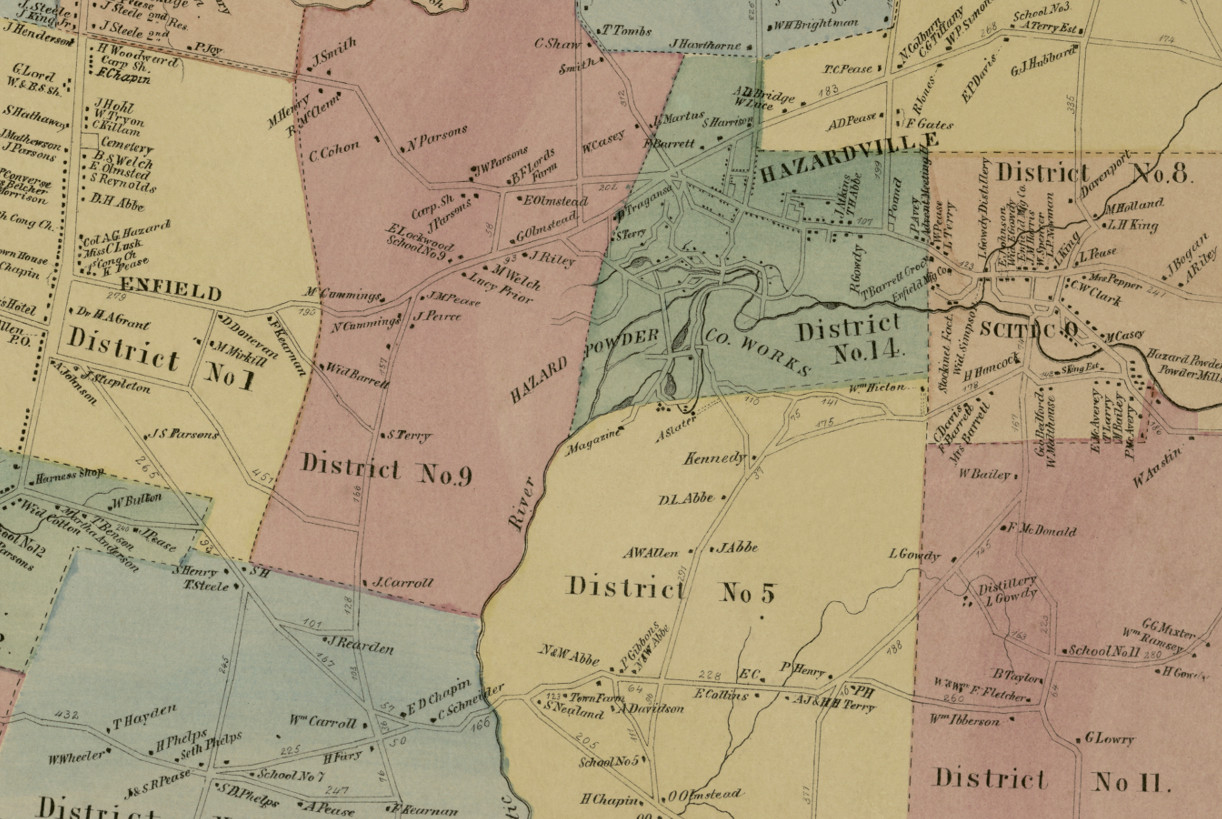
Historic landowners map of Enfield, Connecticut from 1869
Vintage landowners map shows Enfield, Connecticut as it used to be
 Connecticut
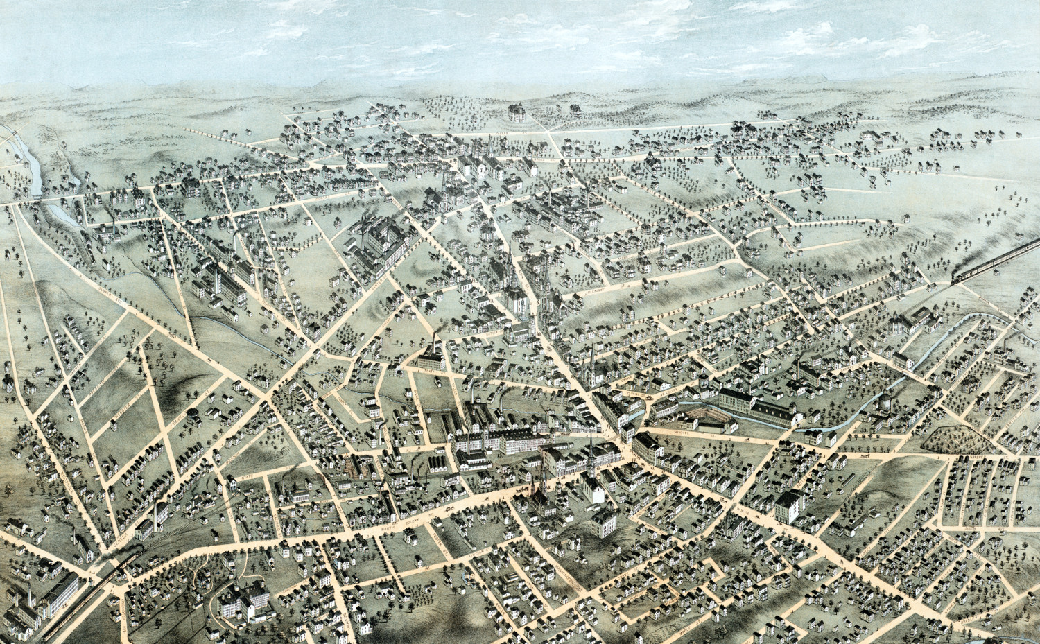
Beautifully restored map of Meriden, Connecticut from 1875
Detailed bird's eye view of Meriden, Connecticut in 1875
 Connecticut
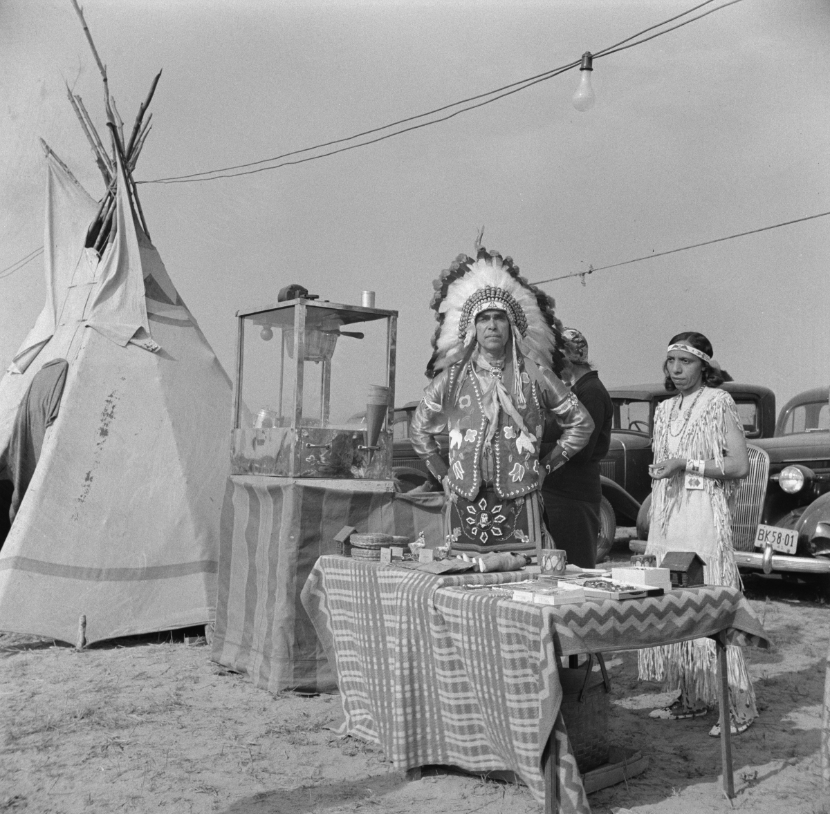
12 Vintage Pictures of Windsor Locks, Connecticut’s Indian Harvest Festival in 1941
The Windsor Locks Indian Harvest Festival took place from September - October, 1941
 Connecticut
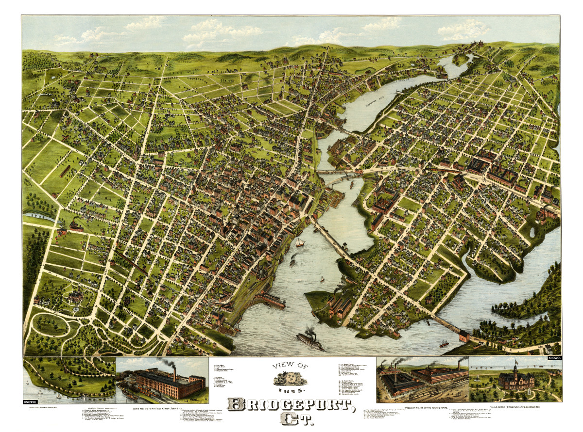
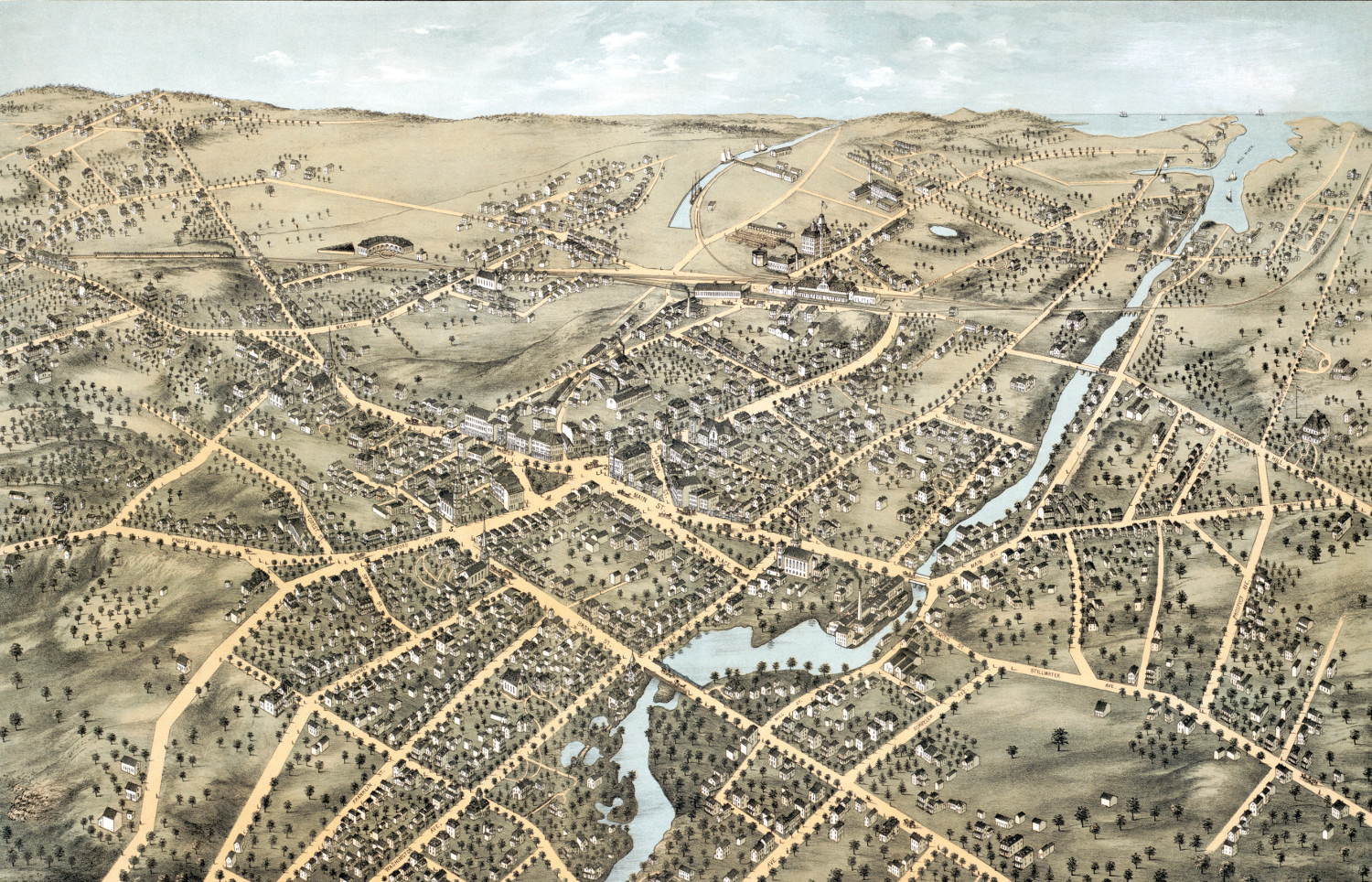
Amazing bird’s eye view of Bridgeport, Connecticut in 1875
This is how Bridgeport looked when only 20,000 people lived there!
 Connecticut
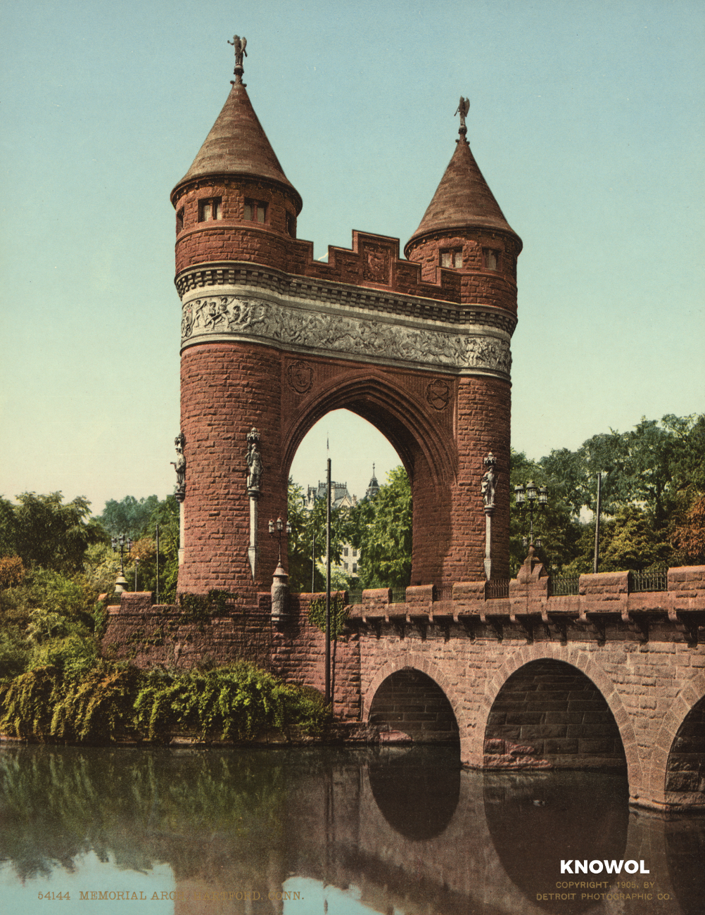
Hartford’s State Capital, Memorial Arch, and Bushnell Park
These pictures of Hartford, Connecticut were taken over the span of 20 years, from 1900 -1920.
 Connecticut
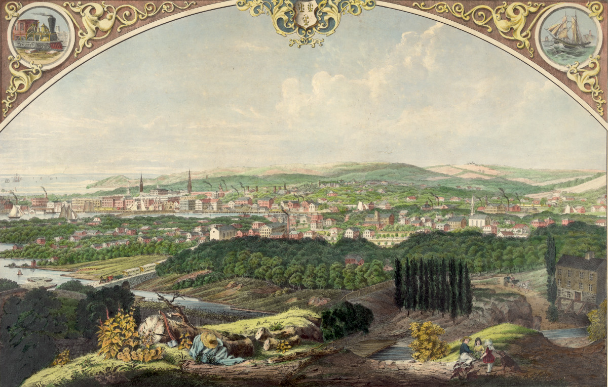
Cityscape view of Bridgeport, Connecticut from a nearby hill in 1857
This beautiful vintage print shows Bridgeport, Connecticut as it looked in 1857. The artist, Walter Staengel, sat atop what was then known as "Old…
 Connecticut
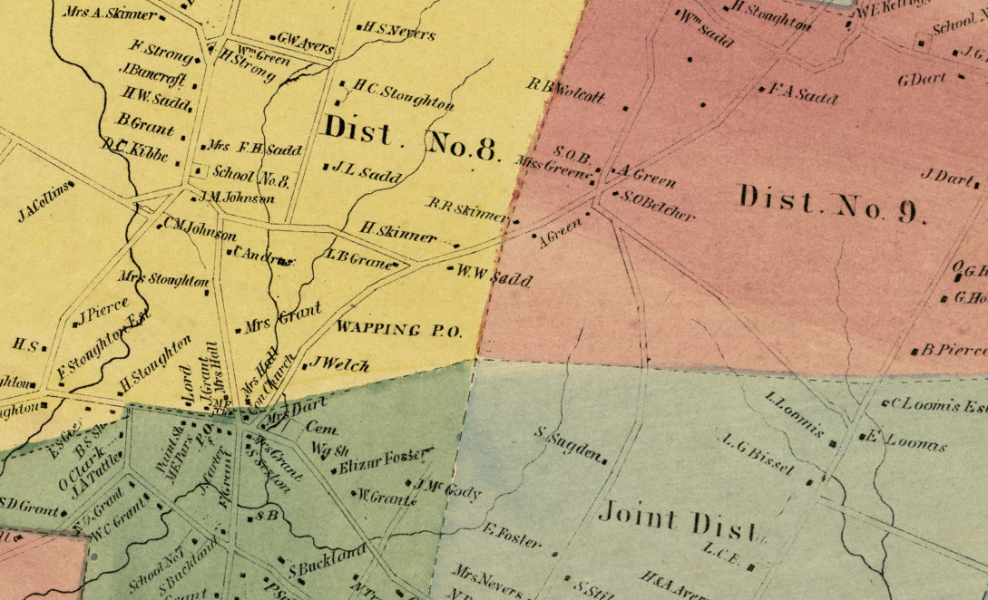
Historic landowners map of South Windsor, CT from 1869
Vintage landowners map shows South Windsor, Connecticut as it used to be
 Connecticut
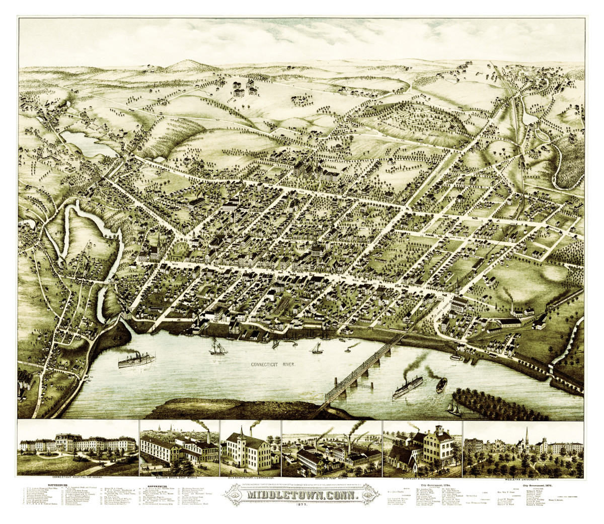
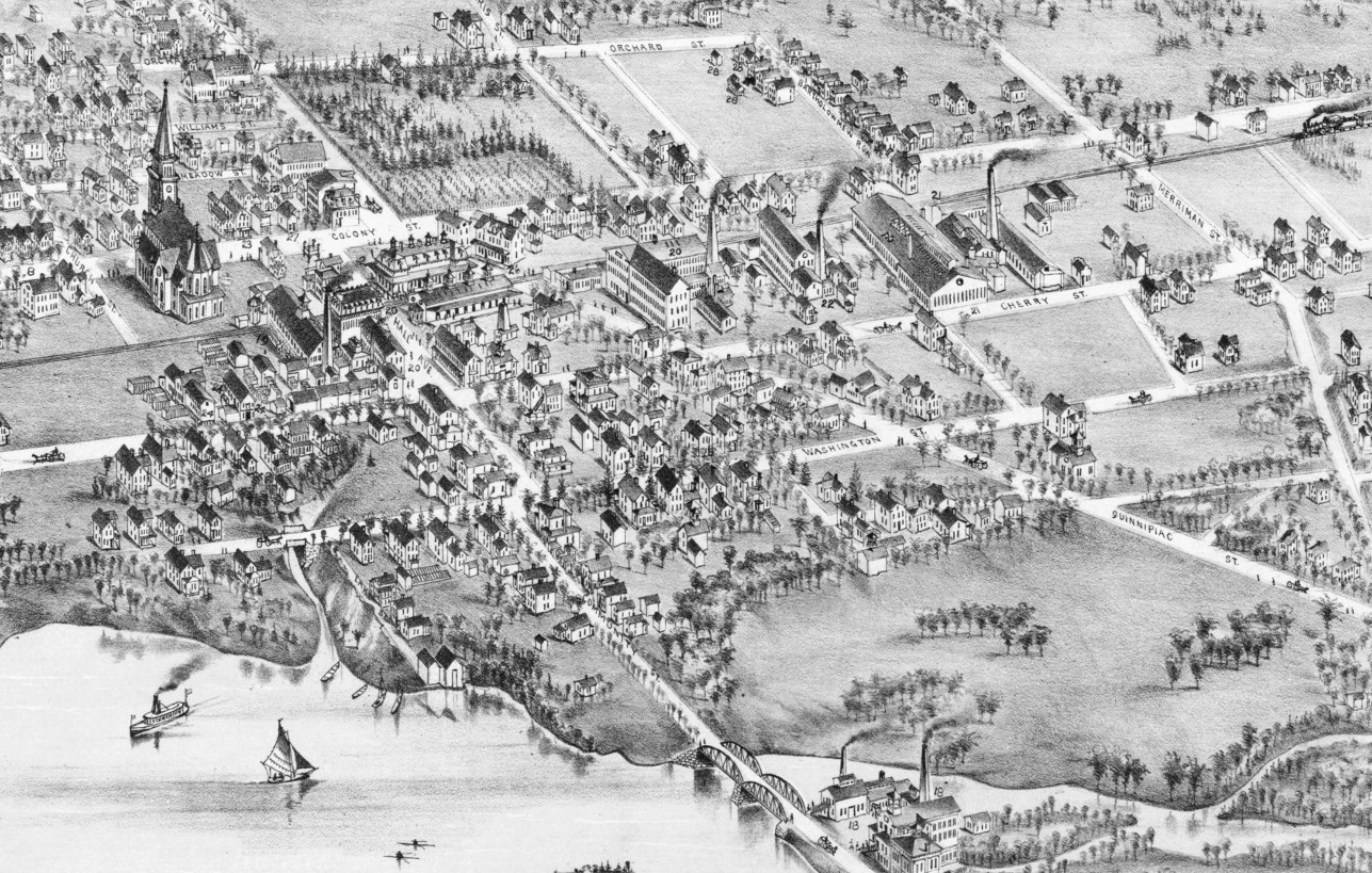
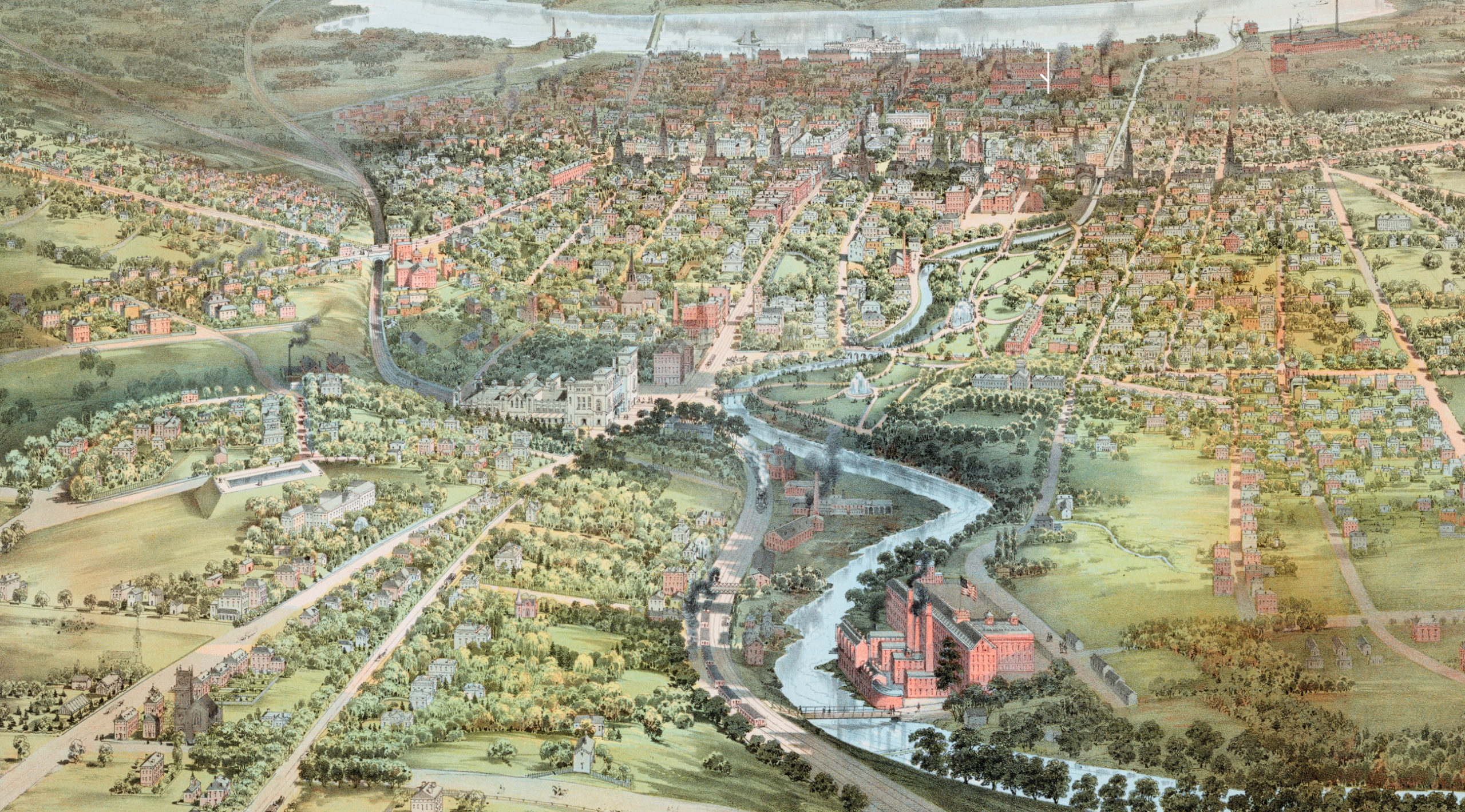
Bird’s eye view of Middletown, Connecticut in 1877
This beautiful vintage map shows Middletown, Connecticut as it looked in 1877. At the time approximately 7,000 people lived in Middletown and manufacturing was the…
 Connecticut
Beautifully restored map of Wallingford, Connecticut in 1881
Historic bird's eye view of Wallingford, Connecticut
 Connecticut
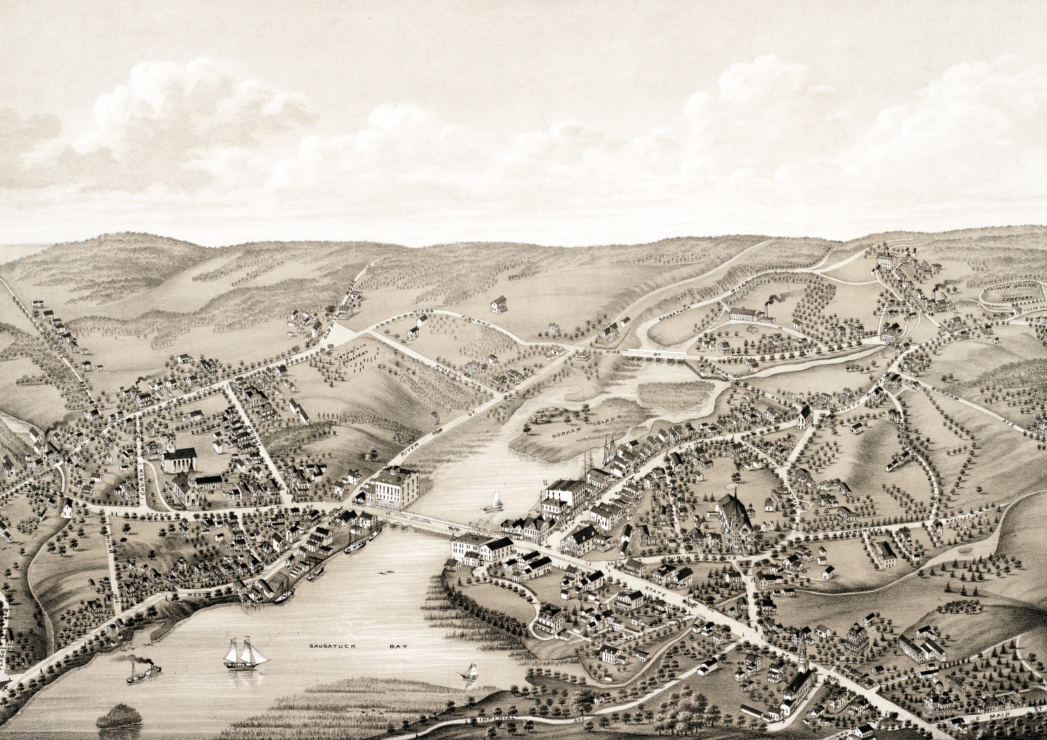
Beautifully detailed map of Westport, CT from 1878
Detailed bird's eye view of Westport, Connecticut in 1878
 Connecticut
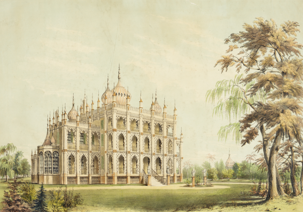
Iranistan, P.T. Barnum’s lost palace once located in Bridgeport, CT
P.T. Barnum, most famously known for founding the Barnum & Bailey Circus...
 Connecticut
Beautifully detailed map of Stamford, CT from 1875
Historic bird's eye view of Stamford, Connecticut in 1875
 Connecticut
Beautifully detailed map of Hartford, Connecticut from 1864
Historic bird's eye view of Hartford, Connecticut from 1836
 Connecticut
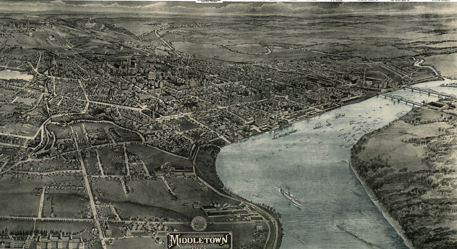
Vintage map shows Middletown, Connecticut in 1915
This old map shows Middletown, Connectiicut in the early 20th century.
 Connecticut
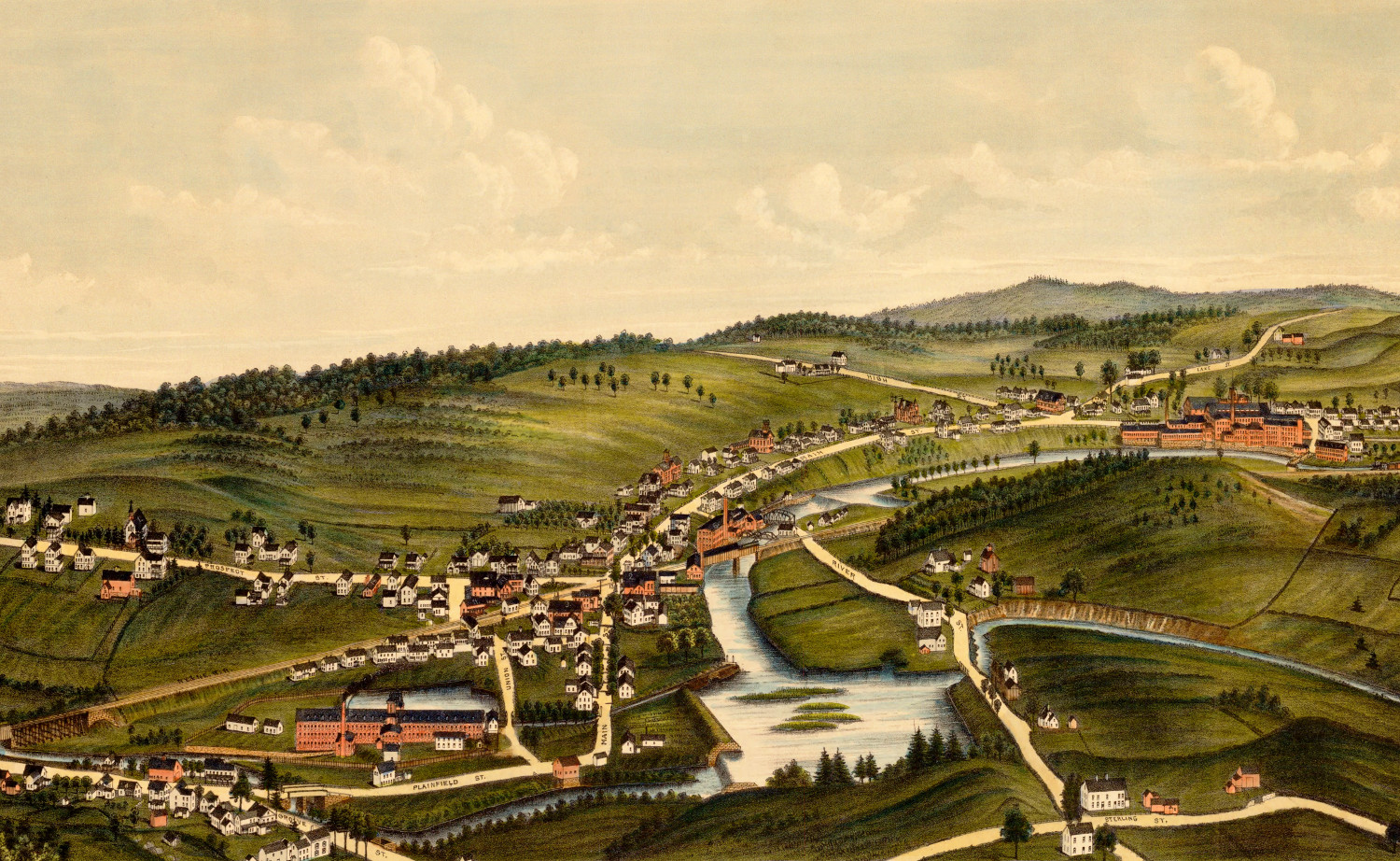
Old map showing a bird’s eye view of Moosup, Connecticut in 1889
This old map shows Moosup, Connecticut in the late 19th century.