
Connecticut
Browse historical articles, vintage map research, and collectible print discoveries connected to Connecticut.
 Connecticut
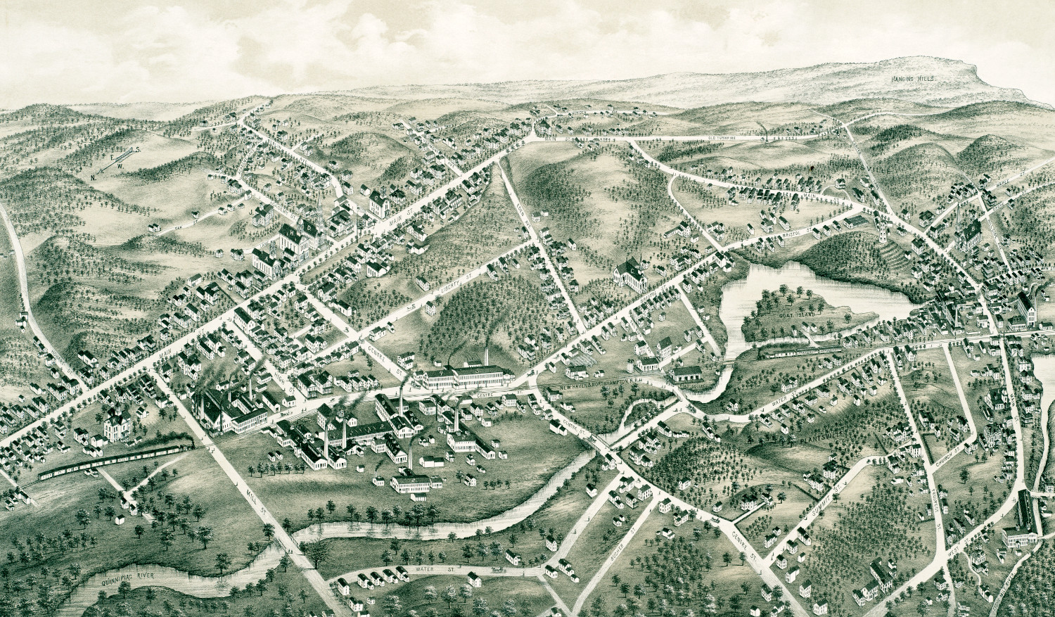
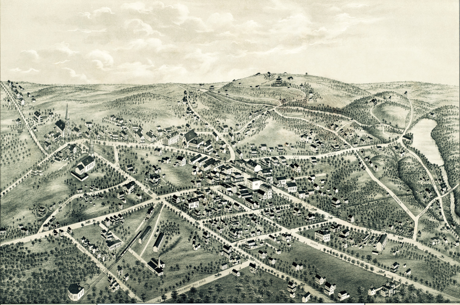
Beautifully restored map of Southington, CT from 1878
This map shows Southington, Connecticut as it looked in 1878.
 Connecticut
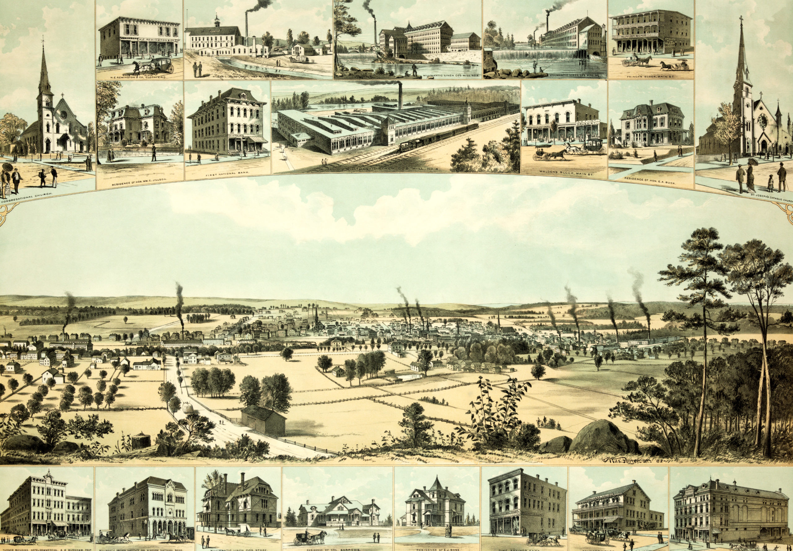
Bird’s eye view of Willimantic, CT from 1882
This old map shows Willimantic, Connecticut in the late 19th century.
 Connecticut
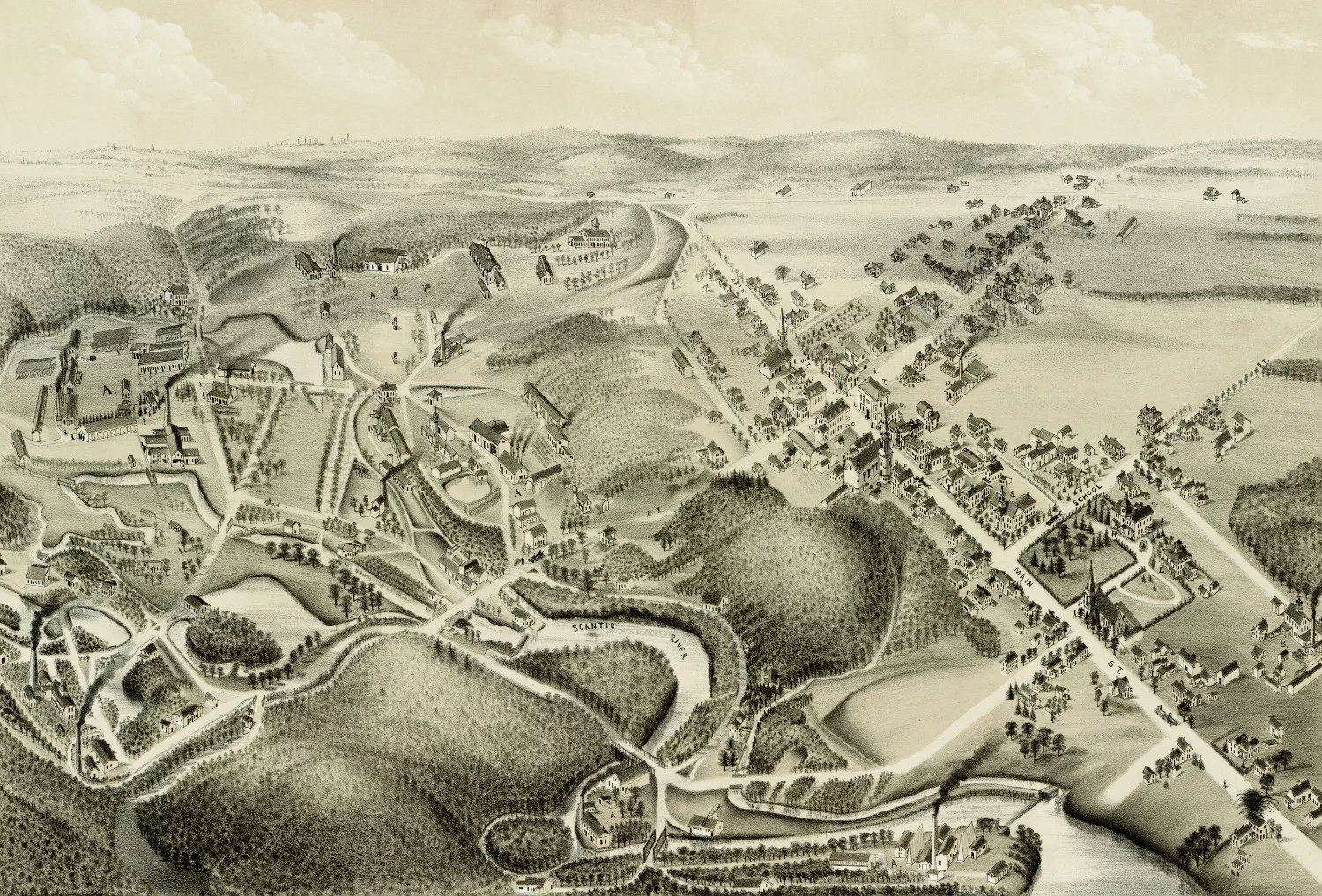
Old map showing a bird’s eye view of Hazardville, CT in 1880
This old map shows Hazardville, Connecticut in the late 19th century.
 Connecticut
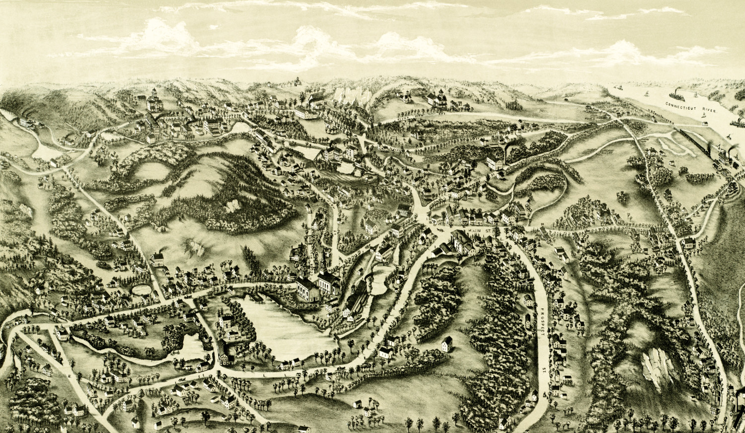
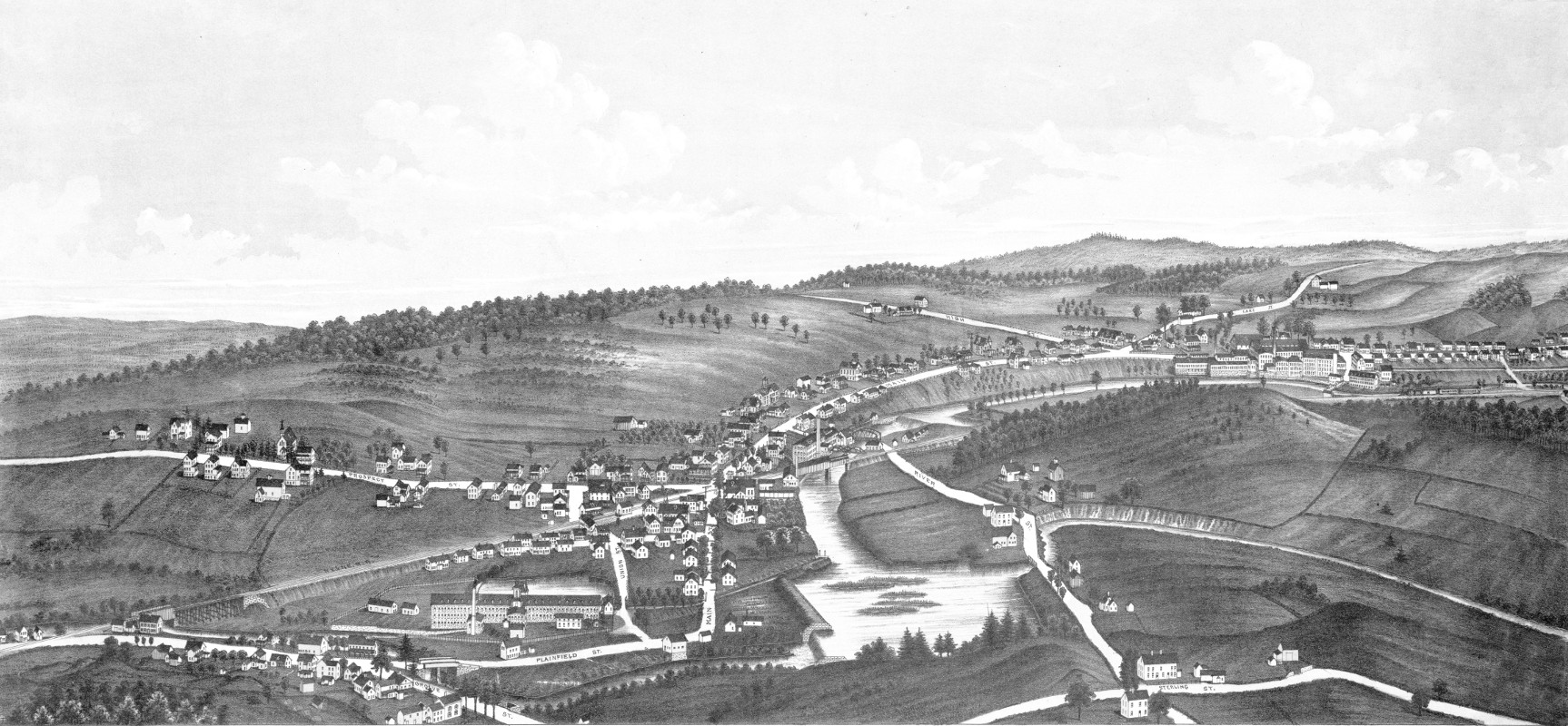
Bird’s eye view of Chester, Connecticut from 1881
This old map shows Chester, Connecticut in the late 19th century.
 Connecticut
Historic old map shows bird’s eye view of Bethel, Connecticut in 1879
Historic bird's eye view of Bethel, Connecticut in 1879
 Connecticut
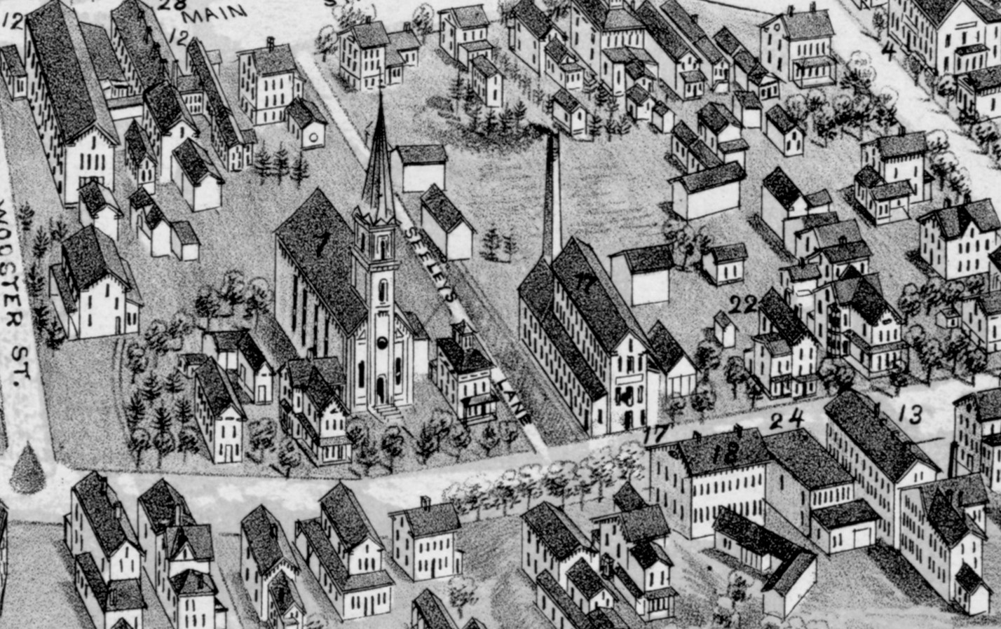
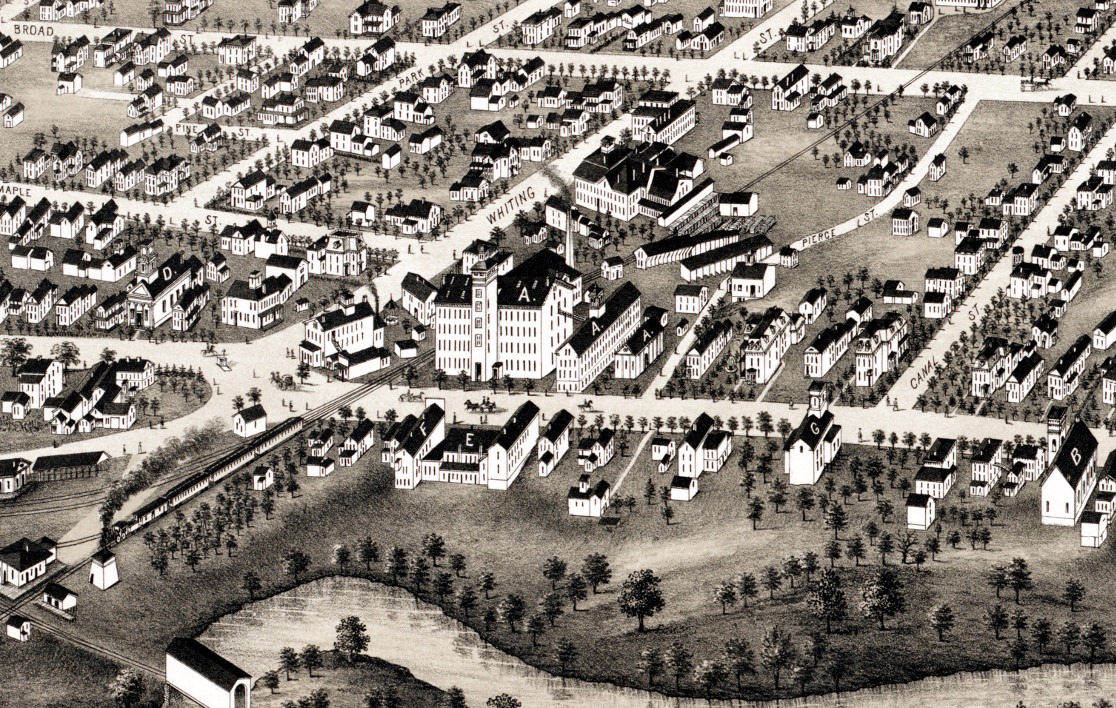
Welcome to Meriden, one of the finest cities in Connecticut
Meriden is a city in Connecticut located almost equidistant from Boston and...
 Connecticut
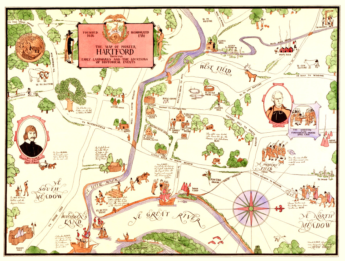
Map of Pioneer Hartford, CT highlights life in the 1600’s
This vintage map of Hartford, CT shows the city as it looked in the 1600's.
 Connecticut
Beautifully detailed map of Branford, Connecticut in 1905
Detailed bird's eye view of Branford in the early 20th century.
 Connecticut
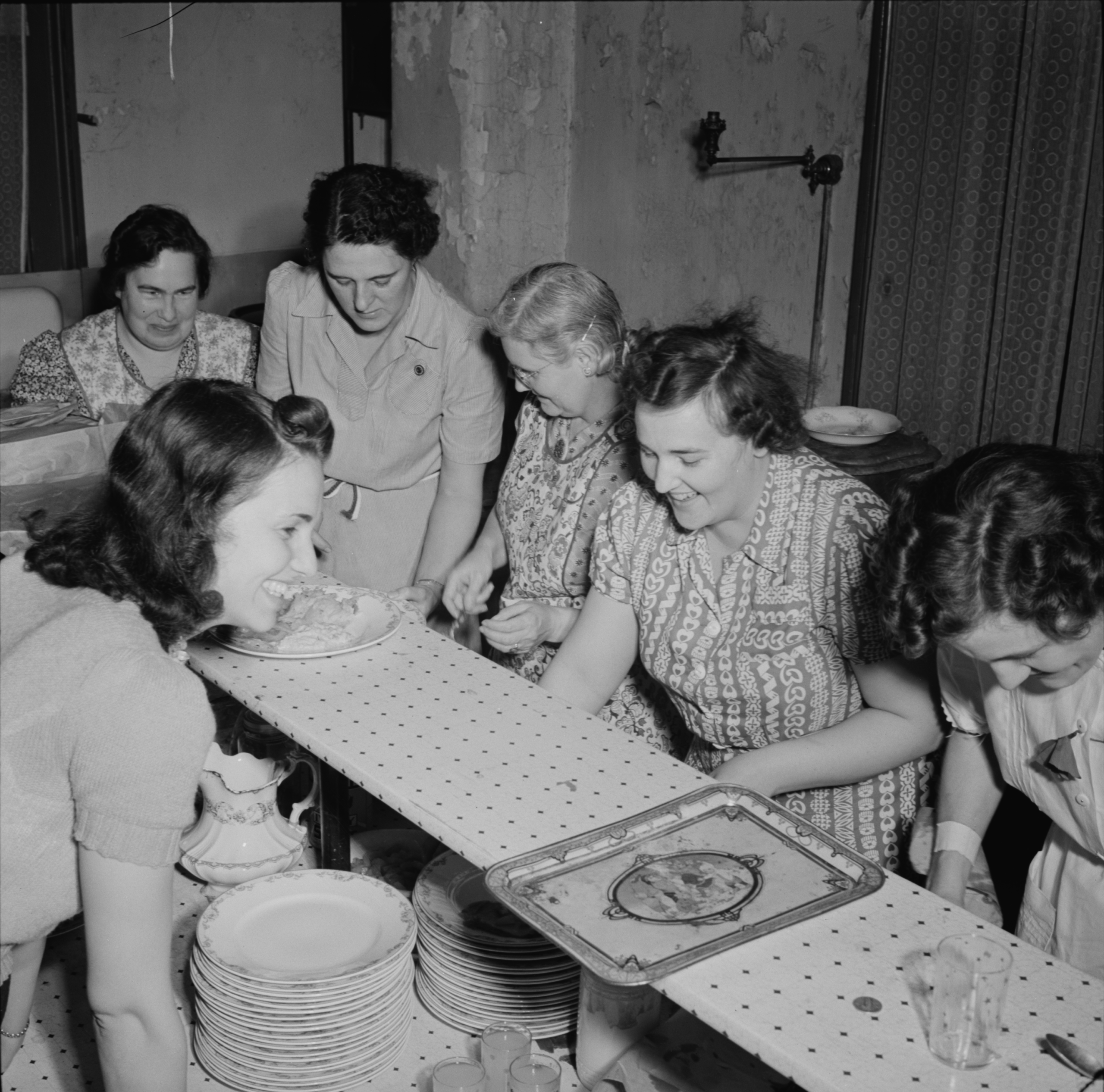
55 historical pictures of Southington Connecticut during WWII
This collection of pictures shows what daily life was like in Southington during WWII.
 Connecticut
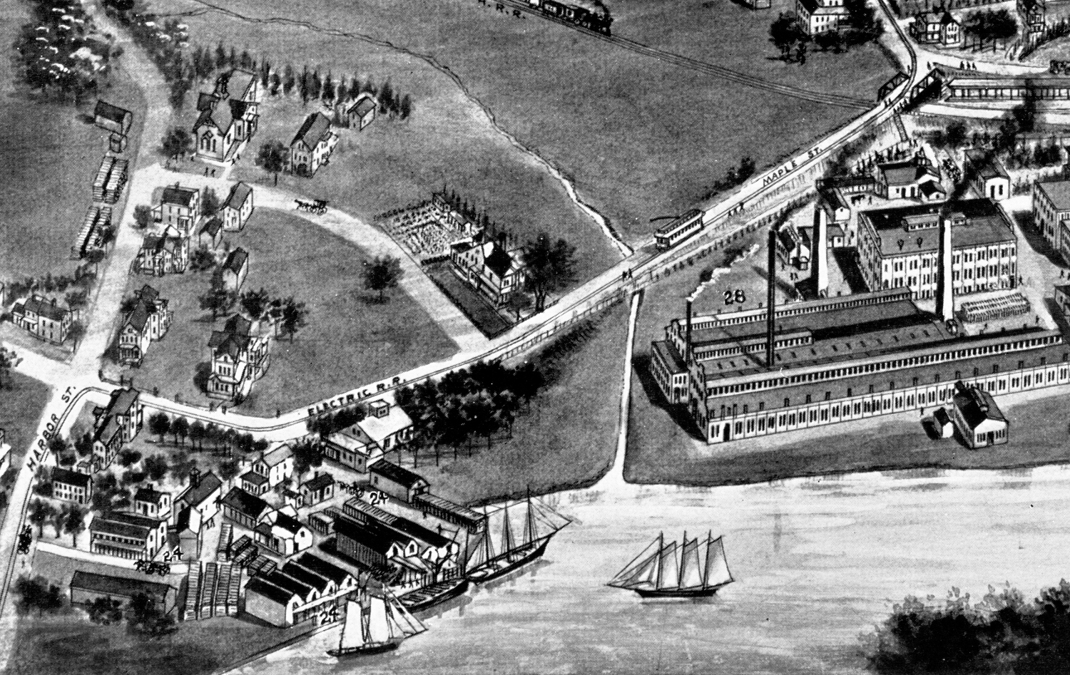
Amazing old map of Windsor Locks, CT in 1877
This map shows Windsor Locks, Connecticut as it looked in 1877
 Connecticut
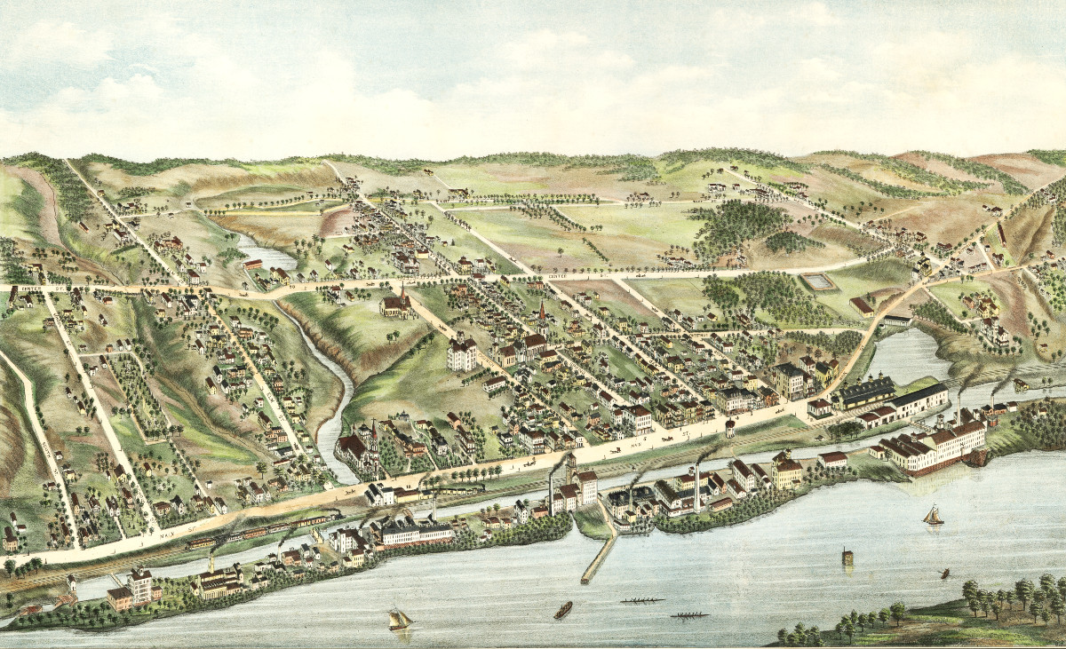
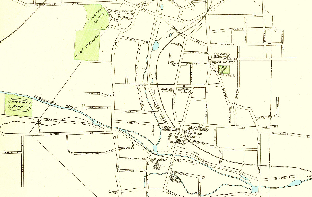
Hand colored map of Bristol, Connecticut from 1893
Click here to see what Bristol looked like more than 100 years ago!
 Connecticut
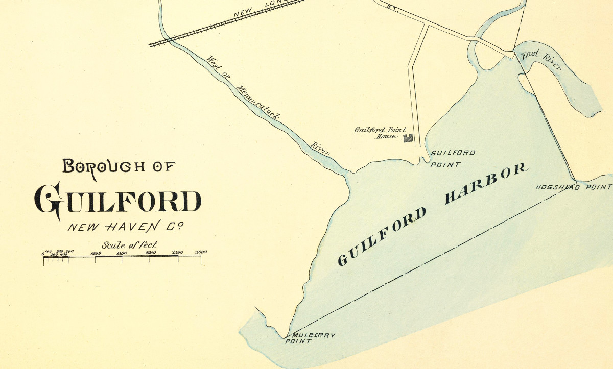
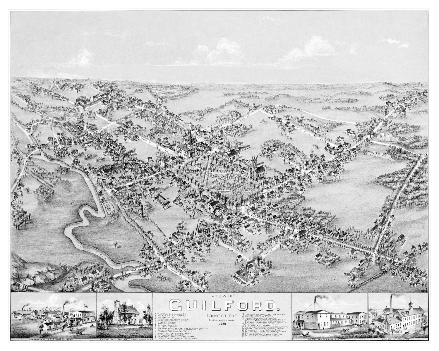
Historical map of Guilford, Connecticut created in 1893
This old map shows Guilford, CT as it looked in the late 19th century.
 Connecticut
Historical map of Wallingford, Connecticut created in 1893
This old map of Wallingford, CT is a hand colored lithograph from 1893. The map was created by D.H. Hurd & Company and printed…
 Connecticut
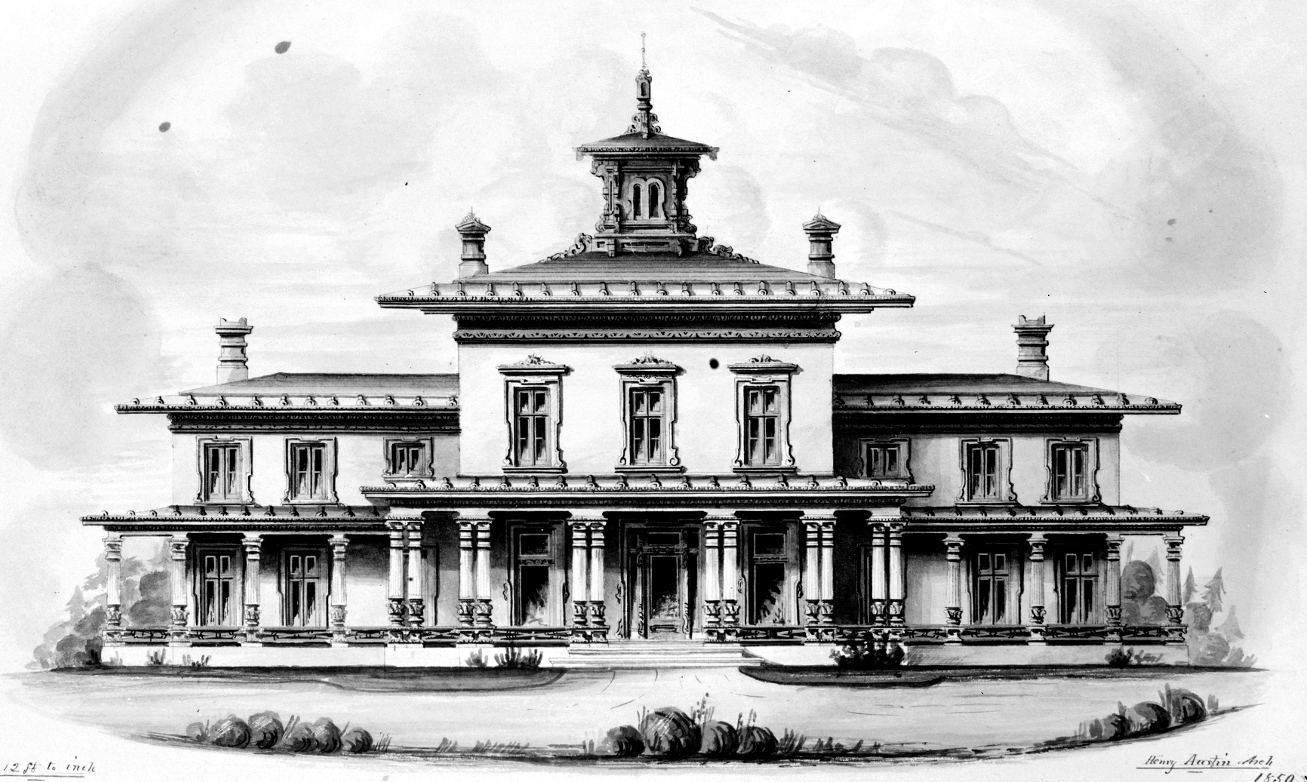
The most luxurious house ever built in Wallingford, Connecticut
Moses Yale Beach was an American inventor and publisher born in Wallingford...
 Connecticut
Beautifully restored map of New Canaan, Connecticut from 1878
This old map shows New Canaan, Connecticut in the late 19th century.
 Connecticut
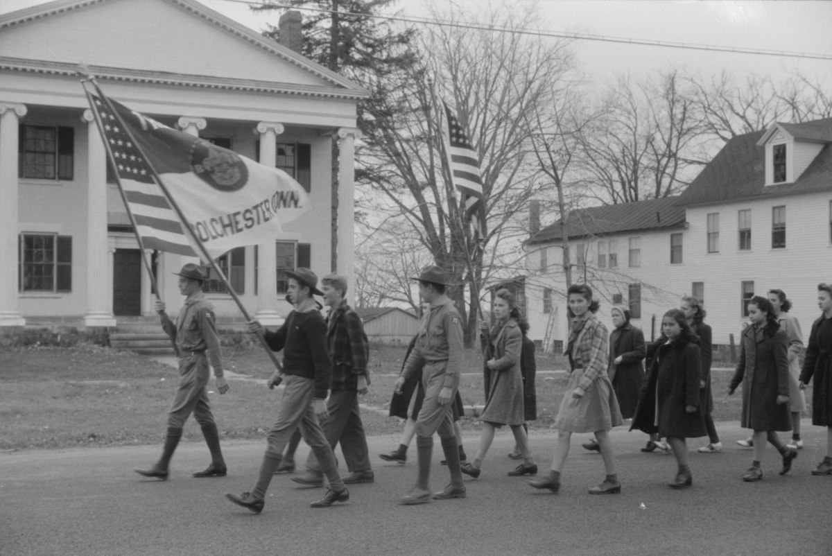
Fascinating Pictures of Colchester Connecticut in the 1940’s
Jack Delano's photos of Colchester, CT from the 1940's.
 Connecticut
Beautifully restored map of Plainville, Connecticut in 1878
Historic bird's eye view of Plainville, Connecticut in 1878
 Connecticut
Beautiful vintage map of Moosup, CT from 1889
This map shows Moosup, Connecticut as it looked in 1889.
 Connecticut
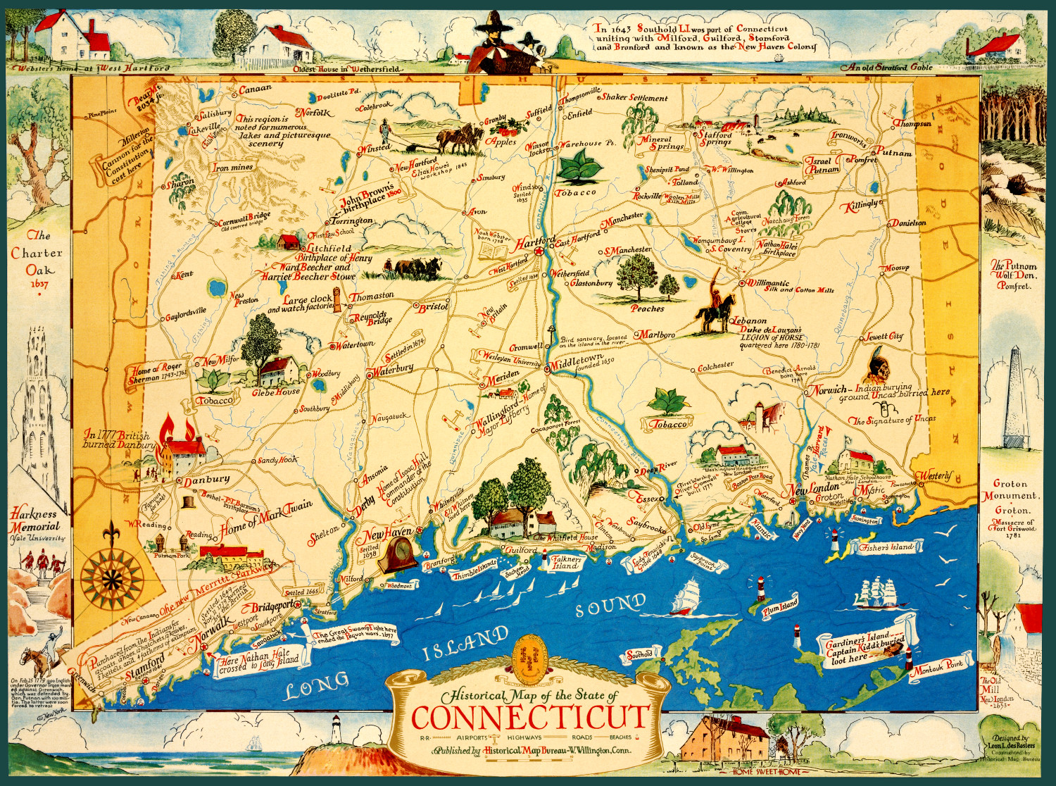
Vintage map featuring historical Connecticut facts and trivia
This old map features historical Connecticut trivia from the 17th - 20th century.
 Connecticut
Vintage map of Guilford, Connecticut from 1881
This map of Guilford, CT shows the town as it looked in 1881.
 Connecticut
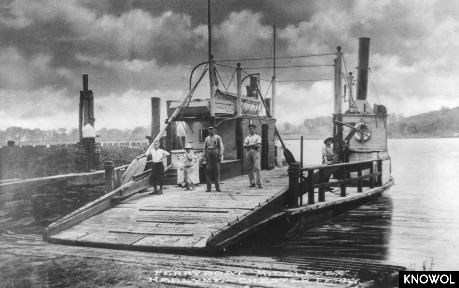
Connecticut’s Chester–Hadlyme Ferry
The Chester-Hadlyme ferry is the second oldest continuously operating ferry service in the state.