
Connecticut
Browse historical articles, vintage map research, and collectible print discoveries connected to Connecticut.
 Connecticut
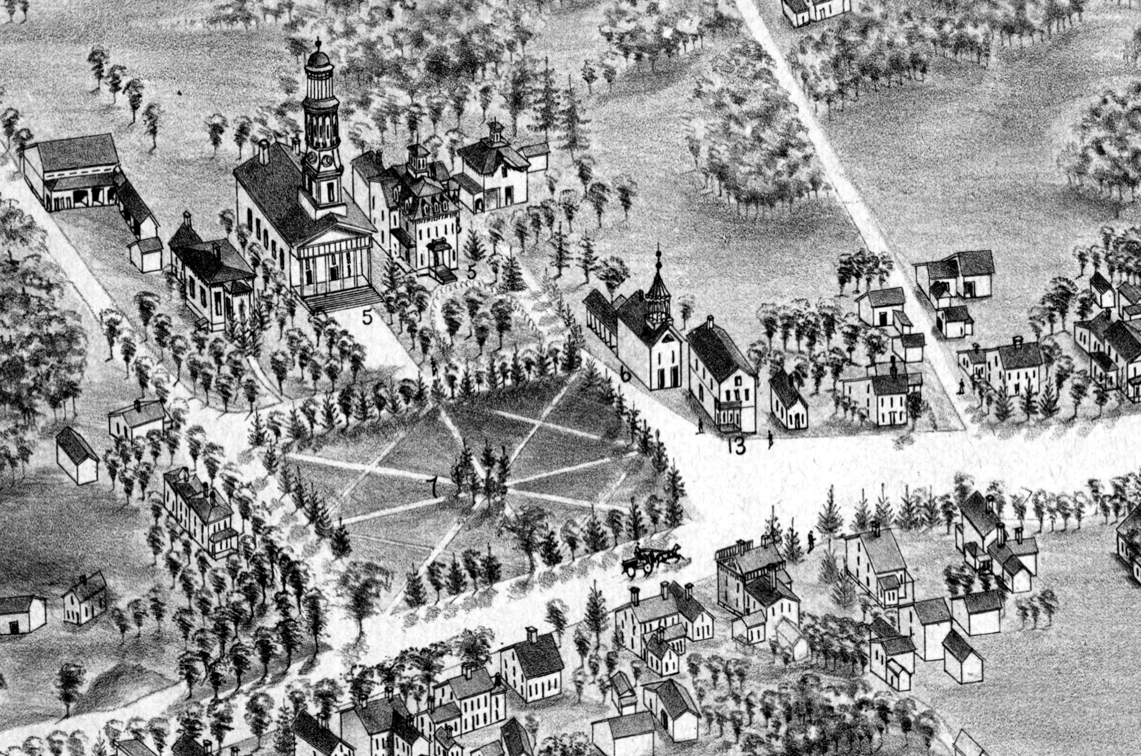
Amazing Vintage Map of Manchester, CT in 1880
This map shows Manchester, Connecticut as it looked in 1880, including the NY and New England Railroad Station
 Connecticut
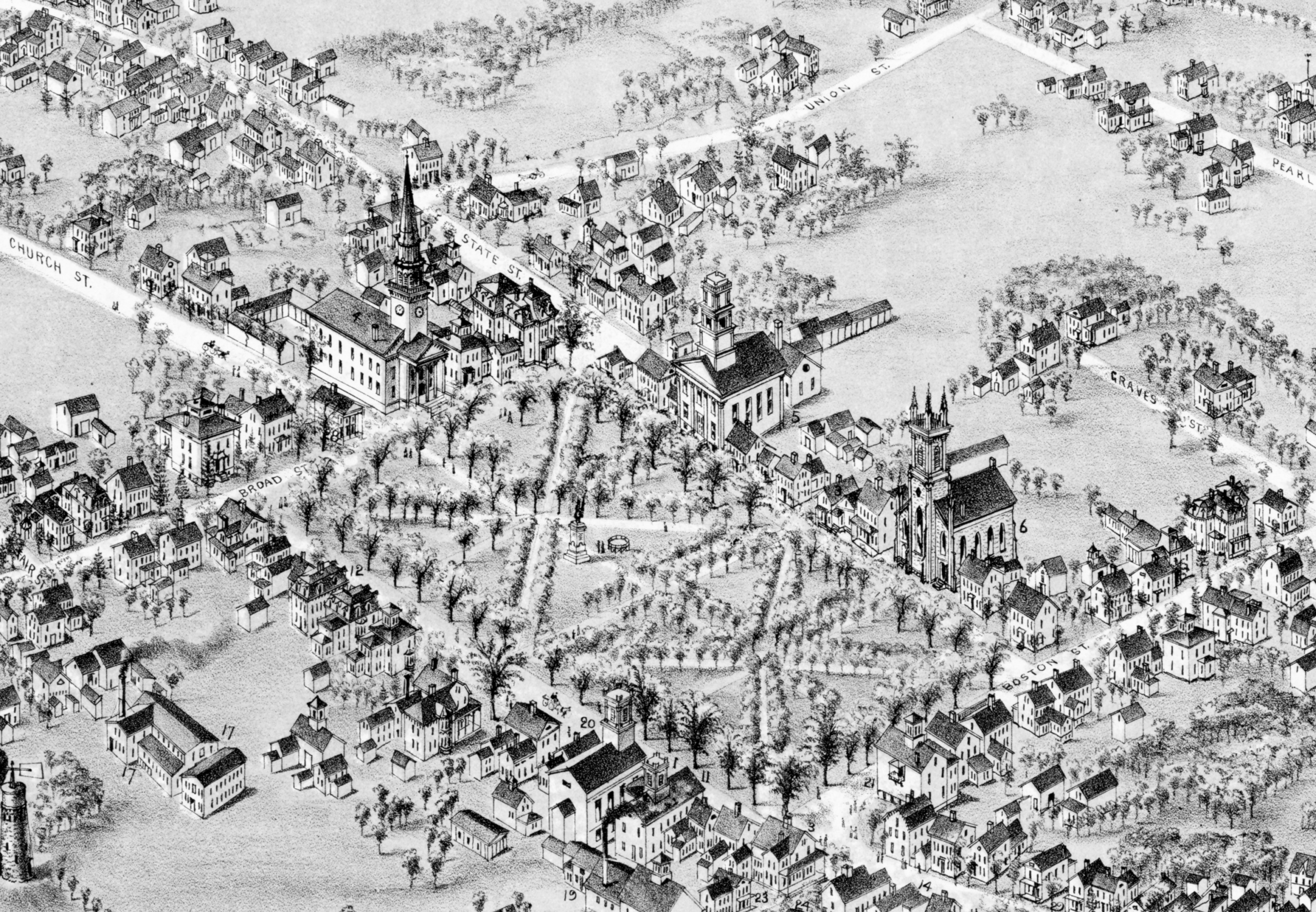
Beautifully restored map of Guilford, Connecticut from 1881
Historic bird's eye view of Guilford, Connecticut in 1881
 Connecticut
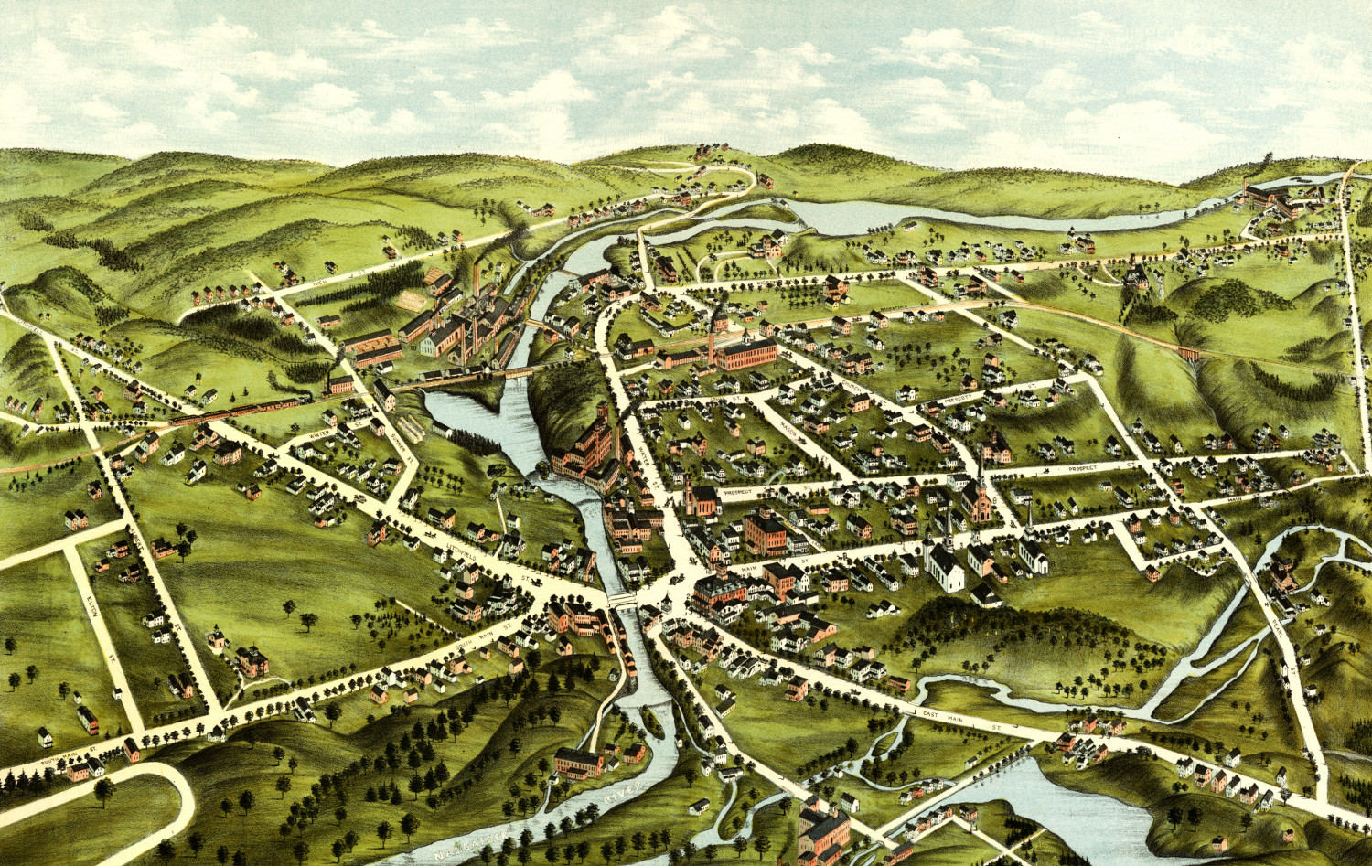
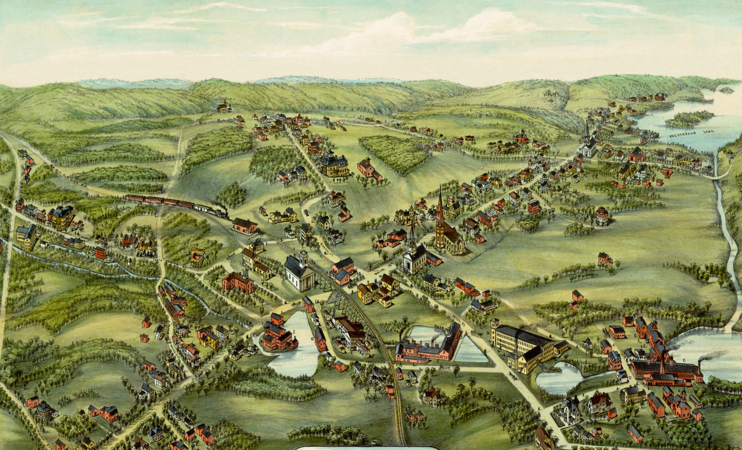
Beautiful bird’s eye view of Wolcotville (Torrington), Connecticut from 1877
This old map shows Wolcotville (now Torrington), Connecticut in the late 19th century.
 Connecticut
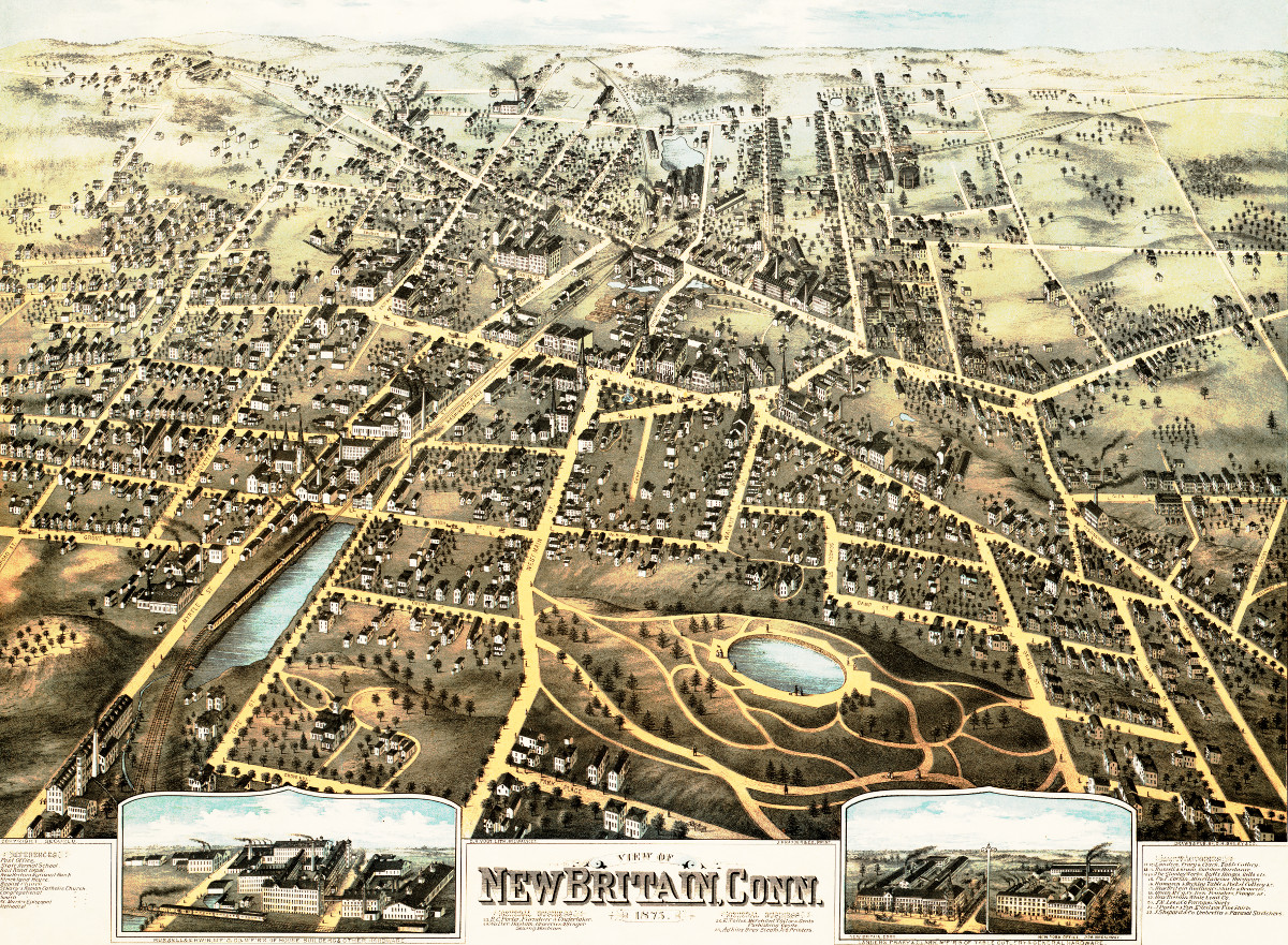
Amazing old map of New Britain, Connecticut from 1875
This map shows New Britain, Connecticut in 1875.
 Connecticut
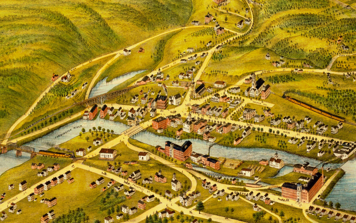
Beautifully restored old map of New Hartford, CT from 1878
This old map shows New Hartford, Connecticut in the late 19th century.
 Connecticut
Restored bird’s eye view of Clinton, CT from 1881
This old map shows Clinton, Connecticut in the late 19th century.
 Connecticut
Restored bird’s eye view of East Hampton, Connecticut from 1880
This old map shows East Hampton, Connecticut in the late 19th century.
 Connecticut
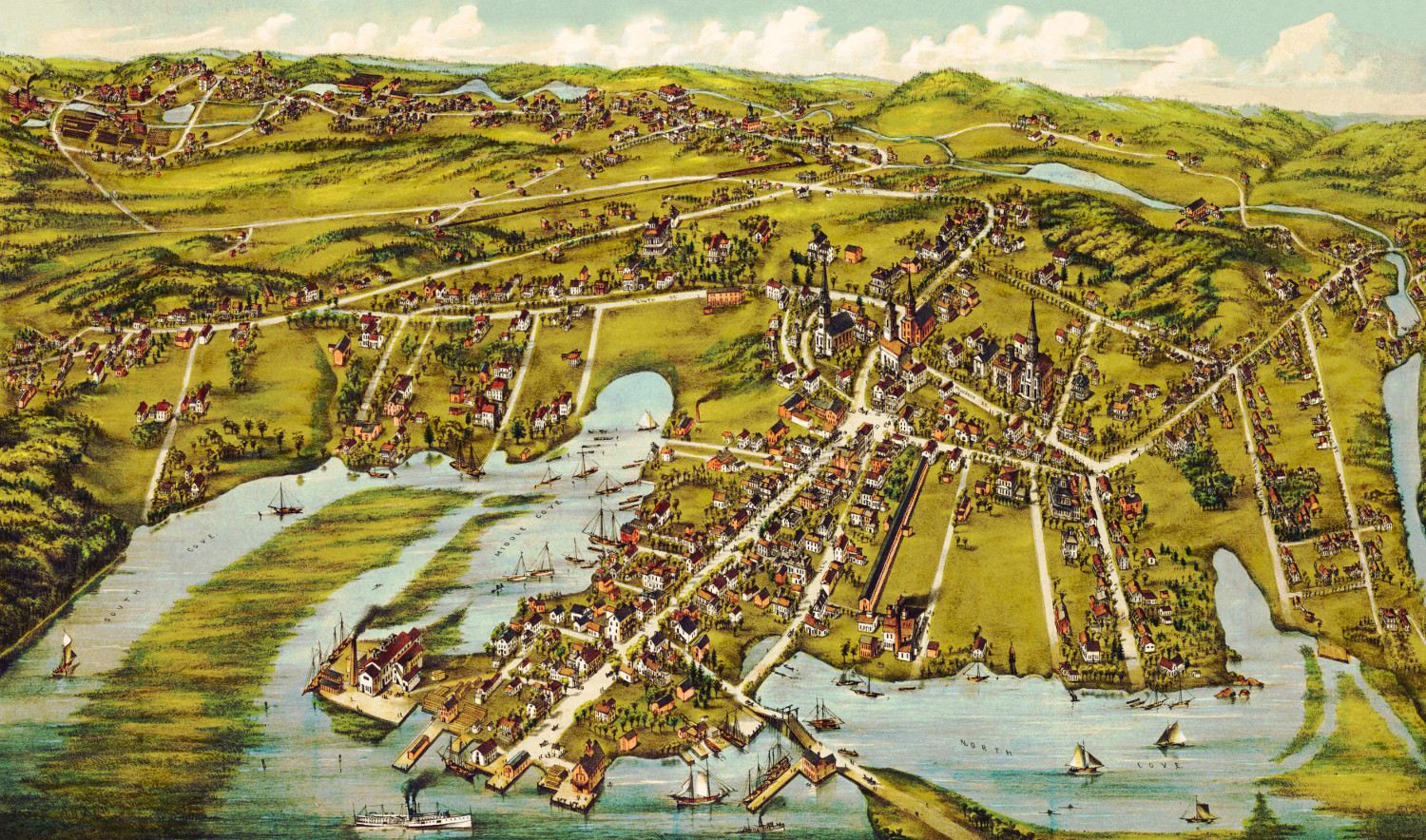
Beautiful bird’s eye view of Essex, Connecticut in 1881
This old map shows a bird's eye view of Essex, Connecticut in the late 19th century.
 Connecticut
Beautifully restored map of Canton, CT from 1869
Vintage landowners map of Canton, Connecticut as it used to be
 Connecticut
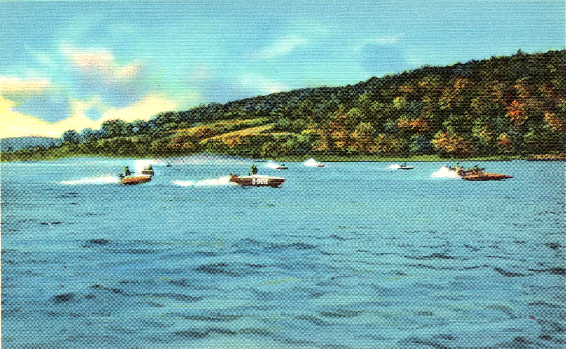
11 vintages images reveal the beauty of Connecticut’s Candlewood Lake
Candlewood Lake is a manmade lake located in Connecticut that is is bordered by five towns: Brookfield, Danbury, New Fairfield, New Milford, and Sherman. The following…
 Connecticut
Beautifully restored map of Rocky Hill, CT from 1869
Vintage landowners map of Rocky Hill, Connecticut as it used to be
 Connecticut
Beautiful hand drawn map of Stamford, Connecticut in 1883
Click here to see what Stamford looked like 100+ years ago.
 Connecticut
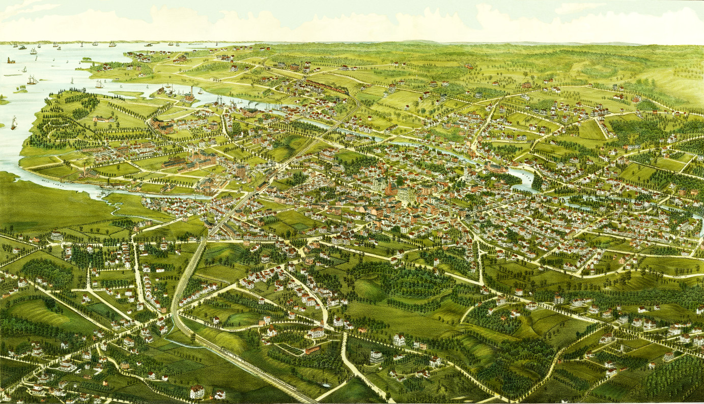
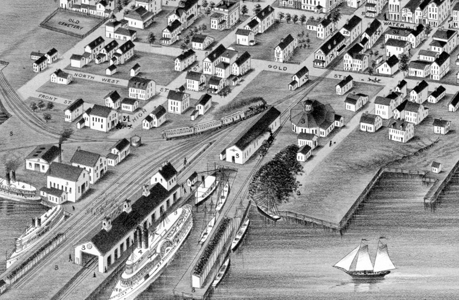
Beautifully restored map of Stonington, Connecticut from 1879
Historic bird's eye view of Stonington, Connecticut as it used to be
 Connecticut
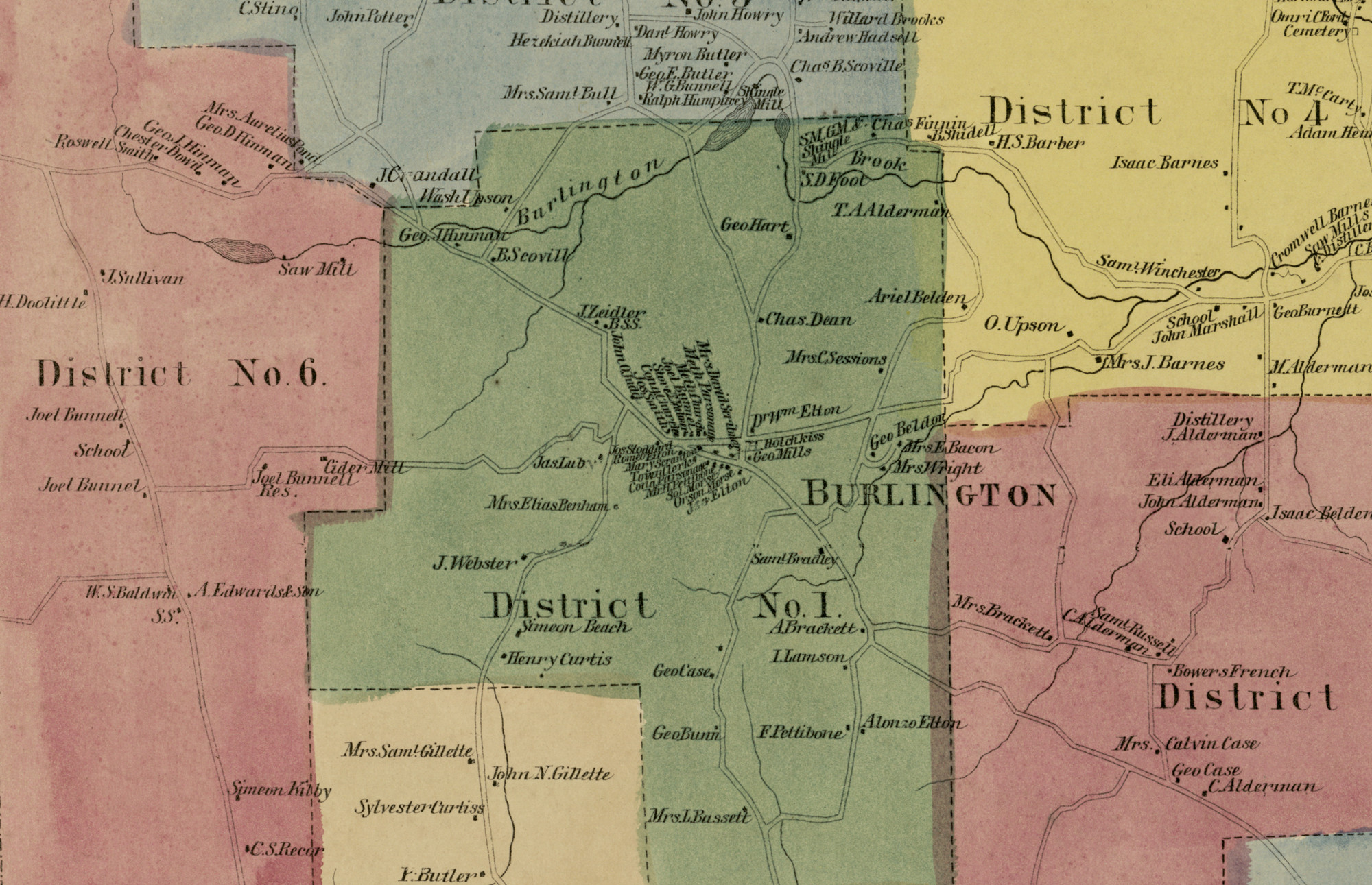
Historic landowners map of Burlington, CT from 1869
Vintage landowners map of Burlington, Connecticut as it used to be
 Connecticut
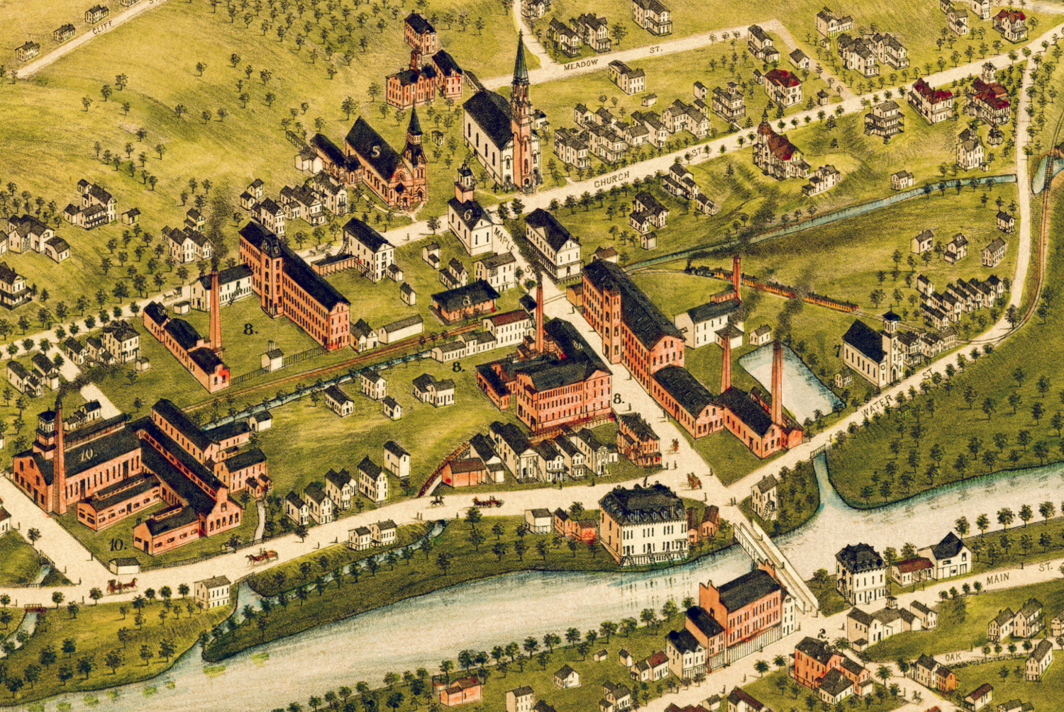
Beautifully restored map of Naugatuck, Connecticut from 1877
Historic bird's eye view of Naugatuck, Connecticut from 1877
 Connecticut
Beautifully restored map of Cheshire, Connecticut from 1882
Detailed bird's eye view of Cheshire, Connecticut as it used to be
 Connecticut
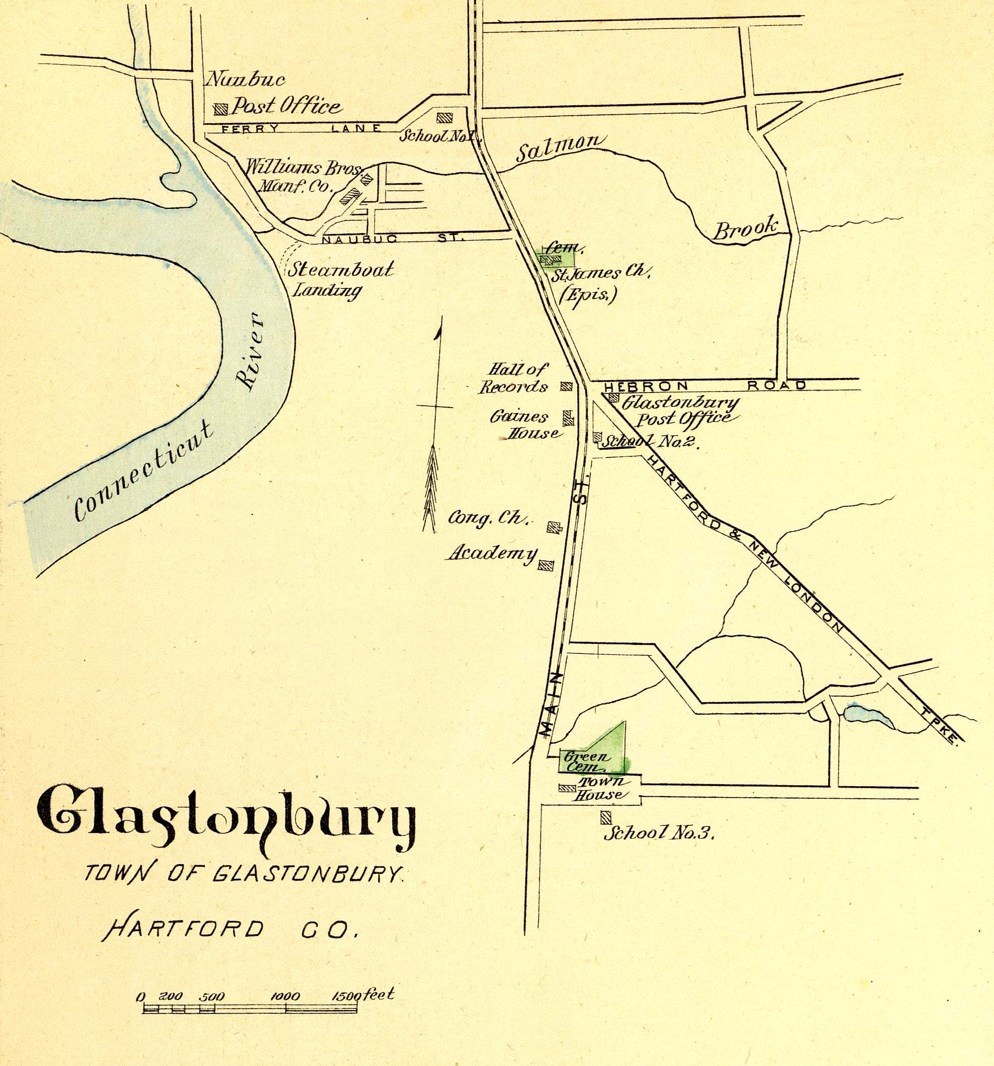
Glastonbury, Rocky Hill, Enfield & Collinsville, CT in 1893
This map shows Glastonbury, Rocky Hill, Enfield & Collinsville, Connecticut as they looked in 1893. The hand colored map was originally printed as a…
 Connecticut
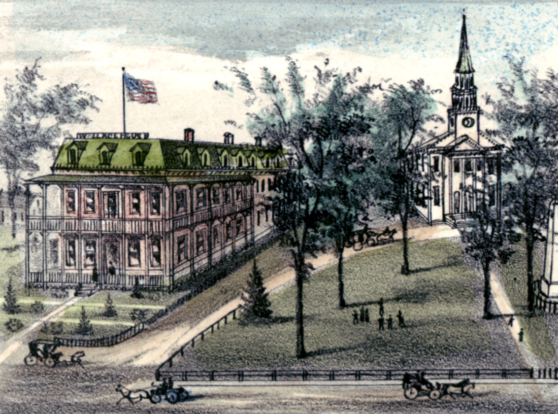
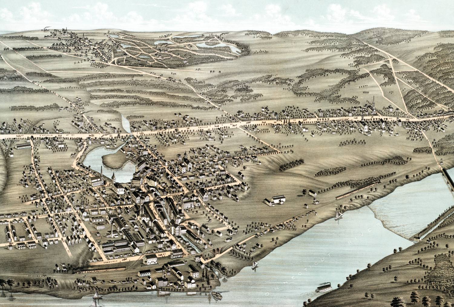
Beautifully restored map of Thompsonville, CT from 1878
This old map shows Thompsonville, Connecticut as it looked in 1878.
 Connecticut
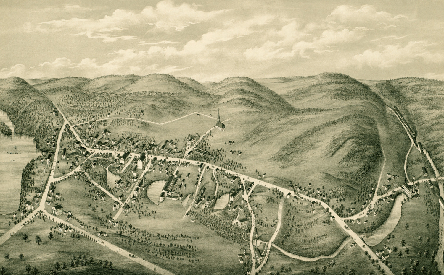
Beautiful old map of South Coventry, CT from 1878
This vintage map shows South Coventry, CT as it looked in 1878.
 Connecticut
Beautifully restored map of Madison, Connecticut in 1881
Bird's eye view of Madison, Connecticut as it used to be
 Connecticut
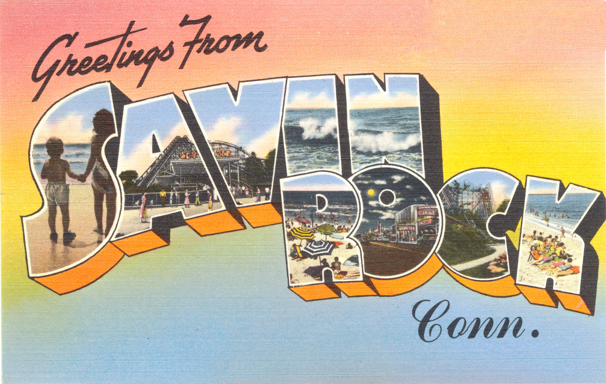
4 vintage images of Savin Rock Amusement Park in West Haven
Savin Rock was an amusement park in West Haven, Connecticut that operated from the 1870's - 1966.