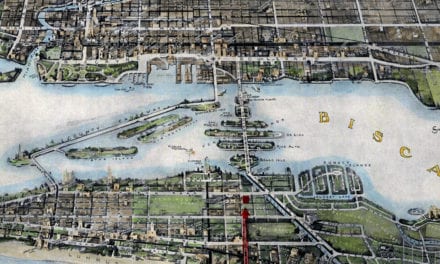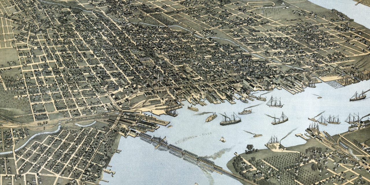
This old map of Jacksonville, Florida was created in 1893 by Augustus Koch, a prominent 19th century map maker. The map shows a bird’s eye view of Jacksonville as it used to be, including street names and old landmarks. Koch first visited the city in 1876, then returned to capture the changes to Jacksonville’s landscape. Click here to see Koch’s 1876 map of Jacksonville.
Landmarks on the map include Seminole Club House, Armour Packing Company, Simms Wholesale Liquor House & Beer Agency, South Jacksonville Ferry Landing, El Modelo Cigar Factory, Jacksonville Refrigerator Ice Works, St. James Hotel, Masonic Hall, The Travelers Hotel, Hospital & Asylum, St. Luke’s Hospital, Park Opera House, Duval High School, various denominations of churches, and more.
This historic map of Jacksonville, FL has been restored by KNOWOL. Reproductions of the map are available here.
Bird’s Eye View of Jacksonville, Florida in 1893
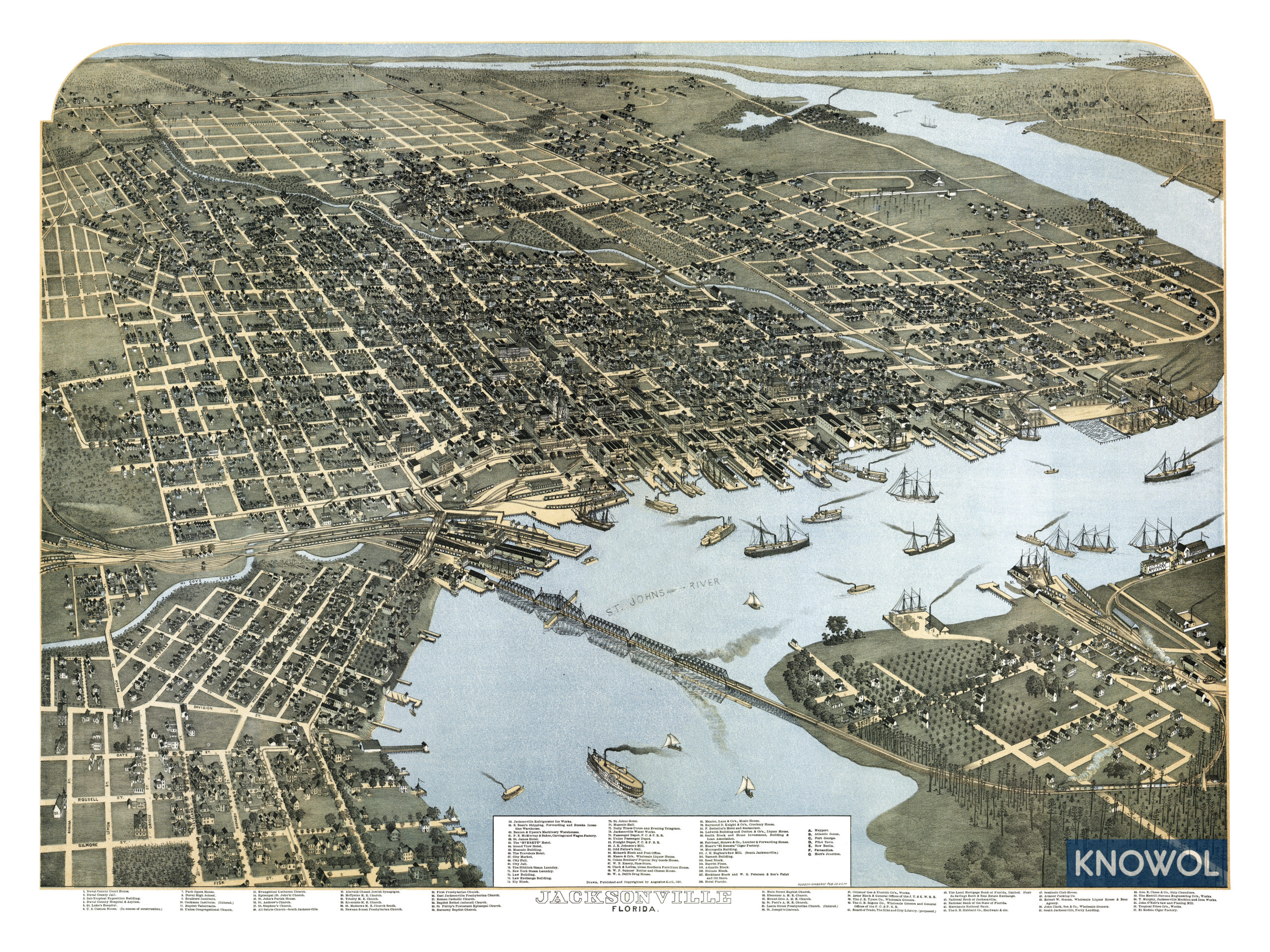
This old map of Jacksonville will make an attractive addition to your office, library, or den and can even be used to teach children the geography and history of the area. When you’re done exploring, click here to get your copy.