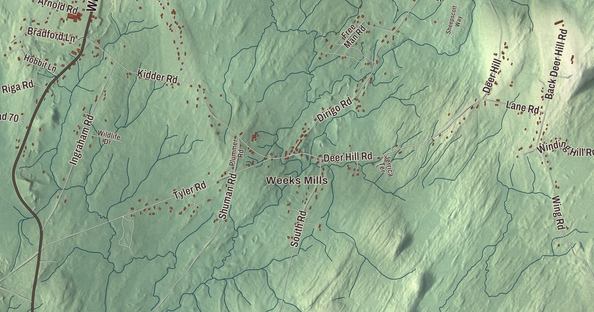
If you grew up in China, you’ll find China Lake and Threemile Pond on this map of China, Maine. South China, Dirigo Corner, Weeks Mills and Coles are printed around them, with Lakeview Drive, Belfast Road, Vassalboro Road, Windsor Road, Waterville Road and Albion Road tying the town together. Click here to purchase a print of this map for your wall.
China is a town in Kennebec County, with 4,408 people at the 2020 census.
KNOWOL made this map in 2026 from public survey data, and it carries the look of an old county atlas. The ridges along the lake are shaded from United States Geological Survey elevation data, and the roads and town line come from the Census Bureau. Of the 56.86 square miles the Bureau counts in China, 6.98 are water.
A town named for a hymn
John “Black” Jones surveyed this land in 1773 and 1774, and in 1774 the Clark family settled here and established Jones’ Plantation. Edmund and Rachel Clark were Quakers, and their farm on the west side of China Lake stayed with their descendants for generations. The oldest part of the farmhouse dates to about 1789, and it never had modern heat, plumbing or electricity; a telephone was its one modern convenience. The Edmund and Rachel Clark Homestead joined the National Register of Historic Places in 2006.
The plantation became the town of Harlem late in the 1700s, and on June 25, 1818, the Town of China was incorporated, combining land from Harlem, Fairfax (now Albion) and Winslow. Japheth Washburn, a member of the Massachusetts legislature, picked the name. He first wanted Bloomville, but people in Bloomfield objected that the two names were too alike, and he settled on China because it was the name of one of his favorite hymns. Timothy Swan of Northfield, Massachusetts, wrote that tune in 1790 and published it in his New England Harmony in 1801, and when Swan died his obituary said he was generally known to the public as the author of China.
China also holds a story of freedom. A fourth district once lay on the height of land between Palermo and Albion, part of it now known as Thurston Park, and numerous families of African-American descent settled there. Their history runs from roughly 1790 to 1860 and can be traced in the Maine state archives. The town’s page records a theory that they came because China and several other towns were Quaker towns, where people hunting those who had escaped slavery wouldn’t be tolerated, whatever federal law demanded. A few cemetery plots can still be found with a guide, among them a large obelisk in memory of “Tolbot” on a high wooded ridge where an early shingle mill also stood.
Rufus Jones and South China
Rufus Jones was born in 1863 in the Quaker farming village of South China, in the house his grandfather Abel Jones had built in 1815 on what’s now Jones Road. As a boy he worshipped at the Pond Meeting House, built in 1807 and one of the oldest surviving buildings in town, and later at the South China Meeting House, which the Quakers built in the 1880s to replace it. He went on to teach philosophy at Haverford College for 41 years, wrote more than 50 books, and helped found the American Friends Service Committee in 1917, serving as its first chairman. The committee shared the 1947 Nobel Peace Prize. He’s also the only person to have given two Swarthmore Lectures. Jones kept coming home: his summer house, Pendle Hill, stands on a ridge between U.S. Route 202 and China Lake, and he summered there until his death in 1948.
His uncle and aunt, Eli and Sybil Jones, were missionaries whose travels took them to Europe, the Middle East and West Africa, where they were received by the President of Liberia. Their 1833 house stands at the corner of State Route 3 and Dirigo Road, east of South China village. Erskine Academy, the private high school in South China, grew out of a trust set up after Sullivan Erskine died in 1880, and it opened in 1883. The Abel Jones House, the Pond Meeting House, the South China Meeting House, Pendle Hill and the Eli and Sybil Jones House are all on the National Register.
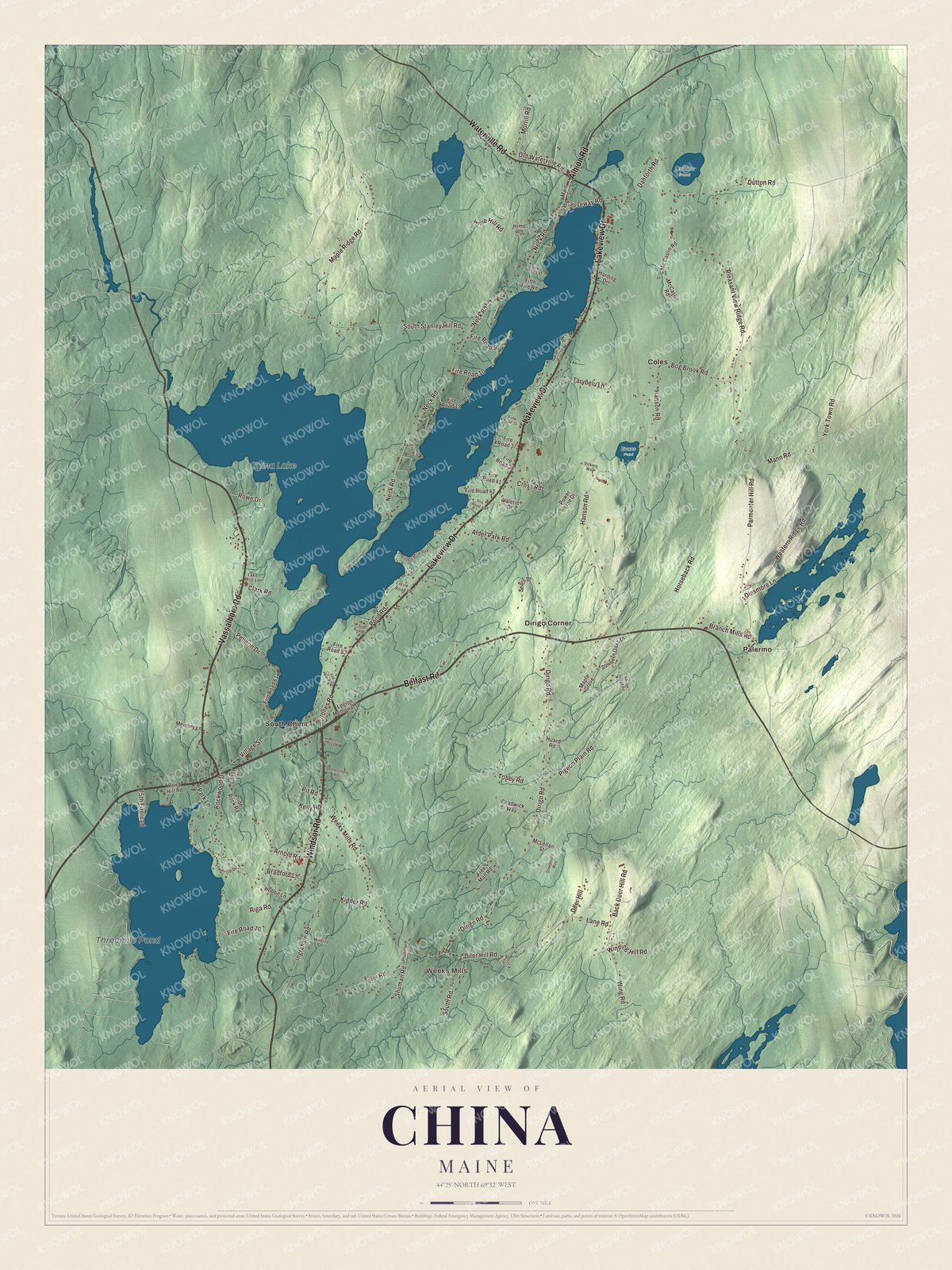
Click to explore a larger preview. The digital watermark does not appear on printed maps.
See it on a wall
The China map as a framed print. Swipe for more.


Around the lake
China Lake covers 3,939 acres, in two large basins joined by a narrow neck. The long eastern basin lies entirely in China, its shore lined with homes and seasonal cottages, while the rounder western basin reaches into Vassalboro and serves as a water supply for Waterville and Winslow. China Village grew at the north tip of the lake, where nearby streams gave it water power, and an academy opened there in 1823. Most of the village is a historic district, and about three quarters of its buildings went up before 1850. Its side streets carry the names Canton and Peking.
Lakeview Drive is printed on the map. It’s the local name of U.S. Route 202 between South China and China. Belfast Road is printed too. That’s the name for the stretch where Route 202, Route 9 and Route 3 run together to South China. The town counts five villages, China Village, South China, China, Weeks Mills and Branch Mills. South China, Weeks Mills and Dirigo Corner are printed on the map, along with Coles and Palermo. The National Register gives Dirigo Corner as the address of the Eli and Sybil Jones House, and Palermo is the town on China’s eastern border. Threemile Pond covers 1,174 acres, and Route 3 gives access to it a mile south of the South China church.
Vassalboro Road, Windsor Road, Waterville Road and Albion Road are printed as well. Three of them share their names with towns on China’s border, Vassalboro to the west, Windsor to the south and Albion to the northeast.
This China map makes a fine addition to an office, library or den, and it can help teach children the geography and history of the area. It’s made for everyone who calls China home, from Weeks Mills to the shore of China Lake, as it looks today. Zoom in on the preview above to explore the details, then click here to get your copy of the China, Maine map.

Sources
- China, Maine, Wikipedia
- China Village, Maine, Wikipedia
- Edmund and Rachel Clark Homestead, Wikipedia
- Timothy Swan, Wikipedia
- Rufus Jones (writer), Wikipedia
- Abel Jones House, Wikipedia
- Pond Meeting House, Wikipedia
- South China Meeting House, Wikipedia
- Pendle Hill (China, Maine), Wikipedia
- Eli and Sybil Jones House, Wikipedia
- Erskine Academy, Wikipedia
- China Lake (Maine), Wikipedia
- South China, Maine, Wikipedia
- Maine State Route 3, Wikipedia