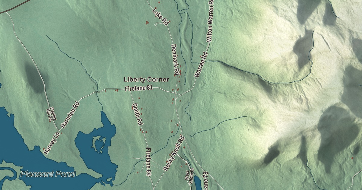
Moose Pond, East Main Street and West Main Street are where most people from Denmark, Maine start on this map, with Liberty Corner and East Denmark close by. Bull Ring Road, Schrader Road, Harvey Lane and Harnden Road lead out toward Heads Corner and West Denmark. Click here to purchase a print of this map for your wall.
Denmark is a town in Oxford County, with 1,197 people at the 2020 census.
KNOWOL made this map in 2026 from public survey data and gave it the look of an old atlas. The Census Bureau measures the town at 49.93 square miles, 3.81 of them water, and its files give the roads and the town line. United States Geological Survey elevation data shades the hills, and Denmark has a listed elevation of 486 feet.
A name nobody can explain
This land was once part of Pequawket, the Sokokis Abenaki village at what’s now Fryeburg. The township that became Denmark was pieced together from a Massachusetts grant to Fryeburg Academy, a tract called Foster’s Gore and a strip of Brownfield, and several of its settlers came from Andover, Massachusetts. It was incorporated on February 20, 1807, while Maine was still part of Massachusetts. Residents put forward several names, and at the ceremony in the legislature the governor picked Denmark. The reasons behind the name aren’t clear anymore, and the town’s page is careful to add that Denmark isn’t a Danish community.
Farmers found the soil stony and sandy, good for fair crops of potatoes, corn and oats, but the streams had excellent water power. Mills here turned out grain, long lumber, barrel staves, sashes, blinds and doors, and Denmark Village grew up at the foot of Moose Pond, where the outlet, Moose Pond Brook, gave the best water power in town.
Moose Pond and the summer camps
Moose Pond is the largest of Denmark’s many ponds, about 8 miles long, and it reaches into Bridgton and Sweden as well. Today the town is home to summer camps. Camp Wyonegonic, a camp for girls on Moose Pond, was founded in 1902, and the town’s page calls it the oldest girls’ camp in the country. Camp Winona, a camp for boys, is on the pond too, and Camp Walden opened in Denmark in 1916. The Denmark Arts Center followed in 1994. The pond also holds Maine’s record largemouth bass, a fish of 11 pounds.
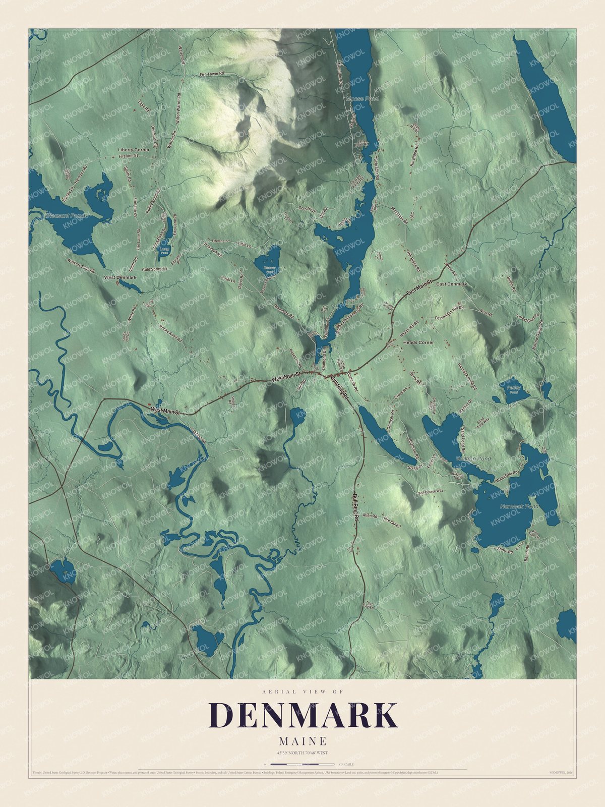
Click to explore a larger preview. The digital watermark does not appear on printed maps.
See it on a wall
The Denmark map as a framed print. Swipe for more.


Born in Denmark
Several people born here made their names far from Oxford County. Rufus Ingalls was born in the village of Denmark in 1818, the son of Cyrus Ingalls, a mill owner who took part in Maine’s constitutional convention of 1819. Rufus graduated from West Point in the class of 1843 with his friend Ulysses S. Grant, ran supply for the Union armies around Petersburg and Richmond, and in 1882 became the 16th Quartermaster General of the United States Army.
Hazen S. Pingree was born in Denmark in 1840. He went to work in a Saco cotton factory at fourteen, served in the Union Army, and later built a shoe company in Detroit. As mayor of Detroit from 1889 to 1897 he fought the city’s utility monopolies and, during the depression of 1893, opened vacant lots to the poor for growing food, his “potato patch plan.” He then served as the 24th governor of Michigan. Nathaniel Cobb Deering, born here in 1827, served three terms in Congress from Iowa, and James W. Milliken, born in Denmark and raised in Saco, became a Michigan state senator.
Corners and ponds
Moose Pond is labeled on the map, along with Hancock Pond, Pleasant Pond and Walden Pond. Liberty Corner, East Denmark, Heads Corner and West Denmark are printed on the map too. East Main Street, West Main Street, Bull Ring Road, Schrader Road, Harvey Lane and Harnden Road carry their names, and the smaller roads between the ponds are drawn in as well.
This Denmark map makes a fine addition to an office, library or den, and it can help teach children the geography and history of the area. It’s made for everyone who calls Denmark home, from Moose Pond to West Denmark, as it looks today. Zoom in on the preview above to explore the details, then click here to get your copy of the Denmark, Maine map.

Sources