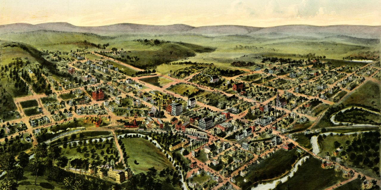
This map of Oakland, Maryland was first published by Thaddeus Mortimer Fowler in 1906. T.M. Fowler (1842 – 1922) was an American cartographer who spent much of his life creating beautiful hand drawn maps of American towns.
To create this map of Oakland, Fowler walked the streets of the town, sketching buildings, trees, and other features to present a complete and accurate rendering of the town. Fowler’s map of Oakland, MD shows the town at a time when only 1600 people lived there.
Click here to see the map of Oakland, MD in 1906.
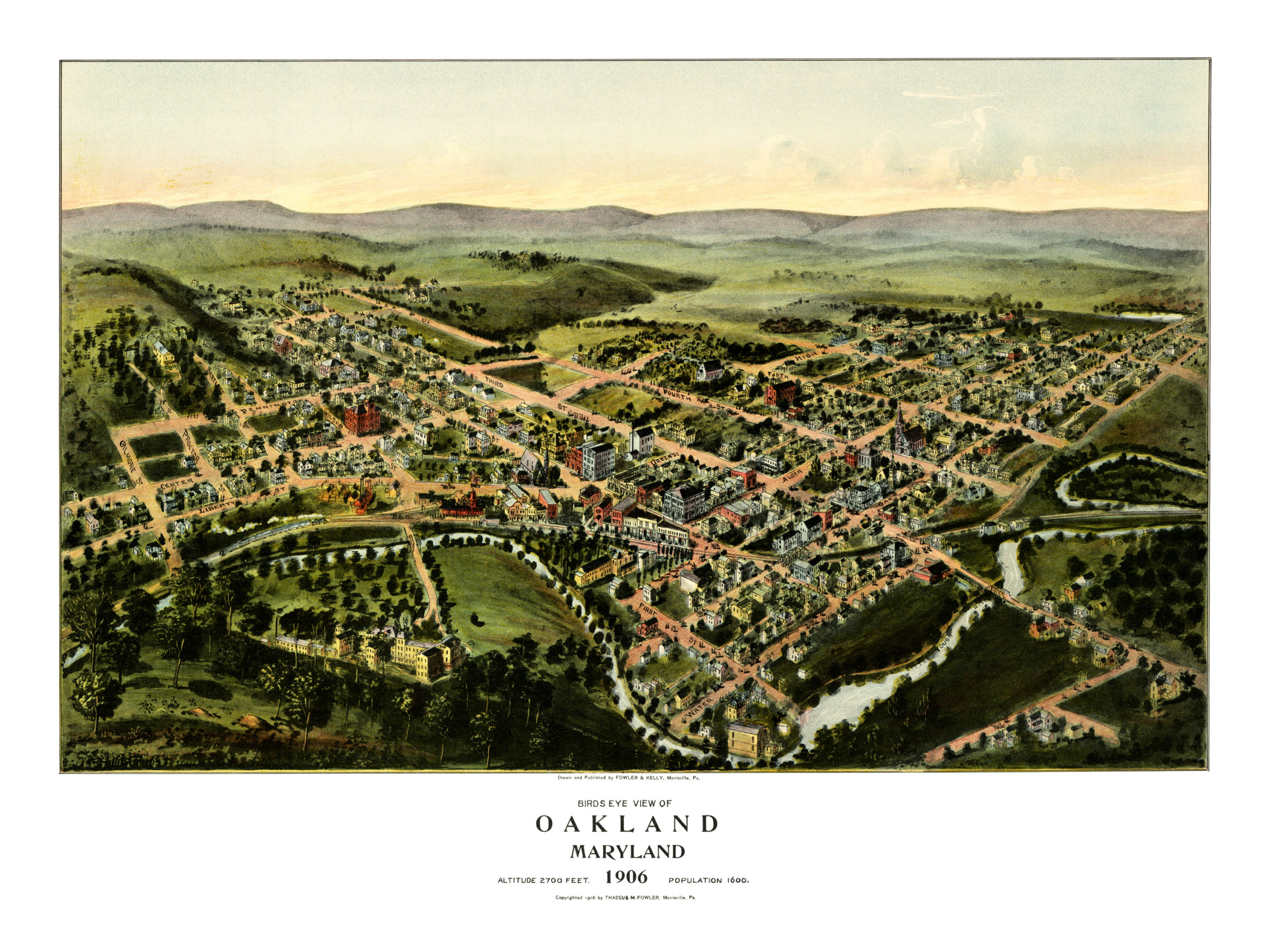
This map of Oakland, MD has been lovingly restored by the team at KNOWOL. Reproductions of the restored map are available on museum quality, archival paper to ensure that this piece of Oakland history can be passed on to the next generation. Click here to get yours.