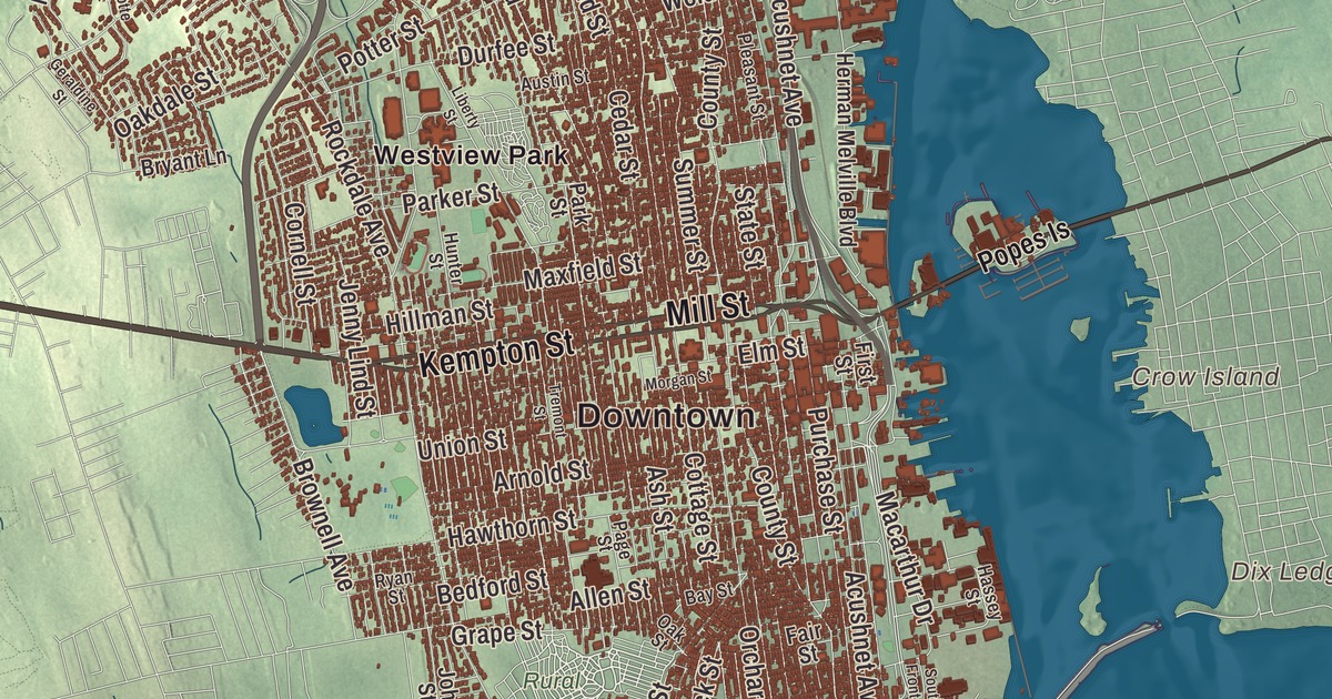
New Bedford runs long and narrow up the west bank of the Acushnet River. This map takes in the whole length of it, with Acushnet Avenue, Ashley Boulevard, Kempton Street, Mill Street, Tarkiln Hill Road and Brownell Avenue carrying printed names. Inland Park, Turner Pond, Hamlins Pond and the Acushnet River Reservoir are printed on it, and so is Crow Island out in the harbor. Click here to purchase a print of this map for your wall.
New Bedford is in Bristol County.
KNOWOL made this map in 2026 from public survey data and gave it the look of an old atlas. The land comes from United States Geological Survey elevation data, and the streets and the city line come from the Census Bureau. From its northern line at Freetown to Clark’s Point on Buzzards Bay the city stretches about 14 miles, but it’s only about 2 miles across. Dartmouth lies to the west and Acushnet and Fairhaven to the east, across the river, which widens into New Bedford Harbor before it reaches the bay. The city covers 20.0 square miles of land and had 101,079 people at the 2020 census.
Bedford Village
The Wampanoag lived along the Acushnet River long before the English came. In 1652 the colonists bought Old Dartmouth, 115,000 acres that now make up Dartmouth, Acushnet, New Bedford, Fairhaven and Westport, from Ousamequin, also called Massasoit, and his son Wamsutta, a sale the Wampanoag have disputed because owning land outright was a foreign idea to them. Quakers were a majority of Old Dartmouth’s settlers by 1691. The City of New Bedford’s recorded history, in the Secretary of the Commonwealth’s list, dates European settlement to 1640. A riverside part of Old Dartmouth called Bedford Village was incorporated as a town in 1787 as New Bedford, a name suggested by the Russell family; the Dukes of Bedford were Russells too, and a Bedford, Massachusetts already existed. New Bedford was incorporated as a city in 1847, with Abraham Hathaway Howland as its first mayor.
The whaling city
In the 1760s some of Nantucket’s leading whaling families moved here, and after the Revolution New Bedford, with its deeper harbor on the mainland, took Nantucket’s place as the nation’s leading whaling port. Ships with tryworks on board could stay at sea for up to four years, rendering oil as they went. The city grew from about 4,000 people in 1820 to about 24,000 in 1860, and in 1857, when its harbor held 329 vessels worth over $12 million, New Bedford became the richest city per capita in North America. Herman Melville worked out of New Bedford as a whaler and opened Moby-Dick here, with a scene in the Seamen’s Bethel, the sailors’ chapel finished in 1832 on Johnny Cake Hill that still stands. Since 1996 the Bethel, the Whaling Museum and the historic district around them have made up the New Bedford Whaling National Historical Park, 34 acres spread over 13 city blocks.
New Bedford was also a center of abolitionism and a stop on the Underground Railroad. Frederick Douglass and his wife Anna Murray Douglass settled here in 1838 after his escape from slavery; their host, Nathan Johnson, suggested the name Douglass, and he worked on the wharves for three years. Lewis Temple, born into slavery in Richmond, Virginia, came to New Bedford in the 1820s as a blacksmith and made “Temple’s Toggle,” a harpoon tip that kept a whale from pulling free; he never patented it. As whaling faded after 1859, cotton mills took its place, and the Wamsutta Mills remained the world’s largest weaving plant until 1892. Families from Portugal, the Azores, Madeira and Cape Verde came for work in whaling, and in 1915 four immigrants from Madeira began the Feast of the Blessed Sacrament, held each August at Madeira Field and recognized, its page says, as the largest festival of Portuguese culture in the world. As of 2019, New Bedford Harbor’s catch had the highest annual value of any fishing port in the United States.
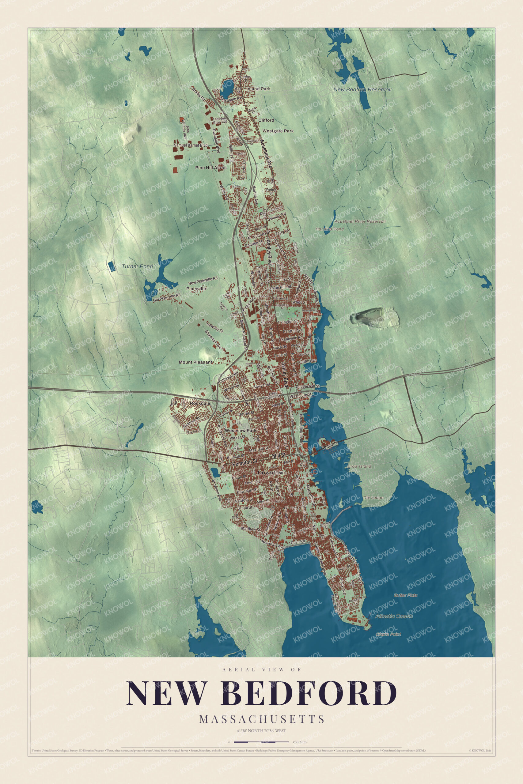
Click to explore a larger preview. The digital watermark does not appear on printed maps.
Names on this map
These names are printed on this map.
Places: Downtown, Inland Park, Butler Flats, Clarks Point, Crow Island, Dix Ledge, Acushnet River Reservoir, Hamlins Pond, Turner Pond, New Bedford Reservoir, Atlantic Ocean, Rural Cemetery, Clifford, Mount Pleasant, Pine Hill Acres, Plainville, Rockdale, Westgate Park and Westview Park.
Streets and roads: Acushnet Avenue, Ashley Boulevard, Kempton Street, Mill Street, Tarkiln Hill Road, Brownell Avenue, Kings Highway, Mount Pleasant Street, Cottage Street, Shawmut Avenue, Rockdale Avenue, County Street.
More street names, A to Z
Airport Road, Allen Street, Arnold Street, Ash Street, Austin Street, Aviation Way, Bartlett Street, Bay Street, Bedford Street, Belair Street, Belleville Avenue, Belleville Road, Beverly Street, Bolton Street, Braley Road, Briarwood Drive, Brock Avenue, Brooklawn Street, Brook Street, Bryant Lane, Butler Street, Cedar Grove Street, Cedar Street, Central Avenue, Chaffee Street, Charlotte Street, Church Street, Cleveland Street, Coffin Avenue, Coggeshall Street, Conduit Street, Cornell Street, Cove Road, Cove Street, Crapo Street, Dartmouth Street, Davis Street, Division Street, Doreen Street, Downey Street, Duchaine Boulevard, Durfee Street, Earle Street, Easton Street, East Rodney French Boulevard, Ellen Street, Elm Street, Erin Court, Essex Street, Fair Street, First Street, Forbes Street, Geraldine Street, Gifford Street, Grape Street, Hassey Street, Hathaway Road, Hawthorn Street, Hemlock Street, Heritage Drive, Herman Melville Boulevard, Hersom Street, Highland Street, Hillman Street, Howard Avenue, Hunter Street, Irvington Street, Ivy Road, Jarry Street, Jenkins Street, Jenny Lind Street, John Street, John Vertente Boulevard, Jones Street, King Street, Lafayette Street, Lambeth Street, Lang Street, Lark Street, Lauren Drive, Liberty Street, Lowell Street, Lucas Street, Macarthur Drive, Matthew Street, Maxfield Street, May Street, Mill Road, Mina Street, Morgan Street, Morris Street, Morton Avenue, Myrtle Street, Nash Road, Nauset Street, Nellie Road, New Plainville Road, North Front Street, Oakdale Street, Oakley Street, Oak Street, Old Plainville Road, Orchard Street, Otis Street, Page Street, Park Avenue, Parker Street, Park Street, Phillips Road, Pine Grove Street, Pine Hill Drive, Pleasant Street, Popes Is, Portland Street, Potter Street, Prescott Street, Purchase Street, River Road, Rodney French Boulevard, Rosa Drive, Ryan Street, Samuel Barnet Boulevard, Sassaquin Avenue, Sawyer Street, Sharon Street, South Front Street, State Street, Summer Street, Tarkiln Place, Terry Lane, Theodore Rice Boulevard, Tremont Street, Union Street, Victoria Street, Washburn Street, Webster Court, Welby Road, Weld Street, West Rodney French Boulevard, Wilson Street, Winston Street, Wood Street, Worcester Street, Yale Street.
Around the map
Start with Inland Park, then follow Acushnet Avenue, Ashley Boulevard, Kempton Street, Mill Street, Tarkiln Hill Road and Brownell Avenue across the city. Then look outward toward Clifford, Mount Pleasant, Pine Hill Acres, Plainville and Rockdale. Crow Island, the Acushnet River Reservoir, Hamlins Pond and Turner Pond are all labeled on the map, and every one of those names is printed directly on the artwork, along with Tarkiln Hill and Pine Hill. Kempton Street and Brownell Avenue make two sides of Buttonwood Park, the 97-acre park Charles Eliot planned in the 1890s, with streets of Craftsman and Colonial Revival houses around it; its Buttonwood Park Zoo opened in 1894 and is the third-oldest zoo in New England. Crow Island, out in the harbor, belongs to Fairhaven.
The New Bedford map makes a fine addition to an office, library or den, and it can help teach children the geography and history of the old whaling city on the Acushnet. It’s made for people who call New Bedford home, from the Freetown line to Clark’s Point, and it shows the city as it looks today. Zoom in on the preview above to explore the details, then click here to get your copy of the New Bedford, Massachusetts map.

We made a map for every town and city in Massachusetts. Explore the complete Massachusetts map collection and find your town.
Sources
- New Bedford, Massachusetts, Wikipedia
- Seamen’s Bethel, Wikipedia
- New Bedford Whaling National Historical Park, Wikipedia
- Frederick Douglass, Wikipedia
- Lewis Temple (inventor), Wikipedia
- Feast of the Blessed Sacrament, Wikipedia
- Buttonwood Park Historic District, Wikipedia
- Buttonwood Park Zoo, Wikipedia
- Crow Island (Massachusetts), Wikipedia
- City and Town Incorporation and Settlement Dates, Secretary of the Commonwealth of Massachusetts (archived copy)