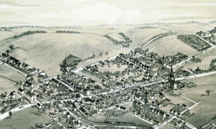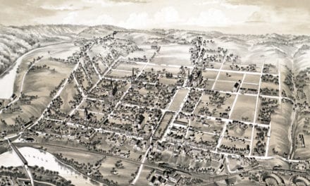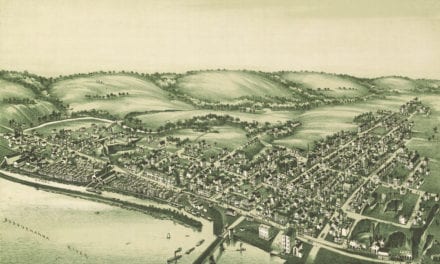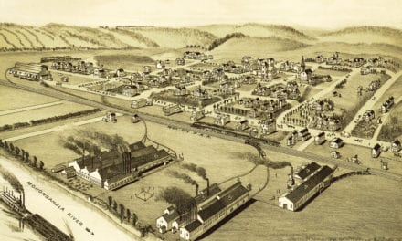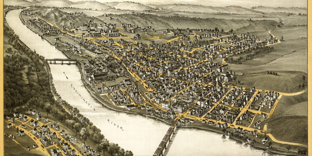
This map of Apollo, Pennsylvania was first published by Thaddeus Mortimer Fowler in 1893. Fowler (1842 – 1922) was an American cartographer from Morrisville, PA who spent much of his life creating beautiful hand drawn maps of American towns.
This map shows a bird’s eye view of Apollo, PA as it looked toward the end of the 19th century. Notable landmarks on the map include the Apollo Iron & Steel Company, Superior Roller Mills, Apollo Water Company, the Chambers House and Apollo Public Schools.
Click here to see Apollo, Pennsylvania in 1893.
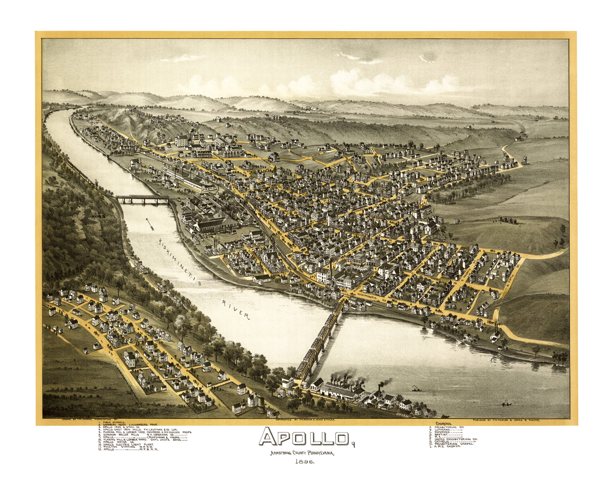
This map of Apollo, PA has been lovingly restored by the team at KNOWOL. Reproductions of the restored map are available on museum quality, archival paper to ensure that this piece of Apollo history can be passed on to the next generation. Click here for yours.