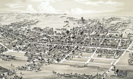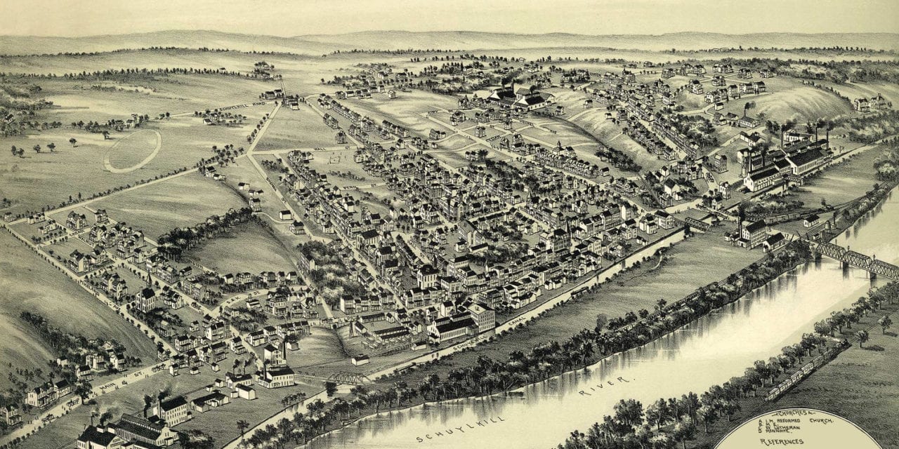
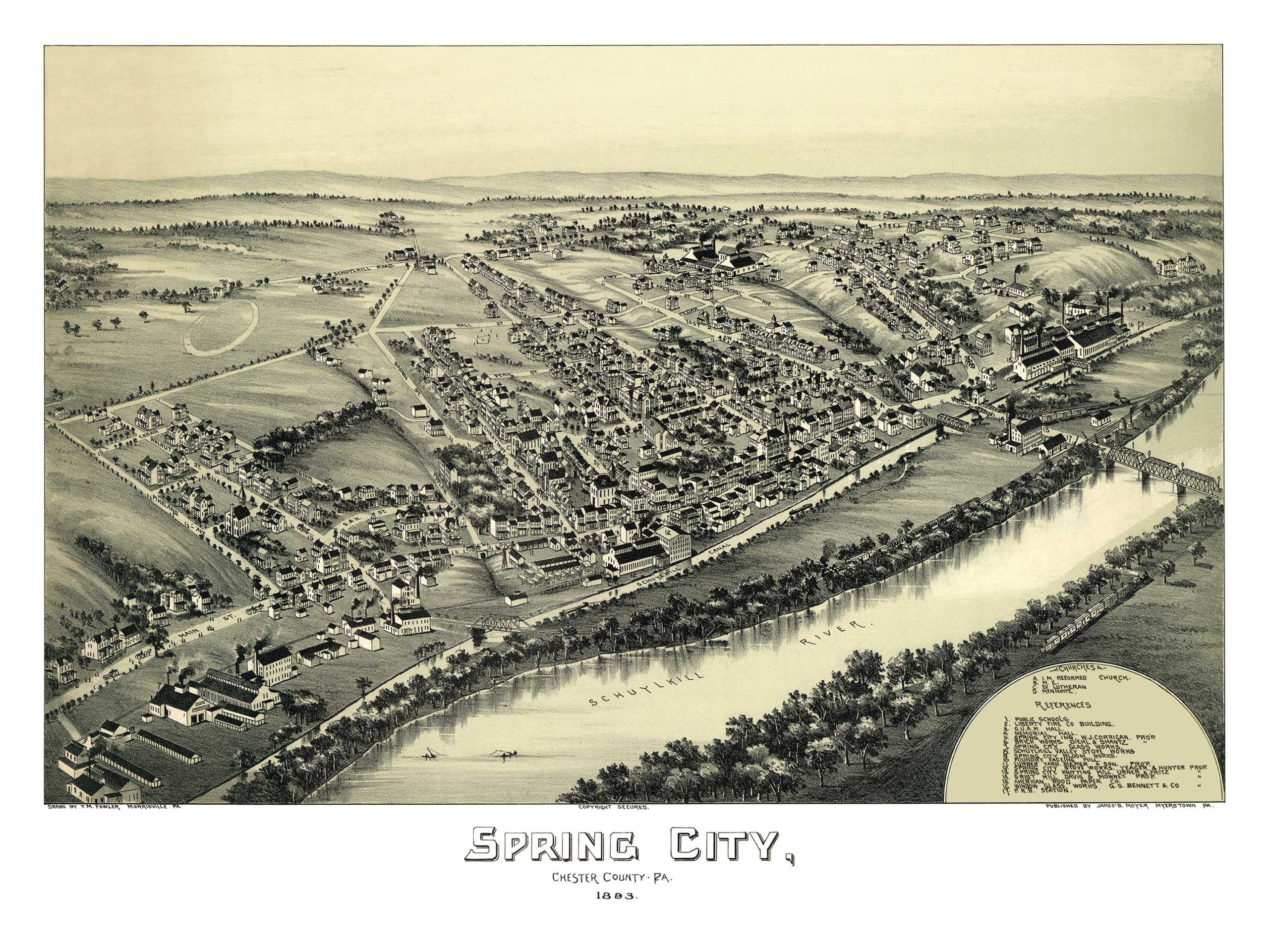
This map of Spring City, Pennsylvania was created in 1893 by T.M. Fowler, a prominent 19th century map maker. The map shows a beautifully detailed bird’s eye view of Spring City, including street names and old landmarks.
Landmarks on the map include Memorial Hall, Liberty Fire Company, Diehl & Shantz Brick Works, Spring City Bloom Works, Schuykill Valley Stove Works, Spring City Knitting Mill, and the Pennsylvania Railroad Station.
This historic map of Spring City has been restored by KNOWOL. Reproductions of the map are available here.
Bird’s Eye View of Spring City, PA in 1893
 This map of Spring City will make an attractive addition to your office, library, or den, and can even be used to teach children the geography and history of the area. When you’re done exploring, click here to get your copy.