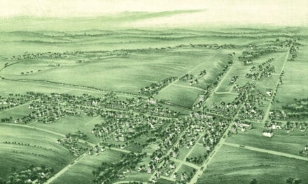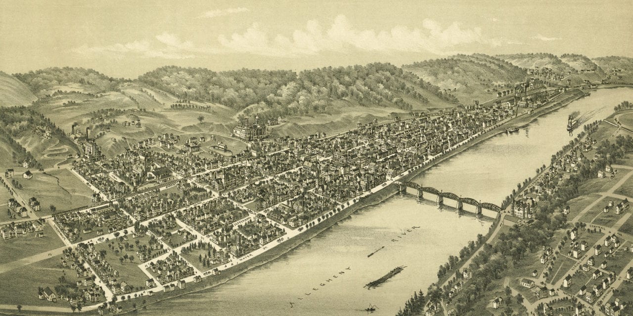
This old map of Kittanning, Pennsylvania was published in 1896 by Thaddeus Mortimer Fowler and James B. Moyer. T.M. Fowler was one of the most prolific map publishers of the 19th century and spent a majority of his life publishing beautiful hand drawn maps of American towns. Moyer was an artist who frequently collaborated with Fowler.
The map shows a bird’s eye view of Kittanning, PA as it looked at the end of the 19th century. Landmarks on the map include Linnon’s Hotel, Kittanning Opera House, The Alexander Hotel, Elk Brewing Company, Daugherty Visible Type Write Company, the Electric Light Plant and more.
Click here to see Kittanning, PA in 1896.
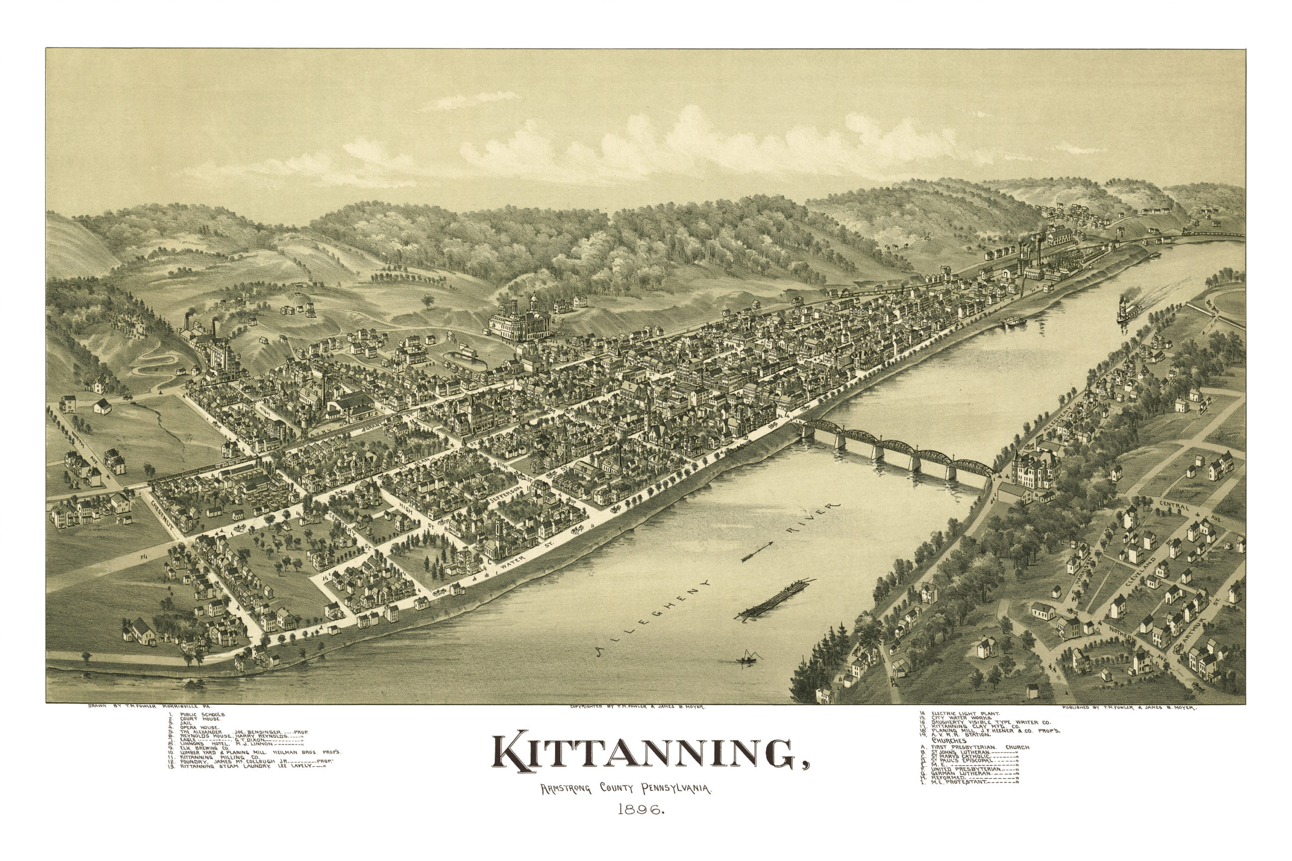
This old map of Kittanning has been lovingly restored by the team at KNOWOL. Reproductions of the restored map are available on museum quality, archival paper to ensure that this piece of Kittanning history can be passed on to the next generation. Click here to get a copy of the map.