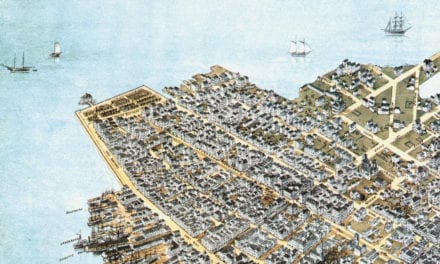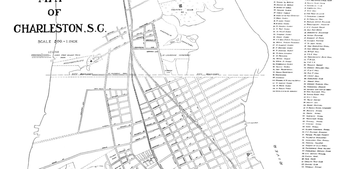
This historic map of Charleston, South Carolina was created in 1912, and shows a detailed view of the area as it used to be. The map was created by Walker, Evans & Cogswell, publishers from Charleston.
Landmarks on the map include Hibernian Hall, Charleston Library, Revolutionary Magazine, U.S. Customs House, Merchant’s Exchange, Cotton Exchange, Academy of Music, St. John Hotel, Irish Volunteer Hall, College of Charleston, Carolina Yacht Club, a wide variety of churches, and more.
This historic map of Charleston has been restored by KNOWOL. Reproductions of the restored map are available here.
Historic Old Map of Charleston, South Carolina from 1912
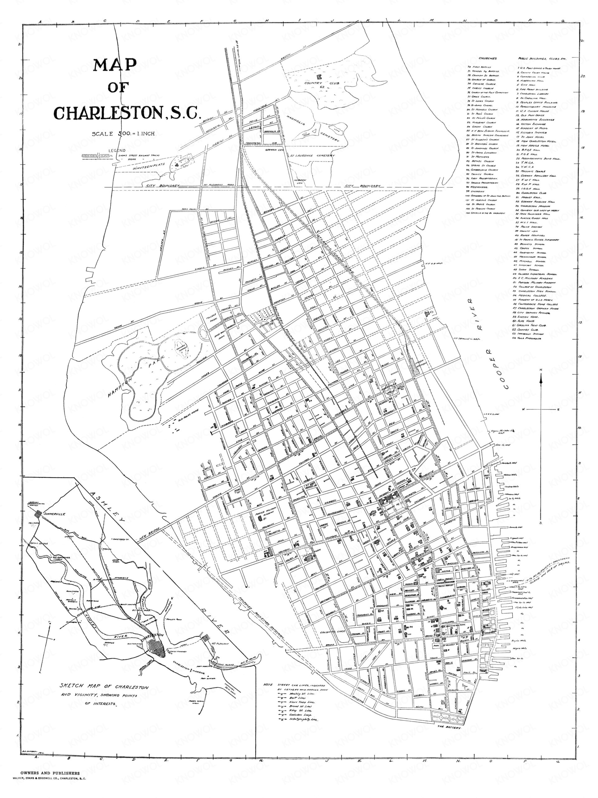
This vintage map of Charleston makes an attractive addition to your office, library, or den, and can even be used to teach children the geography and history of the area. When you’re done exploring, click here to get your copy of the restored map.