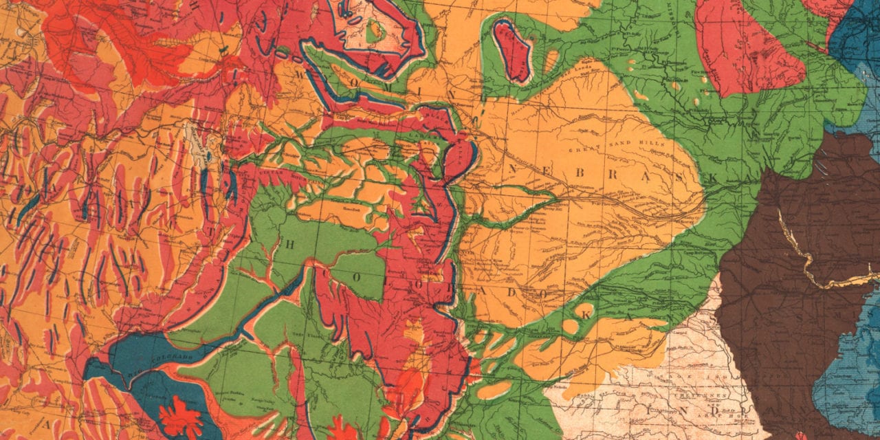
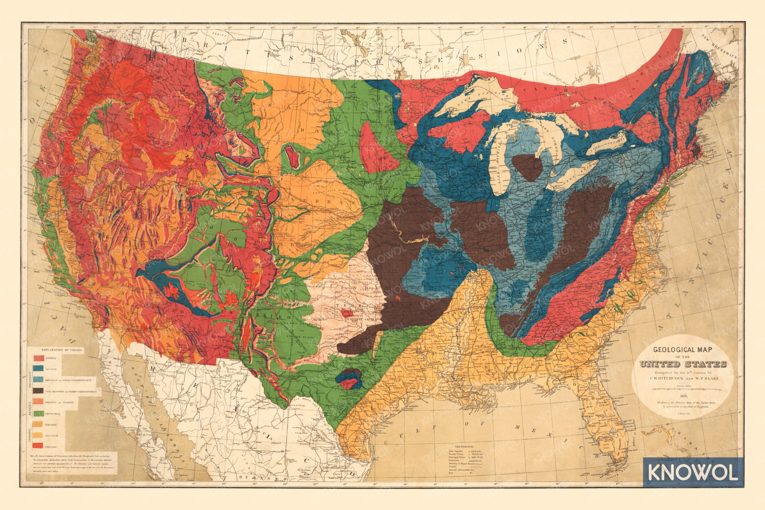
This historic geological map of the United States was created in 1872 by C.H. Hitchcock and W.P. Blake. The colors on the map represent Eozoic, Silurian, Devonian and Lower Carboniferous, Coal, Measures and Permo-Carboniferous, Triassic and Jurassic, Cretaceous, Tertiary, Alluvium, and Volcanic formations.
The base map was created using the official military map of the United States created by the Chief of Engineers. The map shows State Capitals, County Towns, Principal Cities, Railroad, Military & Wagon Roads, Canals, Forts, and more.
This historic geological map has been restored by KNOWOL. Reproductions of the restored map are available here.
Historic United States Geological Map, 1872
This vintage geological map makes an attractive addition to your office, library, or den, and can even be used to teach children the geography and history of the area. When you’re done exploring, click here to get your copy of the restored map.