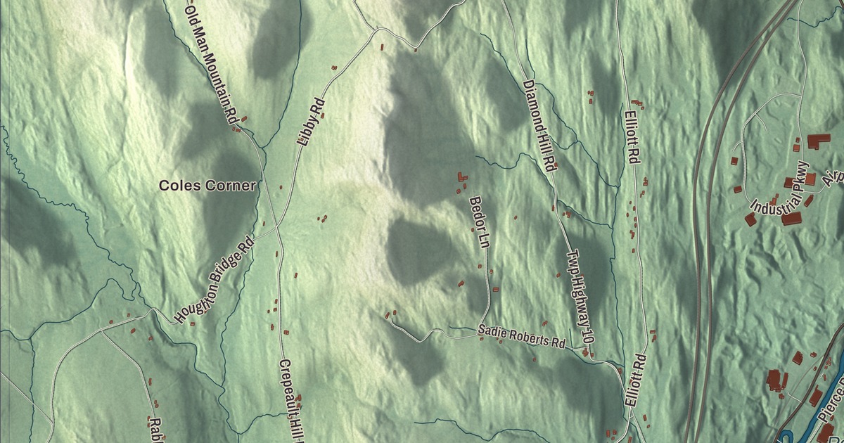
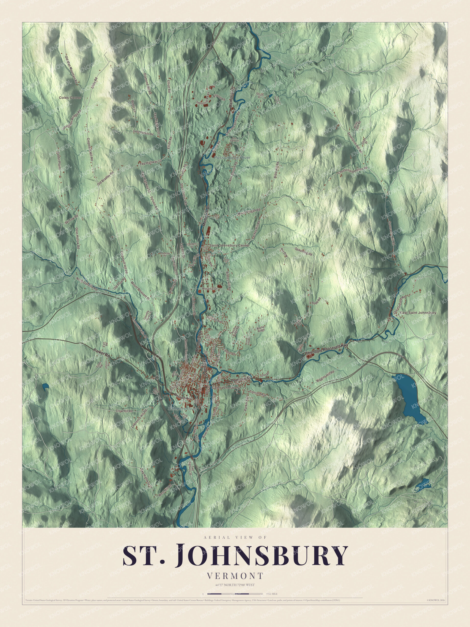
St. Johnsbury, “St. J” to the people who live here, sits where the Moose and Sleepers rivers meet the Passumpsic, and it’s the largest town by population in Vermont’s Northeast Kingdom. This map prints Coles Corner, East Saint Johnsbury, Saint Johnsbury and Saint Johnsbury Center, with Railroad Street, Portland Street, Memorial Drive and the Theodore Roosevelt Highway.
St. Johnsbury is a town in Caledonia County, Vermont.
KNOWOL made this map in 2026 from public survey data and gave it the look of an old county atlas, shading the hills from United States Geological Survey elevation data and drawing the roads and town line from the Census Bureau. The town covers 36.8 square miles, and 7,364 people lived here at the 2020 census. Click here to purchase a print of this map for your wall.
Bessborough, Dunmore, St. Johnsbury
The land was first granted in 1760 among the New Hampshire Grants as Bessborough. Vermont granted it again on October 27, 1786, as Dunmore, and settlers came that same year. Among them was Jonathan Arnold, a physician who had served as an army surgeon in the Revolution and as a Rhode Island delegate to Congress, and who wrote Rhode Island’s act of May 1776 breaking its allegiance to Britain. He moved here in 1787 and, with six other families, built homes at what’s now the town center. By 1790 the village had 143 people, and at the first town meeting, held that year in Arnold’s home, the town took the name St. Johnsbury. Local lore says Ethan Allen proposed naming it St. John for his friend Jean de Crèvecœur, the French-born writer known in America as J. Hector St. John, and that Crèvecœur suggested St. Johnsbury instead, to keep it apart from Saint John, New Brunswick. The town organized on June 21, 1790, and Joel Roberts first represented it in the legislature in 1791.
The Fairbanks town
Thaddeus Fairbanks made carriages in a shop above his father’s mills on the Sleepers River, then opened an iron foundry with his brother Erastus. In 1830 he invented the platform scale here, and his scales, which could weigh large loads accurately, sold around the world. When the railroad from Boston to Montreal arrived in the 1850s, St. Johnsbury grew quickly, and in 1856 it replaced Danville as the shire town of Caledonia County. In the 1940s three companies here were each the largest of their kind in the world: Fairbanks Scales, a maple sugar candy maker and a maker of candlepins for bowling. Maple Grove Farms, founded by Katharine Ide Gray in 1915, is today the largest packer of pure maple syrup in the United States.
The Fairbanks family gave the town its great buildings. Erastus, Thaddeus and Joseph Fairbanks founded St. Johnsbury Academy in 1842. St. Johnsbury runs no public high school, and most of its high school students attend the Academy at the town’s expense. Horace Fairbanks funded the St. Johnsbury Athenaeum, a library that opened with 8,000 books, and in 1873 he added an art gallery of black walnut lit by an arched skylight, where Albert Bierstadt’s ten-by-fifteen-foot Domes of Yosemite hangs among Hudson River School paintings. It’s the only National Historic Landmark in the Northeast Kingdom. Franklin Fairbanks’s Fairbanks Museum and Planetarium, a red sandstone Richardsonian Romanesque building, opened in 1891, and its weather station has kept records at the same spot since 1893 and broadcasts the Eye on the Sky forecast.
Click to explore a larger preview. The digital watermark does not appear on printed maps.
Names on this map
These names are printed on this map.
Places: Coles Corner, East Saint Johnsbury, Saint Johnsbury, Saint Johnsbury Center, Passumpsic River and Sleepers River.
Streets and roads: Railroad Street, Theodore Roosevelt Highway, Memorial Drive, Portland Street, Parker Road, Crepeault Hill Road, Mount Pleasant Street, Elliott Road, Libby Road, Twp Highway 12, Pleasant Street, Old Bradley Road.
More street names, A to Z
Airport Road, Bay Street, Bedor Lane, Bible Hill Road, Breezy Hill Road, Central Street, Chesterfield Hollow Road, Cliff Street, Coffin Road, Concord Avenue, Costa Avenue, Country View Lane, Cross Avenue, Crow Hill Road, Deer Avenue, Deer Creek Lane, Depot Hill Road, Diamond Hill Road, Dillon Drive, Elm Street, Emerson Falls Road, Farmer Drive, Farr Road, Fenoff Circle, Field and Stream Road, Fifth Avenue, Flanders Drive, Fourth Street, Gilman Avenue, Goss Hollow Road, Hastings Street, Higgins Hill Road, High Street, Hillside Avenue, Hospital Drive, Houghton Bridge Road, Industrial Parkway, Johnson Road, Lackey Hill Road, Lapierre Drive, Lawrence Hill Road, Lower Ridge Road, Main Street, Mallory Road, Mooney Road, Moose River Drive, Mount Pisgah Road, New Boston Road, North Danville Road, Oak Street, Olcutt Drive, Old Center Road, Old Concord Road, Old Man Mountain Road, Old Prue Road, Parker Avenue, Parks Road, Pearl Street, Pierce Road, Pine Drive, Pine Street, Rabbit Plains, River Road, Rocky Ridge, Rocky Ridge Road, Rodd Road, Sadie Roberts Road, Saint John Street, Sanger Circle, Severance Hill Road, Ski Tow Road, Snell Road, Spaulding Road, Stark District Road, Sugar House Road, Summer Street, Sunset Drive, Sylvain Road, Tilton Road, Twp Highway 10, Twp Highway 27, Twp Highway 36, Twp Highway 37, Twp Highway 52, Western Avenue, West Hill Road, Willey Farm Road, Zarbarsky Road.
See it on a wall
The St. Johnsbury map as a framed print. Swipe for more.


Around the map
Railroad Street was the busy heart of town late in the 1800s, when lines from Boston to Montreal and across northern Vermont met at the brick union depot of 1883. After fires in 1892 and 1896, new brick blocks went up on Railroad Street north of Eastern Avenue, and with the depot they make up the Railroad Street Historic District. On Portland Street, which is U.S. Route 2, a carriage painter built the Morency Paint Shop and Apartment Building in 1890. The town has 13 other places on the National Register of Historic Places, the most in Caledonia County. The first air flight in Vermont took place at the St. Johnsbury fair on April 19, 1910, and The Caledonian-Record has been published here since 1837. In 1995 the folk artist Stephen Huneck bought a mountaintop farm in St. Johnsbury, named it Dog Mountain and built the Dog Chapel there, filled with his carvings.
On the map, start with Coles Corner and East Saint Johnsbury, then follow Railroad Street, Theodore Roosevelt Highway, Memorial Drive, Portland Street, Parker Road and Crepeault Hill Road across town. Then look outward toward Saint Johnsbury and Saint Johnsbury Center. The Passumpsic River and Sleepers River are printed too. St. Johnsbury dates to 1786.
This map of St. Johnsbury is made for everyone who calls St. Johnsbury home, and it shows the town as it looks today, from Railroad Street and Portland Street to the Passumpsic River and Saint Johnsbury Center. Hang it in an office, library or den, or use it to teach children the geography and history of their town. It’s printed on museum quality archival paper. Zoom in on the preview above to explore the details, then click here to get your copy of the St. Johnsbury, Vermont map.

Sources
- St. Johnsbury, Vermont, Wikipedia
- Town histories and representatives, S towns, Vermont Legislature
- Jonathan Arnold, Wikipedia
- Thaddeus Fairbanks, Wikipedia
- St. Johnsbury Academy, Wikipedia
- St. Johnsbury Athenaeum, Wikipedia
- Fairbanks Museum and Planetarium, Wikipedia
- Railroad Street Historic District, Wikipedia
- Morency Paint Shop and Apartment Building, Wikipedia
- Stephen Huneck, Wikipedia