Nebraska Town Maps A to Z
All 602 town maps, from Abie to Yutan. Each one opens its own page with the whole map.
A
B
- Bancroft
- Barada
- Barneston
- Bartlett
- Bartley
- Bassett
- Battle Creek
- Bayard
- Bazile Mills
- Beacon View
- Beatrice
- Beaver City
- Beaver Crossing
- Beaver Lake
- Bee
- Beemer
- Belden
- Belgrade
- Bellevue
- Bellwood
- Belmar
- Belvidere
- Benedict
- Benkelman
- Bennet
- Bennington
- Benson
- Berea
- Bertrand
- Berwyn
- Bethany
- Big Springs
- Bladen
- Blair
- Bloomfield
- Bloomington
- Blue Hill
- Blue Springs
- Boelus
- Bow Valley
- Boys Town
- Bradshaw
- Brady
- Brainard
- Brewster
- Bridgeport
- Bristow
- Broadwater
- Brock
- Broken Bow
- Brownlee
- Brownville
- Brule
- Bruning
- Bruno
- Brunswick
- Buccaneer Bay
- Burchard
- Burr
- Burton
- Burwell
- Bushnell
- Butte
- Byron
C
- Cairo
- Callaway
- Cambridge
- Campbell
- Carleton
- Carroll
- Cedar Bluffs
- Cedar Creek
- Cedar Rapids
- Center
- Central City
- Ceresco
- Chadron
- Chalco
- Chambers
- Champion
- Chapman
- Chappell
- Cheney
- Chester
- Clarks
- Clarkson
- Clatonia
- Clay Center
- Clearwater
- Clinton
- Cody
- Coleridge
- College View
- Colon
- Columbus
- Comstock
- Concord
- Cook
- Cordova
- Cornlea
- Cortland
- Cotesfield
- Cowles
- Cozad
- Crab Orchard
- Craig
- Crawford
- Creighton
- Creston
- Crete
- Crofton
- Crookston
- Culbertson
- Curtis
- Cushing
D
E
F
G
H
- Hadar
- Haigler
- Hallam
- Halsey
- Hamlet
- Hampton
- Harbine
- Hardy
- Harlan County Lake
- Harrisburg
- Harrison
- Hartington
- Harvard
- Hastings
- Hay Springs
- Hayes Center
- Hazard
- Heartwell
- Hebron
- Hemingford
- Henderson
- Hendley
- Henry
- Herman
- Hershey
- Hickman
- Hildreth
- Holbrook
- Holdrege
- Holmesville
- Holstein
- Homer
- Hooper
- Hordville
- Hoskins
- Howells
- Hubbard
- Hubbell
- Humboldt
- Humphrey
- Huntley
- Hyannis
I
J
K
L
M
N
O
P
R
S
- Salem
- Santee
- Sarben
- Sargent
- Saronville
- Schuyler
- Scotia
- Scottsbluff
- Scribner
- Seneca
- Seward
- Shelby
- Shelton
- Shickley
- Sholes
- Shubert
- Sidney
- Silver Creek
- Simeon
- Smithfield
- Snyder
- South Bend
- South Sioux City
- Spalding
- Spencer
- Sprague
- Springfield
- Springview
- St. Edward
- St. Helena
- St. Libory
- St. Paul
- Stamford
- Stanton
- Staplehurst
- Stapleton
- Steele City
- Steinauer
- Stella
- Sterling
- Stockham
- Stockville
- Strang
- Stratton
- Stromsburg
- Stuart
- Sumner
- Sunol
- Superior
- Surprise
- Sutherland
- Sutton
- Swanton
- Syracuse
T
U
V
W
- Waco
- Wahoo
- Wakefield
- Wallace
- Walthill
- Walton
- Wann
- Washington
- Waterbury
- Waterloo
- Wauneta
- Wausa
- Waverly
- Wayne
- Weeping Water
- Wellfleet
- West Point
- Western
- Westerville
- Weston
- White Clay
- Whitney
- Wilber
- Wilcox
- Willow Island
- Wilsonville
- Winnebago
- Winnetoon
- Winside
- Winslow
- Wisner
- Wolbach
- Wood Lake
- Wood River
- Woodland Hills
- Woodland Park
- Wymore
- Wynot
Y
Don’t see your town? Ask us to draw it.
About Nebraska
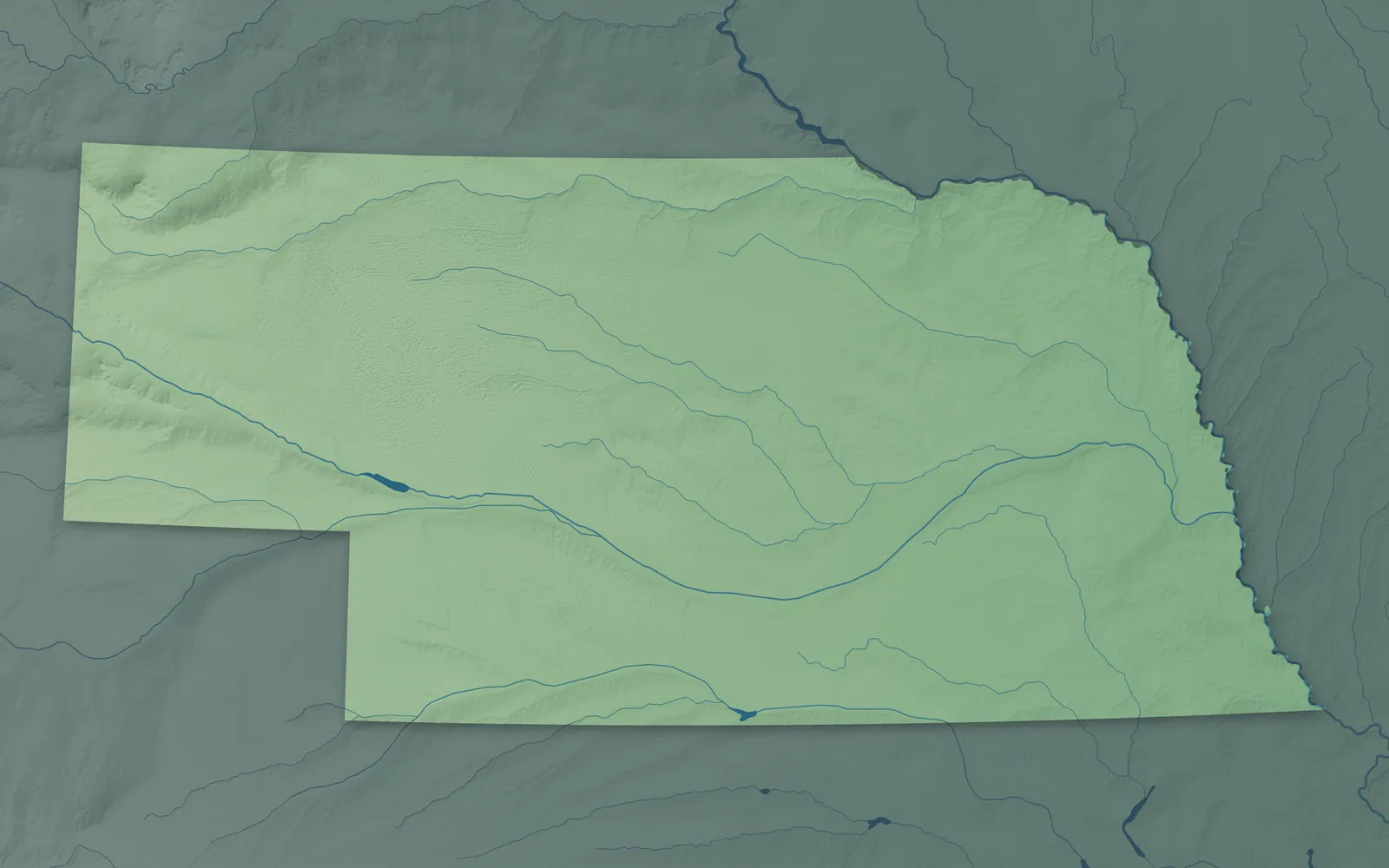
Nebraska's name comes from Otoe and Omaha words for the Platte River that mean flat water. The Platte and its forks cross the whole state, and the land climbs west from the Missouri River bluffs to the Sandhills and the buttes of the Panhandle. Nebraska is the only state that joined the Union over a president's veto, when Congress overrode Andrew Johnson in 1867.
More than half of Nebraskans live in and around Omaha and Lincoln. The oldest towns sit along the Missouri River, and many more began on the Union Pacific, which followed the Platte west after the Civil War. German is the most common family background, and towns like Wilber, Stromsburg and Dannebrog still hold Czech, Swedish and Danish festivals.
- Statehood
- March 1, 1867
- Capital
- Lincoln
- Population
- 2,018,0062025 Census estimate
- Highest point
- Panorama Point, 5,432 feet
- Lowest point
- Missouri River at the Kansas border, 840 feet
- Size
- 77,348 square miles, the 16th largest state
Omaha and Lincoln
Omaha, Bellevue and Papillion have grown together beside the Missouri River, and Lincoln lies to the southwest. In 1879, Ponca chief Standing Bear won his case in an Omaha court, where a judge ruled that an Indian is a person under the law. Lincoln was a village called Lancaster until it became the capital in 1867. Its Capitol stands 400 feet tall, topped by a statue called The Sower.


Southeast Nebraska
Beatrice, York, Crete, Nebraska City, Falls City and Fairbury are the biggest towns in this rolling farm country. In Nebraska City, J. Sterling Morton started Arbor Day, and Nebraskans planted about a million trees on the first one in 1872. West of Beatrice, Homestead National Historical Park sits on land Daniel Freeman claimed on January 1, 1863, one of the first homestead claims. The Iowa Tribe of Kansas and Nebraska and the Sac and Fox Nation of Missouri have reservation land near Falls City.


Northeast Nebraska
Norfolk, Columbus, Fremont, South Sioux City, Wayne and O'Neill are the main towns in this farm country. Norfolk is named for the North Fork of the Elkhorn River, and Nebraskans still say Norfork. O'Neill was settled mostly by Irish immigrants, and a giant shamrock is painted where its highways cross. The Omaha Tribe is based at Macy, the Winnebago Tribe at Winnebago, the Santee Sioux Nation at Santee and the Ponca Tribe of Nebraska at Niobrara.


Central Nebraska and the Platte Valley
Grand Island, Kearney, Hastings, Lexington, North Platte and Ogallala grew up along the Platte River and the railroads. Every spring, hundreds of thousands of sandhill cranes stop on the Platte between Kearney and Grand Island. Edwin Perkins invented Kool-Aid in Hastings in 1927. From 1941 to 1946, North Platte volunteers met the troop trains at the depot and served more than six million men and women in uniform.


McCook and the Republican Valley
The Republican River, named for a band of the Pawnee, runs across southern Nebraska past Benkelman, McCook and Red Cloud. Imperial, Grant, Alma and Superior are farm towns here too. Red Cloud, named for the Oglala Lakota leader, is where Willa Cather grew up, and buildings she wrote about in her novels still stand there. Senator George Norris, who championed Nebraska's one-house legislature, made his home in McCook.


The Sandhills
The Sandhills are grass-covered sand dunes that spread over about a quarter of Nebraska, with shallow lakes in the valleys between them. Valentine, Ainsworth, Mullen, Broken Bow, Burwell and Ord are ranch and farm towns here. Near Valentine, canoeists float the Niobrara, which Congress made a National Scenic River in 1991. Near Halsey, the Nebraska National Forest was set aside in 1902 and planted by hand, and it's still the largest hand-planted forest in the country.


The Panhandle and the Pine Ridge
Scottsbluff, Gering, Sidney, Alliance, Chadron and Kimball are the main towns of the Panhandle. Pioneers on the Oregon Trail wrote about Chimney Rock, near Bayard, more than any other landmark. Jim Reinders built Carhenge near Alliance in 1987, copying Stonehenge with old cars painted gray. Pine-covered buttes rise along the Pine Ridge near Chadron and Crawford, and Fort Robinson, outside Crawford, trained Army dogs in World War II.


- 12 × 18 inPrint $39.99Framed $89.99
- 18 × 24 inPrint $49.99Framed $129.99
- 24 × 36 inPrint $89.99Framed $199.99

Sizes and Prices
Every map comes in three sizes on archival matte paper. Framed prints come in black or white wood.
How each map is made
It starts with the real place
Streets, buildings, terrain and water form the map, drawn the way Nebraska looks today.
Then the details
Local research and an old atlas style give each town its character.
Then it's yours
Look around the map, then pick a print to keep or give.