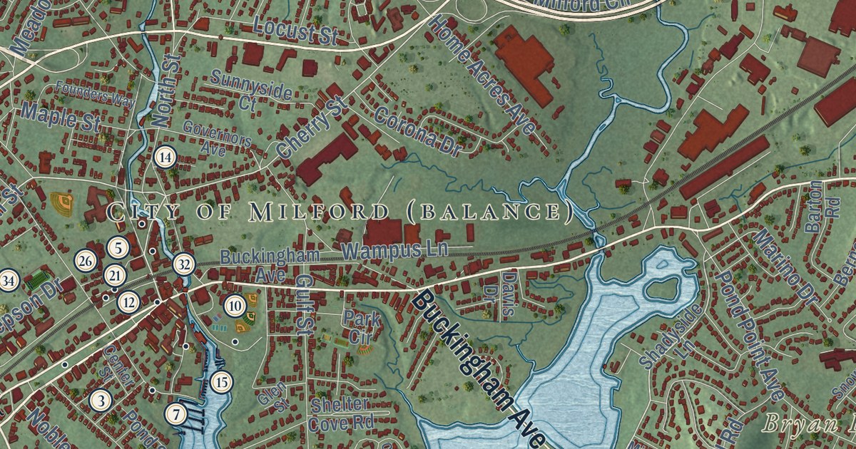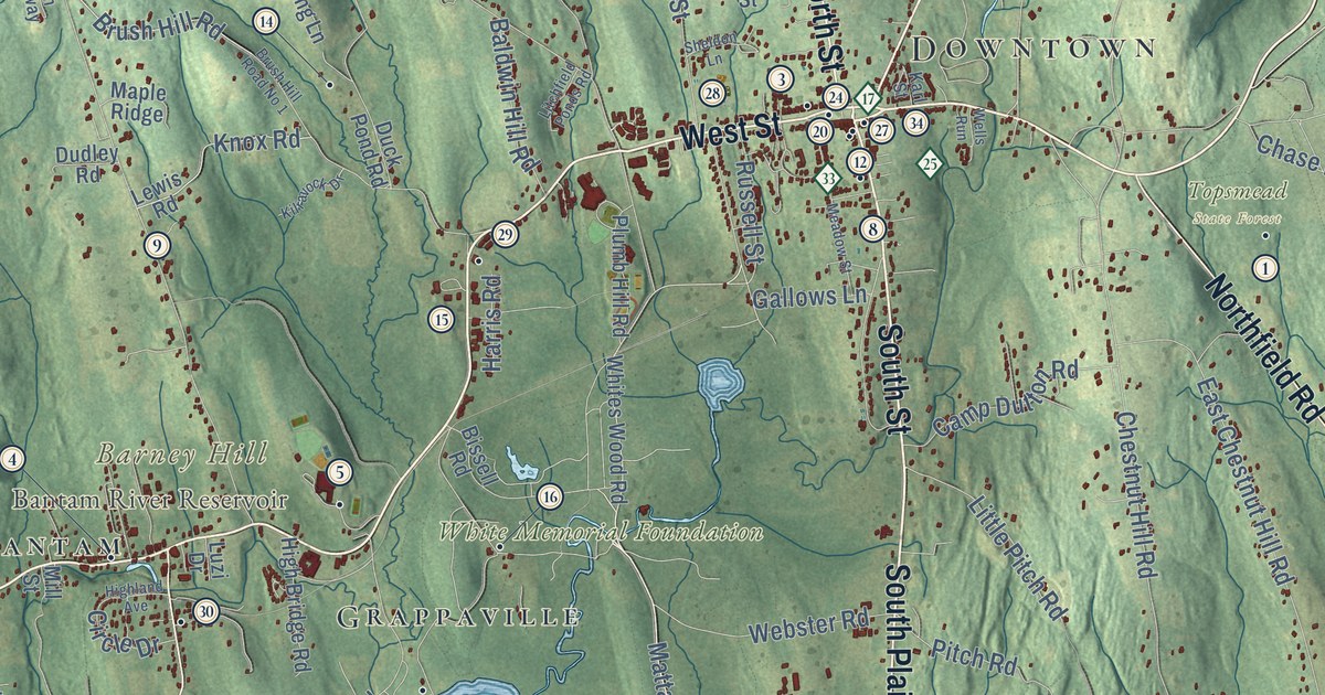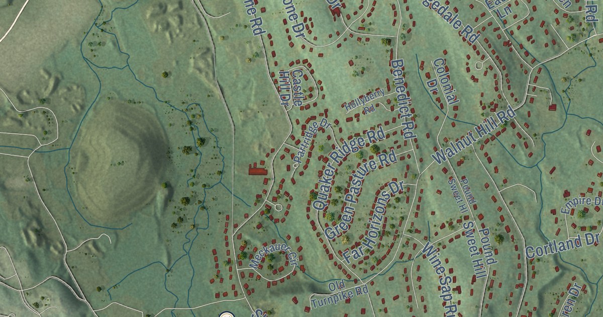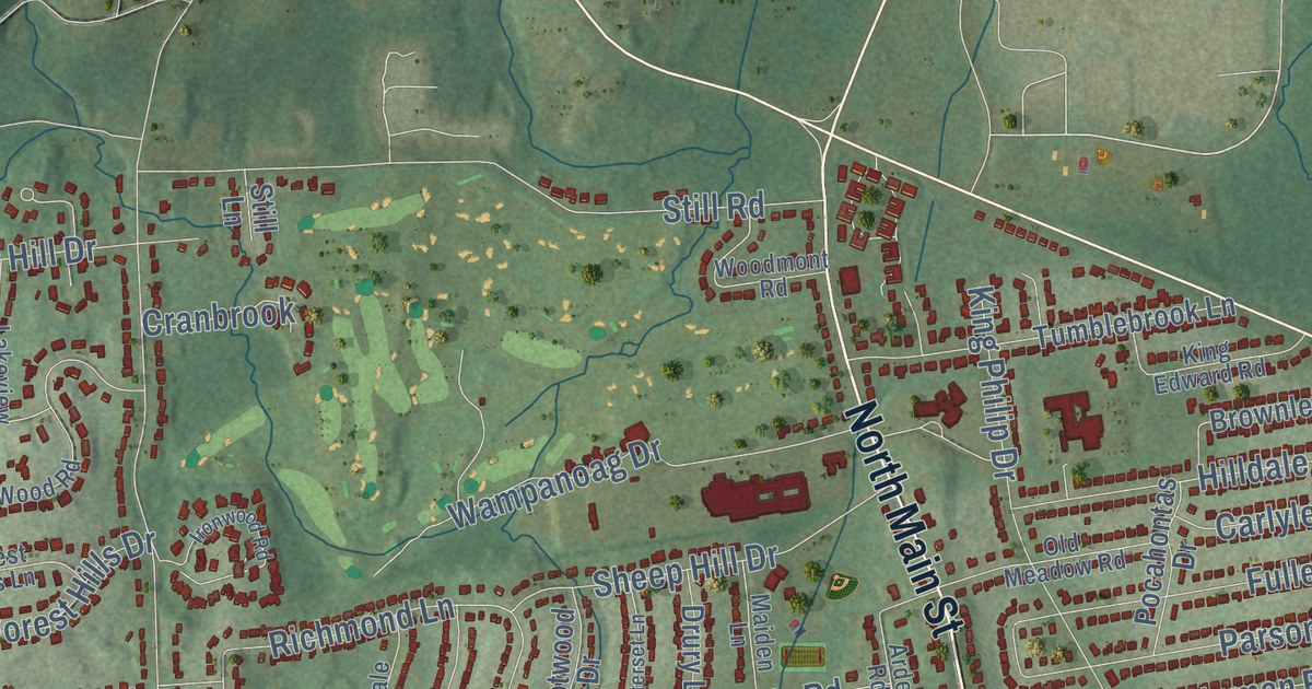
This beautifully detailed map of West Hartford, Connecticut was created in 2026 using aerial imagery combined with modern topographical, census, street and landmark data. It’s a one-of-a-kind view of West Hartford that combines accurate data with a vintage aesthetic. The map shows every building in its true location, many of the roads carry their names, and the shaded topographic relief shows the shape of the land.
See it on a wall
The West Hartford map as an 18 x 24 inch print in a black frame.

Explore an aerial view of West Hartford, Connecticut
On the map you’ll find Downtown, Elmwood, West Hill, Burnt Hill, Elmwood Hill, Hamilton Hill, Johnson Hill, Bugbee Reservoir, Burnt Hill Reservoir, Elizabeth Park, Fairview Cemetery, Reservoir 6 Recreation Area, and more. If you look closely you can even find your house accurately drawn in its correct location. Zoom in on the preview to look for yours. Click here to learn more about the history of West Hartford.
Take a closer look at the West Hartford map
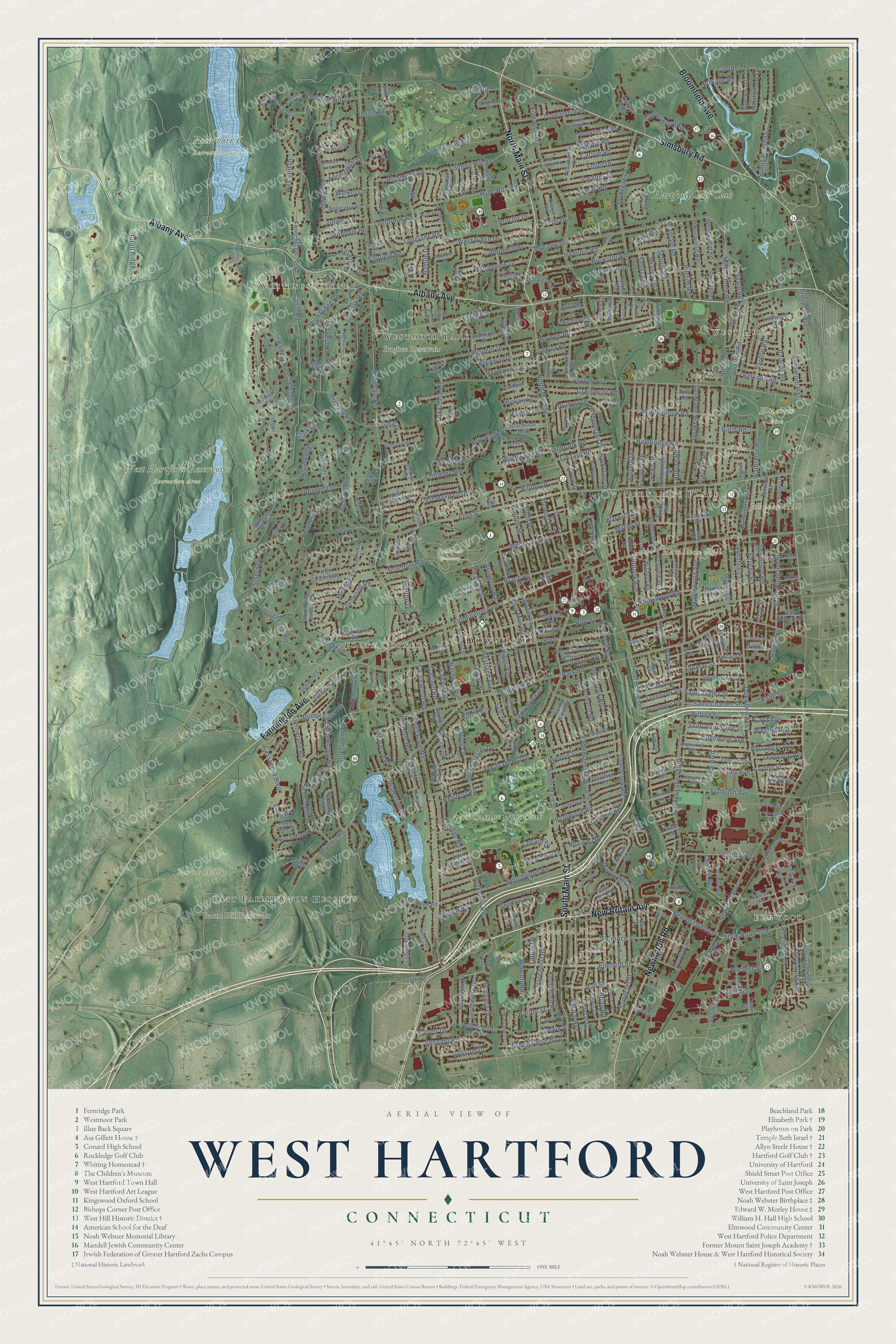
Click to explore a larger preview. The digital watermark does not appear on printed maps.
Names on this map
These names are printed on this map.
Places: Downtown, Elmwood, West Hill, Burnt Hill, Elmwood Hill, Hamilton Hill, Johnson Hill, Bugbee Reservoir, Burnt Hill Reservoir, Elizabeth Park, Fairview Cemetery, Reservoir 6 Recreation Area, West Hartford Reservoirs Recreation Area, Wolcott Park, Whitings Corner, Fernridge Place, Foote Corners, Westmoor Park, East Farmington Heights, Hartford Golf Club, Rockledge Golf Club and Court Park.
Streets and roads: South Main Street, New Britain Avenue, North Main Street, Newington Road, Albany Avenue, Simsbury Road, Bloomfield Avenue, Farmington Avenue, Fern Street, Shepard Road, Mountain Road, Berkshire Road.
More street names, A to Z
Abbotsford Avenue, Alderwood Drive, Andover Drive, Apple Hill Road, Arden Road, Ardmore Road, Arlen Way, Arlington Road, Arnoldale Road, Arundel Avenue, Asylum Avenue, Auburn Road, Avalon Road, Avondale Road, Bainbridge Road, Bainton Road, Baldwin Street, Balfour Road, Ballard Drive, Banbury Lane, Barksdale Road, Barton Street, Beacon Hill Drive, Beechwood Road, Belcrest Road, Belknap Road, Bentwood Road, Berwyn Road, Beverly Road, Birch Hill Drive, Birch Road, Bishop Road, Blue Ridge Lane, Bonny View Road, Boswell Road, Boulanger Avenue, Boulevard, Brace Road, Braeburn Road, Brainard Road, Braintree Drive, Bramley Road, Brenway Drive, Bretton Road, Brewster Road, Brian Road, Briarwood Road, Bridlepath Road, Brighton Road, Brightview Drive, Brightwood Lane, Brixton Road, Brookline Drive, Brookmoor Road, Brookside Boulevard, Brookside Drive, Brook Street, Brownleigh Road, Buena Vista Road, Burgoyne Street, Burnham Drive, Burr Street, Calvin Road, Canal Road, Carleton Road, Carlyle Road, Carney Road, Carol Road, Cascade Road, Cassandra Boulevard, Cassilis Road, Castlewood Road, Caya Avenue, Cedar Ledge Road, Chatfield Drive, Chelton Avenue, Cherryfield Drive, Chestnut Hill Road, Clarendon Avenue, Clark Drive, Claybar Drive, Cliffmore Road, Clifford Drive, Clifton Avenue, Clover Drive, Cobbs Road, Cody Street, Colonial Street, Colony Road, Common Drive, Conard Drive, Concord Street, Coolidge Road, Cornerstone Drive, Crabapple Road, Craigmoor Road, Cranbrook, Crestwood Road, Crosby Street, Croydon Drive, Cumberland Road, Custer Street, Cypress Road, Dale Street, Darcy Street, Davenport Road, Day Road, Dayton Lane, Dover Road, Drury Lane, Duffield Drive, Dwight Road, East Maxwell Drive, East Normandy Drive, Eastview Street, Edgemere Avenue, Edgemont Avenue, Ellsworth Road, Elm Drive, Elmfield Street, Elmhurst Street, Emily Way, Englewood Avenue, Fairfax Avenue, Fairfield Road, Fairlee Road, Fairview Street, Fairwood Farms Drive, Federal Street, Fennbrook Road, Fenwood Avenue, Ferncliff Drive, Fernwood Road, Flagg Road, Flatbush Avenue, Florence Street, Foley Street, Forest Hills Drive, Forest Hills Lane, Forest Road, Four Mile Road, Fox Chase Lane, Foxcroft Road, Foxridge Road, Frederick Road, Fuller Drive, Fulton Place, Gallaudet Drive, Garfield Road, Garland Road, Geneva Avenue, Gerthmere Drive, Gifford Road, Gillette Street, Glenbrook Road, Glenwood Road, Gloucester Lane, Goodwin Place, Grassmere Avenue, Greenhouse Boulevard, Greenhurst Road, Grenhart Street, Grennan Road, Grissom Drive, Griswold Drive, Grove Street, Hall Street, Hamilton Avenue, Hamlin Drive, Hammick Road, Hampton Avenue, Hartwell Road, Hatheway Drive, Haynes Road, Henley Way, Hickory Lane, High Farms Road, High Gate Lane, Highland Street, High Ridge Road, High Wood Road, Hillcrest Avenue, Hilldale Road, Hillsboro Drive, Hilltop Drive, Holbrook Road, Hollywood Avenue, Howland Road, Huckleberry Lane, Hunter Drive, Hurlbut Street, Huron Drive, Hyde Road, Ironwood Road, Iroquois Road, Isham Road, Jackson Avenue, Jacobs Road, Jansen Court, Jefferson Avenue, Jensen Road, Jessamine Street, Jillian Circle, John Smith Drive, Juniper Lane, Kane Street, King Edward Road, King Philip Drive, King Road, Kingswood Road, Kirkwood Road, Knollwood Road, Knolton Lane, Lakeview Drive, Lancaster Road, Laurel Drive, Lawler Road, Layton Street, Ledgewood Road, Ledyard Road, Lemay Street, Levesque Avenue, Lewis Lane, Lexington Road, Lilley Road, Linbrook Road, Lincoln Avenue, Lindy Lane, Linnard Road, Linwold Drive, Little Lane, Longlane Road, Loomis Drive, Lostbrook Road, Lovelace Drive, Lowell Road, Lyman Road, Madsen Road, Maiden Lane, Maplewood Avenue, Mayflower Street, Meadowbrook Road, Meadow Lane, Memorial Road, Miamis Road, Middlebrook Road, Middlefield Drive, Middle Road, Midlands Drive, Mildred Road, Milton Street, Mohawk Drive, Mohegan Drive, Montclair Drive, Morningcrest Drive, Mountain Farms Road, Mountain Terrace Road, Mountain View Drive, Nesbit Avenue, New Park Avenue, Newport Avenue, Northbrook Drive, Northmoor Road, North Steele Road, Norwood Road, Nursery Drive, Oak Ridge Lane, Oakwood Avenue, Old Meadow Road, Old Mill Lane, Old Oak Road, Old Stone Crossing, Orchard Road, Osage Road, Outlook Avenue, Overbrook Road, Overhill Road, Owings Road, Park Road, Parsons Drive, Paxton Road, Pelham Road, Penn Drive, Pheasant Chase, Pheasant Hill Drive, Pilgrim Road, Pine Brook Lane, Pinecrest Road, Pine Road, Pioneer Drive, Pleasant Street, Pocahontas Drive, Pontiac Road, Portage Road, Porter Drive, Price Boulevard, Proctor Drive, Prospect Avenue, Quail Hollow, Quaker Lane North, Quaker Lane South, Race Brook Road, Randal Avenue, Ranger Lane, Ravenwood Road, Raymond Road, Red Top Drive, Reed Avenue, Regency Drive, Richard Street, Richmond Lane, Ridgebrook Drive, Ridgewood Road, Riggs Avenue, Rillbank Terrace, Ringgold Street, Ritoli Ridge, Robin Road, Rockledge Drive, Rosedale Road, Royal Oak Drive, Rumford Street, Rushleigh Road, Saddle Ridge Drive, Saint Augustine Street, Saint Charles Street, Saint James Street, Sedgwick Road, Selden Hill Drive, Seminole Circle, Seneca Road, Sequin Road, Seymour Avenue, Shadow Lane, Sheep Hill Drive, Sherwood Road, Shield Street, Sidney Avenue, Sims Road, Sioux Lane, Skonet Road, Sky View Drive, Soby Drive, Somerset Street, South Highland Street, South Road, South Street, Spring Lane, Squirrel Hill Road, Starkel Road, State Road 529, Steele Road, Still Lane, Still Road, Stoneham Drive, Stoner Drive, Stratford Road, Sulgrave Road, Sunny Reach Drive, Sunrise Hill Drive, Sunset Farm Road, Sunset Terrace, Sycamore Road, Sylvan Avenue, Talcott Road, Tanager Drive, Ten Acre Lane, Terrace Road, The Crossways, Thicket Lane, Thomas Street, Thomson Road, Timber Lane, Timberwood Road, Timrod Road, Treeborough Drive, Trotwood Drive, Trout Brook Drive, Troy Street, Tumblebrook Lane, Tunxis Road, Uplands Drive, Van Buren Avenue, Vanderbilt Avenue, Vandervere Road, Vardon Road, Vera Street, Vine Hill Road, Walbridge Road, Walden Street, Walker Lane, Walter Avenue, Walton Drive, Wampanoag Drive, Wardwell Road, Warwick Street, Waterside Lane, Webster Hill Boulevard, Wells Road, Wendy Lane, West Beacon Street, Westcliff Drive, Westfield Road, Westland Avenue, Westminster Drive, Westmont Street, West Normandy Drive, Westphal Street, West Point Terrace, West Ridge Drive, Westwood Road, Whetton Road, White Avenue, Whitehill Drive, Whiting Lane, Whitman Avenue, Wilfred Street, Willowbrook Road, Wiltshire Lane, Winterset Lane, Wolcott Road, Woodlawn Street, Woodmere Road, Woodmont Road, Wood Pond Road, Woodridge Circle, Woodrow Street, Wyndwood Road, Yale Street.
This beautifully detailed map of West Hartford makes an attractive addition to your office, library, or den, and it can even be used to teach children the geography and history of the area. It also makes a great gift for anyone with West Hartford roots. When you’re done exploring, click here to get your copy of the West Hartford map.