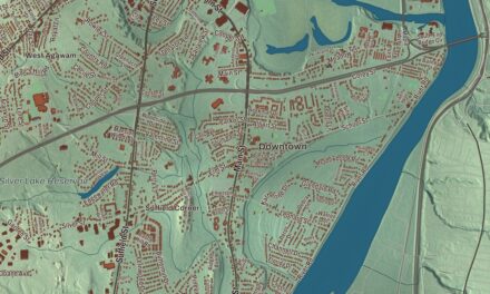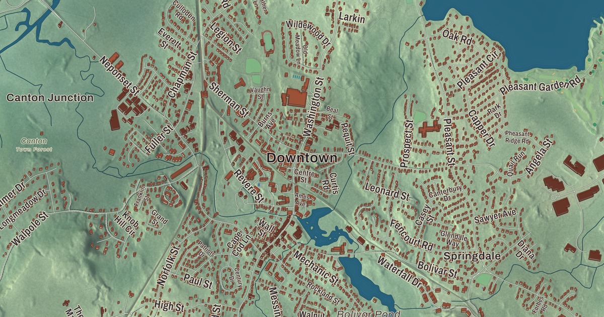
Canton sits at the foot of Great Blue Hill, and if you’re from here you know the stone arches of the viaduct over the Canton River and the walk around Ponkapoag Pond. This map prints Washington Street, Turnpike Street, High Street, Cedar Street, Pleasant Street and Randolph Street, with Ponkapoag Pond, Reservoir Pond, Bolivar Pond, the Blue Hills Reservation and Buck Hill. Click here to purchase a print of this map for your wall.
Canton is in Norfolk County, about 15 miles southwest of Boston.
KNOWOL made this map in 2026 from public survey data and gave it the look of an old atlas. The relief comes from United States Geological Survey elevation data, and the streets and the town line come from the Census Bureau. Canton covers 19.6 square miles. The Canton River runs through the center of town, linking a chain of small lakes including Bolivar and Forge ponds, and flows into the Neponset River, which forms the line with Norwood, Westwood and Dedham. Wetlands spread along Route 138 in the east and along Interstate 95 in the west, and the town had 24,370 people at the 2020 census.
Ponkapoag
People lived here for thousands of years before the colonists came. The Paleo-Indian site called Wamsutta, at Signal Hill, has been radiocarbon dated to 12,140 years before the present. When the Puritans arrived in the early 1600s, the Neponset band of the Massachusett, led by the sachem Chickatawbut, lived here for part of each year. In 1657 Ponkapoag was set off from Dorchester as the second Praying Town in the Massachusetts Bay Colony, after Natick, a 6,000-acre settlement for Native people who had accepted Christianity. The name comes from the pond and is usually translated as a shallow pond, or a spring that bubbles up from red soil. People who trace their descent to Ponkapoag still carry its name today, among them the Massachusett Tribe at Ponkapoag.
The Town of Canton’s recorded history, in the Secretary of the Commonwealth’s list, dates European settlement to 1630, when the land was part of the large original town of Dorchester. Stoughton split off from Dorchester in 1726, and Canton was incorporated as a town from Stoughton’s territory in 1797, on February 23. Elijah Dunbar suggested the name in the belief that Canton, the Chinese city now called Guangzhou, lay on the exact opposite side of the globe. It doesn’t, since both are well north of the Equator, though their longitudes come within about 2 degrees of opposite. The town remains part of Norfolk County today.
Singers, copper and stove polish
Dunbar was also the first president of the Stoughton Musical Society, from 1786 to 1808. Now the Old Stoughton Musical Society, it’s called the oldest choral society in the United States on the town page, and America’s oldest performing musical organization on its own; around 1790 its singers are said to have won what’s believed to be the first singing contest in America, against a Dorchester chorus, with the Hallelujah Chorus sung from memory.
In late 1800 Paul Revere bought an old ironworks in Canton, and in 1801 he opened the nation’s first copper rolling mill there, using a Navy loan to turn out copper sheets for sheathing the bottoms of ships. He wrote a poem, Canton Dale, about his affection for the town, and the nine-acre Paul Revere Heritage Site is dedicated to his work in copper. Elijah Morse made stove polish in Canton at his Rising Sun Stove Polish Company, and he served in Congress from 1889 to 1897.
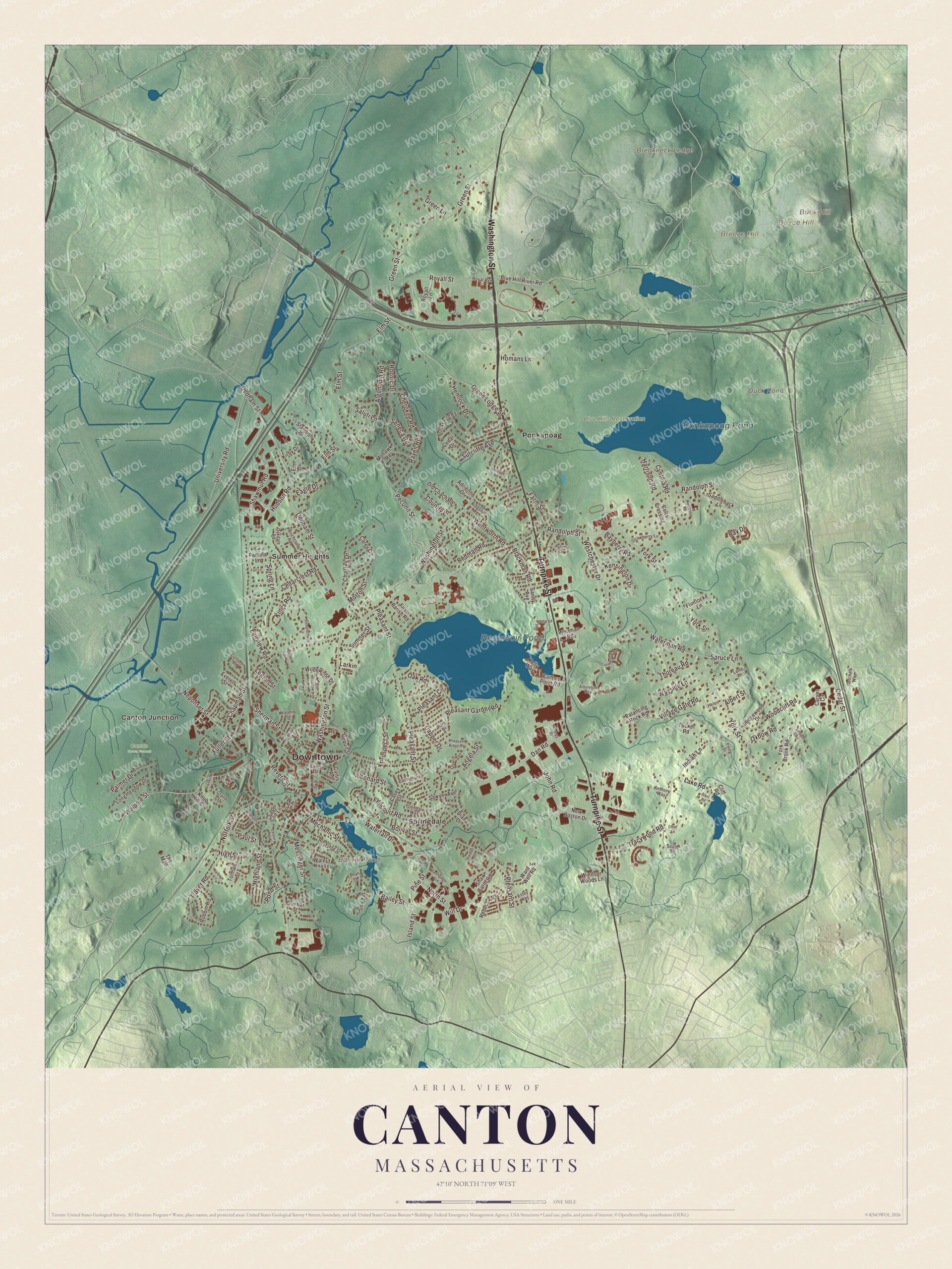
Click to explore a larger preview. The digital watermark does not appear on printed maps.
Names on this map
These names are printed on this map.
Places: Downtown, Canton Junction, Springdale, Boyce Hill, Breakneck Ledge, Breeze Hill, Buck Hill, Bolivar Pond, Duck Pond, Reservoir Pond, Ponkapoag Pond, Blue Hills Reservation, Canton Town Forest, Ponkapoag and Summer Heights.
Streets and roads: Washington Street, Turnpike Street, High Street, Cedar Street, Pleasant Street, Randolph Street, York Street, Green Lodge Street, Dedham Street, Neponset Street, Elm Street, Green Street.
More street names, A to Z
Adrienne Drive, Albert Street, Algonquin Road, Ames Avenue, Angela Street, Anthony Way, Arboretum Way, Autumn Circle, Bailey Street, Balancing Rock Road, Bayberry Road, Bay Drive, Beal Street, Birchcroft Road, Blackman Road, Blue Hill River Road, Bolivar Street, Brooksweld Road, Burns Avenue, Canterbury Drive, Canton Point Road, Cape Cod Lane, Capper Drive, Carey Circle, Carver Circle, Casey Street, Cedarcrest Road, Cedar Drive, Centre Street, Century Drive, Chapman Street, Charles Drive, Cherokee Road, Chief Lane, Cliff Road, Colts Crossing, Country Lane, Culloden Road, Curtis Road, Cynthia Road, Dan Road, Del Pond Drive, Diana Drive, Dunbar Street, Eagle Drive, Elm Drive, Energy Drive, Estey Way, Everett Street, Fairview Road, Fall Lane, Farm Street, Fencourt Road, First Parish Road, Flintlocke Lane, Forbes Road, Franklin Street, Fuller Street, Getchell Way, Glendale Way, Glen Road, Grand Street, Green Lane, Harrison Road, Heather Lane, Helen Drive, Hemlock Drive, Heritage Lane, Highland Street, Homans Lane, Hoosic Drive, Hudson Road, Indian Lane, Irving Street, Island Street, John Road, June Terrace, Kathryn Lane, Kelly Way, Kensington Drive, Kings Road, Kirby Drive, Knob Hill Circle, Lake Road, Lamb Lane, Larkin, Ledgewood Drive, Legion Street, Lehan Street, Leonard Street, Linden Glen, Longmeadow Drive, Mechanic Street, Messinger Street, Mohawk Road, Morton Street, New Boston Drive, Norfolk Street, North Street, Oakdale Road, Oak Road, Old Coach Road, Old Meadow Lane, Oxbow Road, Palmer Drive, Pamela Lane, Park Drive, Patriots Drive, Paul Street, Pecunit Street, Pequit Street, Pheasant Ridge Road, Pine Street, Pleasant Circle, Pleasant Garden Road, Pond Street, Prospect Street, Quail Run, Raven Road, Rebecca Road, Redman Road, Revere Street, Ridgehill Road, Robbin Road, Rockland Street, Royal Avenue, Royall Lane, Royall Street, Saddleback Lane, Saluti Lane, Sandy Avenue, Sawyer Avenue, Seneca Road, Shaw Farm Road, Shawmut Road, Sherman Street, South Street, Springdale Avenue, Spring Lane, Spruce Lane, Standish Drive, Steeplechase Lane, Strawberry Lane, Sumner Street, Sunnybrook Lane, Sutcliffe Avenue, The Mall, Thoreau Road, Tolman Street, Tracywood Road, Trayer Road, Tucker Road, Turtlebrook Road, University Road, Vaughn Street, Village Gate Road, Wall Street, Walnut Knolls, Walpole Street, Ward Well Road, Waterfall Drive, Waterman Road, Wayside Lane, Wentworth Road, Westchester Drive, Westdale Road, Whitman Road, Wildewood Drive, Will Drive, Windsor Woods Lane, Woodcliff Road, York Brook Road.
See it on a wall
The Canton map as a framed print. Swipe for more.


The viaduct
The Canton Viaduct carries the railroad about 65 feet above the Canton River, just south of Canton Junction. It was built in 1834 and 1835 for the Boston and Providence Railroad and designed by William Gibbs McNeill with George Washington Whistler, father of the painter James McNeill Whistler. At its completion it was the longest and tallest railroad viaduct in the world, and it still carries Amtrak’s Northeast Corridor and MBTA commuter trains. Tsar Nicholas I of Russia sent workmen to draw extensive diagrams of it, and two viaducts on the Moscow to Saint Petersburg railway were modeled on it. The town page calls it one of the two oldest surviving multiple arch stone railroad bridges still in active mainline use in the country.
Canton Corner, where Pleasant and Washington streets meet, is the old town center and a historic district of more than 25 properties. Washington Street was laid out in 1700 and Pleasant Street in 1723, crossing a dam on Pequid Brook that formed Reservoir Pond; the first meetinghouse went up at the Corner in 1707, and the First Congregational Parish Church dates from 1824. The David Tilden House at 93 Pleasant Street dates from about 1725. Out on Washington Street, the Eleanor Cabot Bradley Estate, a 1902 country house by Charles A. Platt with a walled garden and about 3 miles of trails, is open free every day. William Augustus Hinton, the first Black professor in Harvard’s history and creator of the Hinton test for syphilis, served as a physician at the Mass Hospital School in Canton after he retired from Harvard.
Around the map
Start at Canton Junction, where the Stoughton Branch splits from the Northeast Corridor, then follow Washington Street, Turnpike Street, High Street, Cedar Street, Pleasant Street and Randolph Street across town, and look outward toward Springdale, Ponkapoag and Summer Heights. Interstates 93 and 95, U.S. Route 1 and Route 128 all diverge in Canton. Ponkapoag Pond, 203 acres on the Randolph line inside the Blue Hills Reservation, is ringed by a walking trail and marshland, with the Appalachian Mountain Club’s cabins on its eastern shore. The 7,000-acre reservation, bought in 1893 by the Metropolitan Parks Commission as one of the state’s first areas set aside for public recreation, takes in parts of six towns, and its highest point, Great Blue Hill, rises 635 feet on the Milton, Randolph and Canton lines. Bolivar Pond, Duck Pond, Reservoir Pond, Ponkapoag Pond, the Blue Hills Reservation, Boyce Hill, Breeze Hill, Buck Hill and Breakneck Ledge are all printed on the map.
Canton’s map makes a fine addition to an office, library or den, and it can help teach children the geography and history of Paul Revere’s mill town. It’s made for people who call Canton home, from Canton Corner to Ponkapoag, and it shows the town as it looks today. Zoom in on the preview above to explore the details, then click here to get your copy of the Canton, Massachusetts map.

Sources
- Canton, Massachusetts, Wikipedia
- Ponkapoag, Wikipedia
- Stoughton Musical Society, Wikipedia
- Revere Copper Company, Wikipedia
- Elijah A. Morse, Wikipedia
- Canton Viaduct, Wikipedia
- Canton Junction station, Wikipedia
- Canton Corner Historic District, Wikipedia
- Eleanor Cabot Bradley Estate, Wikipedia
- William Augustus Hinton, Wikipedia
- Ponkapoag Pond, Wikipedia
- Blue Hills Reservation, Wikipedia
- Great Blue Hill, Wikipedia
- City and Town Incorporation and Settlement Dates, Secretary of the Commonwealth of Massachusetts (archived copy)