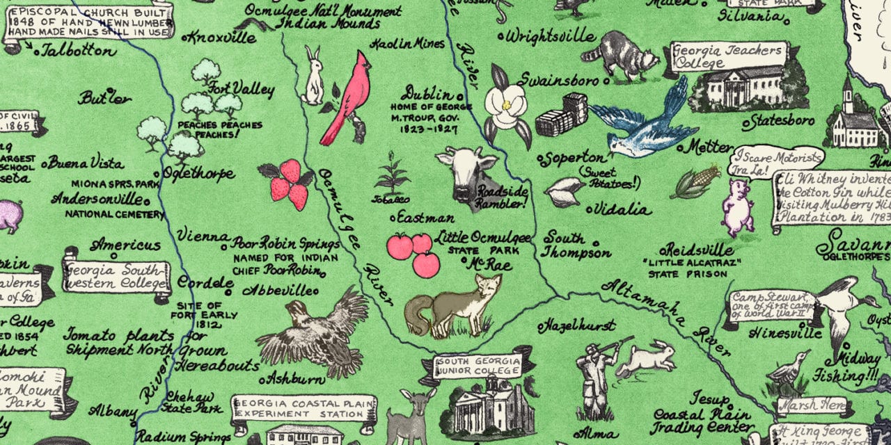
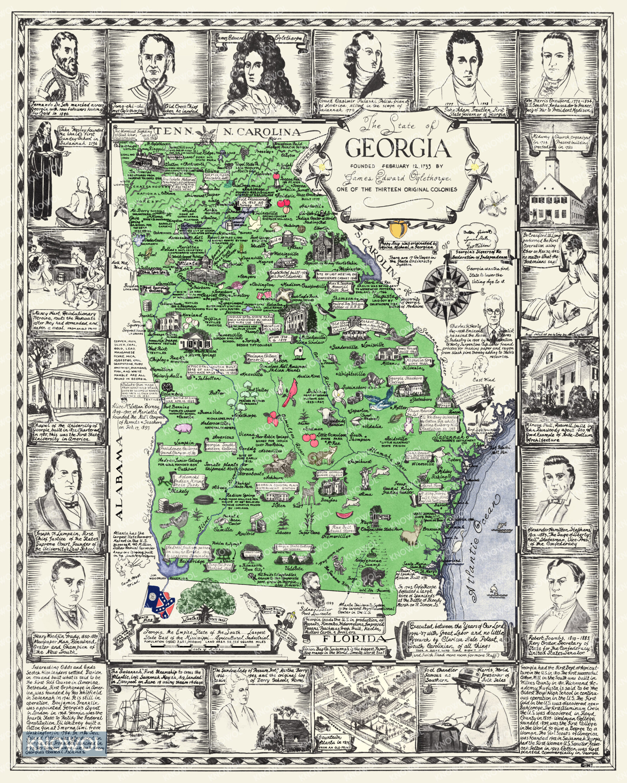
This beautiful historical map of Georgia was created in 1946 by Clarissa Hale Poteat, an artist from South Carolina who loved Georgia so much that she called it home for the majority of her adult life. Clarissa spent eleven years researching and creating this amazing piece of Georgia history, and it is a delight to explore for those who call Georgia home.
Dalton is labeled “bedspread land”, Thomasville is “Rose City”, and Fort Benning is listed as the world’s largest infantry school. Each area of the state features an interesting note or historical fact. Images of native crops and animals are strewn throughout, while the border features people and places important to native Georgians. This map is an important piece of Georgia history and a joy to explore and dive into for further research.
This historic map of Georgia was lovingly restored by KNOWOL. A limited number of reproductions of the restored map are available here.
Historical Map of Georgia, 1957
This beautifully restored pictorial map of Georgia will make an attractive addition to your office, library, or den and can even be used to teach children the geography and history of the area. When you’re done exploring, click here to get your copy of the restored map.